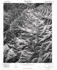
1976 Map of Clingmans Dome
USGS Topo · Published 1978About this map
Clingmans Dome stands as the central landmark of this high-elevation mountain environment along the North Carolina and Tennessee border. Produced from aerial photography taken in the spring of 1976, this orthophotograph highlights the complex drainage patterns and sharp ridgelines of the Great Smoky Mountains before the seasonal foliage obscured the terrain details. The image reveals a network of prominent geographic spines including Noland Divide, Fork Ridge, and Thomas Ridge, all radiating from the high peaks. This specific photographic survey by the Geological Survey and the State of North Carolina captures the summit at Mt Collins and the surrounding forest cover, providing a clear visual representation of the land surface and topographic relief in a period of active natural resource management and community development in the region.
Find a feature on this map
5 named features on this map. Tap any name to fly to it.
Don’t see what you’re looking for? This feature index may not catch every label — zoom into the map to look around manually.
Map Details
Editions of this 1976 Clingmans Dome Map
This is the sole edition of this map. No revisions or reprints were ever made.
Other maps of this area

1886 · Knoxville
USGS Topo · 1:125,000

1891 · Cowee
USGS Topo · 1:125,000

1892 · Knoxville
USGS Topo · 1:125,000

1893 · Mt Guyot
USGS Topo · 1:125,000

1894 · Knoxville
USGS Topo · 1:125,000

1895 · Knoxville
USGS Topo · 1:125,000

1897 · Cowee
USGS Topo · 1:125,000

1901 · Knoxville
USGS Topo · 1:125,000

1907 · Cowee
USGS Topo · 1:125,000

1912 · Mt Guyot
USGS Topo · 1:125,000