
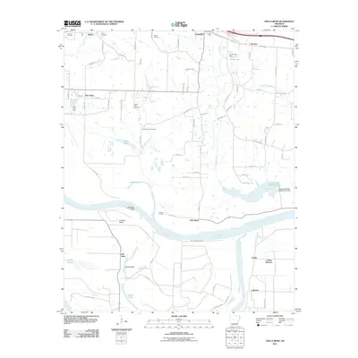
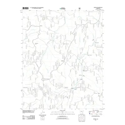
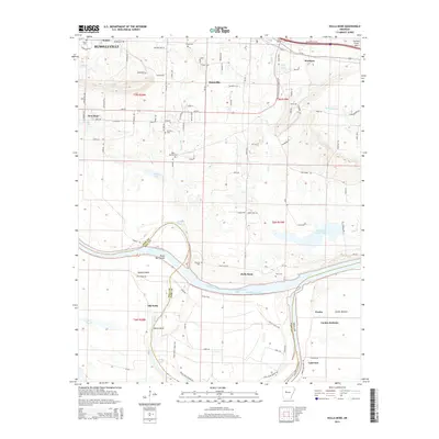
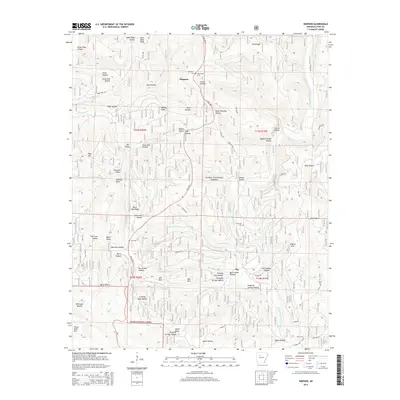
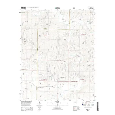
1974 Map of Treat SE
USGS Topo · Published 1975About this map
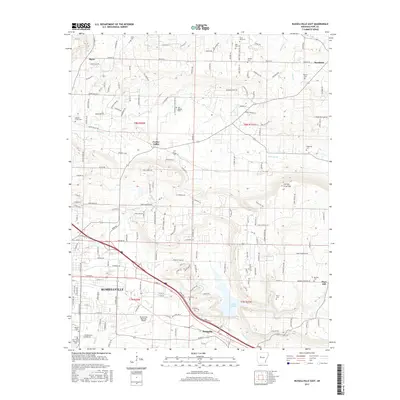
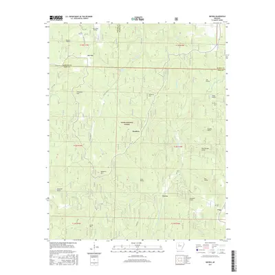
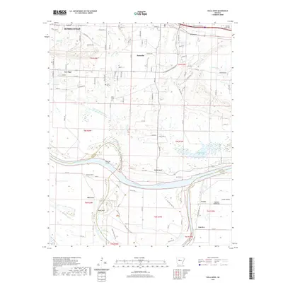
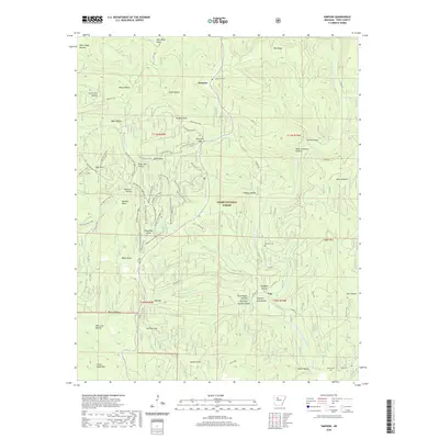
North Fork Illinois Bayou snakes through the center of this 1974 orthophotographic study, illustrating the dense timber and winding drainage patterns of northern Pope County. Prepared from high-altitude aerial photography, this visual record reveals the specific texture of the Arkansas landscape during the mid-1970s, from the clearings of agricultural plots to the shadowed folds of the Ozark foothills. The small settlement of Simpson stands as the primary named point of reference, centered near the northern boundary. Unlike traditional topographic maps that use contour lines to represent elevation, this orthophotoquad provides a direct photographic view of the ground surface, making it an invaluable resource for researchers tracing property lines, forest density, and rural road networks as they existed fifty years ago.
Find a feature on this map
2 named features on this map. Tap any name to fly to it.
Don’t see what you’re looking for? This feature index may not catch every label — zoom into the map to look around manually.
Map Details
Editions of this 1974 Treat SE Map
This is the sole edition of this map. No revisions or reprints were ever made.
Historical Maps of Simpson Through Time
85 maps found

1879 Washington
Pope County, AR

1887 Smyrna
Pope County, AR

1888 Dardanelle #1
Pope County, AR

1889 Marshall #3
Pope County, AR

1889 Treat
Pope County, AR

1932 Treat
Pope County, AR

1934 Treat
Pope County, AR

1940 Smyrna
Pope County, AR

1943 Smyrna
Pope County, AR

1962 Moreland
Pope County, AR

1962 Russellville East
Pope County, AR

1963 Lee Mountain
Pope County, AR

1963 Russellville West
Pope County, AR

1972 Holla Bend
Pope County, AR

1974 Smyrna NE
Pope County, AR

1974 Smyrna NW
Pope County, AR

1974 Smyrna SW
Pope County, AR

1974 Treat NE
Pope County, AR
1974 Treat SE
Pope County, AR

1980 Sand Gap
Pope County, AR

1980 Simpson
Pope County, AR

1980 Smyrna
Pope County, AR

1980 Solo
Pope County, AR

1980 Tilly
Pope County, AR

1980 Treat
Pope County, AR

1989 Moreland
Pope County, AR

1993 Holla Bend
Pope County, AR

1993 Lee Mountain
Pope County, AR

1993 Russellville East
Pope County, AR

1993 Russellville West
Pope County, AR
2011 Holla Bend
Pope County, AR
2011 Lee Mountain
Pope County, AR
2011 Moreland
Pope County, AR

2011 Russellville East
Pope County, AR

2011 Russellville West
Pope County, AR
2011 Sand Gap
Pope County, AR
2011 Simpson
Pope County, AR
2011 Smyrna
Pope County, AR
2011 Solo
Pope County, AR

2011 Tilly
Pope County, AR
2011 Treat
Pope County, AR
2014 Holla Bend
Pope County, AR
2014 Lee Mountain
Pope County, AR
2014 Moreland
Pope County, AR

2014 Russellville East
Pope County, AR

2014 Russellville West
Pope County, AR
2014 Sand Gap
Pope County, AR
2014 Simpson
Pope County, AR
2014 Smyrna
Pope County, AR
2014 Solo
Pope County, AR
2014 Tilly
Pope County, AR
2014 Treat
Pope County, AR
2017 Holla Bend
Pope County, AR
2017 Lee Mountain
Pope County, AR
2017 Moreland
Pope County, AR
2017 Russellville East
Pope County, AR
2017 Russellville West
Pope County, AR
2017 Sand Gap
Pope County, AR
2017 Simpson
Pope County, AR
2017 Smyrna
Pope County, AR
2017 Solo
Pope County, AR
2017 Tilly
Pope County, AR
2017 Treat
Pope County, AR
2020 Holla Bend
Pope County, AR

2020 Lee Mountain
Pope County, AR
2020 Moreland
Pope County, AR
2020 Russellville East
Pope County, AR

2020 Russellville West
Pope County, AR
2020 Sand Gap
Pope County, AR
2020 Simpson
Pope County, AR

2020 Smyrna
Pope County, AR
2020 Solo
Pope County, AR

2020 Tilly
Pope County, AR
2020 Treat
Pope County, AR

2024 Holla Bend
Pope County, AR

2024 Lee Mountain
Pope County, AR

2024 Moreland
Pope County, AR

2024 Russellville East
Pope County, AR

2024 Russellville West
Pope County, AR

2024 Sand Gap
Pope County, AR

2024 Simpson
Pope County, AR

2024 Smyrna
Pope County, AR

2024 Solo
Pope County, AR

2024 Tilly
Pope County, AR

2024 Treat
Pope County, AR