1969 Map of Hayden Butte
USGS Topo · Published 1972About this map
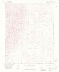
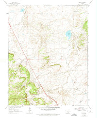
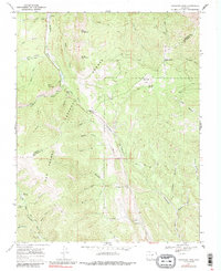
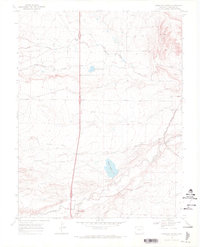
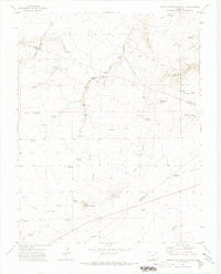
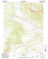
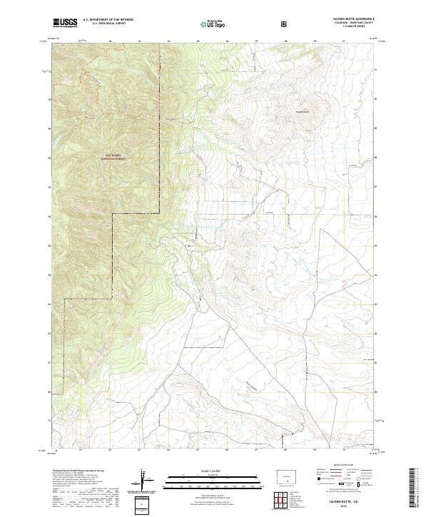
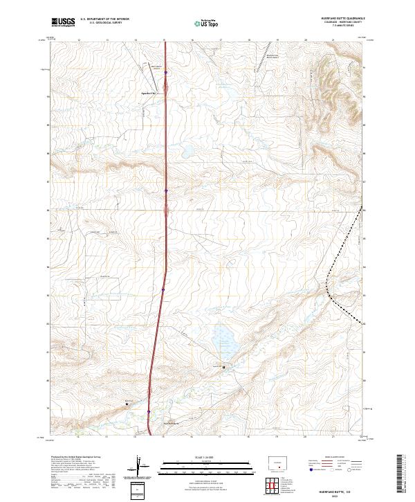
Isabel National Forest dominates the western portion of this Huerfano County landscape, where the high terrain gives way to a complex system of drainage branches and arroyos. The 1969 field-checked data shows a territory defined by water action, with North Apache Creek and South Apache Creek flowing eastward from the mountain slopes. The namesake Hayden Butte stands as a prominent landmark north of where the various forks of Apache Creek converge. A clear boundary for Vigil and St Vrain is marked in the southern section, reflecting the historical land grant divisions of southern Colorado. Human activity is sparse but visible through a Prospect and Gravel Pit, suggesting small-scale resource extraction amidst the more dominant natural features like Pole Canyon and Greasewood Arroyo.
Find a feature on this map
16 named features on this map. Tap any name to fly to it.
Don’t see what you’re looking for? This feature index may not catch every label — zoom into the map to look around manually.
Map Details
Editions of this 1969 Hayden Butte Map
2 editions found
Historical Maps of Huerfano County Through Time
64 maps found

1889 Huerfano Park
Huerfano County, CO
1892 Huerfano Park
Huerfano County, CO

1963 Black Hills
Huerfano County, CO
1963 Cuchara
Huerfano County, CO

1963 La Veta Pass
Huerfano County, CO
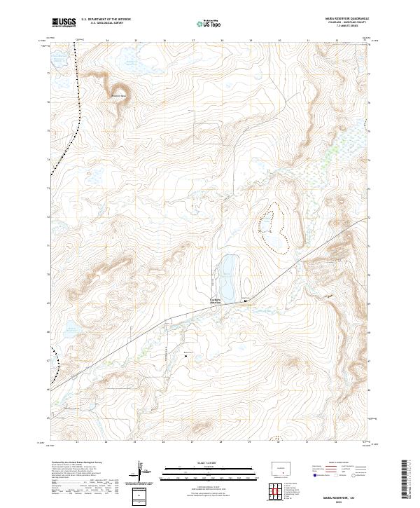
1963 Maria Reservoir
Huerfano County, CO
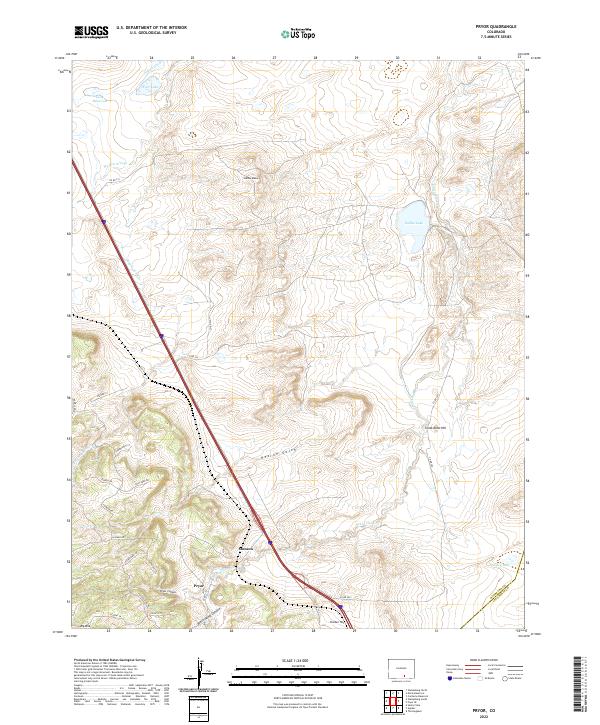
1963 Pryor
Huerfano County, CO
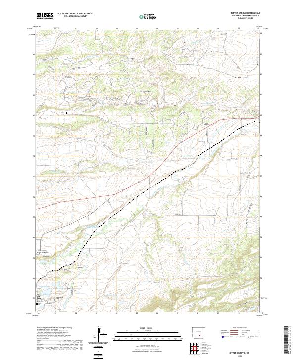
1963 Ritter Arroyo
Huerfano County, CO

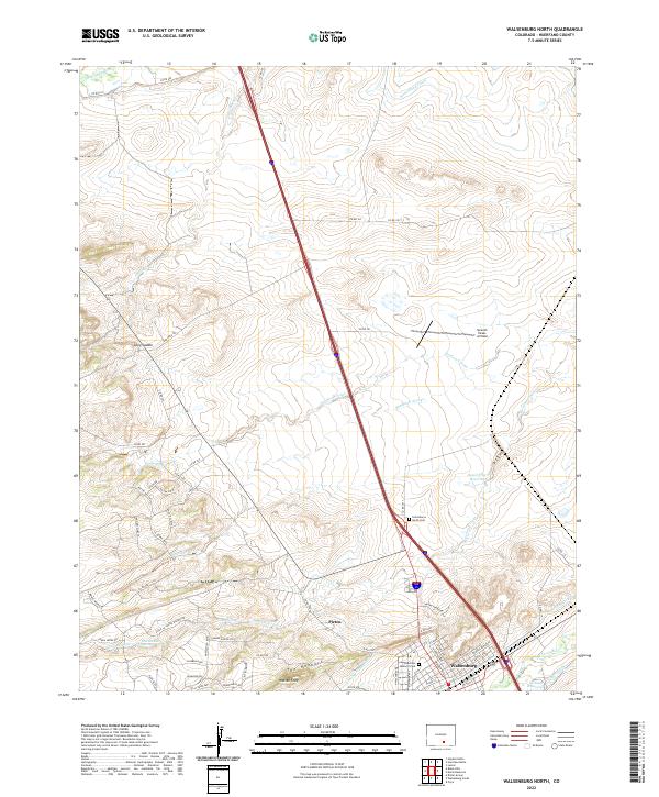
1963 Walsenburg North
Huerfano County, CO
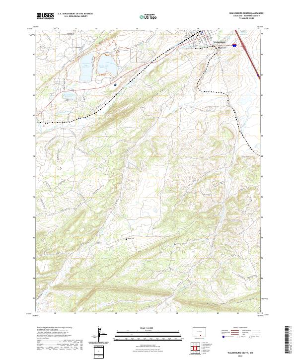
1963 Walsenburg South
Huerfano County, CO
1967 Creager Reservoir
Huerfano County, CO

1967 Cuchara
Huerfano County, CO
1967 Cucharas Pass
Huerfano County, CO
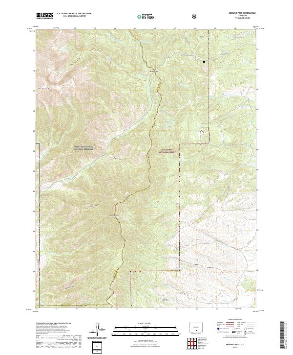
1967 Medano Pass
Huerfano County, CO

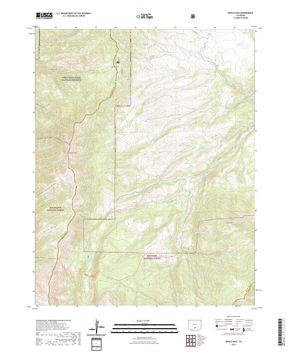
1967 Mosca Pass
Huerfano County, CO

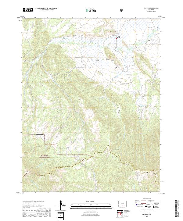
1967 Red Wing
Huerfano County, CO
1969 Badito Cone
Huerfano County, CO

1969 Bear Creek
Huerfano County, CO

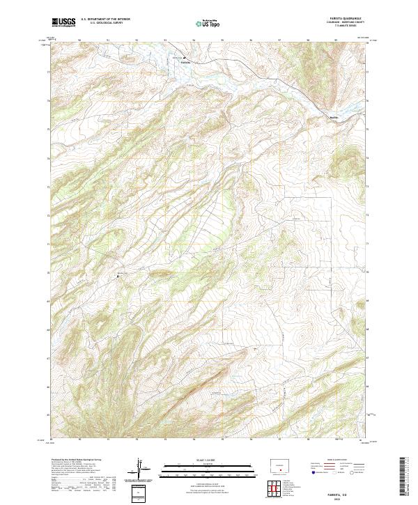
1969 Farisita
Huerfano County, CO
1969 Hayden Butte
Huerfano County, CO
1969 Huerfano Butte
Huerfano County, CO
1969 Little Sheep Mountain
Huerfano County, CO
1970 Capps Springs
Huerfano County, CO

1970 Cucharas Reservoir
Huerfano County, CO
1970 Lascar
Huerfano County, CO
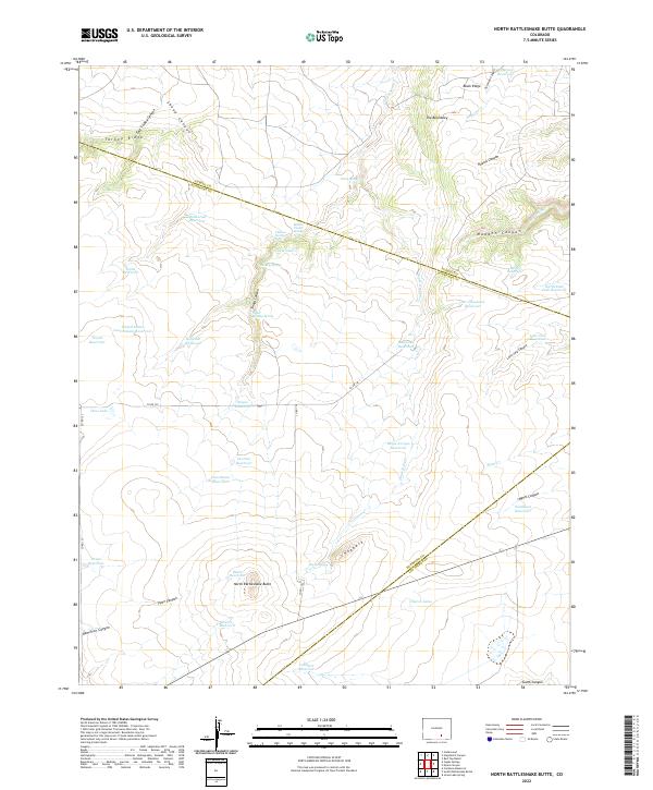
1971 North Rattlesnake Butte
Huerfano County, CO
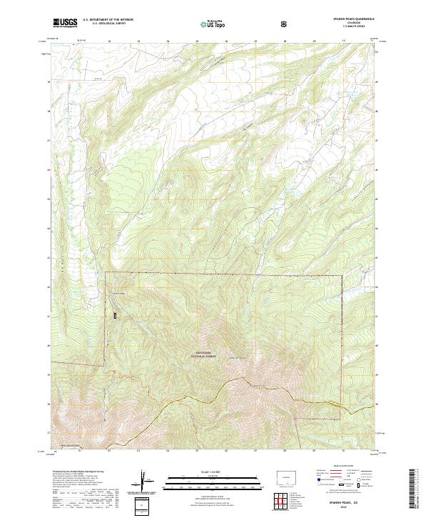
1971 Spanish Peaks
Huerfano County, CO
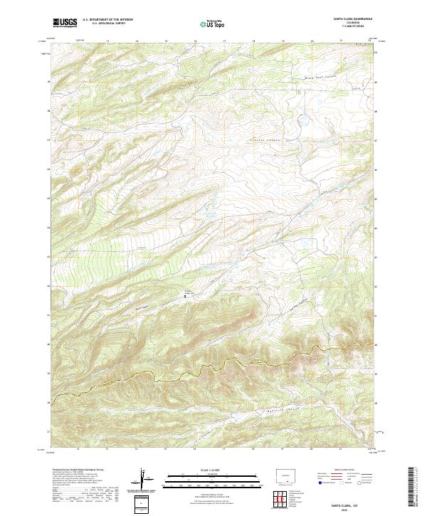
1972 Santa Clara
Huerfano County, CO

1982 Blanca Peak
Huerfano County, CO
1994 Badito Cone
Huerfano County, CO

1994 Bear Creek
Huerfano County, CO
1994 Creager Reservoir
Huerfano County, CO

1994 Cuchara
Huerfano County, CO

1994 Cucharas Pass
Huerfano County, CO
1994 Hayden Butte
Huerfano County, CO

1994 Spanish Peaks
Huerfano County, CO

2001 Medano Pass
Huerfano County, CO

2001 Mosca Pass
Huerfano County, CO

2001 Red Wing
Huerfano County, CO
2022 Badito Cone
Huerfano County, CO
2022 Bear Creek
Huerfano County, CO
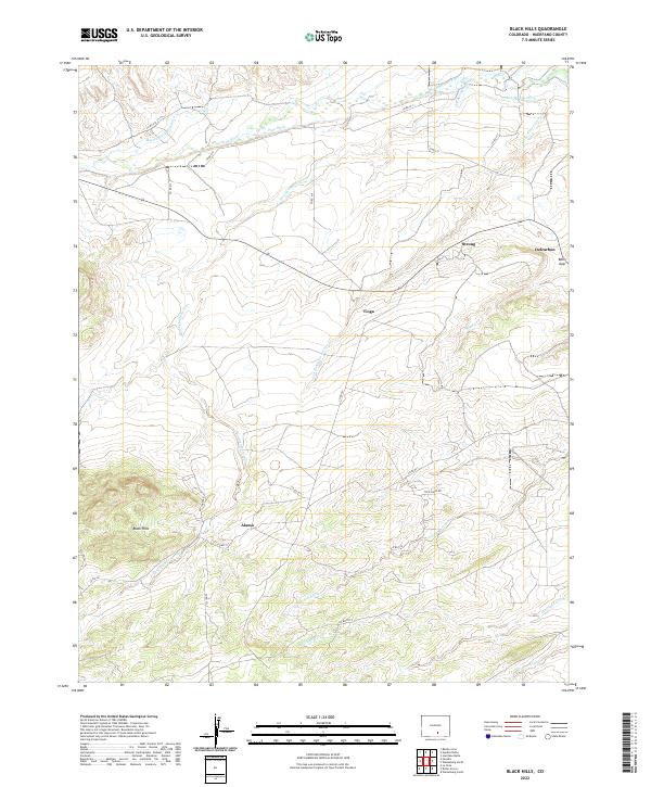
2022 Black Hills
Huerfano County, CO
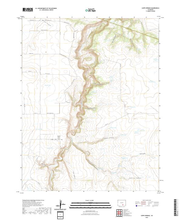
2022 Capps Springs
Huerfano County, CO
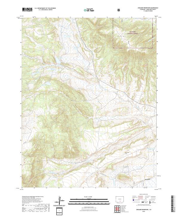
2022 Creager Reservoir
Huerfano County, CO
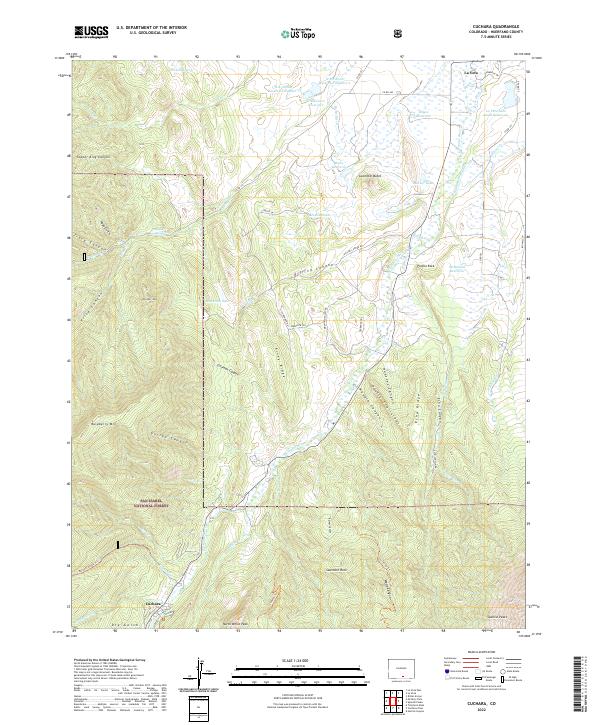
2022 Cuchara
Huerfano County, CO
2022 Cucharas Pass
Huerfano County, CO
2022 Cucharas Reservoir
Huerfano County, CO
2022 Farisita
Huerfano County, CO
2022 Hayden Butte
Huerfano County, CO
2022 Huerfano Butte
Huerfano County, CO
2022 Lascar
Huerfano County, CO
2022 La Veta Pass
Huerfano County, CO
2022 Little Sheep Mountain
Huerfano County, CO
2022 Maria Reservoir
Huerfano County, CO
2022 Medano Pass
Huerfano County, CO
2022 Mosca Pass
Huerfano County, CO
2022 North Rattlesnake Butte
Huerfano County, CO
2022 Pryor
Huerfano County, CO
2022 Red Wing
Huerfano County, CO
2022 Ritter Arroyo
Huerfano County, CO
2022 Santa Clara
Huerfano County, CO
2022 Spanish Peaks
Huerfano County, CO
2022 Walsenburg North
Huerfano County, CO
2022 Walsenburg South
Huerfano County, CO