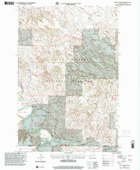
1997 Map of Cliffs Plateau
USGS Topo · Published 2001About this map
Little Missouri National Grassland dominates this corner of the North Dakota badlands, where the Little Missouri River carves a path through the high western plains. The landscape is defined by the broad elevations of Kinley Plateau and Cliffs Plateau, dissected by numerous drainages including Dantz Creek, Bear Creek, and Whites Wash. This late-twentieth-century survey documents the persistent ranching footprint in the region, noting several family operations such as Ginkel Ranch, M Gerbig Ranch, and the L Henders Ranch. The network of travel through this topography relies on unimproved routes like the East River Road and the Third 4WD Road, highlighting the isolation and specialized land use of the Billings and Slope County border area.
Find a feature on this map
20 named features on this map. Tap any name to fly to it.
Don’t see what you’re looking for? This feature index may not catch every label — zoom into the map to look around manually.
Map Details
Editions of this 1997 Cliffs Plateau Map
This is the sole edition of this map. No revisions or reprints were ever made.
Other maps of this area

1953 · Dickinson
USGS Topo · 1:250,000

1957 · Dickinson
USGS Topo · 1:250,000

1961 · Rocky Ridge
USGS Topo · 1:62,500

1962 · Tracy Mountain
USGS Topo · 1:24,000

1962 · Fryburg
USGS Topo · 1:24,000

1979 · Deep Creek North
USGS Topo · 1:24,000
1979 · Chimney Butte
USGS Topo · 1:24,000

1979 · Bullion Butte
USGS Topo · 1:24,000

1980 · Belfield
USGS Topo · 1:100,000
1982 · Cliffs Plateau
USGS Topo · 1:24,000