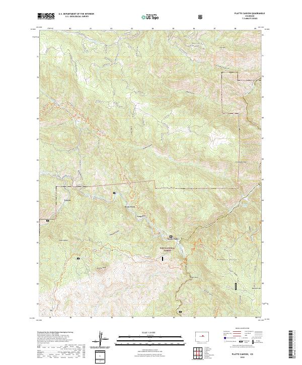
2022 Map of Platte Canyon
USGS Topo · Published 2022About this map
The confluence of the North Fork South Platte River and the South Platte River forms the geographic heart of this landscape, a region defined by dramatic granite outcrops and the steep canyons of the Pike National Forest. Historically significant nodes like South Platte, Foxton, and Longview are situated along these primary watercourses, marking the legacy of mountain rail and road corridors that once facilitated travel through the Front Range. The terrain is characterized by massive formations such as Dome Rock, Chair Rocks, and Eagle Rock, which rise above the deeply incised Cottonwood Gulch and Elkhorn Gulch. Extensive trail networks, including the Waterton Canyon Trl and Saddle Mountain TRL, reflect the transition from early resource access to modern recreational use. This survey details the complex topography where the Rampart Range meets the river forks at the Jefferson and Douglas County line.
Find a feature on this map
76 named features on this map. Tap any name to fly to it.
Don’t see what you’re looking for? This feature index may not catch every label — zoom into the map to look around manually.
Map Details
Editions of this 2022 Platte Canyon Map
This is the sole edition of this map. No revisions or reprints were ever made.
Other maps of this area

1893 · Platte Canyon
USGS Topo · 1:125,000

1899 · West Denver
USGS Topo · 1:125,000

1942 · Littleton
USGS Topo · 1:31,680

1945 · Indian Hills
USGS Topo · 1:31,680

1945 · Platte Canyon
USGS Topo · 1:24,000

1945 · Pine
USGS Topo · 1:24,000

1945 · Kassler
USGS Topo · 1:24,000

1948 · Kassler
USGS Topo · 1:24,000

1948 · Pine
USGS Topo · 1:24,000

1948 · Platte Canyon
USGS Topo · 1:24,000