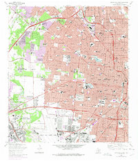
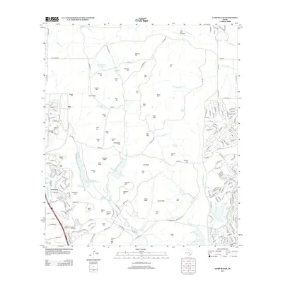
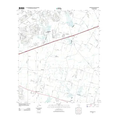
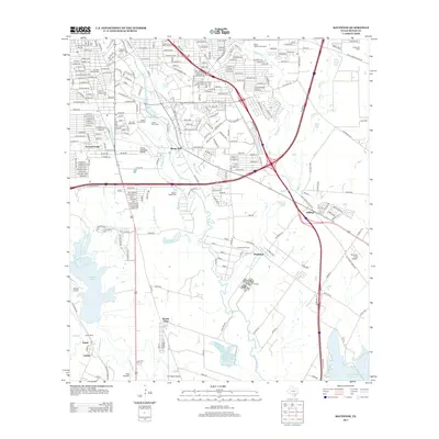
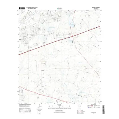
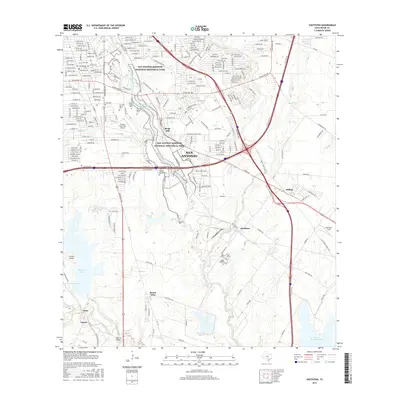
1967 Map of San Antonio West
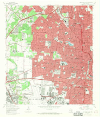
USGS Topo · Published 1975About this map
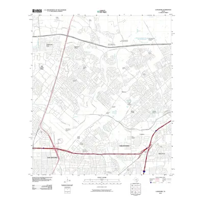
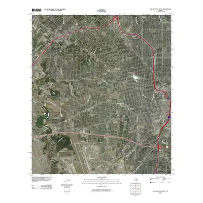
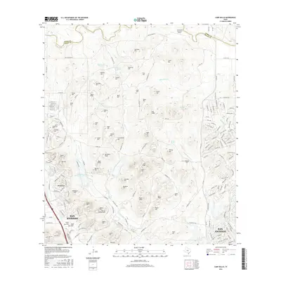
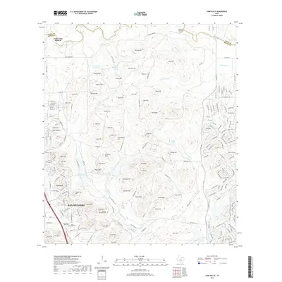
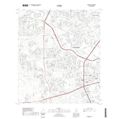
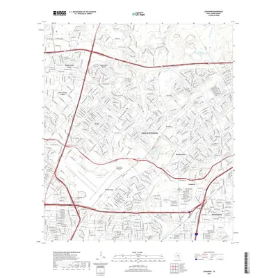
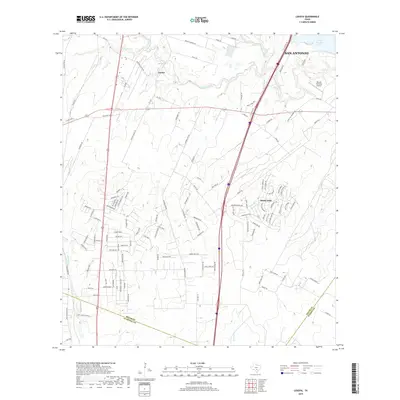
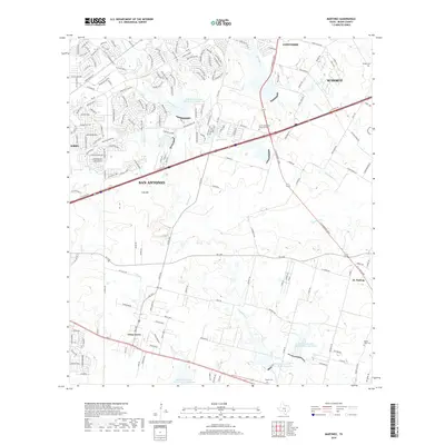
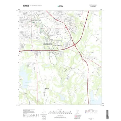
Lackland Air Force Base and Kelly Air Force Base dominate the southern landscape of this mid-century Texas quadrangle, serving as massive anchors for the west side of San Antonio. The area is characterized by dense urban expansion and a high concentration of educational and religious institutions, including St Marys University, Peacock Military Academy, and Holy Cross High Sch. The expansion of the city is evident in the purple-tinted urban extensions that reach toward Leon Valley and Balcones Heights.
Find a feature on this map
83 named features on this map. Tap any name to fly to it.
Don’t see what you’re looking for? This feature index may not catch every label — zoom into the map to look around manually.
Map Details
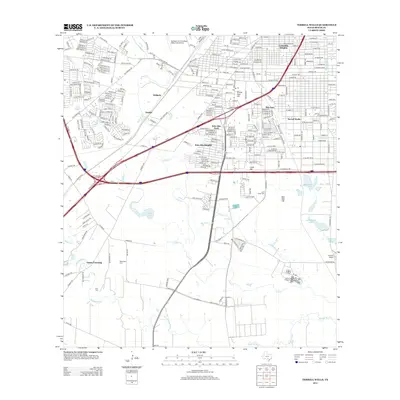
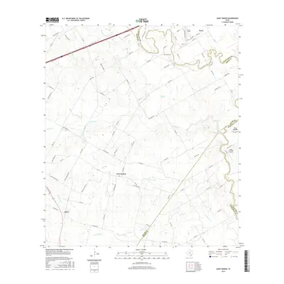
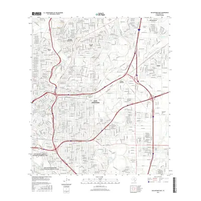
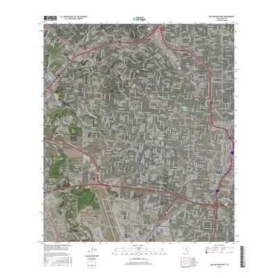
Editions of this 1967 San Antonio West Map
Historical Maps of San Antonio Through Time
91 maps found

1953 Culebra Hill
Bexar County, TX

1953 Longhorn
Bexar County, TX

1953 Martinez
Bexar County, TX

1953 Otis Ridge
Bexar County, TX

1953 San Antonio East
Bexar County, TX

1953 San Antonio West
Bexar County, TX

1953 Southton
Bexar County, TX

1953 Terrell Wells
Bexar County, TX

1953 Van Raub
Bexar County, TX

1958 Losoya
Bexar County, TX

1958 Saint Hedwig
Bexar County, TX

1958 Thelma
Bexar County, TX

1965 Camp Bullis
Bexar County, TX

1966 Culebra Hill
Bexar County, TX

1967 Longhorn
Bexar County, TX

1967 Martinez
Bexar County, TX

1967 San Antonio East
Bexar County, TX

1967 San Antonio West
Bexar County, TX

1967 Southton
Bexar County, TX

1967 Terrell Wells
Bexar County, TX

1967 Van Raub
Bexar County, TX

1991 Van Raub
Bexar County, TX

1992 Camp Bullis
Bexar County, TX

1992 Longhorn
Bexar County, TX

1992 Martinez
Bexar County, TX

1992 Saint Hedwig
Bexar County, TX

1992 San Antonio East
Bexar County, TX

1992 Southton
Bexar County, TX

1992 Terrell Wells
Bexar County, TX

1993 Culebra Hill
Bexar County, TX

1993 San Antonio West
Bexar County, TX
2010 Camp Bullis
Bexar County, TX
2010 Culebra Hill
Bexar County, TX
2010 Longhorn
Bexar County, TX
2010 Losoya
Bexar County, TX
2010 Martinez
Bexar County, TX

2010 Saint Hedwig
Bexar County, TX
2010 San Antonio East
Bexar County, TX
2010 San Antonio West
Bexar County, TX

2010 Southton
Bexar County, TX
2010 Terrell Wells
Bexar County, TX
2010 Thelma
Bexar County, TX
2010 Van Raub
Bexar County, TX
2013 Camp Bullis
Bexar County, TX
2013 Culebra Hill
Bexar County, TX
2013 Longhorn
Bexar County, TX
2013 Losoya
Bexar County, TX
2013 Martinez
Bexar County, TX
2013 Saint Hedwig
Bexar County, TX
2013 San Antonio East
Bexar County, TX
2013 San Antonio West
Bexar County, TX
2013 Southton
Bexar County, TX
2013 Terrell Wells
Bexar County, TX
2013 Thelma
Bexar County, TX
2013 Van Raub
Bexar County, TX
2016 Camp Bullis
Bexar County, TX
2016 Culebra Hill
Bexar County, TX
2016 Longhorn
Bexar County, TX
2016 Losoya
Bexar County, TX
2016 Martinez
Bexar County, TX
2016 Saint Hedwig
Bexar County, TX
2016 San Antonio East
Bexar County, TX
2016 San Antonio West
Bexar County, TX
2016 Southton
Bexar County, TX
2016 Terrell Wells
Bexar County, TX
2016 Thelma
Bexar County, TX
2016 Van Raub
Bexar County, TX
2019 Camp Bullis
Bexar County, TX
2019 Culebra Hill
Bexar County, TX
2019 Longhorn
Bexar County, TX
2019 Losoya
Bexar County, TX
2019 Martinez
Bexar County, TX
2019 Saint Hedwig
Bexar County, TX
2019 San Antonio East
Bexar County, TX
2019 San Antonio West
Bexar County, TX
2019 Southton
Bexar County, TX
2019 Terrell Wells
Bexar County, TX
2019 Thelma
Bexar County, TX
2019 Van Raub
Bexar County, TX

2022 Camp Bullis
Bexar County, TX

2022 Culebra Hill
Bexar County, TX

2022 Longhorn
Bexar County, TX

2022 Losoya
Bexar County, TX

2022 Martinez
Bexar County, TX

2022 Saint Hedwig
Bexar County, TX

2022 San Antonio East
Bexar County, TX

2022 San Antonio West
Bexar County, TX

2022 Southton
Bexar County, TX

2022 Thelma
Bexar County, TX

2022 Van Raub
Bexar County, TX

2023 Terrell Wells
Bexar County, TX