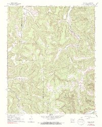
1968 Map of Osage SW
USGS Topo · Published 1991About this map
The Buffalo River headwaters and the deeply incised valleys of the Boston Mountains characterize this 1968 survey of the Newton and Madison County border. Small rural communities like Stoverville and Dinsmore anchor a landscape defined by sharp elevation changes, where numerous hollows such as Sugar Camp Hollow and Hamstring Hollow drain toward the Kings River and the Buffalo. The presence of Lost Valley State Park in the southeast corner highlights the area's transition into a protected wilderness corridor during the mid-20th century.
Find a feature on this map
36 named features on this map. Tap any name to fly to it.
Don’t see what you’re looking for? This feature index may not catch every label — zoom into the map to look around manually.
Map Details
Editions of this 1968 Osage SW Map
4 editions found
Other maps of this area

1900 · Eureka Springs
USGS Topo · 1:125,000

1901 · Eureka Springs
USGS Topo · 1:125,000

1904 · Harrison
USGS Topo · 1:125,000

1905 · Harrison
USGS Topo · 1:125,000

1945 · Harrison
USGS Topo · 1:250,000

1949 · Harrison
USGS Topo · 1:250,000

1954 · Harrison
USGS Topo · 1:250,000

1956 · Russellville
USGS Topo · 1:250,000

1958 · Harrison
USGS Topo · 1:250,000

1964 · Russellville
USGS Topo · 1:250,000