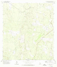
1972 Map of El Chapote Creek
USGS Topo · Published 1975About this map
Intermittent drainage systems and South Texas brushlands define this landscape in Starr County, dominated by the winding course of Arroyo Grande and the eponymous El Chapote Creek. The terrain is marked by a network of ranching and early energy infrastructure, with several Gas Well sites and a prominent Pipeline cutting through the northern and eastern sections. Small pockets of human history appear in the form of family-named landmarks and rural settlements such as Sanchez and Chinges. Local genealogy is anchored by the presence of the Elizondo Cem and Garcia Cem located near the eastern boundary, while the topography is punctuated by numerous Drill Holes that signal the era's subsurface exploration. Numerous small tributaries, including Barrosos Creek and Las Escobas Creek, create a complex web of seasonal watercourses across the undulating plains.
Find a feature on this map
22 named features on this map. Tap any name to fly to it.
Don’t see what you’re looking for? This feature index may not catch every label — zoom into the map to look around manually.
Map Details
Editions of this 1972 El Chapote Creek Map
This is the sole edition of this map. No revisions or reprints were ever made.
Other maps of this area

1938 · Falcon
USGS Topo · 1:62,500

1938 · El Sauz
USGS Topo · 1:62,500

1949 · Mc Allen
USGS Topo · 1:250,000

1954 · McAllen
USGS Topo · 1:250,000

1956 · Escobares
USGS Topo · 1:62,500

1956 · Roma
USGS Topo · 1:62,500

1957 · Mc Allen
USGS Topo · 1:250,000

1962 · McAllen
USGS Topo · 1:250,000

1965 · Salineno
USGS Topo · 1:24,000

1965 · Lopeno
USGS Topo · 1:24,000