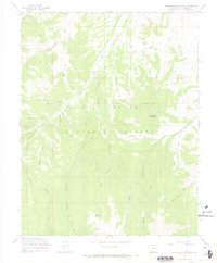
1967 Map of Horseshoe Mountain
USGS Topo · Published 1969About this map
Horseshoe Mountain dominates this portion of the Rio Grande National Forest in the late 1960s, anchoring a landscape defined by deep drainage systems and high peaks. The topography is marked by a complex network of waterways, including the prominent Pinos Creek, which flows past a Gaging Station and is joined by tributaries like Schrader Creek and Bennett Creek. To the south, Poison Mountain rises above the forks of Raton Creek, illustrating the high-elevation divide between various creek basins.
Find a feature on this map
34 named features on this map. Tap any name to fly to it.
Don’t see what you’re looking for? This feature index may not catch every label — zoom into the map to look around manually.
Map Details
Editions of this 1967 Horseshoe Mountain Map
2 editions found
Other maps of this area

1913 · Summitville
USGS Topo · 1:125,000

1914 · Creede
USGS Topo · 1:125,000

1915 · Summitville
USGS Topo · 1:125,000

1915 · Del Norte
USGS Topo · 1:125,000

1916 · Creede
USGS Topo · 1:125,000

1917 · Del Norte
USGS Topo · 1:125,000

1922 · Conejos
USGS Topo · 1:125,000

1945 · Durango
USGS Topo · 1:250,000

1953 · Durango
USGS Topo · 1:250,000

1954 · Durango
USGS Topo · 1:250,000