1943 Map of Weeks Bay
USGS Topo · Published 1943About this map
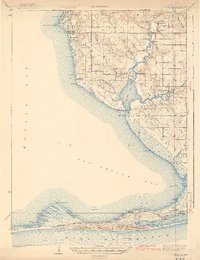
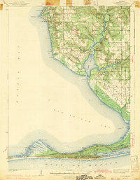
The coastal interface of Mobile Bay and the Gulf Of Mexico defines this 1943 survey, which captures the Baldwin County shoreline during the early 1940s. Inland, the Fish River and Magnolia River snake through the landscape, feeding into Weeks Bay before reaching the broader expanse of Bon Secour Bay. The map reveals a transition from the established coastal landings like Great Point Clear and Battles Wharf to the developing interior settlements of Barnwell and Magnolia Springs.
Find a feature on this map
79 named features on this map. Tap any name to fly to it.
Don’t see what you’re looking for? This feature index may not catch every label — zoom into the map to look around manually.
Map Details
Editions of this 1943 Weeks Bay Map
3 editions found
Historical Maps of Turkey Branch Through Time
62 maps found

1941 Blakeley
Baldwin County, AL

1941 Weeks Bay
Baldwin County, AL

1942 Blakeley
Baldwin County, AL

1942 Dyas
Baldwin County, AL

1942 Hurricane
Baldwin County, AL

1943 Blakeley
Baldwin County, AL

1943 Hurricane
Baldwin County, AL

1943 Tensaw
Baldwin County, AL

1943 Weeks Bay
Baldwin County, AL

1944 Dyas
Baldwin County, AL

1944 Miflin
Baldwin County, AL

1944 Muscogee
Baldwin County, AL

1944 Tensaw
Baldwin County, AL

1953 Bridgehead
Baldwin County, AL

1953 Hurricane
Baldwin County, AL

1958 Fort Morgan
Baldwin County, AL

1978 Dogwood Creek
Baldwin County, AL

1978 Dyas
Baldwin County, AL

1978 Gateswood
Baldwin County, AL

1978 Seminole
Baldwin County, AL

1980 Bay Minette North
Baldwin County, AL

1980 Bay Minette South
Baldwin County, AL

1980 Bon Secour Bay
Baldwin County, AL

1980 Elsanor
Baldwin County, AL

1980 Little Point Clear
Baldwin County, AL

1980 Pine Beach
Baldwin County, AL

1980 St. Andrews Bay
Baldwin County, AL

1980 Steelwood Lake
Baldwin County, AL

1980 The Basin
Baldwin County, AL

1983 Bilbo Island
Baldwin County, AL

1983 Blacksher
Baldwin County, AL

1983 Stiggings Lake
Baldwin County, AL

1983 Tensaw
Baldwin County, AL

1983 Vaughn
Baldwin County, AL

1986 Bay Minette North
Baldwin County, AL

1994 Dogwood Creek
Baldwin County, AL

1994 Dyas
Baldwin County, AL

1994 Gateswood
Baldwin County, AL

1997 Hurricane
Baldwin County, AL

2003 Dyas
Baldwin County, AL

2024 Bay Minette North
Baldwin County, AL

2024 Bay Minette South
Baldwin County, AL

2024 Bilbo Island
Baldwin County, AL

2024 Blacksher
Baldwin County, AL

2024 Bon Secour Bay
Baldwin County, AL

2024 Bridgehead
Baldwin County, AL

2024 Dogwood Creek
Baldwin County, AL

2024 Dyas
Baldwin County, AL

2024 Elsanor
Baldwin County, AL

2024 Gateswood
Baldwin County, AL

2024 Hurricane
Baldwin County, AL

2024 Little Point Clear
Baldwin County, AL

2024 Seminole
Baldwin County, AL

2024 Steelwood Lake
Baldwin County, AL

2024 Stiggins Lake
Baldwin County, AL

2024 Tensaw
Baldwin County, AL

2024 The Basin
Baldwin County, AL

2024 Vaughn
Baldwin County, AL

2025 Fort Morgan
Baldwin County, AL

2025 Gulf Shores OE S
Baldwin County, AL

2025 Pine Beach
Baldwin County, AL

2025 Saint Andrews Bay
Baldwin County, AL