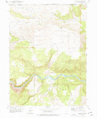
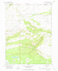
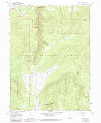
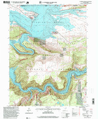
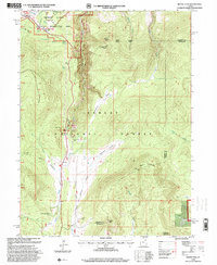
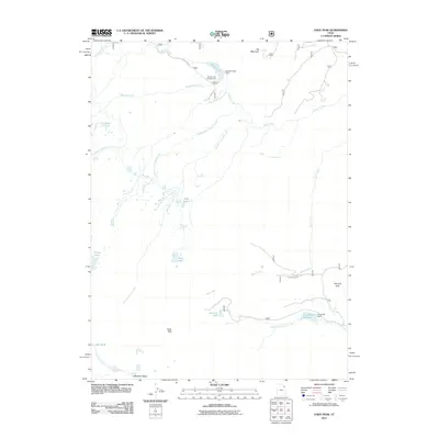
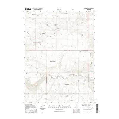
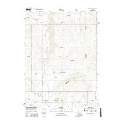
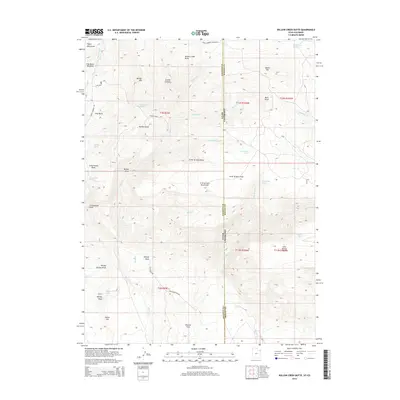
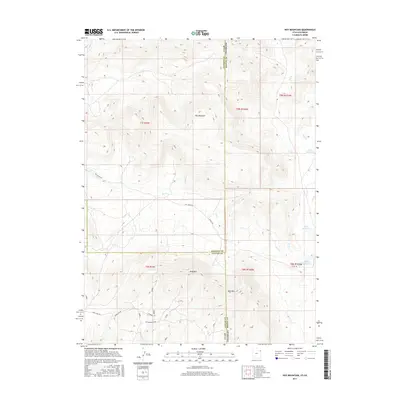
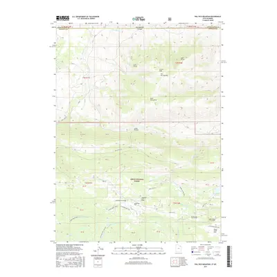
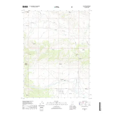
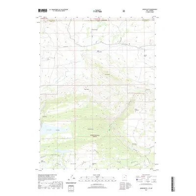
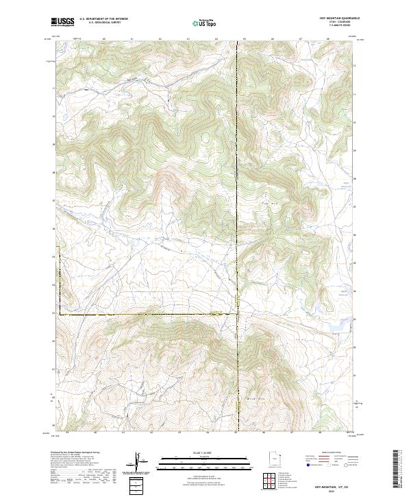
1967 Map of Hoy Mountain
USGS Topo · Published 1979About this map
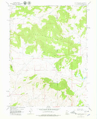
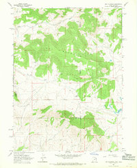
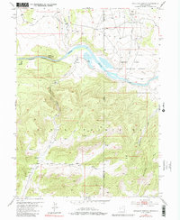
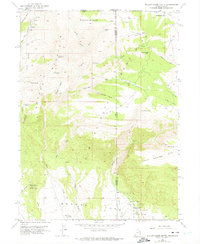
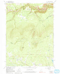
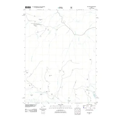
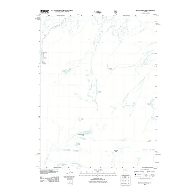
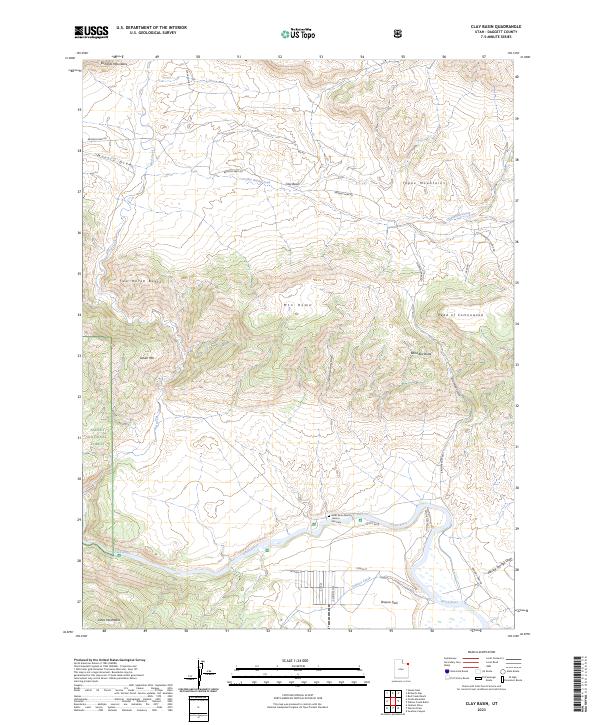
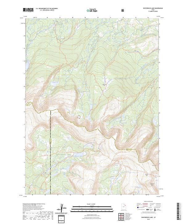
Hoy Mountain and Wild Mountain dominate this high-elevation landscape along the border of Utah and Colorado. Surveyed in the late 1960s, the terrain is defined by a series of significant drainages including Pot Creek, Dry Creek, and Crouse Cr, which cut through the uplifted plateaus. The presence of a Gaging Station on Pot Creek indicates the hydrological importance of these seasonal flows to the surrounding arid regions. Human activity is sparsely recorded here, primarily represented by a primitive network of Jeep Trails and a Gravel Pit near the southern boundary. This map captures the remote character of the tri-county area where Daggett, Moffat, and Uintah counties meet, showing a landscape largely shaped by natural erosional features like Allen Draw and water sources such as Offield Res and various unnamed Springs.
Find a feature on this map
19 named features on this map. Tap any name to fly to it.
Don’t see what you’re looking for? This feature index may not catch every label — zoom into the map to look around manually.
Map Details
Editions of this 1967 Hoy Mountain Map
2 editions found
Historical Maps of Uintah County Through Time
77 maps found
1952 Clay Basin
Daggett County, UT
1952 Dutch John Mtn
Daggett County, UT
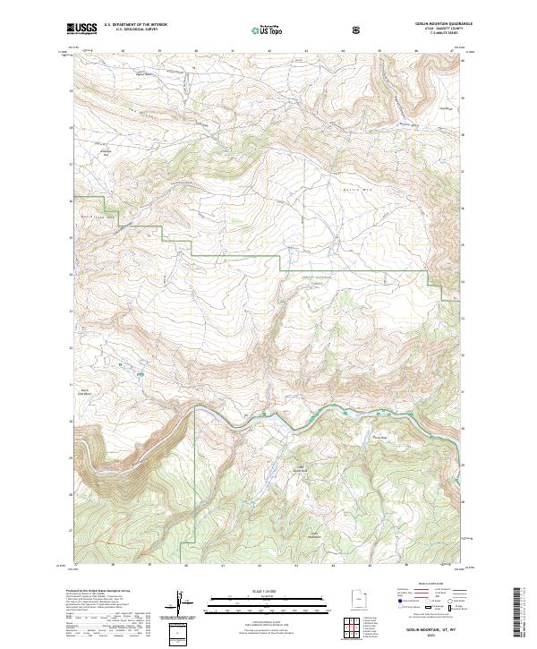
1952 Goslin Mtn
Daggett County, UT
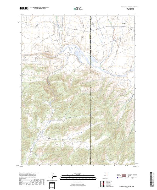
1952 Swallow Canyon
Daggett County, UT
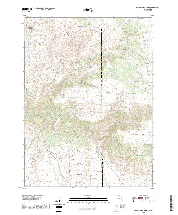
1952 Willow Creek Butte
Daggett County, UT
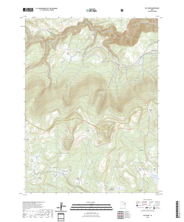
1963 Elk Park
Daggett County, UT
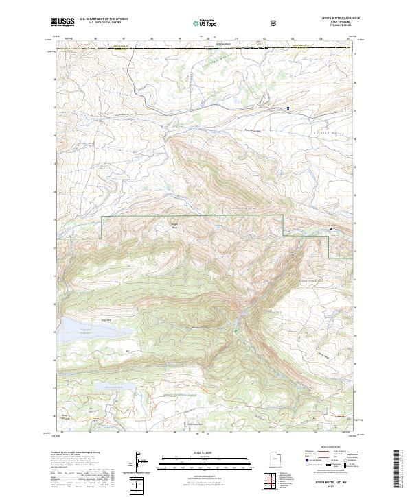
1963 Jessen Butte
Daggett County, UT
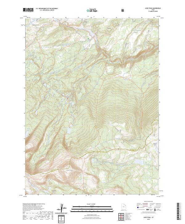
1963 Leidy Peak
Daggett County, UT
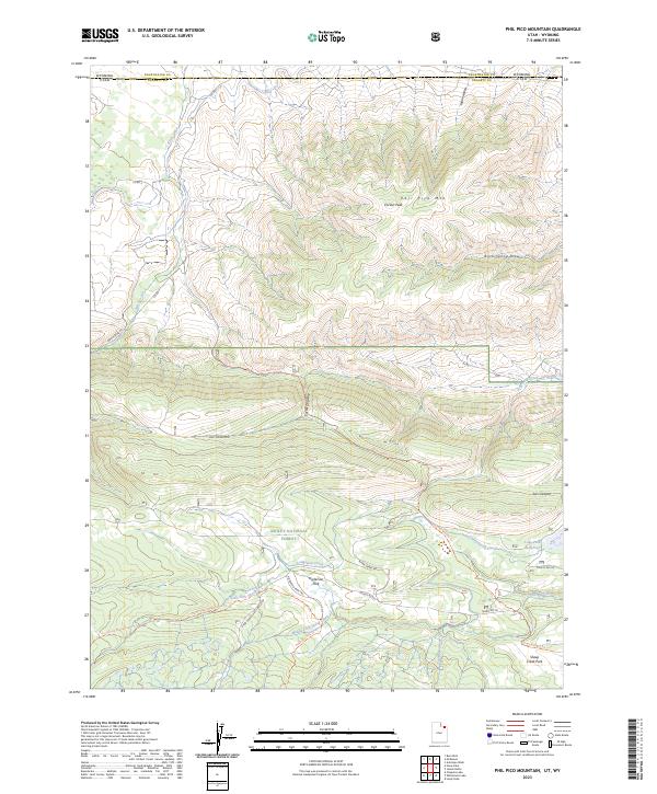
1963 Phil Pico Mtn
Daggett County, UT
1963 Whiterocks Lake
Daggett County, UT
1967 Hoy Mountain
Daggett County, UT
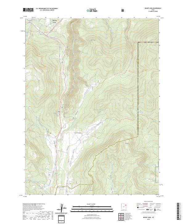
1967 Mount Lena
Daggett County, UT
1990 Whiterocks Lake
Daggett County, UT
1996 Clay Basin
Daggett County, UT
1996 Elk Park
Daggett County, UT
1996 Flaming George
Daggett County, UT
1996 Goslin Mountain
Daggett County, UT
1996 Jessen Butte
Daggett County, UT
1996 Leidy Peak
Daggett County, UT
1996 Mount Lena
Daggett County, UT
1996 Phil Pico Mountain
Daggett County, UT
1996 Whiterocks Lake
Daggett County, UT
2011 Clay Basin
Daggett County, UT
2011 Elk Park
Daggett County, UT
2011 Goslin Mountain
Daggett County, UT
2011 Hoy Mountain
Daggett County, UT
2011 Jessen Butte
Daggett County, UT
2011 Leidy Peak
Daggett County, UT
2011 Mount Lena
Daggett County, UT
2011 Phil Pico Mountain
Daggett County, UT
2011 Swallow Canyon
Daggett County, UT
2011 Whiterocks Lake
Daggett County, UT
2011 Willow Creek Butte
Daggett County, UT
2014 Clay Basin
Daggett County, UT
2014 Elk Park
Daggett County, UT
2014 Goslin Mountain
Daggett County, UT
2014 Hoy Mountain
Daggett County, UT
2014 Jessen Butte
Daggett County, UT
2014 Leidy Peak
Daggett County, UT
2014 Mount Lena
Daggett County, UT
2014 Phil Pico Mountain
Daggett County, UT
2014 Swallow Canyon
Daggett County, UT
2014 Whiterocks Lake
Daggett County, UT
2014 Willow Creek Butte
Daggett County, UT
2017 Clay Basin
Daggett County, UT
2017 Elk Park
Daggett County, UT
2017 Goslin Mountain
Daggett County, UT
2017 Hoy Mountain
Daggett County, UT
2017 Jessen Butte
Daggett County, UT
2017 Leidy Peak
Daggett County, UT
2017 Mount Lena
Daggett County, UT
2017 Phil Pico Mountain
Daggett County, UT
2017 Swallow Canyon
Daggett County, UT
2017 Whiterocks Lake
Daggett County, UT
2017 Willow Creek Butte
Daggett County, UT
2020 Clay Basin
Daggett County, UT
2020 Elk Park
Daggett County, UT
2020 Goslin Mountain
Daggett County, UT
2020 Hoy Mountain
Daggett County, UT
2020 Jessen Butte
Daggett County, UT
2020 Leidy Peak
Daggett County, UT
2020 Mount Lena
Daggett County, UT
2020 Phil Pico Mountain
Daggett County, UT
2020 Swallow Canyon
Daggett County, UT
2020 Whiterocks Lake
Daggett County, UT
2020 Willow Creek Butte
Daggett County, UT
2023 Clay Basin
Daggett County, UT
2023 Elk Park
Daggett County, UT
2023 Goslin Mountain
Daggett County, UT
2023 Hoy Mountain
Daggett County, UT
2023 Jessen Butte
Daggett County, UT
2023 Leidy Peak
Daggett County, UT
2023 Mount Lena
Daggett County, UT
2023 Phil Pico Mountain
Daggett County, UT
2023 Swallow Canyon
Daggett County, UT
2023 Whiterocks Lake
Daggett County, UT
2023 Willow Creek Butte
Daggett County, UT