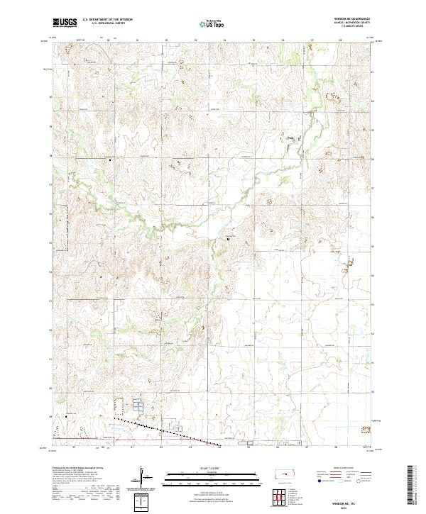
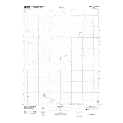
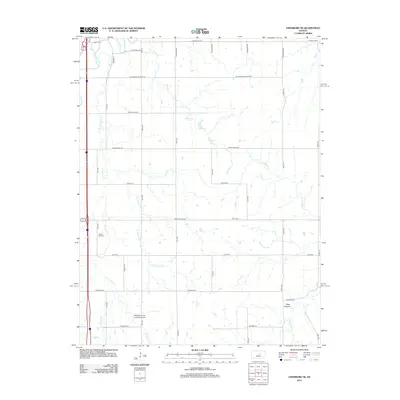
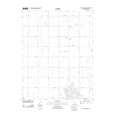
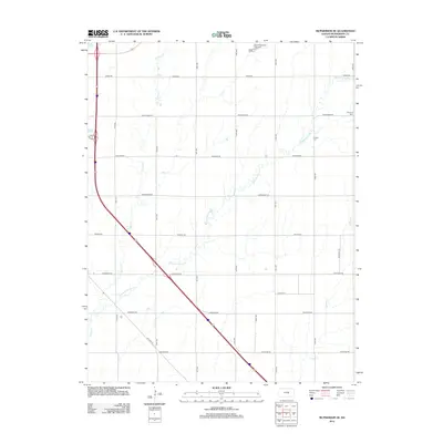
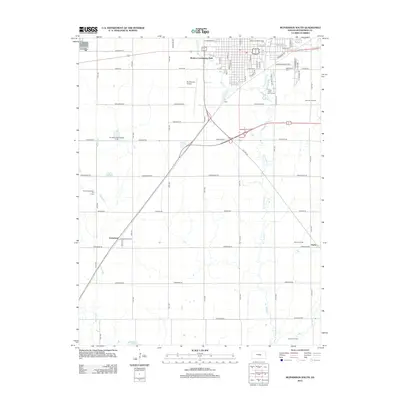
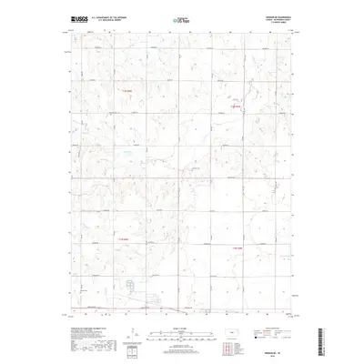
2022 Map of Windom NE
USGS Topo · Published 2022About this map
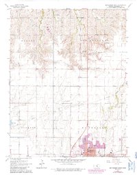
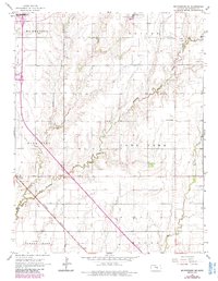
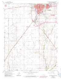
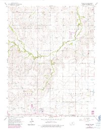
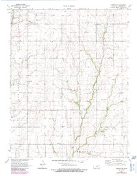
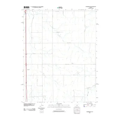
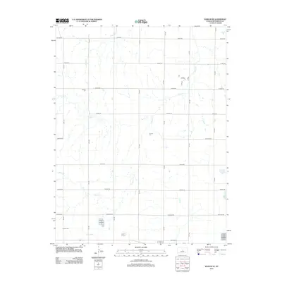
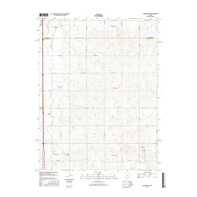
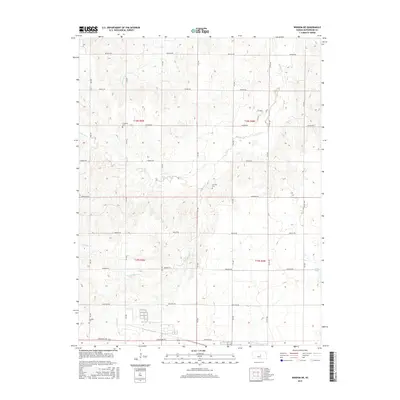
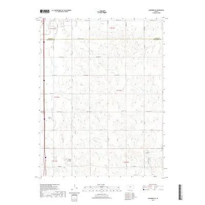
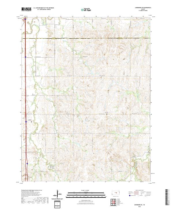
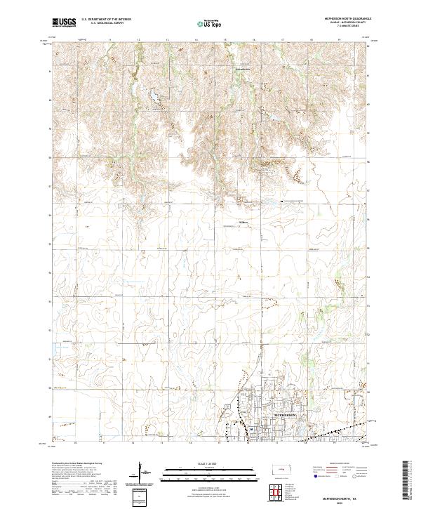
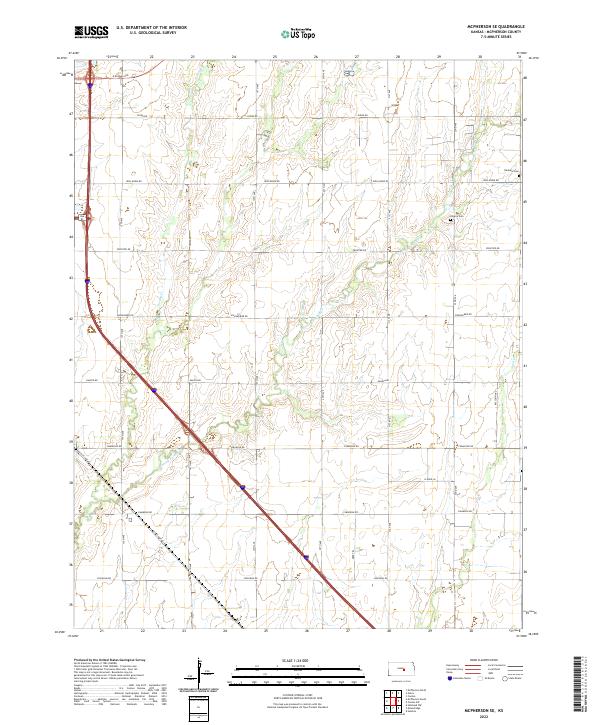
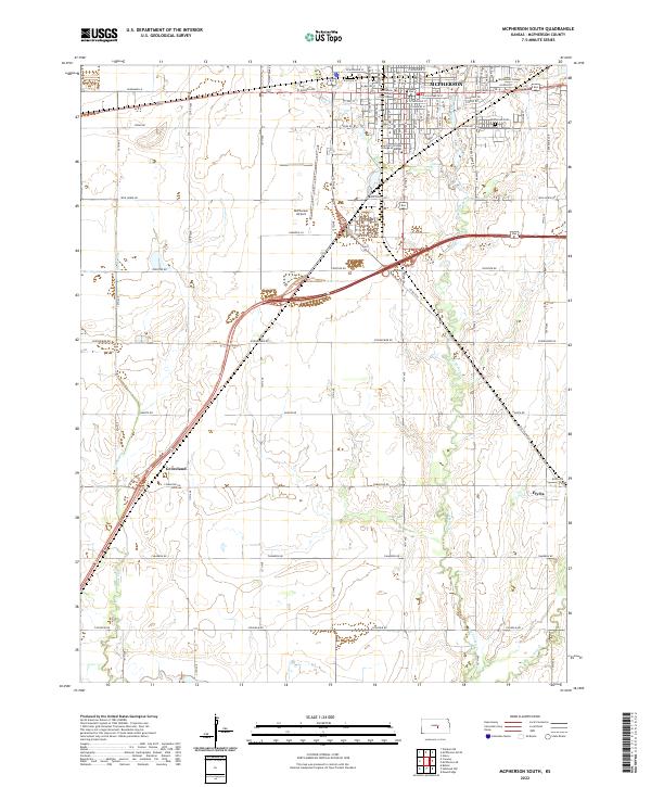
Sharps Cr and its southern tributary, S Sharps Cr, define the drainage patterns of this McPherson County landscape. The area is marked by a rigorous section-line road grid, where travel follows historic naming conventions like Quivera Rd, Pawnee Rd, and Mohawk Rd. For family historians, several small burial grounds serve as anchors for the local rural community, including Excelsior Cem in the northwest and Fairview Cem near the center of the survey area. To the south, Windom Cem sits near the headwaters of Blaze Fork. The topography is largely agricultural, punctuated by a few isolated water features like Clear Pond and Edwards Cr, reflecting a region deeply tied to its hydrology and the systematic 19th-century division of the Great Plains.
Find a feature on this map
21 named features on this map. Tap any name to fly to it.
Don’t see what you’re looking for? This feature index may not catch every label — zoom into the map to look around manually.
Map Details
Editions of this 2022 Windom NE Map
This is the sole edition of this map. No revisions or reprints were ever made.
Historical Maps of McPherson County Through Time
48 maps found
1964 Conway
McPherson County, KS
1965 Halstead NW
McPherson County, KS
1965 Lindsborg SE
McPherson County, KS
1965 Mc Pherson North
McPherson County, KS
1965 Mc Pherson SE
McPherson County, KS
1965 Mc Pherson South
McPherson County, KS
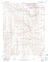
1965 Windom NE
McPherson County, KS
1971 Canton SW
McPherson County, KS
2009 Canton SW
McPherson County, KS
2009 Conway
McPherson County, KS
2009 Halstead NW
McPherson County, KS
2009 Lindsborg SE
McPherson County, KS
2009 McPherson North
McPherson County, KS
2009 McPherson SE
McPherson County, KS
2009 McPherson South
McPherson County, KS
2009 Windom NE
McPherson County, KS
2012 Canton SW
McPherson County, KS
2012 Conway
McPherson County, KS
2012 Halstead NW
McPherson County, KS
2012 Lindsborg SE
McPherson County, KS
2012 McPherson North
McPherson County, KS
2012 McPherson SE
McPherson County, KS
2012 McPherson South
McPherson County, KS
2012 Windom NE
McPherson County, KS
2015 Canton SW
McPherson County, KS
2015 Conway
McPherson County, KS
2015 Halstead NW
McPherson County, KS
2015 Lindsborg SE
McPherson County, KS
2015 McPherson North
McPherson County, KS
2015 McPherson SE
McPherson County, KS
2015 McPherson South
McPherson County, KS
2015 Windom NE
McPherson County, KS
2018 Canton SW
McPherson County, KS
2018 Conway
McPherson County, KS
2018 Halstead NW
McPherson County, KS
2018 Lindsborg SE
McPherson County, KS
2018 McPherson North
McPherson County, KS
2018 McPherson SE
McPherson County, KS
2018 McPherson South
McPherson County, KS
2018 Windom NE
McPherson County, KS
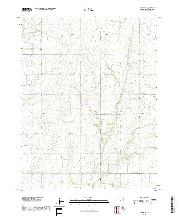
2022 Canton SW
McPherson County, KS
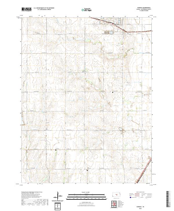
2022 Conway
McPherson County, KS
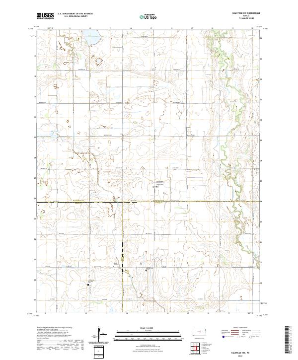
2022 Halstead NW
McPherson County, KS
2022 Lindsborg SE
McPherson County, KS
2022 McPherson North
McPherson County, KS
2022 McPherson SE
McPherson County, KS
2022 McPherson South
McPherson County, KS
2022 Windom NE
McPherson County, KS