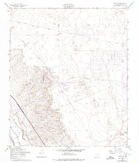
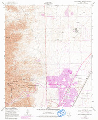
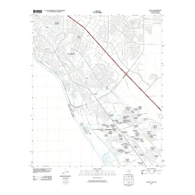
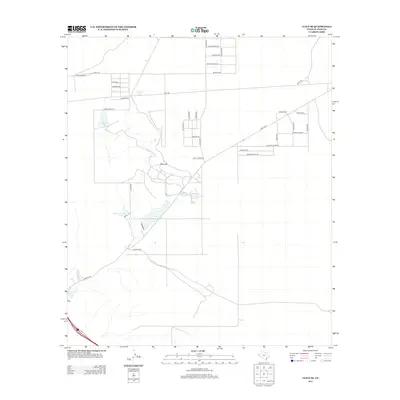
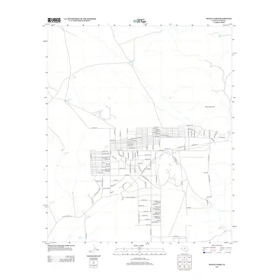
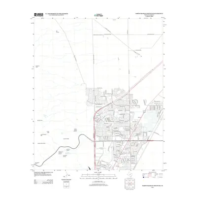
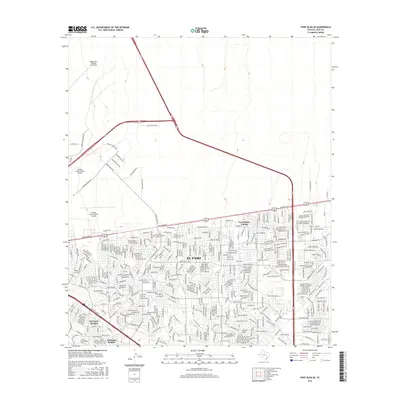
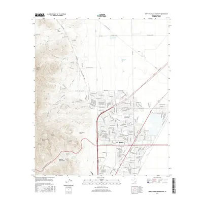
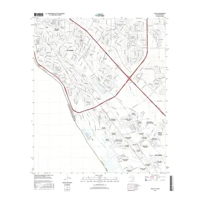
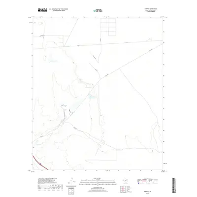
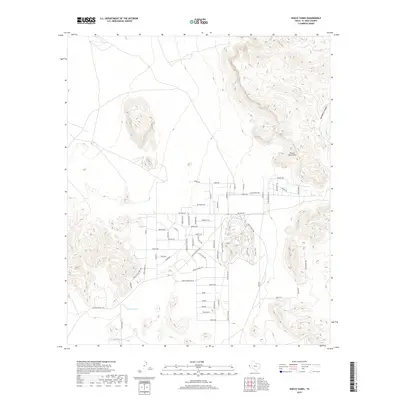
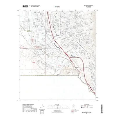
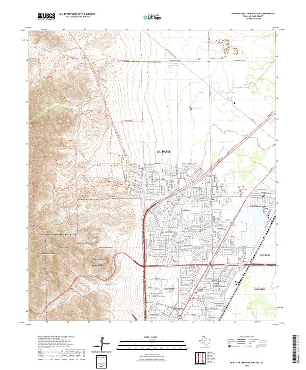
1955 Map of North Franklin Mountain
USGS Topo · Published 1974About this map
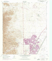
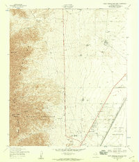
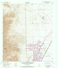
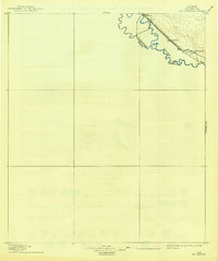
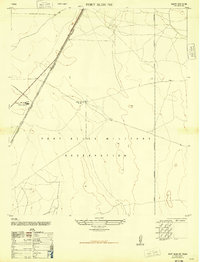
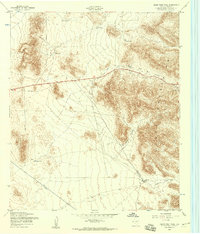
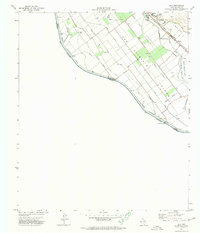
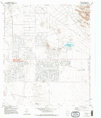
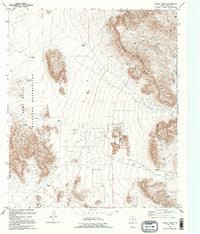
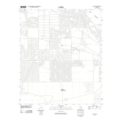
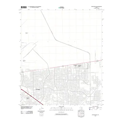
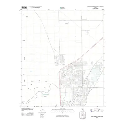
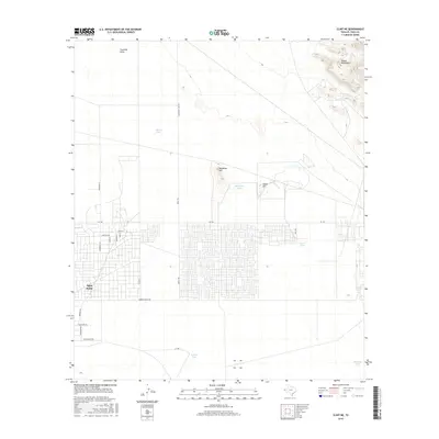
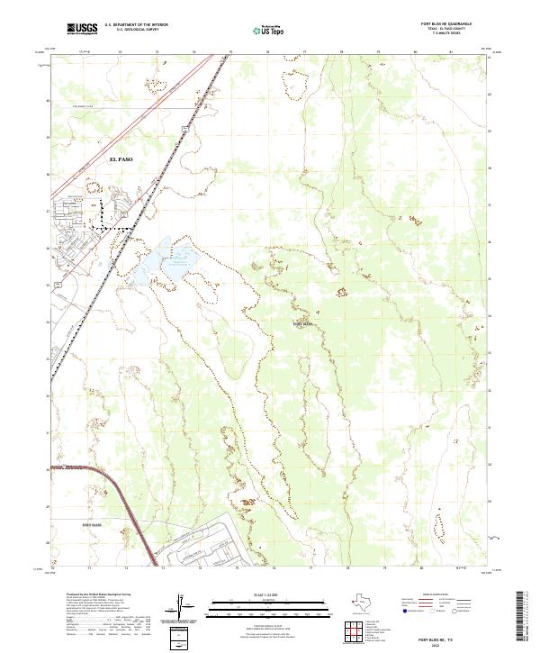
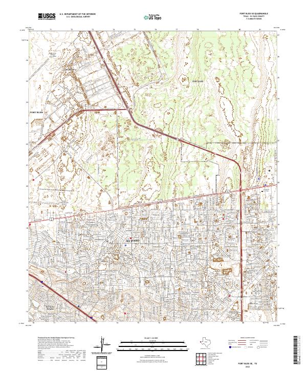
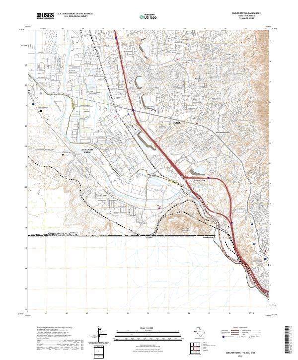
The dramatic vertical rise of North Franklin Mountain and Anthonys Nose dominates this mid-century survey, illustrating the sharp boundary between the desert heights and the expanding urban footprint of El Paso. Much of the rugged western terrain is occupied by the Fort Bliss Military Reservation, including the Castner Range and significant tactical features like Smugglers Pass and Mundys Gap. The map captures a transitional era for the city, with purple photorevisions from the early 1970s showing rapid residential growth pushing toward the mountains. Essential water sources in this arid environment, such as Mundys Spring and Indian Spring, are meticulously noted alongside man-made infrastructure like the Southern Pacific railroad and the Hitt Ranch to the north. This document provides a clear look at how military and municipal borders converged during Texas's post-war expansion.
Find a feature on this map
26 named features on this map. Tap any name to fly to it.
Don’t see what you’re looking for? This feature index may not catch every label — zoom into the map to look around manually.
Map Details
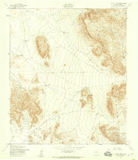
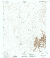
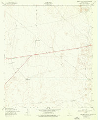
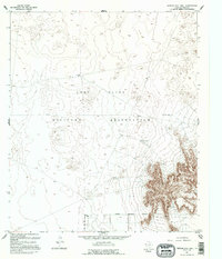
Editions of this 1955 North Franklin Mountain Map
4 editions found
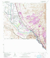
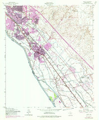
Historical Maps of El Paso Through Time
107 maps found
1896 Rio Grande
El Paso County, TX

1939 Heuco Tanks
El Paso County, TX

1940 Heuco Tanks
El Paso County, TX

1944 Heuco Tanks
El Paso County, TX
1948 Fort Bliss NE
El Paso County, TX

1948 Fort Bliss SE
El Paso County, TX
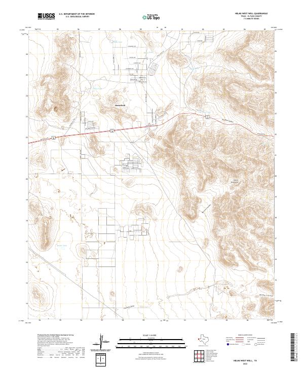
1948 Helms West Well
El Paso County, TX
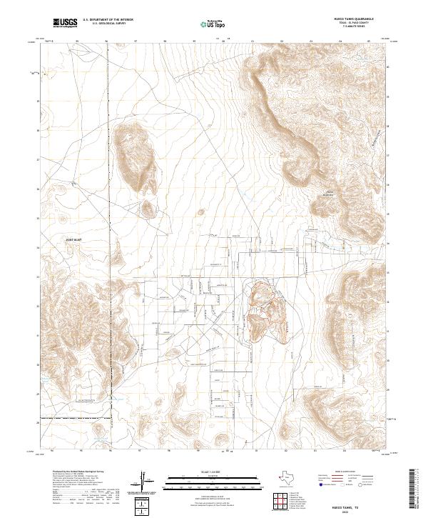
1948 Heuco Tanks
El Paso County, TX
1955 Clint NE
El Paso County, TX
1955 Clint NW
El Paso County, TX
1955 Clint SE
El Paso County, TX
1955 Fort Bliss NE
El Paso County, TX
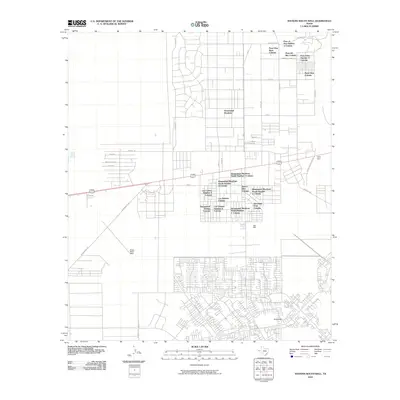
1955 Fort Bliss SE
El Paso County, TX
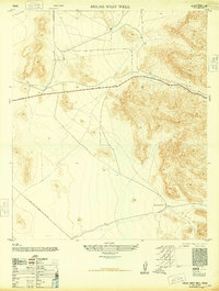
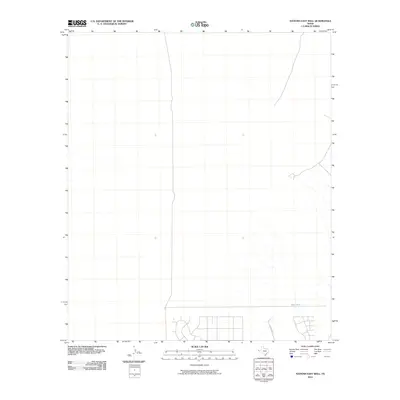
1955 Helms West Well
El Paso County, TX
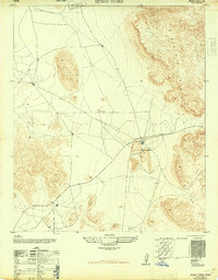
1955 Heuco Tanks
El Paso County, TX
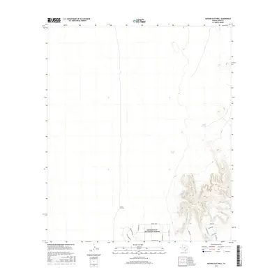
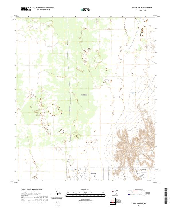
1955 Nations East Well
El Paso County, TX
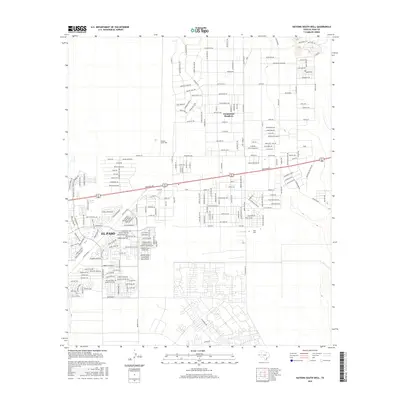
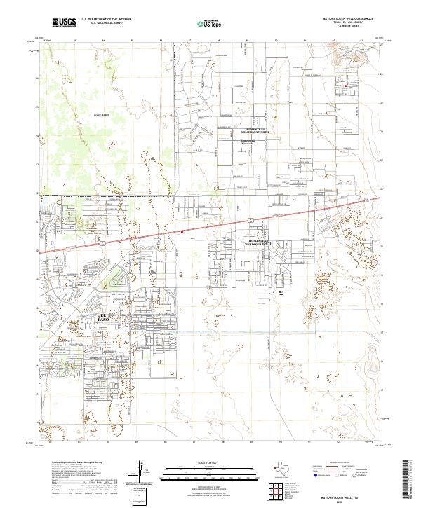
1955 Nations South Well
El Paso County, TX
1955 North Franklin Mountain
El Paso County, TX
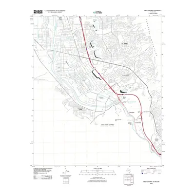
1955 Smeltertown
El Paso County, TX
1955 Ysleta
El Paso County, TX
1955 Ysleta NW
El Paso County, TX
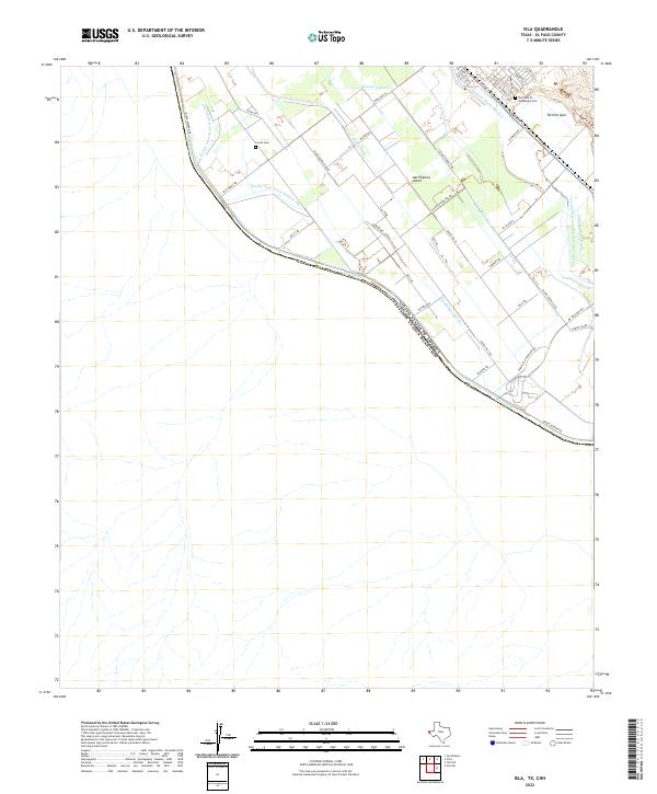
1972 Isla
El Paso County, TX
1990 Ysleta NW
El Paso County, TX
1994 Fort Bliss SE
El Paso County, TX

1994 Smeltertown
El Paso County, TX

1994 Ysleta
El Paso County, TX
1994 Ysleta NW
El Paso County, TX
1995 Clint NE
El Paso County, TX

1995 Clint NW
El Paso County, TX
1995 Clint SE
El Paso County, TX
1995 Fort Bliss NE
El Paso County, TX
1995 Helms West Well
El Paso County, TX
1995 Hueco Tanks
El Paso County, TX
1995 Nations East Well
El Paso County, TX
1995 Nations South Well
El Paso County, TX
1995 North Franklin Mountain
El Paso County, TX

1996 Smeltertown
El Paso County, TX
2010 Clint NE
El Paso County, TX
2010 Clint NW
El Paso County, TX
2010 Clint SE
El Paso County, TX
2010 Fort Bliss NE
El Paso County, TX
2010 Fort Bliss SE
El Paso County, TX
2010 Helms West Well
El Paso County, TX
2010 Hueco Tanks
El Paso County, TX
2010 Isla
El Paso County, TX
2010 Nations East Well
El Paso County, TX
2010 Nations South Well
El Paso County, TX
2010 North Franklin Mountain
El Paso County, TX
2010 Smeltertown
El Paso County, TX
2010 Ysleta
El Paso County, TX
2010 Ysleta NW
El Paso County, TX
2012 Clint NE
El Paso County, TX
2012 Clint NW
El Paso County, TX
2012 Clint SE
El Paso County, TX
2012 Fort Bliss NE
El Paso County, TX
2012 Fort Bliss SE
El Paso County, TX
2012 Helms West Well
El Paso County, TX
2012 Hueco Tanks
El Paso County, TX
2012 Isla
El Paso County, TX
2012 Nations East Well
El Paso County, TX
2012 Nations South Well
El Paso County, TX
2012 North Franklin Mountain
El Paso County, TX
2012 Smeltertown
El Paso County, TX
2012 Ysleta
El Paso County, TX
2012 Ysleta NW
El Paso County, TX
2016 Clint NE
El Paso County, TX
2016 Clint NW
El Paso County, TX
2016 Clint SE
El Paso County, TX
2016 Fort Bliss NE
El Paso County, TX
2016 Fort Bliss SE
El Paso County, TX
2016 Helms West Well
El Paso County, TX
2016 Hueco Tanks
El Paso County, TX
2016 Isla
El Paso County, TX
2016 Nations East Well
El Paso County, TX
2016 Nations South Well
El Paso County, TX
2016 North Franklin Mountain
El Paso County, TX
2016 Smeltertown
El Paso County, TX
2016 Ysleta
El Paso County, TX
2016 Ysleta NW
El Paso County, TX
2019 Clint NE
El Paso County, TX
2019 Clint NW
El Paso County, TX
2019 Clint SE
El Paso County, TX
2019 Fort Bliss NE
El Paso County, TX
2019 Fort Bliss SE
El Paso County, TX
2019 Helms West Well
El Paso County, TX
2019 Hueco Tanks
El Paso County, TX

2019 Isla
El Paso County, TX
2019 Nations East Well
El Paso County, TX
2019 Nations South Well
El Paso County, TX
2019 North Franklin Mountain
El Paso County, TX
2019 Smeltertown
El Paso County, TX
2019 Ysleta
El Paso County, TX
2019 Ysleta NW
El Paso County, TX

2022 Clint NE
El Paso County, TX

2022 Clint NW
El Paso County, TX
2022 Clint SE
El Paso County, TX
2022 Fort Bliss NE
El Paso County, TX
2022 Fort Bliss SE
El Paso County, TX
2022 Helms West Well
El Paso County, TX
2022 Hueco Tanks
El Paso County, TX
2022 Isla
El Paso County, TX
2022 Nations East Well
El Paso County, TX
2022 Nations South Well
El Paso County, TX
2022 North Franklin Mountain
El Paso County, TX
2022 Smeltertown
El Paso County, TX
2022 Ysleta
El Paso County, TX
2022 Ysleta NW
El Paso County, TX