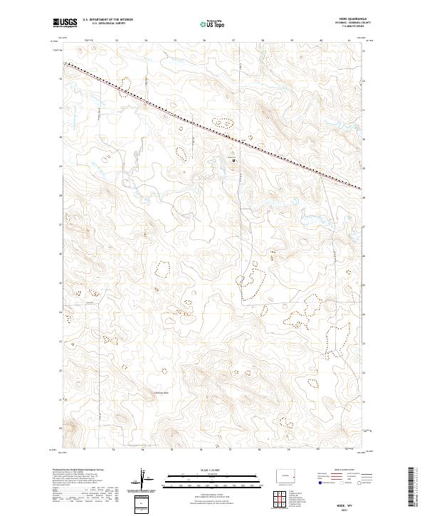
2021 Map of Node
USGS Topo · Published 2021About this map
The small settlement of Node serves as the focal point for this section of eastern Wyoming, where the high plains landscape is defined by the winding course of the Niobrara River. This survey illustrates a rural ranching environment structured by a network of local roads such as Node Rd and Pfister Rd, many bearing the names of local families. The presence of the Node Cem northeast of the main settlement provides a key point of interest for genealogists tracking early residents of Niobrara County. The terrain is characterized by numerous seasonal drainages, including Duck Creek and Bergreen Cr, which cut through the undulating prairie. A prominent natural landmark, Chimney Rock, stands out in the southwestern portion of the map, offering a distinctive navigational marker in a region where the vast topography is shaped by the headwaters of the Silver Springs Cr system.
Find a feature on this map
21 named features on this map. Tap any name to fly to it.
Don’t see what you’re looking for? This feature index may not catch every label — zoom into the map to look around manually.
Map Details
Editions of this 2021 Node Map
This is the sole edition of this map. No revisions or reprints were ever made.
Other maps of this area

1954 · Torrington
USGS Topo · 1:250,000

1958 · Torrington
USGS Topo · 1:250,000

1974 · Mc Master Reservoir
USGS Topo · 1:24,000

1974 · Rawhide Buttes East
USGS Topo · 1:24,000
1974 · Reynolds Spring
USGS Topo · 1:24,000

1977 · Hileman Draw
USGS Topo · 1:24,000

1977 · Prairie Center
USGS Topo · 1:24,000
1978 · Node
USGS Topo · 1:24,000

1978 · Kirtley SW
USGS Topo · 1:24,000

1981 · Lusk
USGS Topo · 1:24,000