
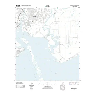
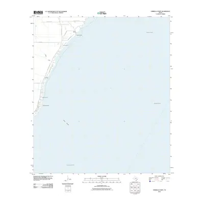
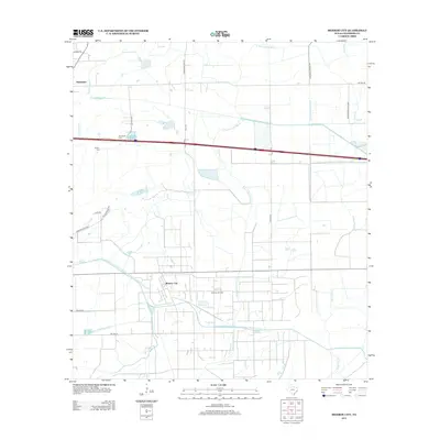
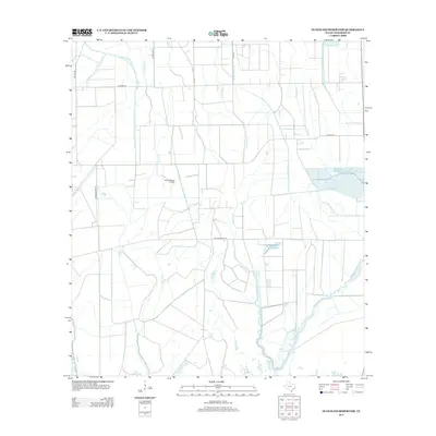
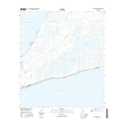
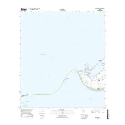
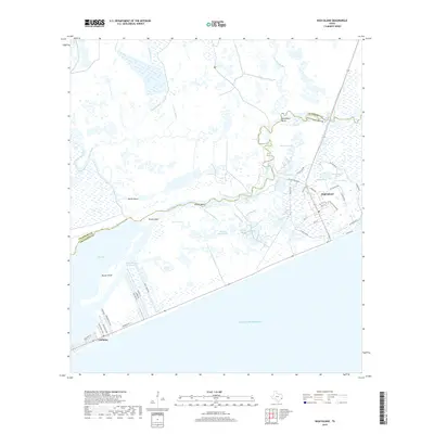
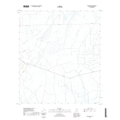
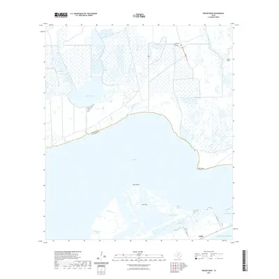
2025 Map of Stanolind Reservoir
USGS Topo · Published 2025About this map
Coastal prairie and managed water systems define this portion of Chambers County, where the Stanolind Reservoir serves as a central landmark for the surrounding drainage network. The landscape is characterized by a sophisticated grid of rural routes and irrigation infrastructure, including the Devers East Canal and named arterials like Fairview RD and Doornbos RD. These roads serve the agricultural parcels that sit between the meandering paths of Onion Bayou and East Bay Bayou, which drain toward the Gulf.
Find a feature on this map
16 named features on this map. Tap any name to fly to it.
Don’t see what you’re looking for? This feature index may not catch every label — zoom into the map to look around manually.
Map Details
Editions of this 2025 Stanolind Reservoir Map
This is the sole edition of this map. No revisions or reprints were ever made.
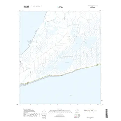
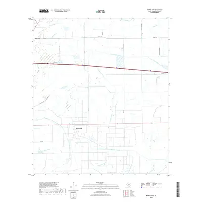
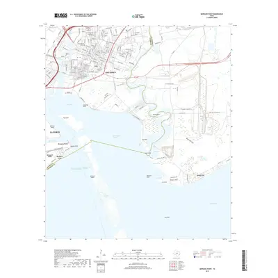
Historical Maps of Chambers County Through Time
86 maps found

1916 Morgan Point
Chambers County, TX

1919 Morgan Point
Chambers County, TX

1931 Frozen Point
Chambers County, TX

1931 High Island
Chambers County, TX

1932 Clifton By The Sea
Chambers County, TX

1933 Frozen Point
Chambers County, TX

1933 Smith Point
Chambers County, TX

1933 Whites Lake
Chambers County, TX

1943 Clifton By The Sea
Chambers County, TX

1943 Frozen Point
Chambers County, TX

1943 High Island
Chambers County, TX

1943 Lake Stephenson
Chambers County, TX

1943 Morgan Point
Chambers County, TX

1943 Sea Breeze
Chambers County, TX

1943 Smith Point
Chambers County, TX

1943 West of Eagle
Chambers County, TX

1945 Sea Breeze
Chambers County, TX

1956 Morgans Point
Chambers County, TX

1961 Lake Stephenson
Chambers County, TX

1961 Monroe City
Chambers County, TX

1961 Oyster Bayou
Chambers County, TX

1961 Smith Point
Chambers County, TX

1961 Umbrella Point
Chambers County, TX

1962 Frozen Point
Chambers County, TX

1962 High Island
Chambers County, TX

1962 Stanolind Reservoir
Chambers County, TX

1982 Morgans Point
Chambers County, TX

1993 Morgans Point
Chambers County, TX

1993 Smith Point
Chambers County, TX

1994 Frozen Point
Chambers County, TX

1994 High Island
Chambers County, TX

1994 Lake Stephenson
Chambers County, TX

1994 Monroe City
Chambers County, TX

1994 Oyster Bayou
Chambers County, TX

1994 Stanolind Reservoir
Chambers County, TX

1994 Umbrella Point
Chambers County, TX

1995 Morgans Point
Chambers County, TX
2010 Frozen Point
Chambers County, TX
2010 High Island
Chambers County, TX
2010 Lake Stephenson
Chambers County, TX
2010 Monroe City
Chambers County, TX
2010 Morgans Point
Chambers County, TX
2010 Oyster Bayou
Chambers County, TX
2010 Smith Point
Chambers County, TX
2010 Stanolind Reservoir
Chambers County, TX
2010 Umbrella Point
Chambers County, TX
2013 Frozen Point
Chambers County, TX
2013 High Island
Chambers County, TX
2013 Lake Stephenson
Chambers County, TX
2013 Monroe City
Chambers County, TX
2013 Morgans Point
Chambers County, TX
2013 Oyster Bayou
Chambers County, TX
2013 Smith Point
Chambers County, TX
2013 Stanolind Reservoir
Chambers County, TX
2013 Umbrella Point
Chambers County, TX
2016 Frozen Point
Chambers County, TX
2016 High Island
Chambers County, TX
2016 Lake Stephenson
Chambers County, TX
2016 Monroe City
Chambers County, TX
2016 Morgans Point
Chambers County, TX
2016 Oyster Bayou
Chambers County, TX
2016 Smith Point
Chambers County, TX
2016 Stanolind Reservoir
Chambers County, TX
2016 Umbrella Point
Chambers County, TX
2019 Frozen Point
Chambers County, TX
2019 High Island
Chambers County, TX
2019 Lake Stephenson
Chambers County, TX
2019 Monroe City
Chambers County, TX
2019 Morgans Point
Chambers County, TX
2019 Oyster Bayou
Chambers County, TX
2019 Smith Point
Chambers County, TX
2019 Stanolind Reservoir
Chambers County, TX
2019 Umbrella Point
Chambers County, TX
2022 Frozen Point
Chambers County, TX
2022 High Island
Chambers County, TX

2022 Lake Stephenson
Chambers County, TX

2022 Monroe City
Chambers County, TX

2022 Morgans Point
Chambers County, TX
2022 Oyster Bayou
Chambers County, TX

2022 Smith Point
Chambers County, TX
2022 Stanolind Reservoir
Chambers County, TX

2022 Umbrella Point
Chambers County, TX

2025 Frozen Point
Chambers County, TX

2025 High Island
Chambers County, TX

2025 Oyster Bayou
Chambers County, TX
2025 Stanolind Reservoir
Chambers County, TX