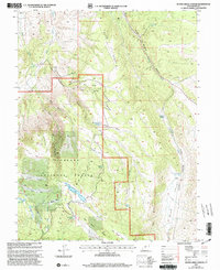
2001 Map of Water Creek Canyon
USGS Topo · Published 2003About this map
Fishlake National Forest encompasses the majority of this high-elevation landscape in Sevier County, characterized by a series of high basins and drainages. The area is defined by its water resources, featuring prominent bodies such as Annabella Reservoir, Big Lake, Deep Lake, and the Davis Hollow Reservoir. These reservoirs and springs, including Hunters Spring and Bumhall Springs, indicate a terrain managed for both natural preservation and water storage. The topography is deeply carved by several major canyons and gulches, notably Squeedunk Canyon, Bell Rock Canyon, and Killian Hollow, which cut through ridges like Bear Ridge and Red Pine Ridge. This map reflects the remote character of the southern Utah mountains as they were surveyed and updated at the turn of the 21st century, showing the established forestry infrastructure and resource management markers like the Gravel Pit and various range improvements across Hunters Flat and Circle Flat.
Find a feature on this map
38 named features on this map. Tap any name to fly to it.
Don’t see what you’re looking for? This feature index may not catch every label — zoom into the map to look around manually.
Map Details
Editions of this 2001 Water Creek Canyon Map
This is the sole edition of this map. No revisions or reprints were ever made.
Other maps of this area

1885 · Beaver
USGS Topo · 1:250,000

1885 · Fish Lake
USGS Topo · 1:250,000

1896 · Fish Lake
USGS Topo · 1:250,000

1940 · Monroe
USGS Topo · 1:62,500

1944 · Monroe
USGS Topo · 1:62,500

1953 · Richfield
USGS Topo · 1:250,000

1956 · Salina
USGS Topo · 1:250,000

1958 · Richfield
USGS Topo · 1:250,000

1960 · Salina
USGS Topo · 1:250,000

1961 · Richfield
USGS Topo · 1:62,500