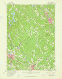
1958 Map of Berwick
USGS Topo · Published 1961About this map
The Salmon Falls River serves as the winding boundary between Maine and New Hampshire, anchoring a landscape of industrial river towns and upland farming communities. In Springvale and Sanford, the dense street grids are punctuated by Nasson College and institutional landmarks like the Lafayette Sch, while the Boston and Maine Railroad corridors illustrate the era's vital transit links. To the west, Rochester appears as a significant hub where the Cocheco River and the emerging Spaulding Turnpike meet, signaling the shift toward modern automotive infrastructure.
Find a feature on this map
149 named features on this map. Tap any name to fly to it.
Don’t see what you’re looking for? This feature index may not catch every label — zoom into the map to look around manually.
Map Details
Editions of this 1958 Berwick Map
3 editions found
Other maps of this area

1891 · Berwick
USGS Topo · 1:62,500

1891 · Kennebunk
USGS Topo · 1:62,500

1891 · Buxton
USGS Topo · 1:62,500

1891 · Newfield
USGS Topo · 1:62,500

1892 · Buxton
USGS Topo · 1:62,500

1893 · Kennebunk
USGS Topo · 1:62,500

1893 · Dover
USGS Topo · 1:62,500

1893 · Berwick
USGS Topo · 1:62,500

1893 · York
USGS Topo · 1:62,500

1893 · Buxton
USGS Topo · 1:62,500