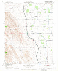
1953 Map of Howard Ranch
USGS Topo · Published 1967About this map
The Stanislaus Co Merced Co line cuts through this section of the Central Valley, where the flat agricultural plains meet the rising foothills. Civil engineering projects define the landscape in the early 1950s, most notably the massive Delta - Mendota Canal and the Outside Canal which channel water through the arid valley floor. These waterways run parallel to the older drainage of Garzas Creek and Quinto Creek, illustrating the transition from natural seasonal flows to a managed irrigation system. Local infrastructure is anchored by the Cottonwood School and Romero School, while the eponymous Howard Ranch and the nearby Gravel Pit suggest a rural economy built on ranching and resource extraction. A network of family-named roads like Rose Garden Road and Jorgensen Road connects these scattered landmarks across the basin.
Find a feature on this map
25 named features on this map. Tap any name to fly to it.
Don’t see what you’re looking for? This feature index may not catch every label — zoom into the map to look around manually.
Map Details
Editions of this 1953 Howard Ranch Map
4 editions found
Other maps of this area

1917 · Newman
USGS Topo · 1:31,680

1918 · Gustine
USGS Topo · 1:31,680

1919 · Orestimba
USGS Topo · 1:62,500

1919 · Orestimba Creek
USGS Topo · 1:31,680

1919 · Ingomar
USGS Topo · 1:31,680

1920 · Pacheco Pass
USGS Topo · 1:62,500

1921 · Volta
USGS Topo · 1:31,680

1922 · San Luis Creek
USGS Topo · 1:31,680

1922 · Howard Ranch
USGS Topo · 1:31,680

1940 · Pacheco Pass
USGS Topo · 1:62,500