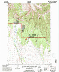
1995 Map of Green Ashley Gulch
USGS Topo · Published 1997About this map
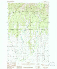
The Snowy Mountains dominate this high-elevation landscape within the Lewis and Clark National Forest and the Musselshell Ranger District. Rising dramatically toward the northeast, peaks like Mt Baldy and Lost Peak overlook a terrain carved by deep canyons and gulches, including Horse-thief Canyon and Bad Canyon. The southern portion of the quadrangle transitions into more open country, where the National Forest Boundary separates protected timberlands from private holdings such as Wirzesinski. Water sources are critical in this environment, indicated by the numerous Springs feeding drainages like Swimming Woman Creek, Merrills Creek, and Ashley Gulch. This 1995 revision provides a clear picture of the land-use patterns on the edge of the mountains, from the rugged heights of Tepee Point to the irrigation infrastructure of the Ditch system in the lower coulees.
Find a feature on this map
28 named features on this map. Tap any name to fly to it.
Don’t see what you’re looking for? This feature index may not catch every label — zoom into the map to look around manually.
Map Details
Editions of this 1995 Green Ashley Gulch Map
This is the sole edition of this map. No revisions or reprints were ever made.
Other maps of this area

1889 · Big Snowy Mountain
USGS Topo · 1:250,000

1893 · Big Snowy Mountain
USGS Topo · 1:250,000

1954 · Roundup
USGS Topo · 1:250,000

1958 · Roundup
USGS Topo · 1:250,000
1970 · Alaska Bench
USGS Topo · 1:24,000
1970 · Half Moon Canyon
USGS Topo · 1:24,000
1970 · Jump Off Peak
USGS Topo · 1:24,000

1986 · Patterson Canyon
USGS Topo · 1:24,000
1986 · Snow Saucer Coulee
USGS Topo · 1:24,000

1986 · Halbert Creek North
USGS Topo · 1:24,000