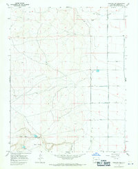
1967 Map of Goshawk Dam
USGS Topo · Published 1970About this map
Goshawk Dam and its neighboring reservoirs, Turkey Dam, Swan Dam, and Ostrich Dam, anchor the southern end of this high-altitude landscape in the late 1960s. These water management structures feed into The Poso, illustrating the critical role of irrigation engineering in the San Luis Valley. To the north and east, the terrain transitions into a more structured agricultural grid defined by an extensive water delivery system. Significant irrigation infrastructure, including the Romero Ditch, Mogote Ditch, and Bountiful Lateral, highlights the organized effort to divert water from natural sources like La Jara Arroyo to the surrounding ranch lands. This 1967 field-checked survey reveals a rugged interior crossed by a solitary Jeep Trail, connecting the remote western elevations near Capulin with the developing valleys to the east.
Find a feature on this map
16 named features on this map. Tap any name to fly to it.
Don’t see what you’re looking for? This feature index may not catch every label — zoom into the map to look around manually.
Map Details
Editions of this 1967 Goshawk Dam Map
This is the sole edition of this map. No revisions or reprints were ever made.
Other maps of this area

1922 · Conejos
USGS Topo · 1:125,000

1945 · Durango
USGS Topo · 1:250,000

1953 · Durango
USGS Topo · 1:250,000

1954 · Durango
USGS Topo · 1:250,000

1954 · Trinidad
USGS Topo · 1:250,000

1955 · Trinidad
USGS Topo · 1:250,000

1958 · Trinidad
USGS Topo · 1:250,000

1959 · Trinidad
USGS Topo · 1:250,000

1961 · Durango
USGS Topo · 1:250,000

1963 · Durango
USGS Topo · 1:250,000