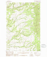
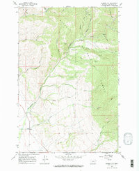
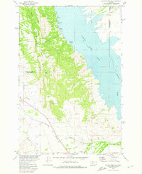
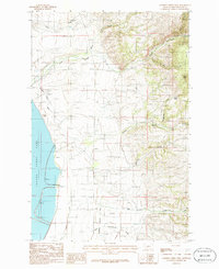
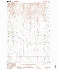
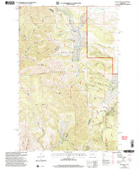
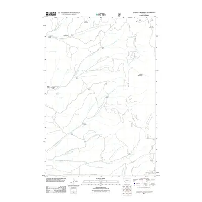
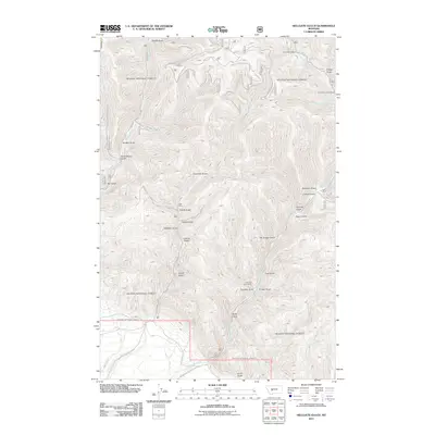
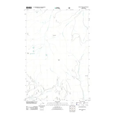
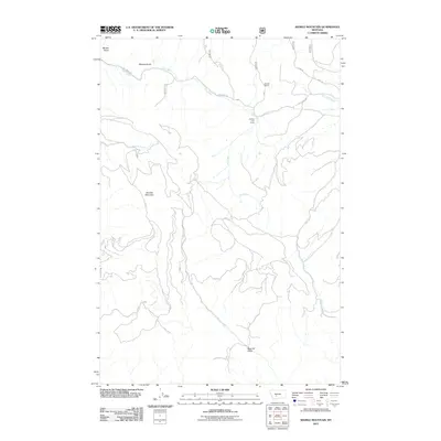
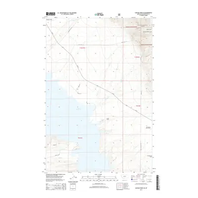
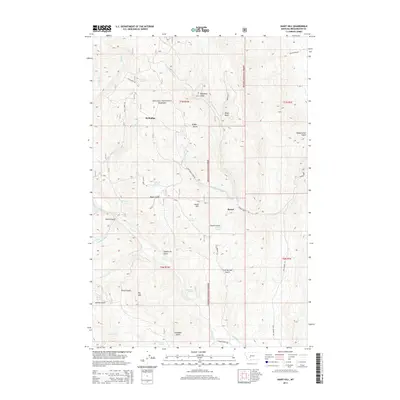
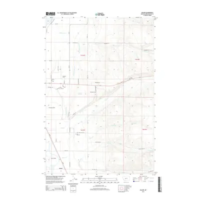
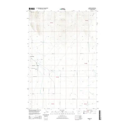
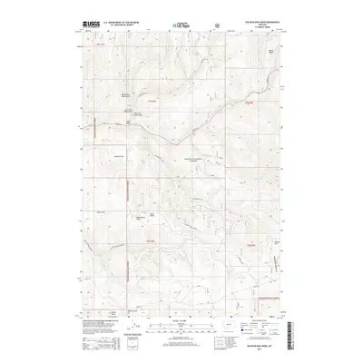
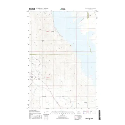
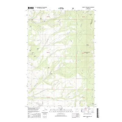
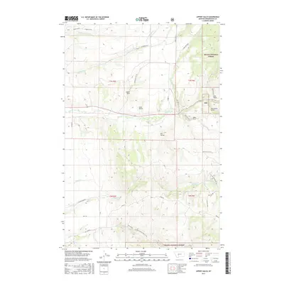
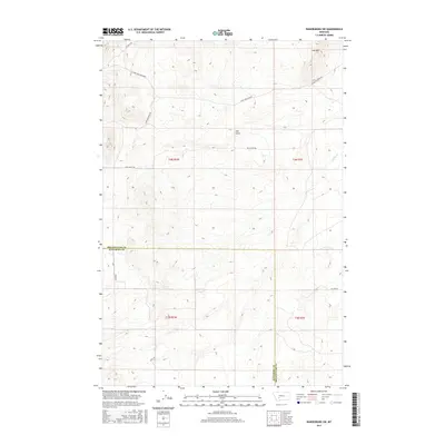
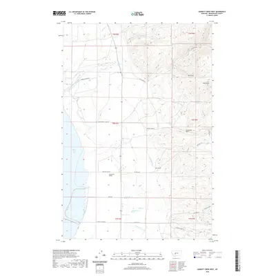
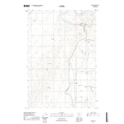
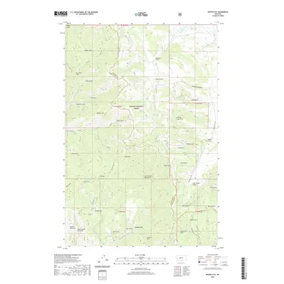
1986 Map of Gurnett Creek East
USGS Topo · Published 1986About this map
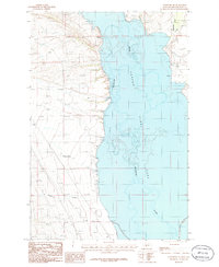
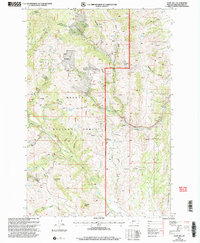
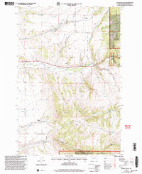
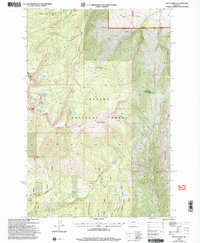
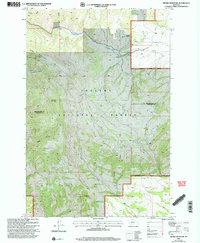
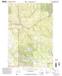
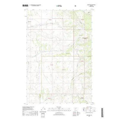
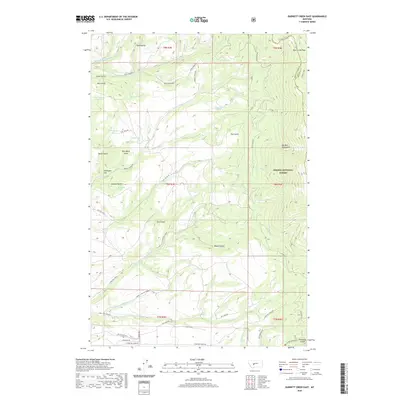
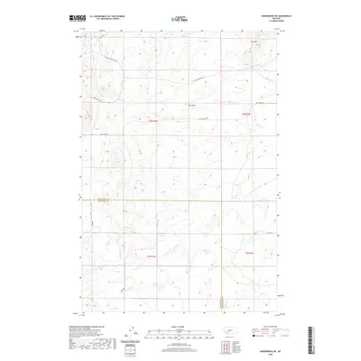
The Helena National Forest dominates the landscape of the Big Belt Mountains on this mid-1980s provisional study, showing a terrain defined by deep gulches and significant elevation changes. This region along the Broadwater and Meagher county line was a network of seasonal water sources and named landmarks vital for navigation and ranching. Distinctive features like Hooligans Hill and Dutchie Butte stand as prominent markers in the western half of the map, while Duck Creek Pass provides a key transition point in the northeast. The presence of numerous Grain Bins and scattered springs such as Hard Cash Spring and Moonshine Spring suggests the continued importance of livestock grazing and land management in the high-country drainages of Gurnett Creek and the multiple forks of Ray Creek.
Find a feature on this map
25 named features on this map. Tap any name to fly to it.
Don’t see what you’re looking for? This feature index may not catch every label — zoom into the map to look around manually.
Map Details
Editions of this 1986 Gurnett Creek East Map
This is the sole edition of this map. No revisions or reprints were ever made.
Historical Maps of Meagher County Through Time
129 maps found
1886 Fort Logan
Broadwater County, MT
1950 Canyon Ferry
Broadwater County, MT
1950 Duck Creek Pass
Broadwater County, MT
1966 Diamond City
Broadwater County, MT

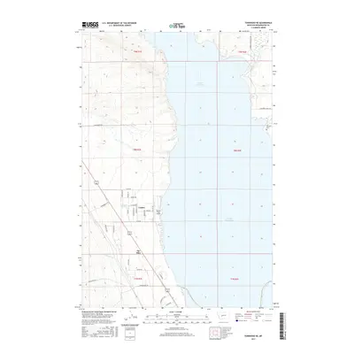
1966 Whites City
Broadwater County, MT
1971 Mount Edith
Broadwater County, MT
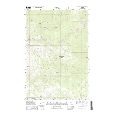
1971 Sulphur Bar Creek
Broadwater County, MT
1972 Canyon Ferry SE
Broadwater County, MT
1972 Canyon Ferry SW
Broadwater County, MT
1972 Hellgate Gulch
Broadwater County, MT
1986 Deer Park
Broadwater County, MT
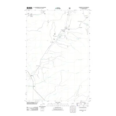
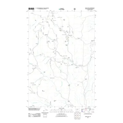
1986 Giant Hill
Broadwater County, MT
1986 Gurnett Creek East
Broadwater County, MT
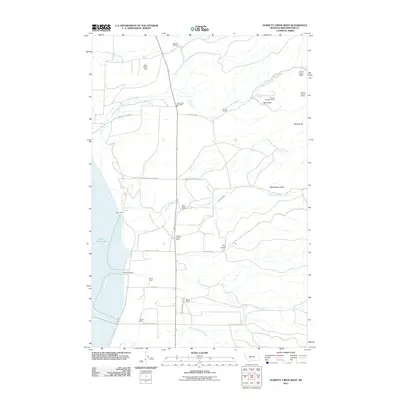
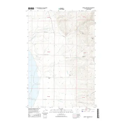
1986 Gurnett Creek West
Broadwater County, MT
1986 Holker
Broadwater County, MT
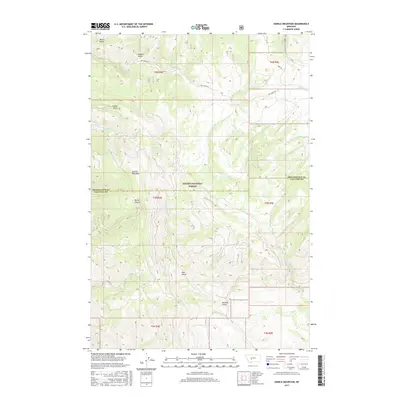
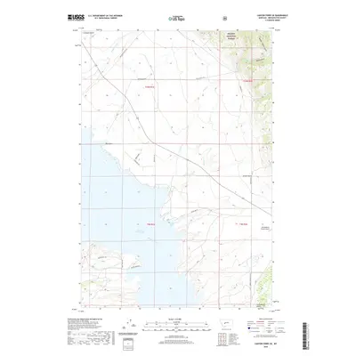
1986 Lippert Gulch
Broadwater County, MT
1986 Lombard
Broadwater County, MT
1986 Parker
Broadwater County, MT
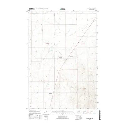
1986 Plunket Lake
Broadwater County, MT
1986 Radersburg SW
Broadwater County, MT
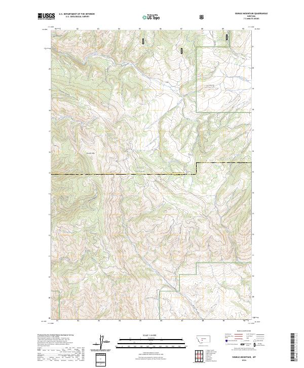
1986 Sixmile Mountain
Broadwater County, MT
1986 Townsend NE
Broadwater County, MT
2001 Canyon Ferry SE
Broadwater County, MT
2001 Deer Park
Broadwater County, MT
2001 Diamond City
Broadwater County, MT
2001 Giant Hill
Broadwater County, MT
2001 Gurnett Creek East
Broadwater County, MT
2001 Hellgate Gulch
Broadwater County, MT
2001 Holker
Broadwater County, MT
2001 Lippert Gulch
Broadwater County, MT
2001 Mount Edith
Broadwater County, MT
2001 Sixmile Mountain
Broadwater County, MT
2001 Sulphur Bar Creek
Broadwater County, MT
2001 Whites City
Broadwater County, MT
2011 Canyon Ferry SE
Broadwater County, MT
2011 Canyon Ferry SW
Broadwater County, MT
2011 Deer Park
Broadwater County, MT
2011 Diamond City
Broadwater County, MT
2011 Giant Hill
Broadwater County, MT
2011 Gurnett Creek East
Broadwater County, MT
2011 Gurnett Creek West
Broadwater County, MT
2011 Hellgate Gulch
Broadwater County, MT
2011 Holker
Broadwater County, MT
2011 Lippert Gulch
Broadwater County, MT
2011 Lombard
Broadwater County, MT
2011 Mount Edith
Broadwater County, MT
2011 Parker
Broadwater County, MT
2011 Plunket Lake
Broadwater County, MT
2011 Radersburg SW
Broadwater County, MT
2011 Sixmile Mountain
Broadwater County, MT
2011 Sulphur Bar Creek
Broadwater County, MT
2011 Townsend NE
Broadwater County, MT
2011 Whites City
Broadwater County, MT
2014 Canyon Ferry SE
Broadwater County, MT
2014 Canyon Ferry SW
Broadwater County, MT
2014 Deer Park
Broadwater County, MT
2014 Diamond City
Broadwater County, MT
2014 Giant Hill
Broadwater County, MT
2014 Gurnett Creek East
Broadwater County, MT
2014 Gurnett Creek West
Broadwater County, MT
2014 Hellgate Gulch
Broadwater County, MT
2014 Holker
Broadwater County, MT
2014 Lippert Gulch
Broadwater County, MT
2014 Lombard
Broadwater County, MT
2014 Mount Edith
Broadwater County, MT
2014 Parker
Broadwater County, MT
2014 Plunket Lake
Broadwater County, MT
2014 Radersburg SW
Broadwater County, MT
2014 Sixmile Mountain
Broadwater County, MT
2014 Sulphur Bar Creek
Broadwater County, MT
2014 Townsend NE
Broadwater County, MT
2014 Whites City
Broadwater County, MT
2017 Canyon Ferry SE
Broadwater County, MT
2017 Canyon Ferry SW
Broadwater County, MT
2017 Deer Park
Broadwater County, MT
2017 Diamond City
Broadwater County, MT
2017 Giant Hill
Broadwater County, MT
2017 Gurnett Creek East
Broadwater County, MT
2017 Gurnett Creek West
Broadwater County, MT
2017 Hellgate Gulch
Broadwater County, MT
2017 Holker
Broadwater County, MT
2017 Lippert Gulch
Broadwater County, MT
2017 Lombard
Broadwater County, MT
2017 Mount Edith
Broadwater County, MT
2017 Parker
Broadwater County, MT
2017 Plunket Lake
Broadwater County, MT
2017 Radersburg SW
Broadwater County, MT
2017 Sixmile Mountain
Broadwater County, MT
2017 Sulphur Bar Creek
Broadwater County, MT
2017 Townsend NE
Broadwater County, MT
2017 Whites City
Broadwater County, MT
2020 Canyon Ferry SE
Broadwater County, MT
2020 Canyon Ferry SW
Broadwater County, MT
2020 Deer Park
Broadwater County, MT
2020 Diamond City
Broadwater County, MT
2020 Giant Hill
Broadwater County, MT
2020 Gurnett Creek East
Broadwater County, MT
2020 Gurnett Creek West
Broadwater County, MT
2020 Hellgate Gulch
Broadwater County, MT
2020 Holker
Broadwater County, MT
2020 Lippert Gulch
Broadwater County, MT
2020 Lombard
Broadwater County, MT
2020 Mount Edith
Broadwater County, MT
2020 Parker
Broadwater County, MT
2020 Plunket Lake
Broadwater County, MT
2020 Radersburg SW
Broadwater County, MT
2020 Sixmile Mountain
Broadwater County, MT
2020 Sulphur Bar Creek
Broadwater County, MT
2020 Townsend NE
Broadwater County, MT
2020 Whites City
Broadwater County, MT
2024 Canyon Ferry SE
Broadwater County, MT
2024 Canyon Ferry SW
Broadwater County, MT
2024 Deer Park
Broadwater County, MT
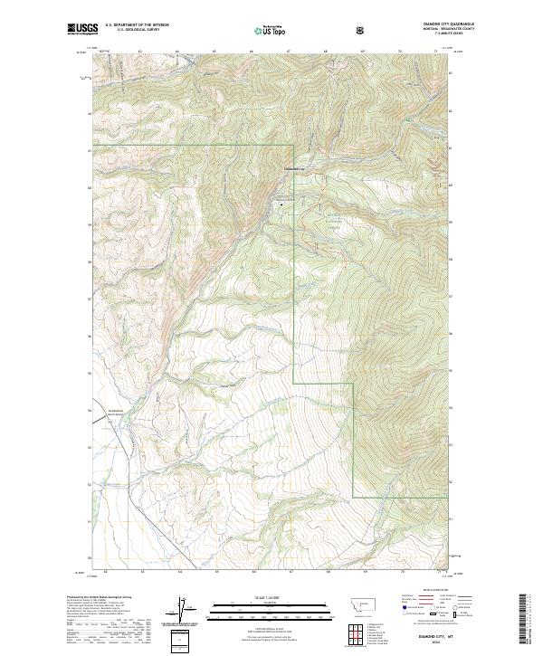
2024 Diamond City
Broadwater County, MT
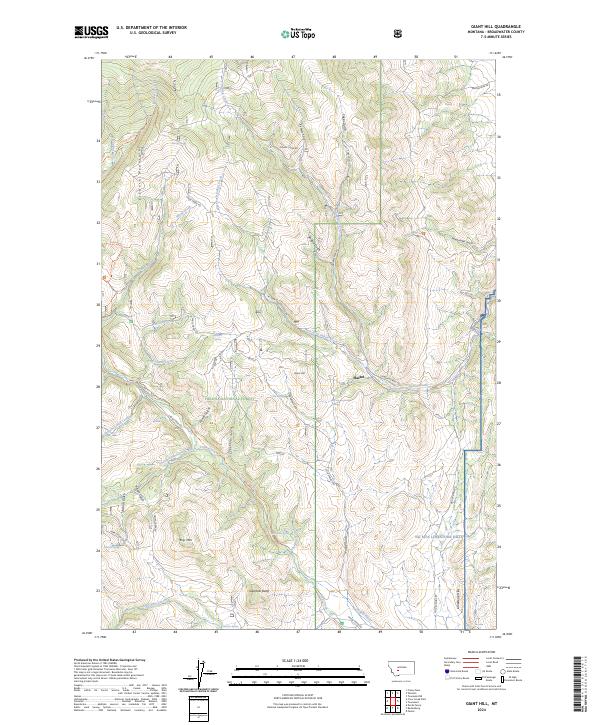
2024 Giant Hill
Broadwater County, MT
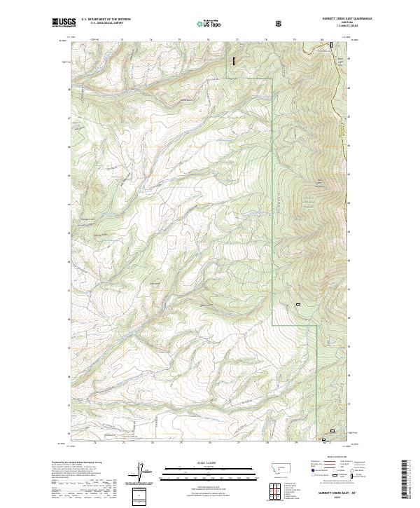
2024 Gurnett Creek East
Broadwater County, MT
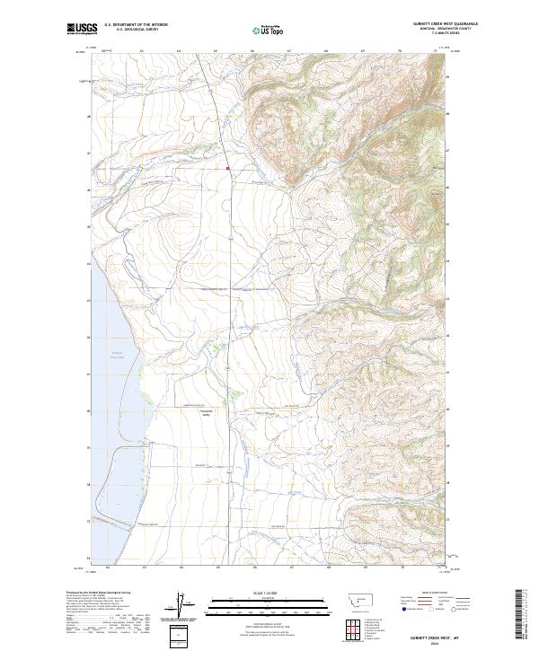
2024 Gurnett Creek West
Broadwater County, MT
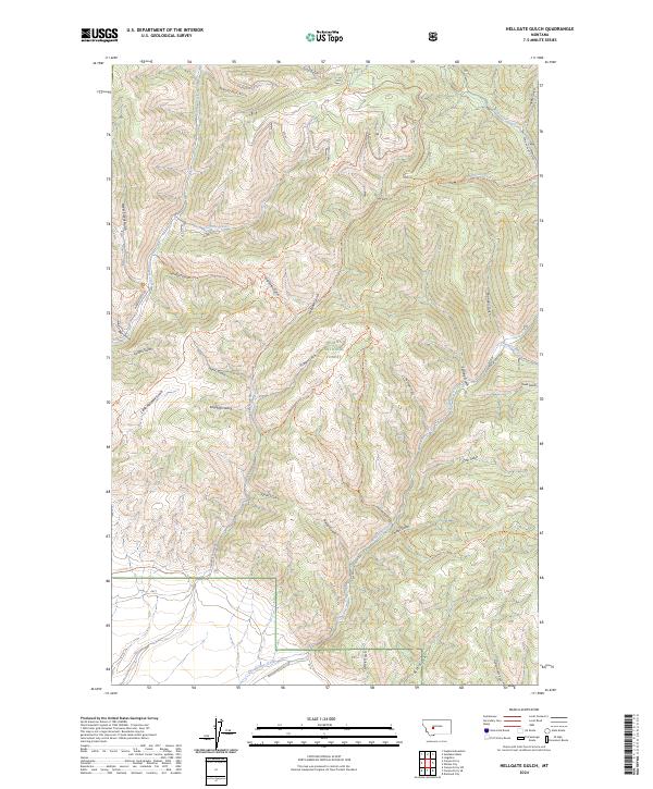
2024 Hellgate Gulch
Broadwater County, MT
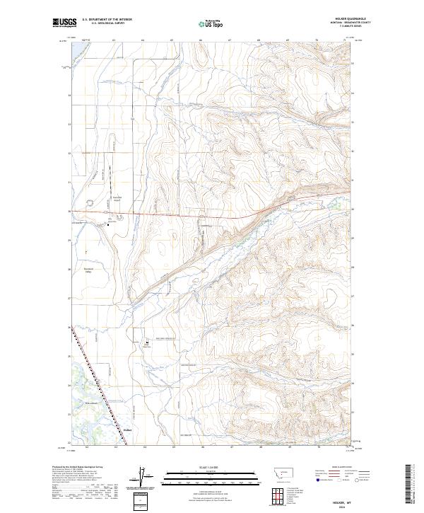
2024 Holker
Broadwater County, MT
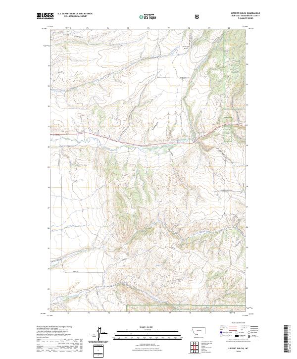
2024 Lippert Gulch
Broadwater County, MT
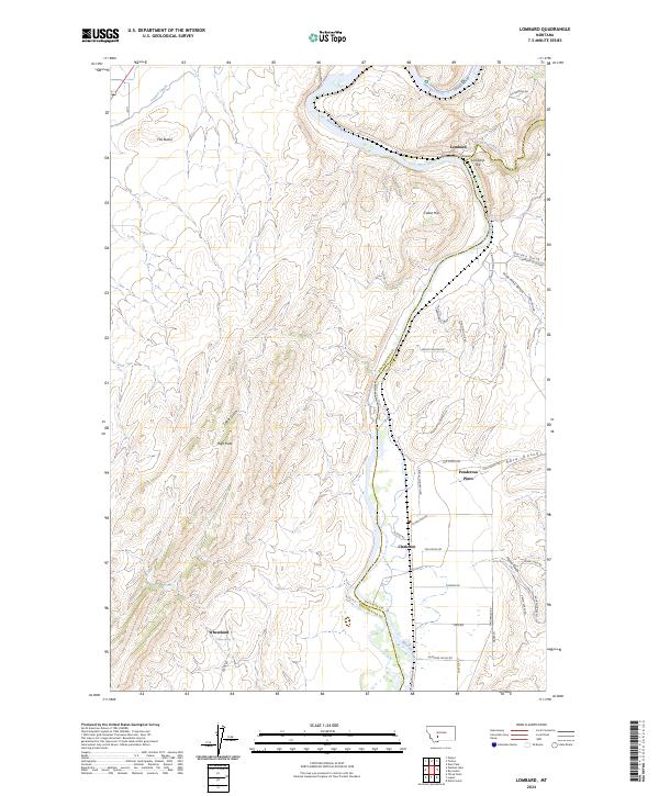
2024 Lombard
Broadwater County, MT
2024 Mount Edith
Broadwater County, MT
2024 Parker
Broadwater County, MT
2024 Plunket Lake
Broadwater County, MT
2024 Radersburg SW
Broadwater County, MT
2024 Sixmile Mountain
Broadwater County, MT
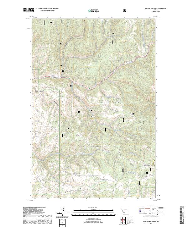
2024 Sulphur Bar Creek
Broadwater County, MT
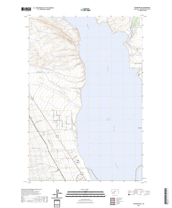
2024 Townsend NE
Broadwater County, MT
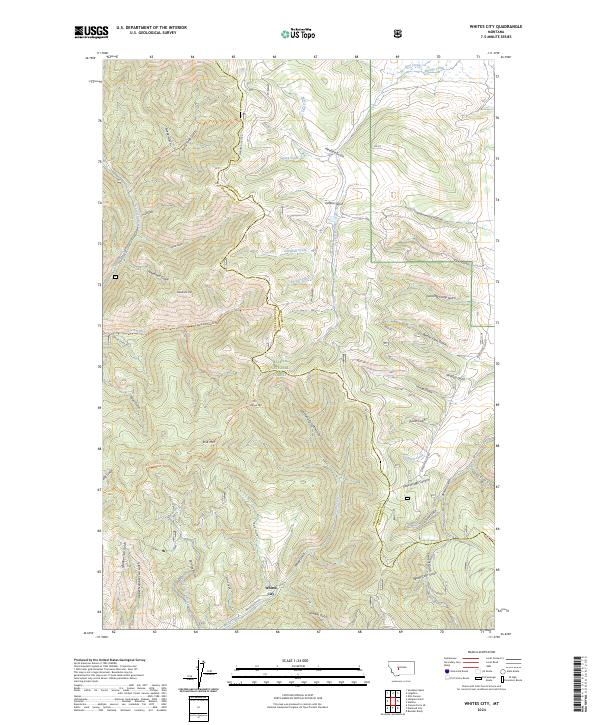
2024 Whites City
Broadwater County, MT