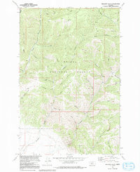
1972 Map of Hellgate Gulch
USGS Topo · Published 1992About this map
Helena National Forest dominates this topographic study of the Big Belt Mountains, revealing a landscape defined by an intricate network of drainages and early mining activity. The terrain is deeply incised by major watercourses like Magpie Creek and Avalanche Creek, which are fed by dozens of named gulches. These natural corridors served as the primary routes for exploration and extraction, as evidenced by the location of the Argo Mine and various prospects scattered near Gatish Gulch and Shannon Gulch.
Find a feature on this map
36 named features on this map. Tap any name to fly to it.
Don’t see what you’re looking for? This feature index may not catch every label — zoom into the map to look around manually.
Map Details
Editions of this 1972 Hellgate Gulch Map
2 editions found
Other maps of this area

1886 · Fort Logan
USGS Topo · 1:250,000

1948 · White Sulphur Springs
USGS Topo · 1:250,000

1950 · Canyon Ferry
USGS Topo · 1:62,500

1958 · White Sulphur Springs
USGS Topo · 1:250,000

1961 · White Sulphur Springs
USGS Topo · 1:250,000

1962 · Hogback Mountain
USGS Topo · 1:24,000

1962 · Snedaker Basin
USGS Topo · 1:24,000

1965 · White Sulphur Springs
USGS Topo · 1:250,000

1966 · Diamond City
USGS Topo · 1:24,000

1966 · Lingshire
USGS Topo · 1:24,000