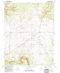
1994 Map of Basin
USGS Topo · Published 1994About this map
Dry Creek Basin dominates this portion of San Miguel County, showing a landscape defined by seasonal watercourses and ranching history in the mid-1990s. The Dry Creek Basin State Wildlife Area covers a significant portion of the territory, while local names like Beards Corner and the Young Ranch reflect a sparse but persistent human presence. The intricate drainage network of Dead Horse Creek, Nelson Creek, and Big Gypsum Creek carves through the terrain, leading toward the deep incisions of Broad Canyon and East Broad Canyon. Notable landmarks such as Poison Spider Spring and Cottonwood Pond indicate critical water sources in an arid environment. The map also documents industrial and agricultural infrastructure, including a Stock Driveway, numerous 4WD trails, and a prominent Pipeline that traverses the basin diagonally.
Find a feature on this map
24 named features on this map. Tap any name to fly to it.
Don’t see what you’re looking for? This feature index may not catch every label — zoom into the map to look around manually.
Map Details
Editions of this 1994 Basin Map
This is the sole edition of this map. No revisions or reprints were ever made.
Other maps of this area

1916 · Paradox Valley
USGS Topo · 1:125,000

1922 · Paradox Valley
USGS Topo · 1:125,000

1948 · Naturita NW
USGS Topo · 1:24,000

1948 · Gypsum Gap
USGS Topo · 1:24,000

1949 · Gypsum Gap
USGS Topo · 1:24,000

1949 · Naturita NW
USGS Topo · 1:24,000

1956 · Cortez
USGS Topo · 1:250,000

1956 · Moab
USGS Topo · 1:250,000

1958 · Cortez
USGS Topo · 1:250,000

1959 · Cortez
USGS Topo · 1:250,000