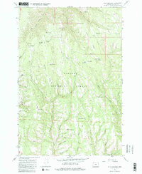
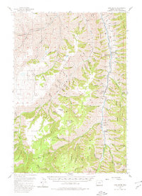
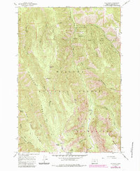
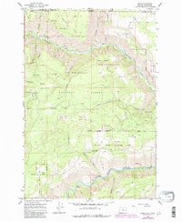
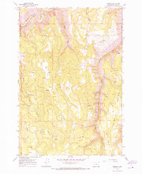
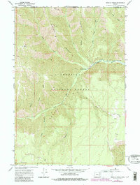
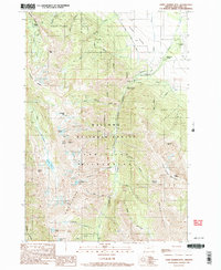
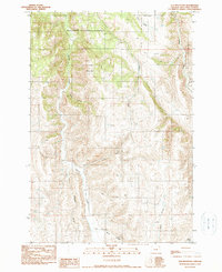
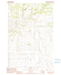
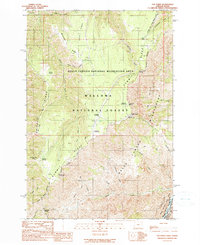
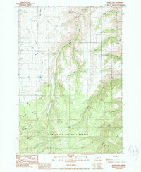
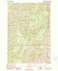
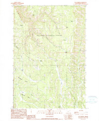
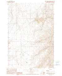
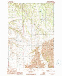
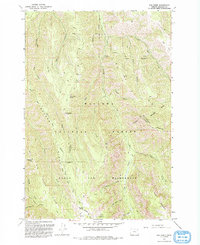
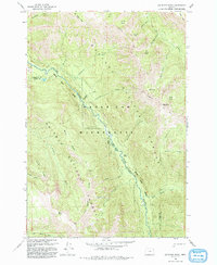
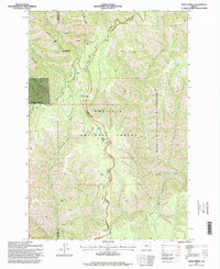
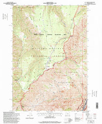
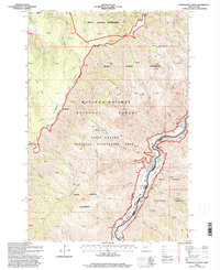
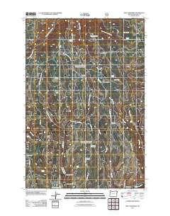
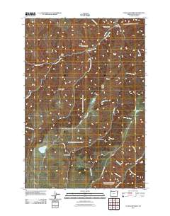
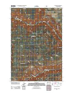
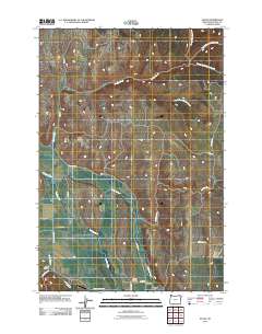
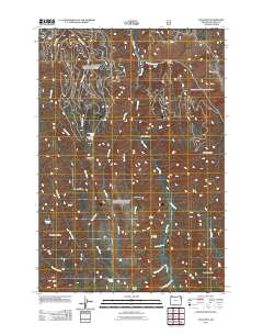
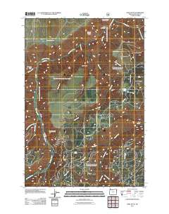
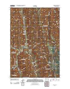
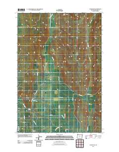
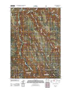
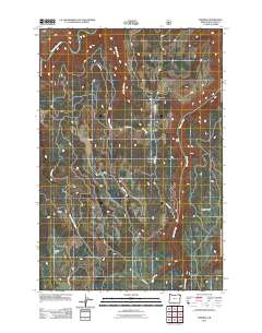
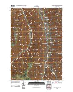
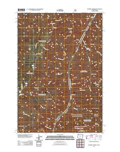
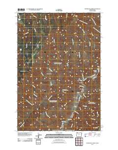
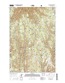
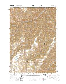
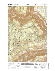
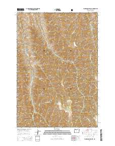
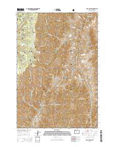
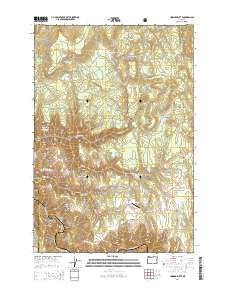
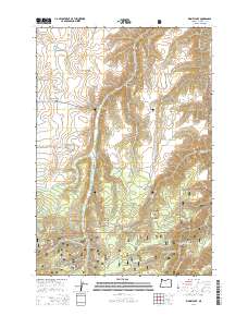
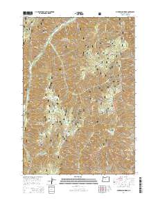
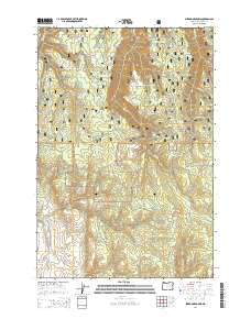
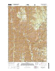
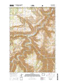
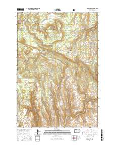
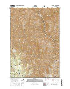
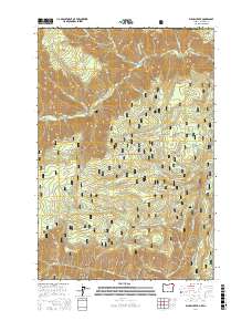
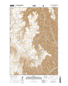
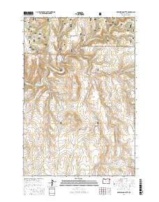
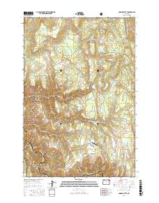
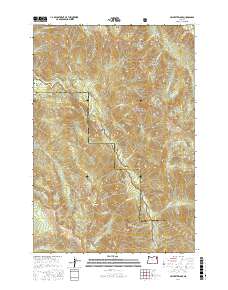
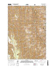
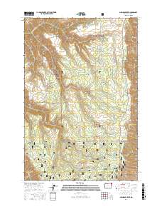
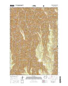
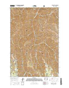
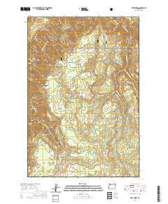
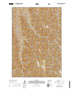
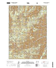
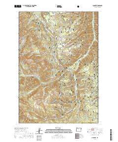
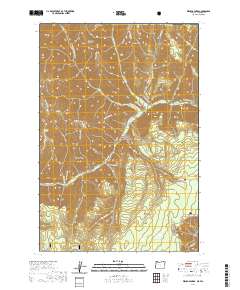
1967 Map of Billy Meadows
USGS Topo · Published 1983About this map
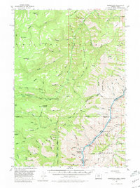
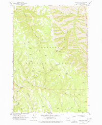
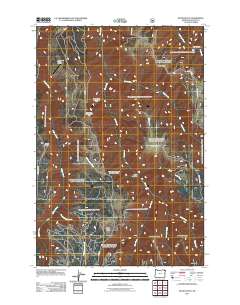
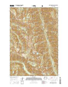
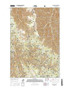
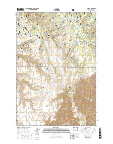
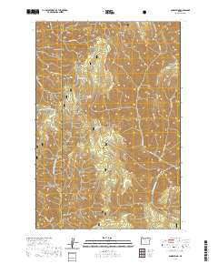
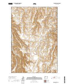
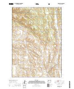
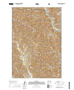
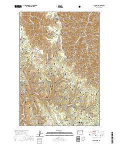
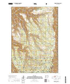
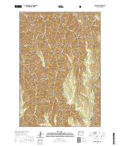
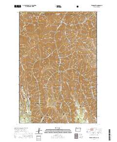
Wallowa National Forest land defines this corner of northeastern Oregon, where the landscape is characterized by high ridges and a dense network of mountain springs. In the late 1960s, this area served as a hub for forest management and seasonal livestock grazing, anchored by the Billy Meadows Guard Station and the Lookout Tower situated on Red Hill. The map reveals a specialized infrastructure for backcountry operations, including the Hollow Log Cow Camp and Hay Pen Camp, alongside water management features like Volstead Reservoir and McCarty Reservoir. A labyrinth of established routes such as the Aspen Spring Trail and the Telephone Trail connect these remote outposts. Numerous named water sources, including Poker Bill Spring, Yew Wood Spring, and Phils Spring, illustrate the vital role of groundwater in sustaining both the local ecosystem and the seasonal camps scattered across Long Ridge and Getchel Ridge.
Find a feature on this map
47 named features on this map. Tap any name to fly to it.
Don’t see what you’re looking for? This feature index may not catch every label — zoom into the map to look around manually.
Map Details
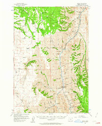
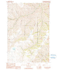
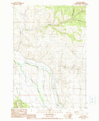
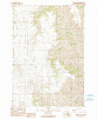
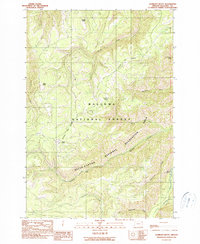
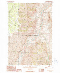
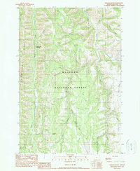
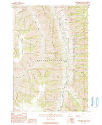
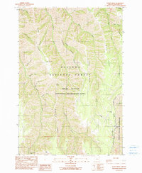
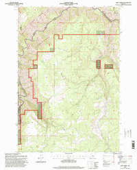
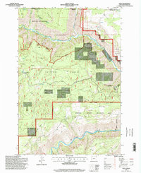
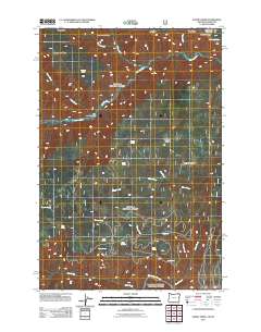
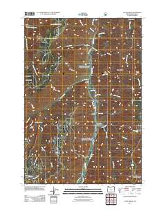
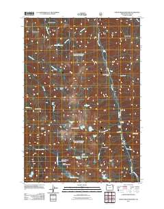
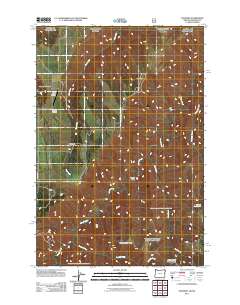
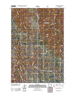
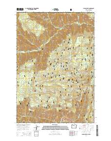
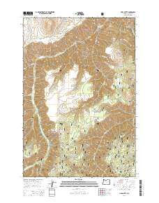
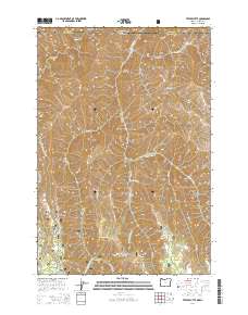
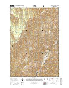
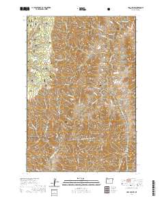
Editions of this 1967 Billy Meadows Map
2 editions found
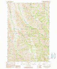
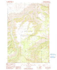
Historical Maps of Wallowa County Through Time
357 maps found
1954 Cornucopia
Wallowa County, OR
1954 Eagle Cap
Wallowa County, OR
1954 Harl Butte
Wallowa County, OR
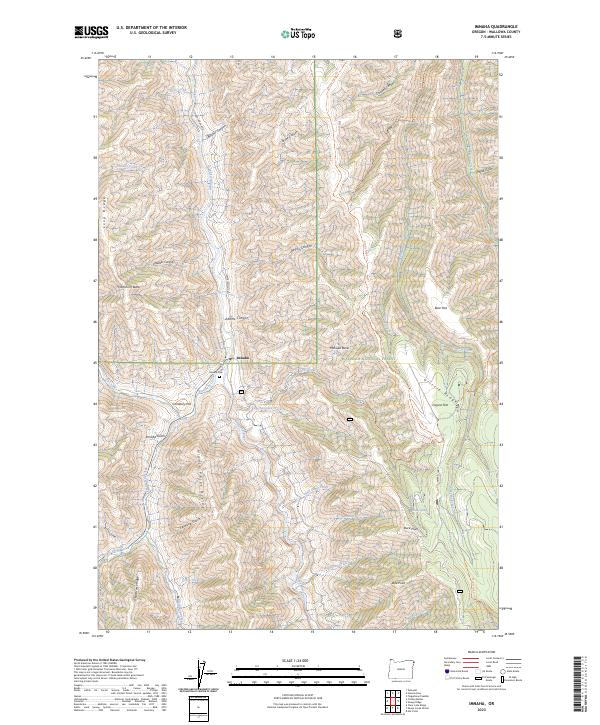
1954 Imnaha
Wallowa County, OR
1954 Kernan Point
Wallowa County, OR
1957 Elk Mountain
Wallowa County, OR
1957 Homestead
Wallowa County, OR
1957 Sled Springs
Wallowa County, OR
1963 Deadhorse Ridge
Wallowa County, OR
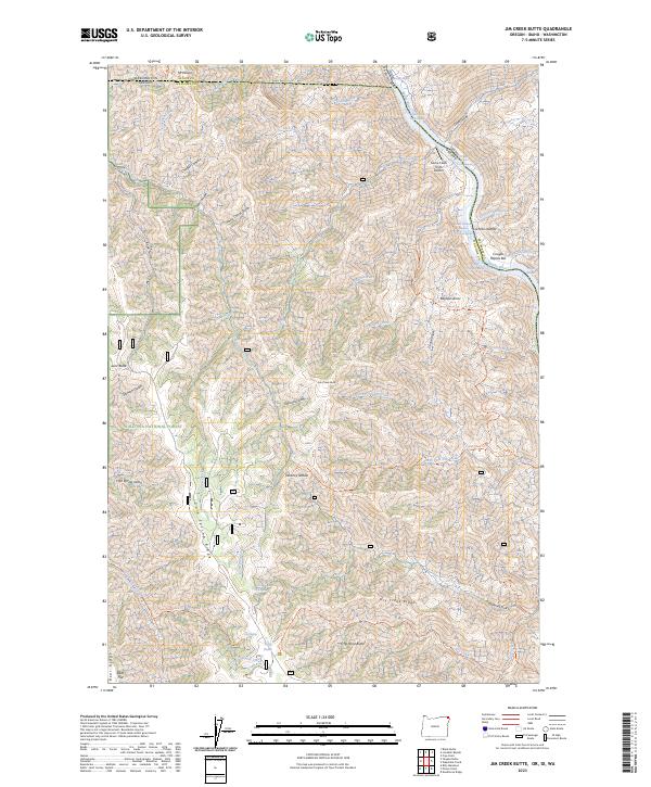
1963 Jim Creek Butte
Wallowa County, OR
1963 Poison Point
Wallowa County, OR
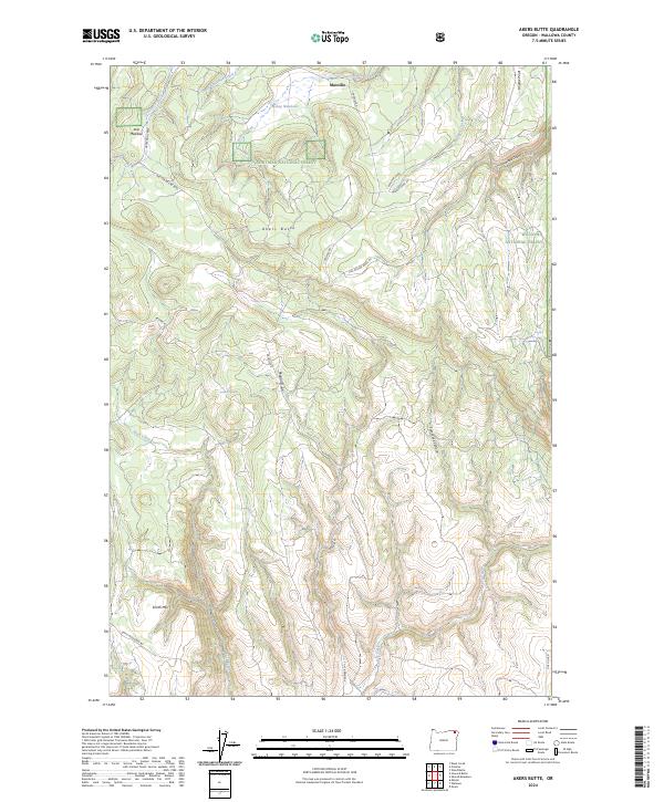
1964 Akers Butte
Wallowa County, OR
1964 Howard Butte
Wallowa County, OR
1964 Minam
Wallowa County, OR
1965 Fox Point
Wallowa County, OR
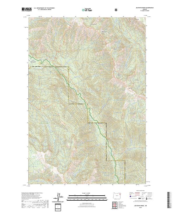
1966 Jim White Ridge
Wallowa County, OR
1967 Billy Meadows
Wallowa County, OR
1967 Bone Spring
Wallowa County, OR
1967 Deep Creek
Wallowa County, OR
1967 Eden
Wallowa County, OR
1967 Elbow Creek
Wallowa County, OR
1967 Flora
Wallowa County, OR
1967 Paradise
Wallowa County, OR
1967 Promise
Wallowa County, OR

1967 Shamrock Creek
Wallowa County, OR
1967 Table Mountain
Wallowa County, OR
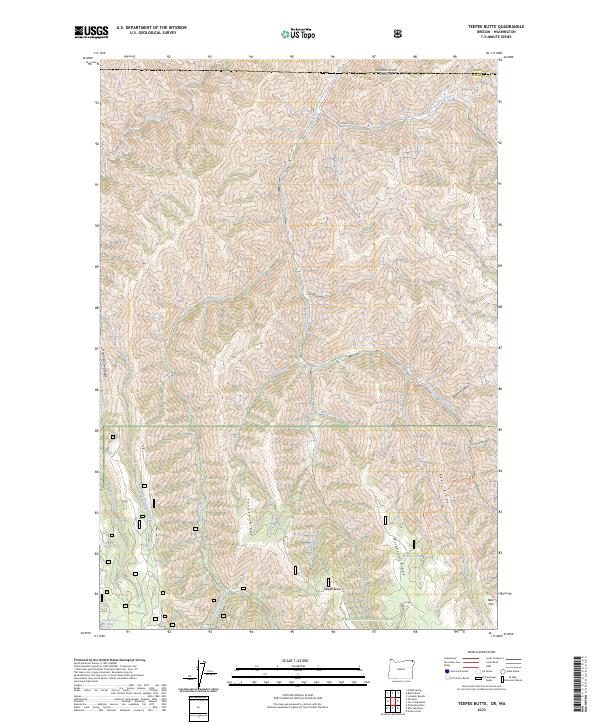
1967 Teepee Butte
Wallowa County, OR
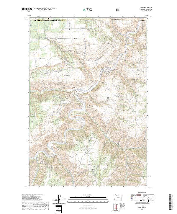
1967 Troy
Wallowa County, OR
1967 Wenaha Forks
Wallowa County, OR
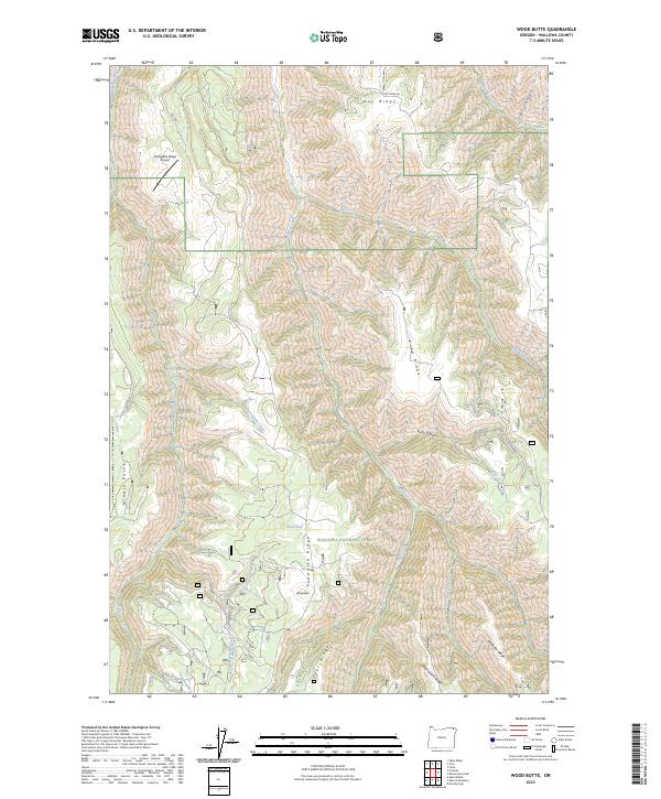
1967 Wood Butte
Wallowa County, OR
1984 Akers Butte
Wallowa County, OR
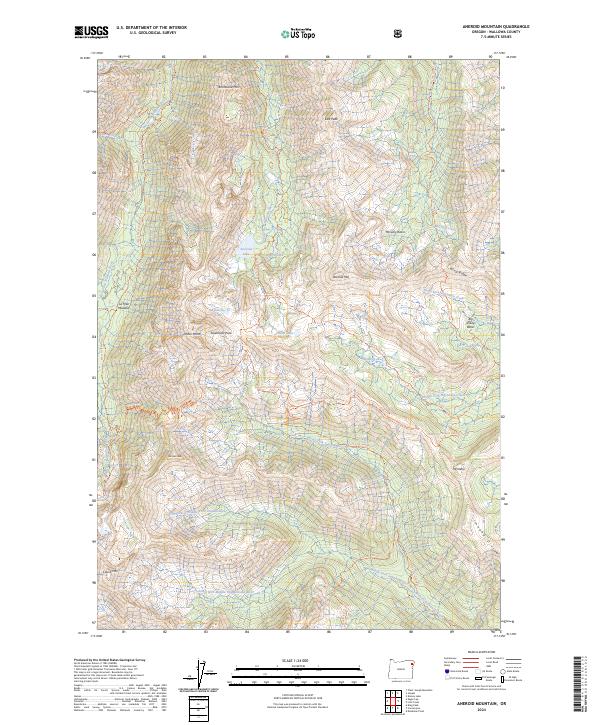
1990 Aneroid Mountain
Wallowa County, OR
1990 Chief Joseph Mtn
Wallowa County, OR
1990 Clear Lake Ridge
Wallowa County, OR
1990 Eagle Cap
Wallowa County, OR
1990 Elk Mountain SE
Wallowa County, OR
1990 Elk Mountain
Wallowa County, OR
1990 Evans
Wallowa County, OR
1990 Findley Buttes
Wallowa County, OR
1990 Fingerboard Saddle
Wallowa County, OR
1990 Greenwood Butte
Wallowa County, OR
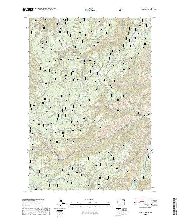
1990 Gumboot Butte
Wallowa County, OR
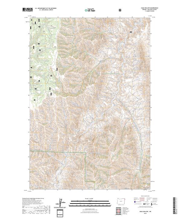
1990 Haas Hollow
Wallowa County, OR
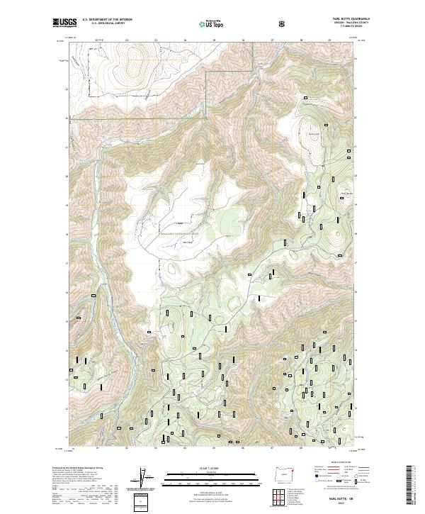
1990 Harl Butte
Wallowa County, OR
1990 Hat Point
Wallowa County, OR
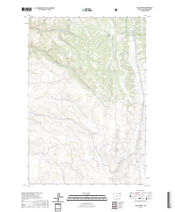
1990 Hicks Spring
Wallowa County, OR

1990 Imnaha
Wallowa County, OR
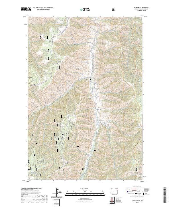
1990 Jaynes Ridge
Wallowa County, OR
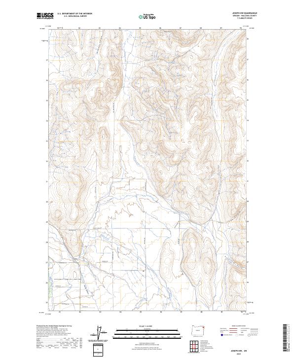
1990 Joseph NW
Wallowa County, OR
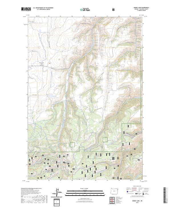
1990 Kinney Lake
Wallowa County, OR
1990 Lick Creek
Wallowa County, OR
1990 Lord Flat
Wallowa County, OR
1990 North Minam Meadows
Wallowa County, OR
1990 Puderbaugh Ridge
Wallowa County, OR
1990 Roberts Butte
Wallowa County, OR
1990 Sheep Creek Divide
Wallowa County, OR
1990 Sherod Meadows
Wallowa County, OR
1990 Sled Springs
Wallowa County, OR
1990 Sleepy Ridge
Wallowa County, OR
1990 Squirrel Prairie
Wallowa County, OR

1990 Steamboat Lake
Wallowa County, OR
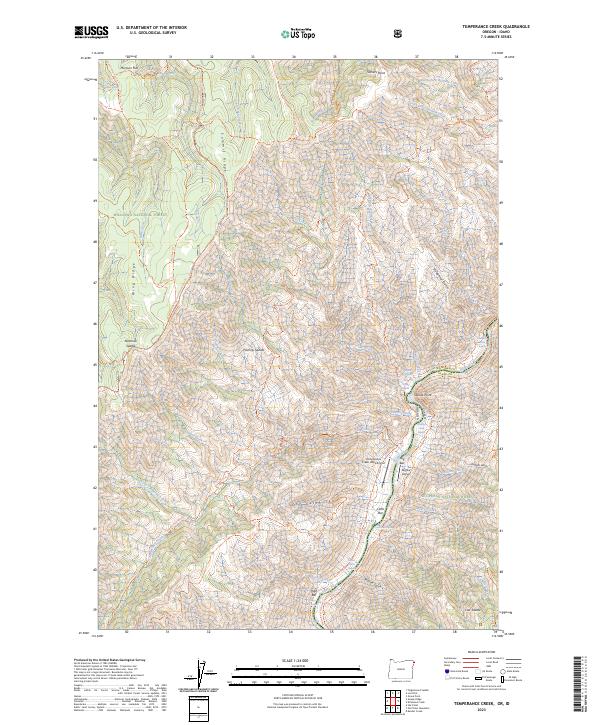
1990 Temperance Creek
Wallowa County, OR
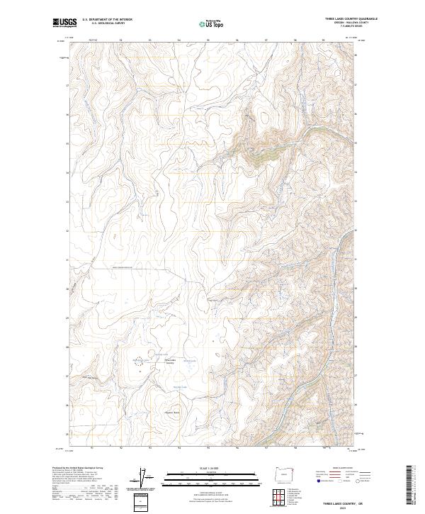
1990 Three Lakes Country
Wallowa County, OR
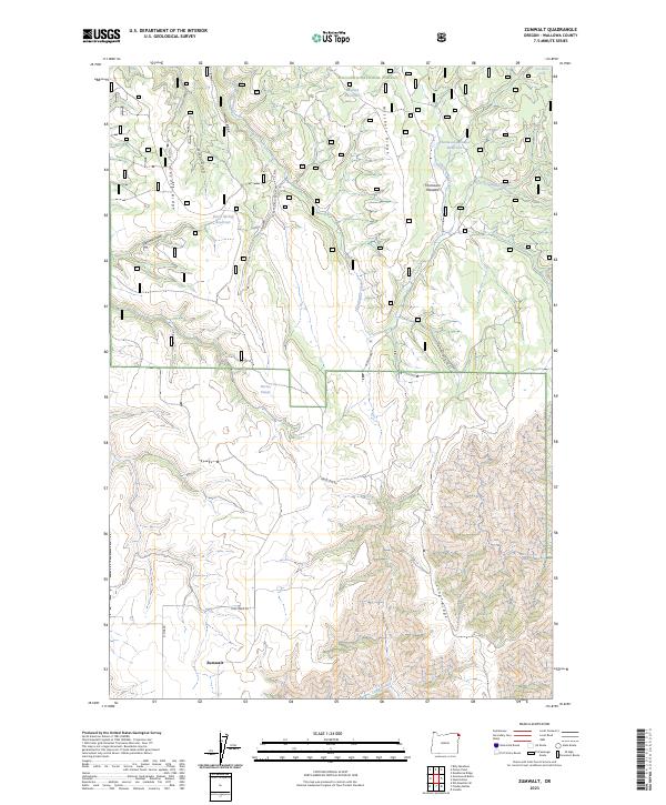
1990 Zumwalt
Wallowa County, OR
1993 Fox Point
Wallowa County, OR
1993 Jim White Ridge
Wallowa County, OR
1995 Bone Spring
Wallowa County, OR
1995 Deep Creek
Wallowa County, OR
1995 Eden
Wallowa County, OR
1995 Elbow Creek
Wallowa County, OR
1995 Hat Point
Wallowa County, OR
1995 Lord Flat
Wallowa County, OR
1995 Promise
Wallowa County, OR
1995 Squirrel Prairie
Wallowa County, OR
1995 Temperance Creek
Wallowa County, OR

1995 Troy
Wallowa County, OR
1995 Wenaha Forks
Wallowa County, OR
2011 Akers Butte
Wallowa County, OR
2011 Aneroid Mountain
Wallowa County, OR
2011 Billy Meadows
Wallowa County, OR
2011 Bone Spring
Wallowa County, OR
2011 Cactus Mountain
Wallowa County, OR
2011 Chief Joseph Mountain
Wallowa County, OR
2011 Clear Lake Ridge
Wallowa County, OR
2011 Deadhorse Ridge
Wallowa County, OR
2011 Deep Creek
Wallowa County, OR
2011 Eagle Cap
Wallowa County, OR
2011 Eden Ridge
Wallowa County, OR
2011 Elbow Creek
Wallowa County, OR
2011 Elk Mountain SE
Wallowa County, OR
2011 Elk Mountain
Wallowa County, OR
2011 Evans
Wallowa County, OR
2011 Findley Buttes
Wallowa County, OR
2011 Fingerboard Saddle
Wallowa County, OR
2011 Flora
Wallowa County, OR
2011 Fox Point
Wallowa County, OR
2011 Greenwood Butte
Wallowa County, OR
2011 Gumboot Butte
Wallowa County, OR
2011 Haas Hollow
Wallowa County, OR
2011 Harl Butte
Wallowa County, OR
2011 Hat Point
Wallowa County, OR
2011 Hicks Spring
Wallowa County, OR
2011 Howard Butte
Wallowa County, OR
2011 Imnaha
Wallowa County, OR
2011 Jaynes Ridge
Wallowa County, OR
2011 Jim Creek Butte
Wallowa County, OR
2011 Jim White Ridge
Wallowa County, OR
2011 Joseph NW
Wallowa County, OR
2011 Kinney Lake
Wallowa County, OR
2011 Lick Creek
Wallowa County, OR
2011 Lord Flat
Wallowa County, OR
2011 Minam
Wallowa County, OR
2011 North Minam Meadows
Wallowa County, OR
2011 Paradise
Wallowa County, OR
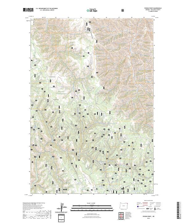
2011 Poison Point
Wallowa County, OR
2011 Promise
Wallowa County, OR
2011 Puderbaugh Ridge
Wallowa County, OR
2011 Roberts Butte
Wallowa County, OR
2011 Shamrock Creek
Wallowa County, OR
2011 Sheep Creek Divide
Wallowa County, OR
2011 Sherod Meadows
Wallowa County, OR
2011 Sled Springs
Wallowa County, OR
2011 Sleepy Ridge
Wallowa County, OR
2011 Squirrel Prairie
Wallowa County, OR
2011 Steamboat Lake
Wallowa County, OR
2011 Table Mountain
Wallowa County, OR
2011 Teepee Butte
Wallowa County, OR
2011 Temperance Creek
Wallowa County, OR
2011 Three Lakes Country
Wallowa County, OR
2011 Troy
Wallowa County, OR
2011 Wenaha Forks
Wallowa County, OR
2011 Wood Butte
Wallowa County, OR
2011 Zumwalt
Wallowa County, OR
2014 Akers Butte
Wallowa County, OR
2014 Aneroid Mountain
Wallowa County, OR
2014 Billy Meadows
Wallowa County, OR
2014 Bone Spring
Wallowa County, OR
2014 Cactus Mountain
Wallowa County, OR
2014 Chief Joseph Mountain
Wallowa County, OR
2014 Clear Lake Ridge
Wallowa County, OR
2014 Deadhorse Ridge
Wallowa County, OR
2014 Deep Creek
Wallowa County, OR
2014 Eagle Cap
Wallowa County, OR
2014 Eden Ridge
Wallowa County, OR
2014 Elbow Creek
Wallowa County, OR
2014 Elk Mountain SE
Wallowa County, OR
2014 Elk Mountain
Wallowa County, OR

2014 Evans
Wallowa County, OR

2014 Findley Buttes
Wallowa County, OR
2014 Fingerboard Saddle
Wallowa County, OR

2014 Flora
Wallowa County, OR
2014 Fox Point
Wallowa County, OR
2014 Greenwood Butte
Wallowa County, OR
2014 Gumboot Butte
Wallowa County, OR
2014 Haas Hollow
Wallowa County, OR
2014 Harl Butte
Wallowa County, OR
2014 Hat Point
Wallowa County, OR
2014 Hicks Spring
Wallowa County, OR
2014 Howard Butte
Wallowa County, OR
2014 Imnaha
Wallowa County, OR

2014 Jaynes Ridge
Wallowa County, OR
2014 Jim Creek Butte
Wallowa County, OR
2014 Jim White Ridge
Wallowa County, OR

2014 Joseph NW
Wallowa County, OR
2014 Kinney Lake
Wallowa County, OR
2014 Lick Creek
Wallowa County, OR
2014 Lord Flat
Wallowa County, OR
2014 Minam
Wallowa County, OR
2014 North Minam Meadows
Wallowa County, OR
2014 Paradise
Wallowa County, OR
2014 Poison Point
Wallowa County, OR
2014 Promise
Wallowa County, OR
2014 Puderbaugh Ridge
Wallowa County, OR
2014 Roberts Butte
Wallowa County, OR
2014 Shamrock Creek
Wallowa County, OR
2014 Sheep Creek Divide
Wallowa County, OR
2014 Sherod Meadows
Wallowa County, OR
2014 Sled Springs
Wallowa County, OR

2014 Sleepy Ridge
Wallowa County, OR
2014 Squirrel Prairie
Wallowa County, OR
2014 Steamboat Lake
Wallowa County, OR
2014 Table Mountain
Wallowa County, OR
2014 Teepee Butte
Wallowa County, OR
2014 Temperance Creek
Wallowa County, OR
2014 Three Lakes Country
Wallowa County, OR
2014 Troy
Wallowa County, OR
2014 Wenaha Forks
Wallowa County, OR
2014 Wood Butte
Wallowa County, OR
2014 Zumwalt
Wallowa County, OR
2017 Akers Butte
Wallowa County, OR

2017 Aneroid Mountain
Wallowa County, OR
2017 Billy Meadows
Wallowa County, OR

2017 Bone Spring
Wallowa County, OR

2017 Cactus Mountain
Wallowa County, OR
2017 Chief Joseph Mountain
Wallowa County, OR
2017 Clear Lake Ridge
Wallowa County, OR
2017 Deadhorse Ridge
Wallowa County, OR
2017 Deep Creek
Wallowa County, OR
2017 Eagle Cap
Wallowa County, OR
2017 Eden Ridge
Wallowa County, OR
2017 Elbow Creek
Wallowa County, OR
2017 Elk Mountain SE
Wallowa County, OR
2017 Elk Mountain
Wallowa County, OR
2017 Evans
Wallowa County, OR
2017 Findley Buttes
Wallowa County, OR
2017 Fingerboard Saddle
Wallowa County, OR
2017 Flora
Wallowa County, OR
2017 Fox Point
Wallowa County, OR
2017 Greenwood Butte
Wallowa County, OR
2017 Gumboot Butte
Wallowa County, OR
2017 Haas Hollow
Wallowa County, OR

2017 Harl Butte
Wallowa County, OR
2017 Hat Point
Wallowa County, OR

2017 Hicks Spring
Wallowa County, OR
2017 Howard Butte
Wallowa County, OR
2017 Imnaha
Wallowa County, OR
2017 Jaynes Ridge
Wallowa County, OR
2017 Jim Creek Butte
Wallowa County, OR
2017 Jim White Ridge
Wallowa County, OR
2017 Joseph NW
Wallowa County, OR
2017 Kinney Lake
Wallowa County, OR
2017 Lick Creek
Wallowa County, OR
2017 Lord Flat
Wallowa County, OR
2017 Minam
Wallowa County, OR
2017 North Minam Meadows
Wallowa County, OR
2017 Paradise
Wallowa County, OR
2017 Poison Point
Wallowa County, OR
2017 Promise
Wallowa County, OR
2017 Puderbaugh Ridge
Wallowa County, OR
2017 Roberts Butte
Wallowa County, OR
2017 Shamrock Creek
Wallowa County, OR
2017 Sheep Creek Divide
Wallowa County, OR
2017 Sherod Meadows
Wallowa County, OR
2017 Sled Springs
Wallowa County, OR
2017 Sleepy Ridge
Wallowa County, OR
2017 Squirrel Prairie
Wallowa County, OR
2017 Steamboat Lake
Wallowa County, OR
2017 Table Mountain
Wallowa County, OR
2017 Teepee Butte
Wallowa County, OR

2017 Temperance Creek
Wallowa County, OR
2017 Three Lakes Country
Wallowa County, OR
2017 Troy
Wallowa County, OR

2017 Wenaha Forks
Wallowa County, OR
2017 Wood Butte
Wallowa County, OR
2017 Zumwalt
Wallowa County, OR
2020 Akers Butte
Wallowa County, OR
2020 Aneroid Mountain
Wallowa County, OR
2020 Billy Meadows
Wallowa County, OR
2020 Bone Spring
Wallowa County, OR
2020 Cactus Mountain
Wallowa County, OR
2020 Chief Joseph Mountain
Wallowa County, OR
2020 Clear Lake Ridge
Wallowa County, OR

2020 Deadhorse Ridge
Wallowa County, OR
2020 Deep Creek
Wallowa County, OR
2020 Eagle Cap
Wallowa County, OR
2020 Eden Ridge
Wallowa County, OR
2020 Elbow Creek
Wallowa County, OR
2020 Elk Mountain SE
Wallowa County, OR
2020 Elk Mountain
Wallowa County, OR
2020 Evans
Wallowa County, OR
2020 Findley Buttes
Wallowa County, OR
2020 Fingerboard Saddle
Wallowa County, OR
2020 Flora
Wallowa County, OR
2020 Fox Point
Wallowa County, OR
2020 Greenwood Butte
Wallowa County, OR
2020 Gumboot Butte
Wallowa County, OR
2020 Haas Hollow
Wallowa County, OR
2020 Harl Butte
Wallowa County, OR
2020 Hat Point
Wallowa County, OR
2020 Hicks Spring
Wallowa County, OR
2020 Howard Butte
Wallowa County, OR
2020 Imnaha
Wallowa County, OR
2020 Jaynes Ridge
Wallowa County, OR
2020 Jim Creek Butte
Wallowa County, OR
2020 Jim White Ridge
Wallowa County, OR
2020 Joseph NW
Wallowa County, OR
2020 Kinney Lake
Wallowa County, OR
2020 Lick Creek
Wallowa County, OR
2020 Lord Flat
Wallowa County, OR
2020 Minam
Wallowa County, OR

2020 North Minam Meadows
Wallowa County, OR
2020 Paradise
Wallowa County, OR
2020 Poison Point
Wallowa County, OR
2020 Promise
Wallowa County, OR
2020 Puderbaugh Ridge
Wallowa County, OR
2020 Roberts Butte
Wallowa County, OR
2020 Shamrock Creek
Wallowa County, OR
2020 Sheep Creek Divide
Wallowa County, OR
2020 Sherod Meadows
Wallowa County, OR
2020 Sled Springs
Wallowa County, OR
2020 Sleepy Ridge
Wallowa County, OR
2020 Squirrel Prairie
Wallowa County, OR
2020 Steamboat Lake
Wallowa County, OR
2020 Table Mountain
Wallowa County, OR
2020 Teepee Butte
Wallowa County, OR
2020 Temperance Creek
Wallowa County, OR
2020 Three Lakes Country
Wallowa County, OR
2020 Troy
Wallowa County, OR
2020 Wenaha Forks
Wallowa County, OR
2020 Wood Butte
Wallowa County, OR
2020 Zumwalt
Wallowa County, OR
2023 Billy Meadows
Wallowa County, OR
2023 Cactus Mountain
Wallowa County, OR
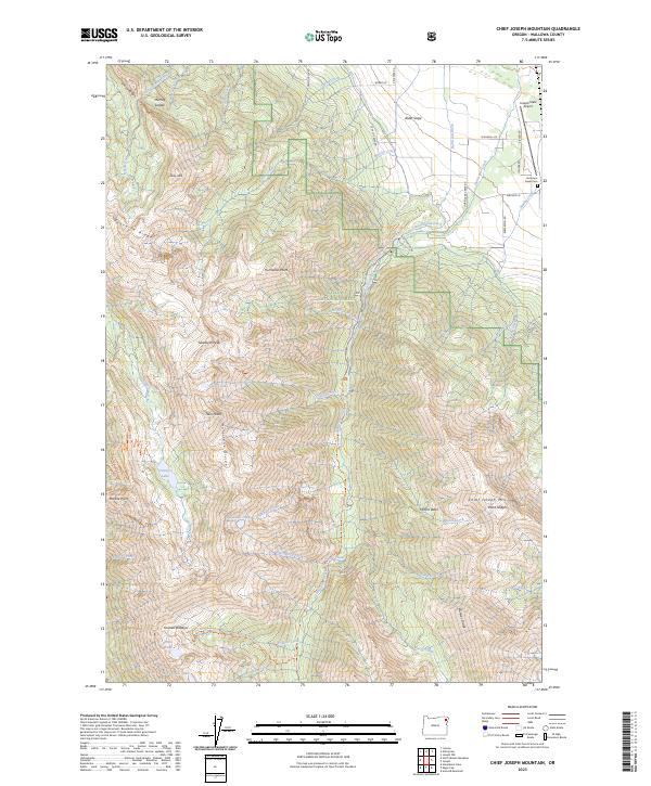
2023 Chief Joseph Mountain
Wallowa County, OR
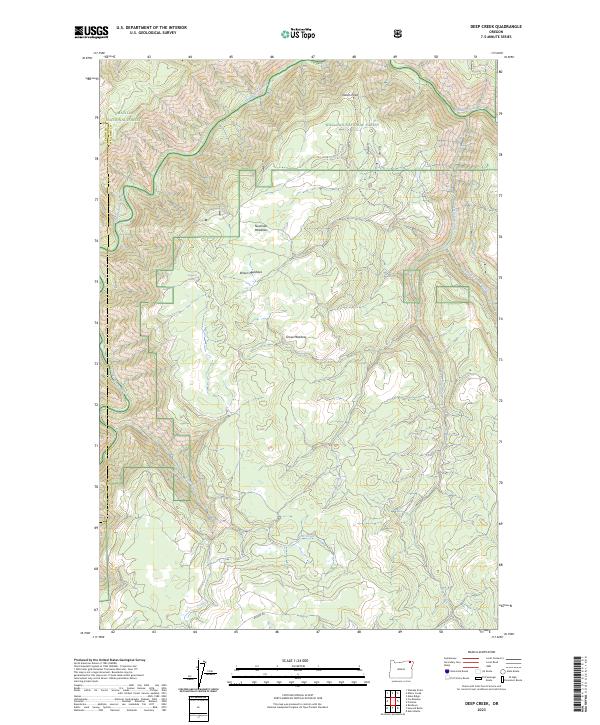
2023 Deep Creek
Wallowa County, OR
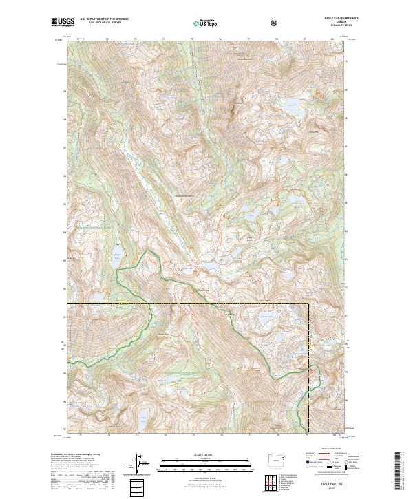
2023 Eagle Cap
Wallowa County, OR
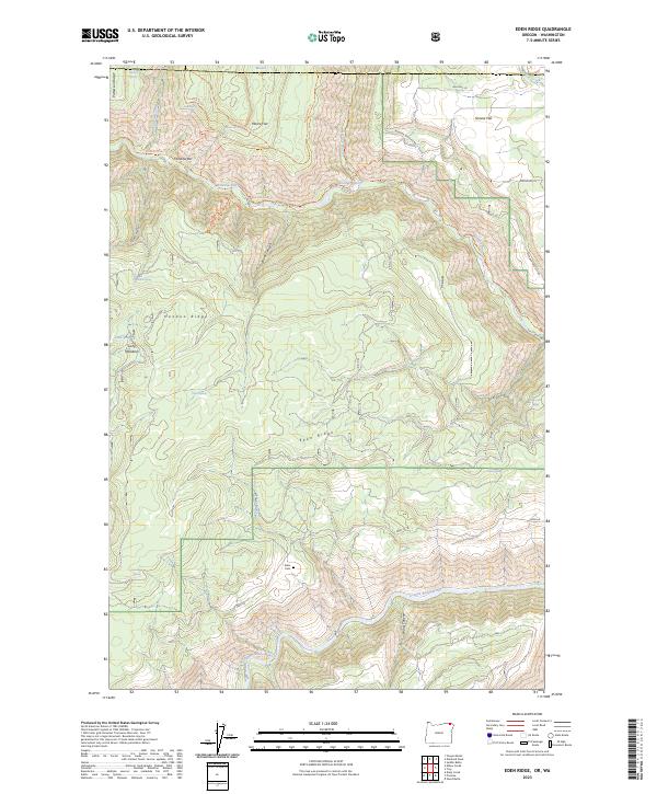
2023 Eden Ridge
Wallowa County, OR
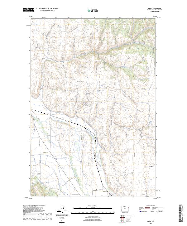
2023 Evans
Wallowa County, OR
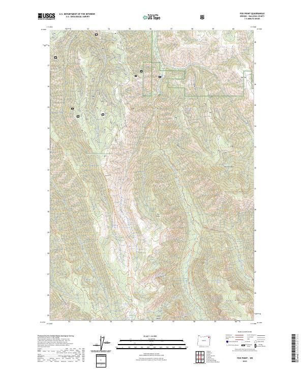
2023 Fox Point
Wallowa County, OR
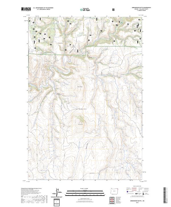
2023 Greenwood Butte
Wallowa County, OR
2023 Gumboot Butte
Wallowa County, OR
2023 Haas Hollow
Wallowa County, OR
2023 Harl Butte
Wallowa County, OR
2023 Hicks Spring
Wallowa County, OR
2023 Imnaha
Wallowa County, OR
2023 Jaynes Ridge
Wallowa County, OR
2023 Jim Creek Butte
Wallowa County, OR
2023 Jim White Ridge
Wallowa County, OR
2023 Joseph NW
Wallowa County, OR
2023 Kinney Lake
Wallowa County, OR
2023 Minam
Wallowa County, OR
2023 Poison Point
Wallowa County, OR
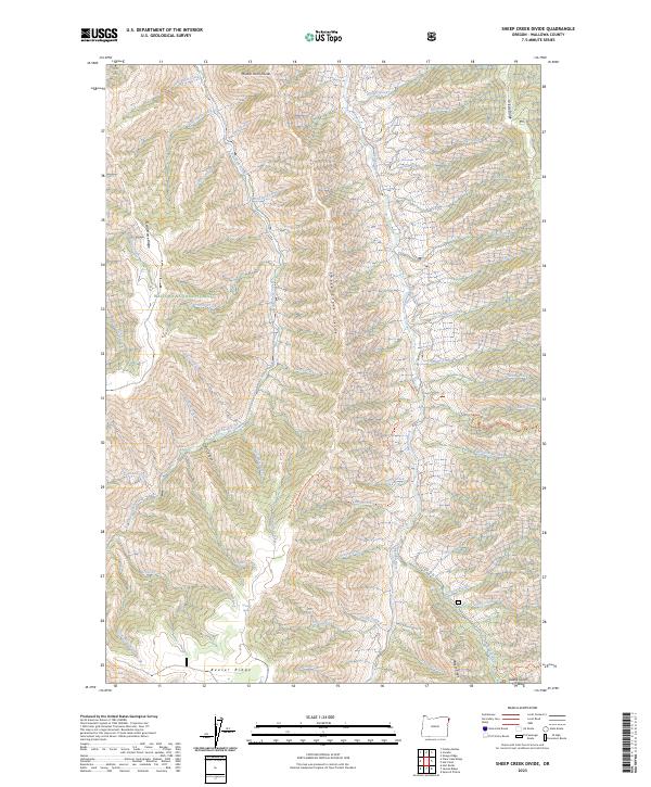
2023 Sheep Creek Divide
Wallowa County, OR
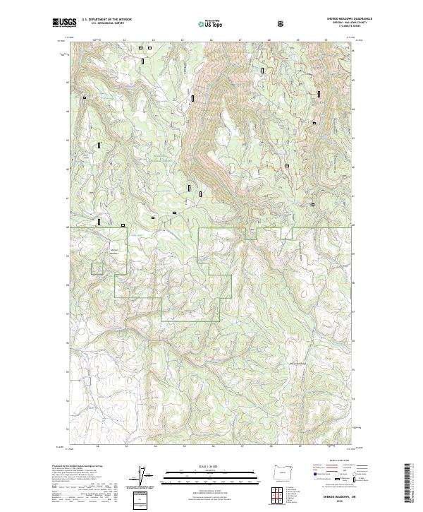
2023 Sherod Meadows
Wallowa County, OR
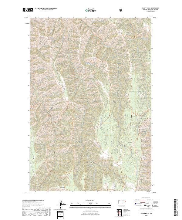
2023 Sleepy Ridge
Wallowa County, OR
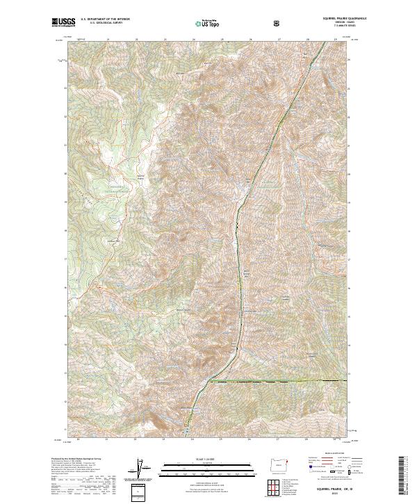
2023 Squirrel Prairie
Wallowa County, OR
2023 Teepee Butte
Wallowa County, OR
2023 Temperance Creek
Wallowa County, OR
2023 Three Lakes Country
Wallowa County, OR
2023 Troy
Wallowa County, OR
2023 Wood Butte
Wallowa County, OR
2023 Zumwalt
Wallowa County, OR
2024 Akers Butte
Wallowa County, OR
2024 Aneroid Mountain
Wallowa County, OR
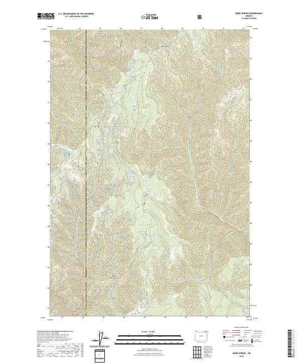
2024 Bone Spring
Wallowa County, OR
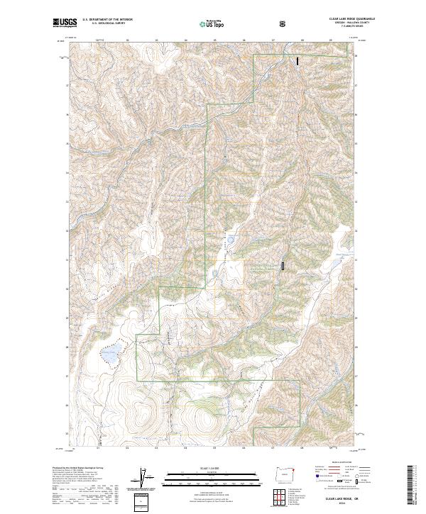
2024 Clear Lake Ridge
Wallowa County, OR
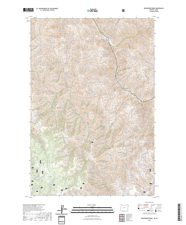
2024 Deadhorse Ridge
Wallowa County, OR
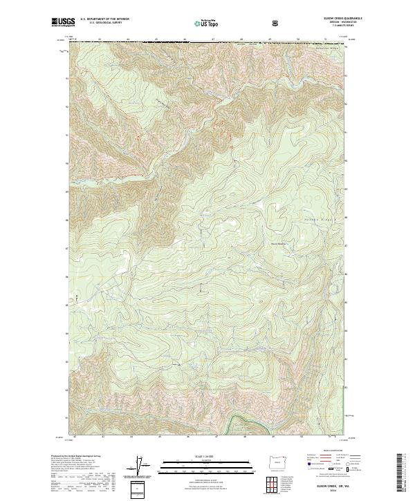
2024 Elbow Creek
Wallowa County, OR
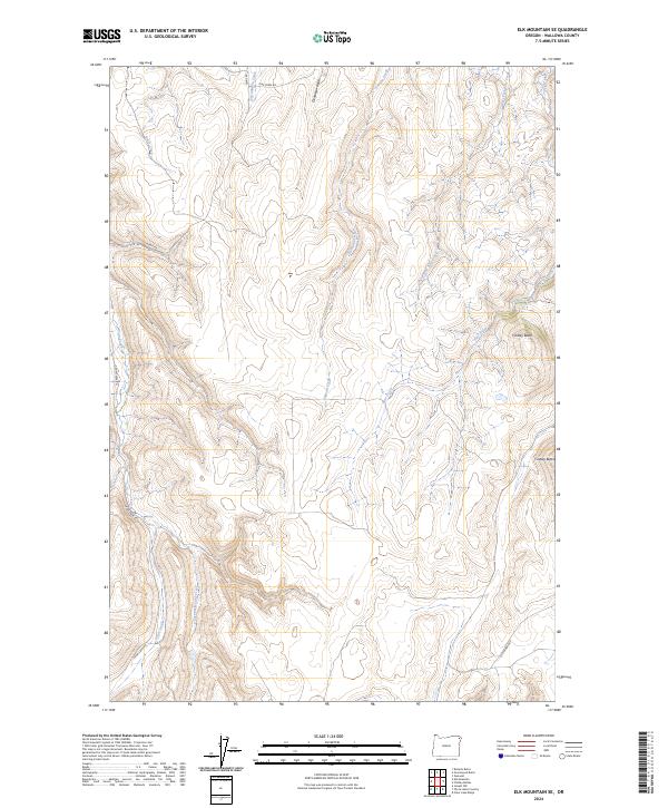
2024 Elk Mountain SE
Wallowa County, OR
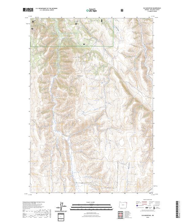
2024 Elk Mountain
Wallowa County, OR
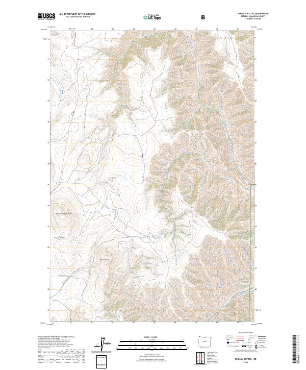
2024 Findley Buttes
Wallowa County, OR
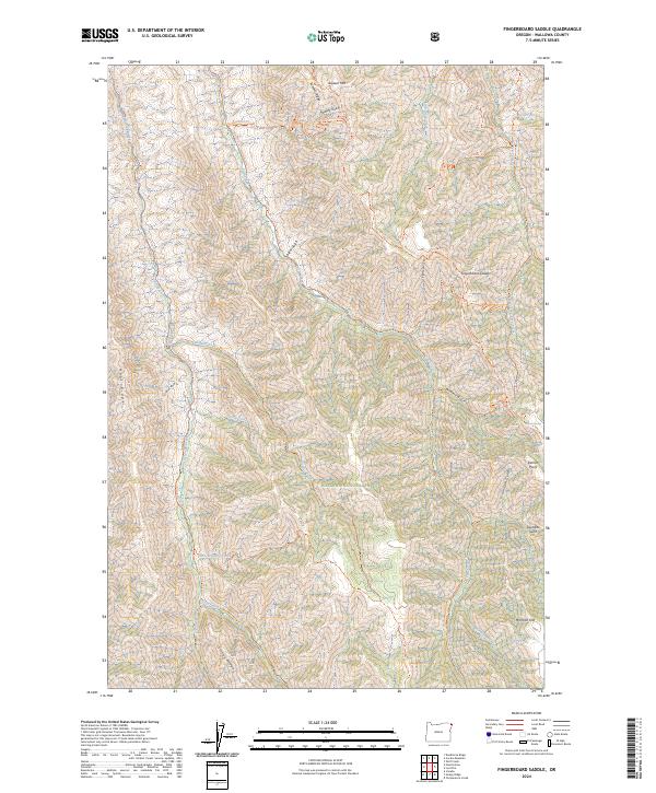
2024 Fingerboard Saddle
Wallowa County, OR
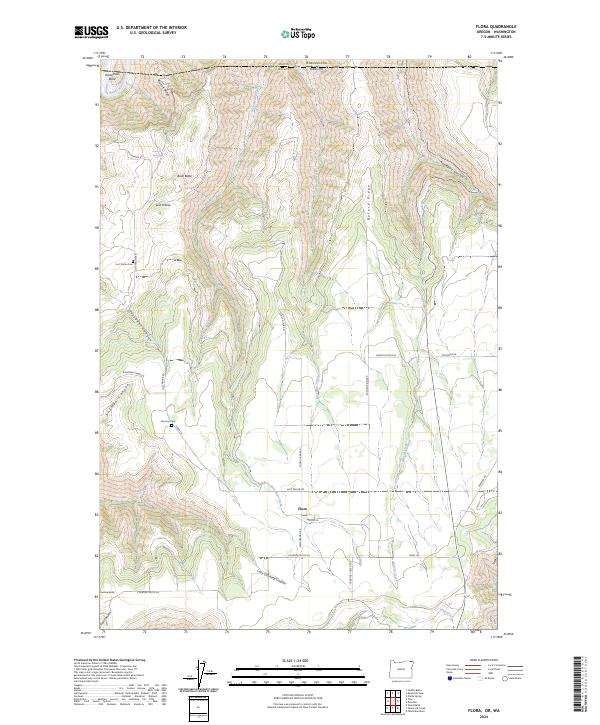
2024 Flora
Wallowa County, OR
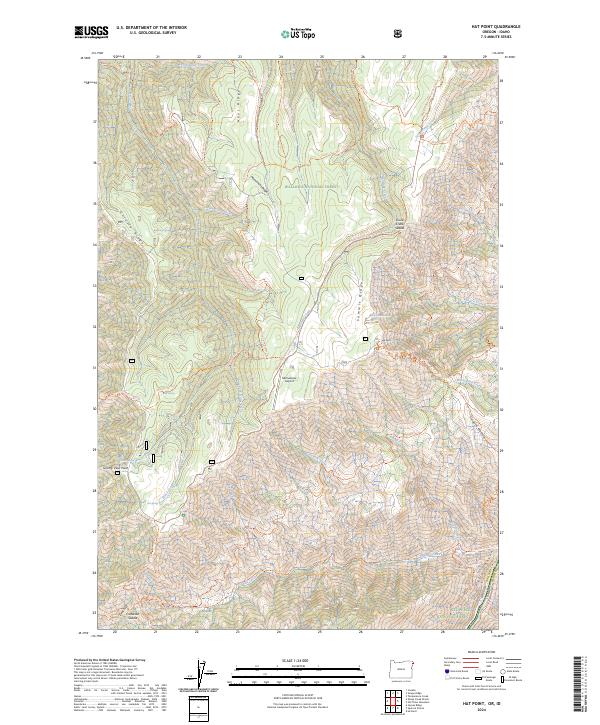
2024 Hat Point
Wallowa County, OR
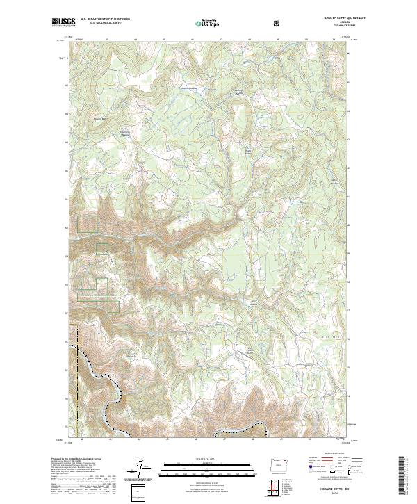
2024 Howard Butte
Wallowa County, OR
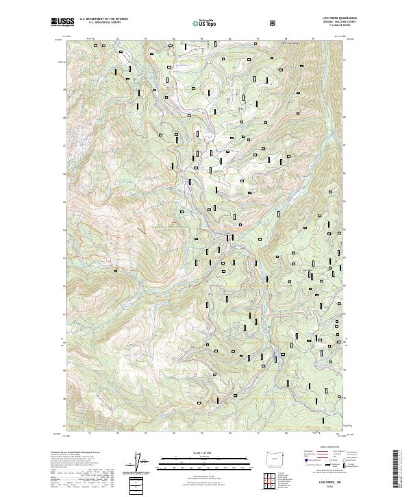
2024 Lick Creek
Wallowa County, OR
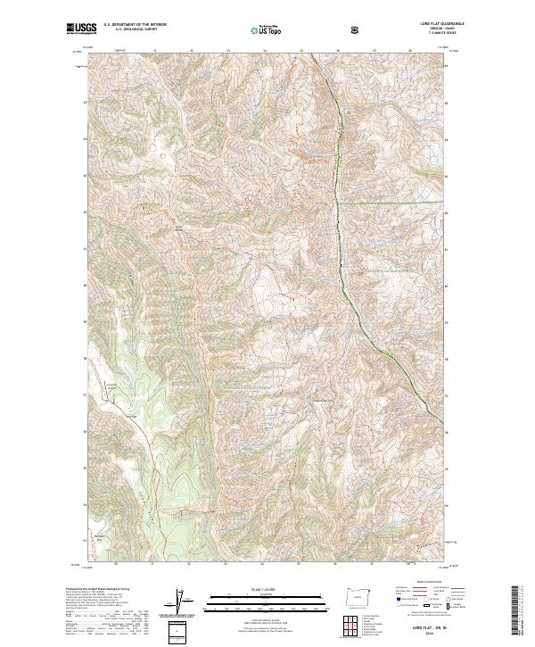
2024 Lord Flat
Wallowa County, OR
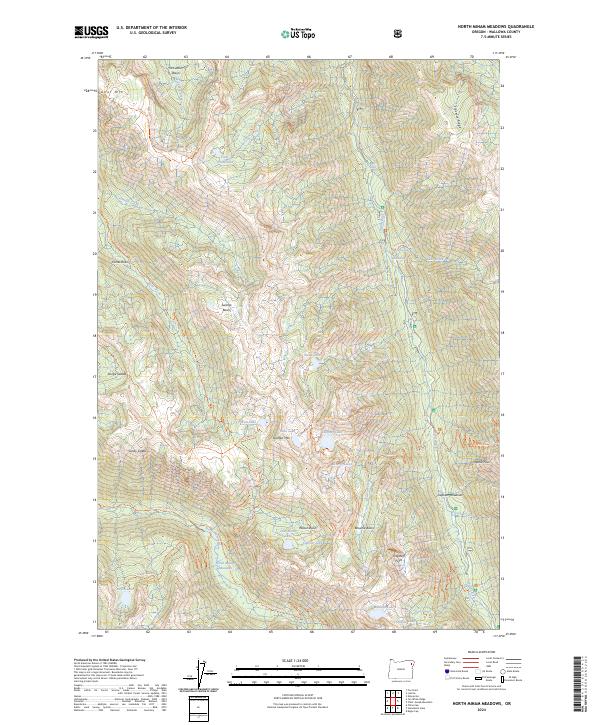
2024 North Minam Meadows
Wallowa County, OR
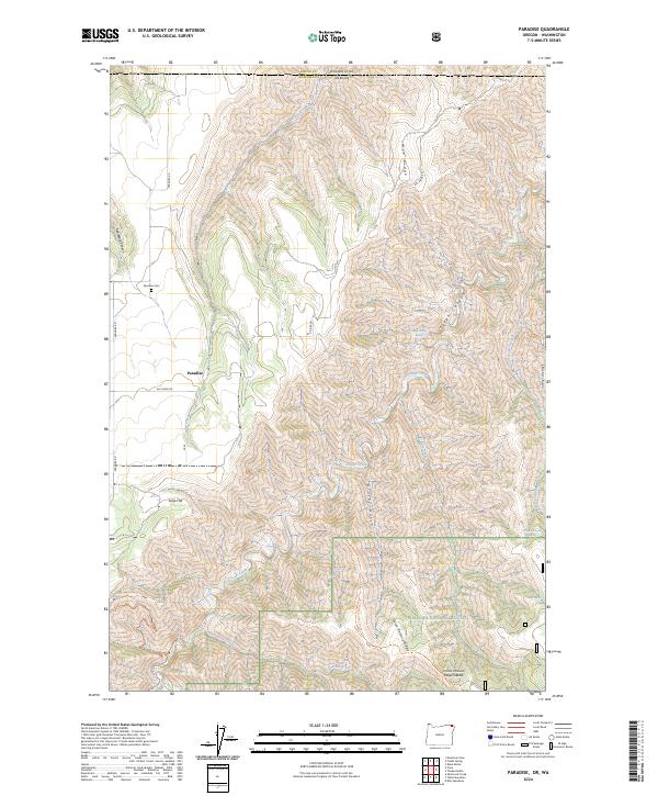
2024 Paradise
Wallowa County, OR

2024 Promise
Wallowa County, OR
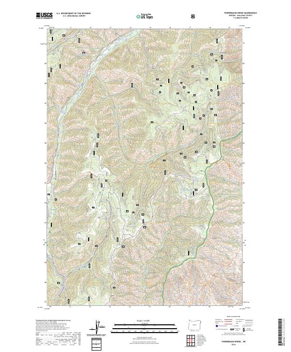
2024 Puderbaugh Ridge
Wallowa County, OR
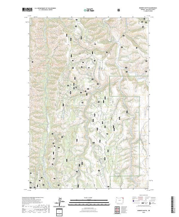
2024 Roberts Butte
Wallowa County, OR
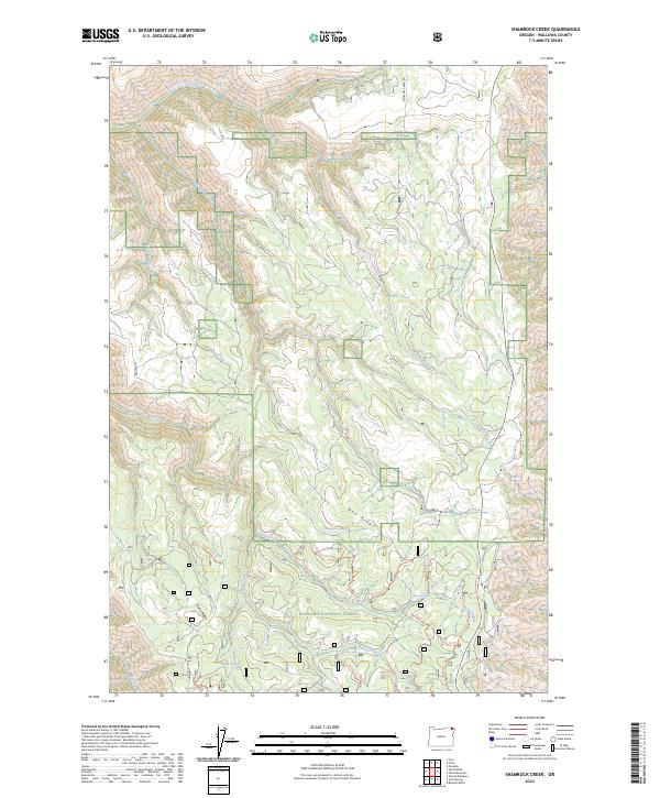
2024 Shamrock Creek
Wallowa County, OR
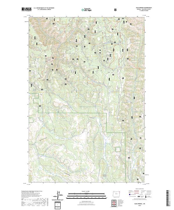
2024 Sled Springs
Wallowa County, OR
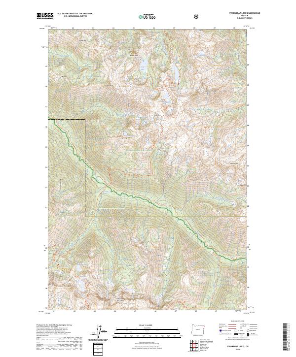
2024 Steamboat Lake
Wallowa County, OR
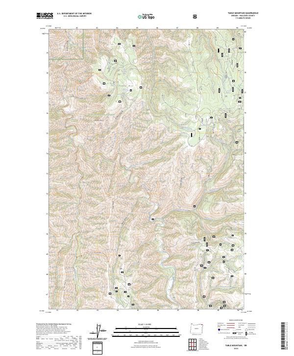
2024 Table Mountain
Wallowa County, OR
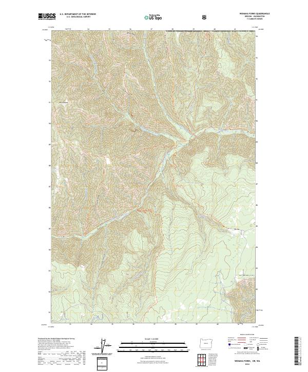
2024 Wenaha Forks
Wallowa County, OR