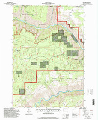
1995 Map of Eden
USGS Topo · Published 1998About this map
The Eden Community Hall and Eden Cemetery mark the heart of a remote mountain settlement in Wallowa County as it appeared during the late twentieth century. Located near the Washington-Oregon state line, the area is defined by the deep canyons of the Grande Ronde River and the Wenaha River. This landscape is heavily protected, partitioned into the Umatilla National Forest, the Wenaha-Tucannon Wilderness, and the Wenaha State Wildlife Area. High-altitude features like Hoodoo Lookout and the Long Meadows Guard Station suggest a history of forest management and fire watch overlooking Hoodoo Ridge. The map details a network of backcountry routes, including the Smooth Ridge Trail and River Trail, which provided access through difficult terrain like Burnt Canyon and Dry Gulch before many modern roads reached these heights.
Find a feature on this map
48 named features on this map. Tap any name to fly to it.
Don’t see what you’re looking for? This feature index may not catch every label — zoom into the map to look around manually.
Map Details
Editions of this 1995 Eden Map
This is the sole edition of this map. No revisions or reprints were ever made.
Other maps of this area

1937 · Pomeroy
USGS Topo · 1:96,000

1942 · Pomeroy
USGS Topo · 1:125,000

1943 · Saddle Butte
USGS Topo · 1:62,500

1946 · Saddle Butte
USGS Topo · 1:62,500

1955 · Pullman
USGS Topo · 1:250,000

1955 · Grangeville
USGS Topo · 1:250,000

1958 · Pullman
USGS Topo · 1:250,000

1959 · Grangeville
USGS Topo · 1:250,000

1967 · Wood Butte
USGS Topo · 1:24,000

1967 · Troy
USGS Topo · 1:24,000