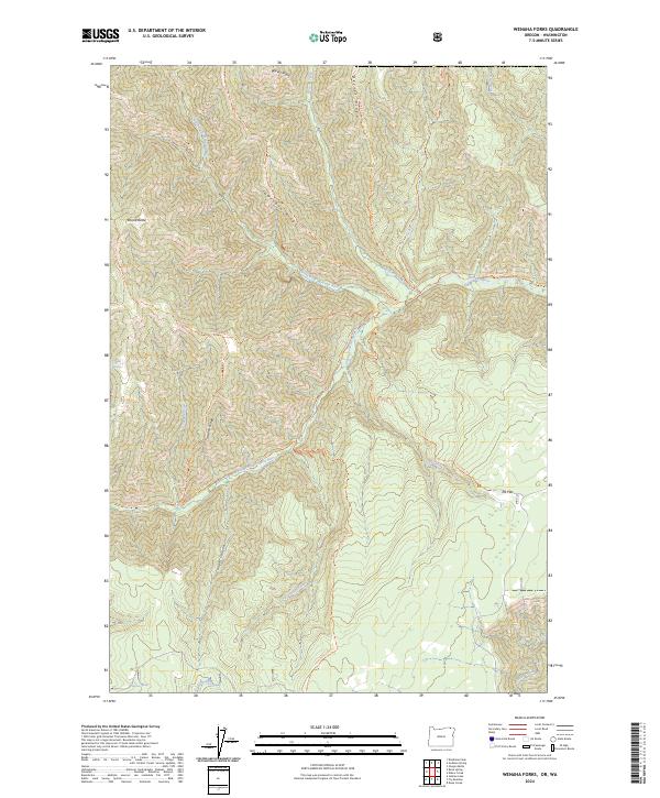
2024 Map of Wenaha Forks
USGS Topo · Published 2024About this map
The confluence of the North Fork Wenaha River and the South Fork Wenaha River forms the heart of this protected landscape in Wallowa County. Most of the terrain is defined by the Wenaha-Tucannon Wilderness, where a dense network of pack trails like the Sawtooth Trl and Trapper Ridge Trl provides the only access through steep drainages. High points such as Round Butte and ridges like Sawtooth Ridge and Beaver Ridge separate the deep cuts of Cougar Canyon and Jaussaud Creek. The hydrological significance of the area is emphasized by the Wenaha Wild and Scenic River designation, while smaller water sources like Bone Spring and Peerless Spring indicate the critical points of refuge for wildlife and travelers in this high-elevation backcountry.
Find a feature on this map
35 named features on this map. Tap any name to fly to it.
Don’t see what you’re looking for? This feature index may not catch every label — zoom into the map to look around manually.
Map Details
Editions of this 2024 Wenaha Forks Map
This is the sole edition of this map. No revisions or reprints were ever made.
Other maps of this area

1937 · Pomeroy
USGS Topo · 1:96,000

1942 · Pomeroy
USGS Topo · 1:125,000

1955 · Pullman
USGS Topo · 1:250,000

1955 · Grangeville
USGS Topo · 1:250,000

1958 · Pullman
USGS Topo · 1:250,000

1959 · Grangeville
USGS Topo · 1:250,000

1967 · Fry Meadow
USGS Topo · 1:24,000

1967 · Elbow Creek
USGS Topo · 1:24,000
1967 · Bone Spring
USGS Topo · 1:24,000

1967 · Oregon Butte
USGS Topo · 1:24,000