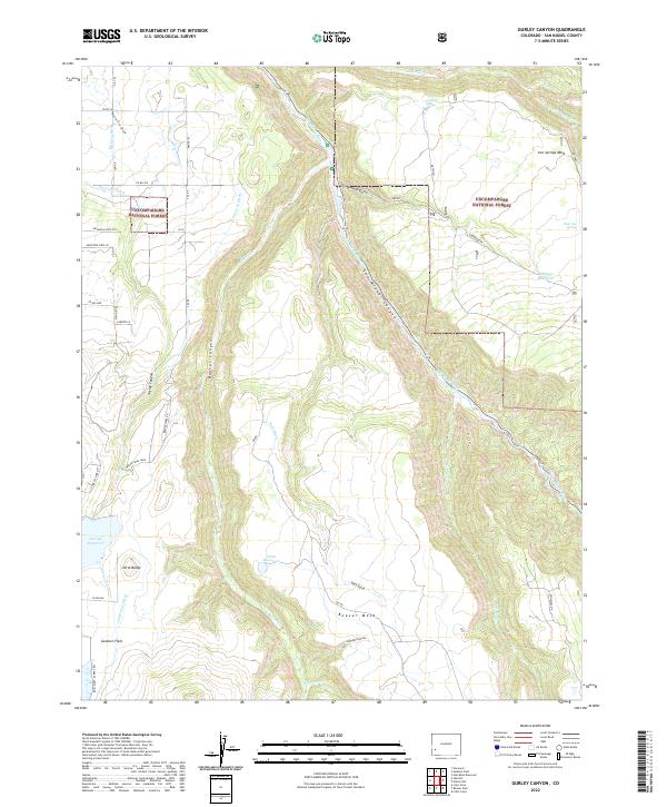
2022 Map of Gurley Canyon
USGS Topo · Published 2022About this map
The San Miguel River carves a deep path through San Miguel Canyon in this portion of southwestern Colorado, revealing a landscape defined by dramatic elevation changes and a sophisticated network of high-altitude water management. Large mesas like Beaver Mesa and Iron Springs Mesa dominate the uplands, while the Uncompahgre National Forest covers much of the eastern terrain. This modern survey illustrates the critical role of irrigation in the region, tracing numerous man-made waterways including the Sullivan Ditch, Bollinger Ditch, and Old Nelson Ditch. These systems connect significant water bodies such as Gurley Reservoir, McKeever Reservoir, and Point Reservoir, which sustain the high-plateau environment. Named landmarks like Little Baldy and Goshorn Flats provide specific points of interest for those studying the physical geography and land-use patterns of the San Miguel region.
Find a feature on this map
50 named features on this map. Tap any name to fly to it.
Don’t see what you’re looking for? This feature index may not catch every label — zoom into the map to look around manually.
Map Details
Editions of this 2022 Gurley Canyon Map
This is the sole edition of this map. No revisions or reprints were ever made.
Other maps of this area

1953 · Placerville
USGS Topo · 1:24,000

1953 · Little Cone
USGS Topo · 1:24,000

1956 · Cortez
USGS Topo · 1:250,000

1956 · Moab
USGS Topo · 1:250,000

1958 · Cortez
USGS Topo · 1:250,000

1959 · Cortez
USGS Topo · 1:250,000

1959 · Moab
USGS Topo · 1:250,000

1960 · Moab
USGS Topo · 1:250,000

1962 · Moab
USGS Topo · 1:250,000

1962 · Cortez
USGS Topo · 1:250,000