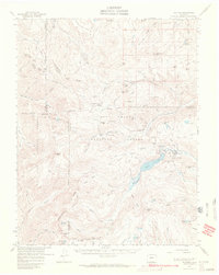
1967 Map of Platoro
USGS Topo · Published 1972About this map
The high-altitude mining and water infrastructure of the San Juan Mountains defines this 1967 survey. Summitville and the settlement of Platoro serve as the primary human anchors in a landscape dominated by the Rio Grande National Forest. The map documents critical extraction and transit history through features like the Mammoth Revenue Mine, Chandler Tunnel, and French Tunnel. The Continental Divide winds through the western half, intersected by the Continental Divide Trail and high passes such as Elwood Pass and Silver Pass. Water management is prominent at the Platoro Reservoir, where a Gatehouse controls the flow, and numerous high-alpine lakes like Lake Annella and Hilman Lake dot the basins. Evidence of early forest management and local shelter appears at the Elwood Guard Sta, McCormick Cabin, and Stunner Cabin.
Find a feature on this map
95 named features on this map. Tap any name to fly to it.
Don’t see what you’re looking for? This feature index may not catch every label — zoom into the map to look around manually.
Map Details
Editions of this 1967 Platoro Map
2 editions found
Other maps of this area

1913 · Summitville
USGS Topo · 1:125,000

1914 · Creede
USGS Topo · 1:125,000

1915 · Summitville
USGS Topo · 1:125,000

1915 · Del Norte
USGS Topo · 1:125,000

1916 · Creede
USGS Topo · 1:125,000

1917 · Del Norte
USGS Topo · 1:125,000

1922 · Conejos
USGS Topo · 1:125,000

1945 · Durango
USGS Topo · 1:250,000

1953 · Durango
USGS Topo · 1:250,000

1954 · Durango
USGS Topo · 1:250,000