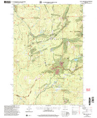
2001 Map of Three Brothers
USGS Topo · Published 2004About this map
Continental Divide traverses the center of this high-elevation terrain where the headwaters of the Missouri and Columbia River systems originate. The landscape is defined by its deep mining heritage, particularly within the Helena National Forest and Deerlodge National Forest. Concentrations of historical extraction are evident near the settlement of Rimini and across the slopes of Jericho Mountain and O'Keefe Mountain. Small outposts and residential clusters like Hub Camp, Newmans Camp, and Booth are scattered among the drainages of Tenmile Creek and Minnehaha Creek. The industrial footprint is further marked by numerous named workings such as the Bullion Mine, Beatrice Mine, and the Solar Mine, alongside water management features like Scott Reservoir and the Sure Thing Swamps.
Find a feature on this map
52 named features on this map. Tap any name to fly to it.
Don’t see what you’re looking for? This feature index may not catch every label — zoom into the map to look around manually.
Map Details
Editions of this 2001 Three Brothers Map
This is the sole edition of this map. No revisions or reprints were ever made.
Other maps of this area

1889 · Helena
USGS Topo · 1:250,000

1893 · Helena
USGS Topo · 1:250,000

1899 · Boulder
USGS Topo · 1:125,000

1899 · Helena
USGS Topo · 1:250,000

1903 · Helena
USGS Topo · 1:250,000

1947 · Butte
USGS Topo · 1:250,000

1950 · Jefferson City
USGS Topo · 1:62,500

1950 · Helena
USGS Topo · 1:62,500

1954 · Basin
USGS Topo · 1:62,500

1958 · Butte
USGS Topo · 1:250,000