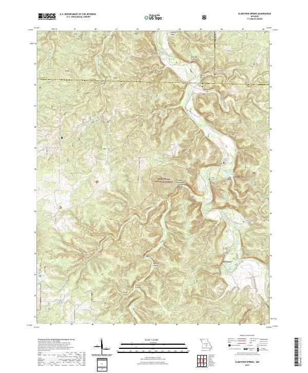
2021 Map of Slabtown Spring
USGS Topo · Published 2021About this map
The Big Piney River carves a deep path through this portion of the Mark Twain National Forest, defining a landscape of hollows and ridges where the boundaries of Texas, Pulaski, and Phelps counties converge. The small settlement of Slabtown and the nearby Hazleton represent the human footprint in this heavily timbered terrain, with the notable Slabtown Spring and Slabtown Lake providing key water sources. This 2021 survey illustrates the endurance of rural landmarks, from the Baldridge School to family burial grounds like Omalley Cem and Merrill Cem. Notable geological features, such as the Paddy Creek Natural Arch and Pocket Eddy, underscore the erosive power of the river system. The presence of State Hwy AF provides the primary transit artery through a region defined by its numerous tributary creeks, including Little Paddy Cr and Little Bald Ridge Cr.
Find a feature on this map
38 named features on this map. Tap any name to fly to it.
Don’t see what you’re looking for? This feature index may not catch every label — zoom into the map to look around manually.
Map Details
Editions of this 2021 Slabtown Spring Map
This is the sole edition of this map. No revisions or reprints were ever made.
Other maps of this area

1937 · Edgar Springs
USGS Topo · 1:48,000

1941 · Big Piney
USGS Topo · 1:62,500

1941 · Bado
USGS Topo · 1:62,500

1943 · Big Piney
USGS Topo · 1:62,500

1943 · Bado
USGS Topo · 1:62,500

1945 · Edgar Springs
USGS Topo · 1:62,500

1949 · Rolla
USGS Topo · 1:250,000

1951 · Prescott
USGS Topo · 1:24,000

1951 · Raymondville
USGS Topo · 1:62,500

1953 · Rolla
USGS Topo · 1:250,000