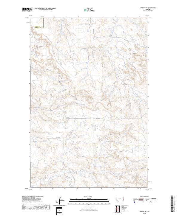
2024 Map of Hodges SW
USGS Topo · Published 2024About this map
Gibson Ditch cuts across the central rangeland of eastern Montana, tracing a legacy of water management in a landscape defined by its drainages. The map details the transition from Dawson County into Wibaux County, where the terrain is carved by the winding paths of Cedar Creek and Wolf Creek. The survey reveals a sparse but deliberate network of rural corridors including Sand Creek Rd and Bar Nothing Rd, which connect isolated ranching sections across the township lines of t13n r57e and t12n r58e. This 2024 edition provides an essential look at the modern topography and land divisions of the Great Plains, capturing the exact alignment of seasonal watercourses like Eastman Creek and the South Fork Horse Creek as they navigate the breaks.
Find a feature on this map
15 named features on this map. Tap any name to fly to it.
Don’t see what you’re looking for? This feature index may not catch every label — zoom into the map to look around manually.
Map Details
Editions of this 2024 Hodges SW Map
This is the sole edition of this map. No revisions or reprints were ever made.
Other maps of this area

1953 · Miles City
USGS Topo · 1:250,000

1957 · Miles City
USGS Topo · 1:250,000

1958 · Miles City
USGS Topo · 1:250,000

1967 · Twin Forks Reservoir
USGS Topo · 1:24,000

1981 · Ayer Spring NE
USGS Topo · 1:24,000

1981 · Cap Rock
USGS Topo · 1:24,000

1981 · Rocking Chair Butte
USGS Topo · 1:24,000

1981 · Wibaux
USGS Topo · 1:100,000
1982 · Hodges SE
USGS Topo · 1:24,000

1982 · Hodges
USGS Topo · 1:24,000