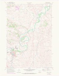
1968 Map of Acme
USGS Topo · Published 1983About this map
The Tongue River meanders through the heart of this Sheridan County landscape, where the settlements of Acme and Kleenburn sit at the confluence of major waterways and industrial transport. The arrival of the Burlington Northern railroad alongside Goose Creek defines the local infrastructure, supporting the area's development near the Montana state line. Agricultural management is evident through an intricate network of irrigation, including the Gladewater Ditch and Interstate Ditch, which divert water to the surrounding basins. The terrain is marked by numerous drainage features such as Beatty Gulch, Youngs Creek, and Hidden Water Creek, illustrating the complex hydrology of the High Plains. This 1968 survey, with later revisions, documents a period of established ranching and rail activity before significant modern landscape changes occurred.
Find a feature on this map
19 named features on this map. Tap any name to fly to it.
Don’t see what you’re looking for? This feature index may not catch every label — zoom into the map to look around manually.
Map Details
Editions of this 1968 Acme Map
This is the sole edition of this map. No revisions or reprints were ever made.
Other maps of this area

1894 · Rosebud
USGS Topo · 1:125,000

1895 · Dayton
USGS Topo · 1:125,000

1901 · Rosebud
USGS Topo · 1:125,000

1901 · Dayton
USGS Topo · 1:125,000

1909 · Sheridan
USGS Topo · 1:125,000

1911 · Sheridan
USGS Topo · 1:125,000

1954 · Hardin
USGS Topo · 1:250,000

1955 · Sheridan
USGS Topo · 1:250,000

1957 · Hardin
USGS Topo · 1:250,000

1958 · Hardin
USGS Topo · 1:250,000