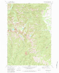
1972 Map of Elkhorn Peak
USGS Topo · Published 1984About this map
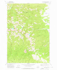
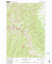
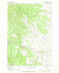
High-elevation mining operations dominate this 1970s survey of the Elkhorn Ridge within the Whitman National Forest. The landscape is defined by its industrial history, specifically the tiered camps of the Baisley-Elkhorn Mine, with its upper, middle, and lower camps connected by a network of pack trails. Several other hard-rock sites, including the Highland Mine, Maxwell Mine, and Chloride Mine, dot the terrain north of Elkhorn Peak. Water management for these operations and the surrounding valleys is evident through the presence of a high-altitude aqueduct and multiple flumes near Nelson Creek. The drainage patterns are clearly marked, showing how systems like Goodrich Creek and Marble Creek flow from alpine basins such as Cougar Basin and glacial features like Rock Creek Lake.
Find a feature on this map
46 named features on this map. Tap any name to fly to it.
Don’t see what you’re looking for? This feature index may not catch every label — zoom into the map to look around manually.
Map Details
Editions of this 1972 Elkhorn Peak Map
4 editions found
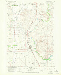
Other maps of this area

1901 · Baker City
USGS Topo · 1:125,000

1901 · Sumpter
USGS Topo · 1:125,000

1955 · Baker
USGS Topo · 1:250,000

1955 · Canyon City
USGS Topo · 1:250,000

1959 · Baker
USGS Topo · 1:250,000

1959 · Canyon City
USGS Topo · 1:250,000
1967 · Haines
USGS Topo · 1:24,000
1967 · Blue Canyon
USGS Topo · 1:24,000
1967 · Wingville
USGS Topo · 1:24,000
1972 · Elkhorn Peak
USGS Topo · 1:24,000