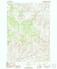
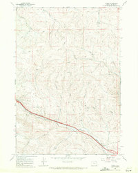
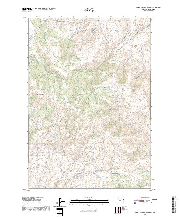
1988 Map of Little Lookout Mtn
USGS Topo · Published 1988About this map
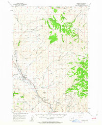
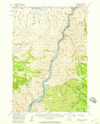
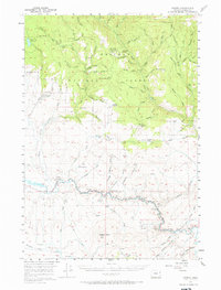
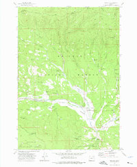
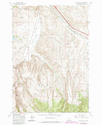
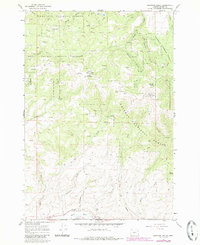
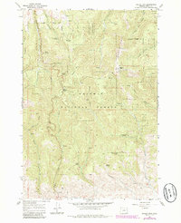
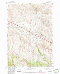
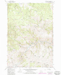
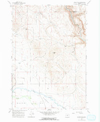
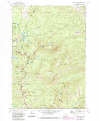
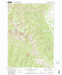
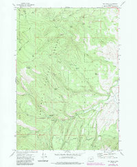
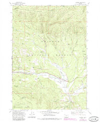
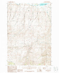
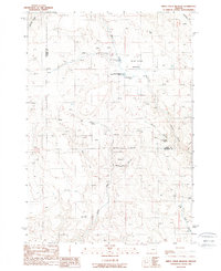
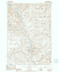
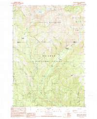
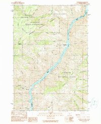
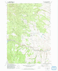
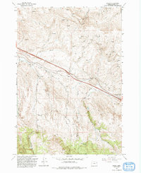
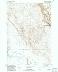
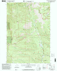
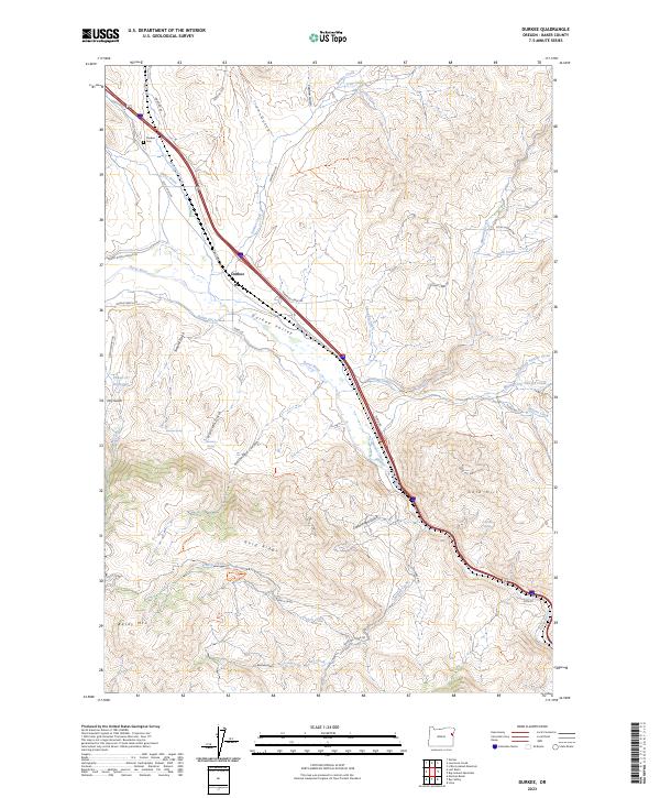
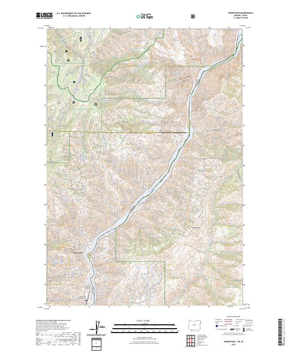
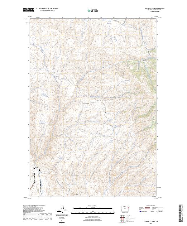
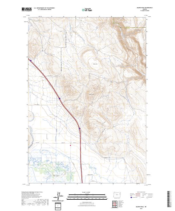
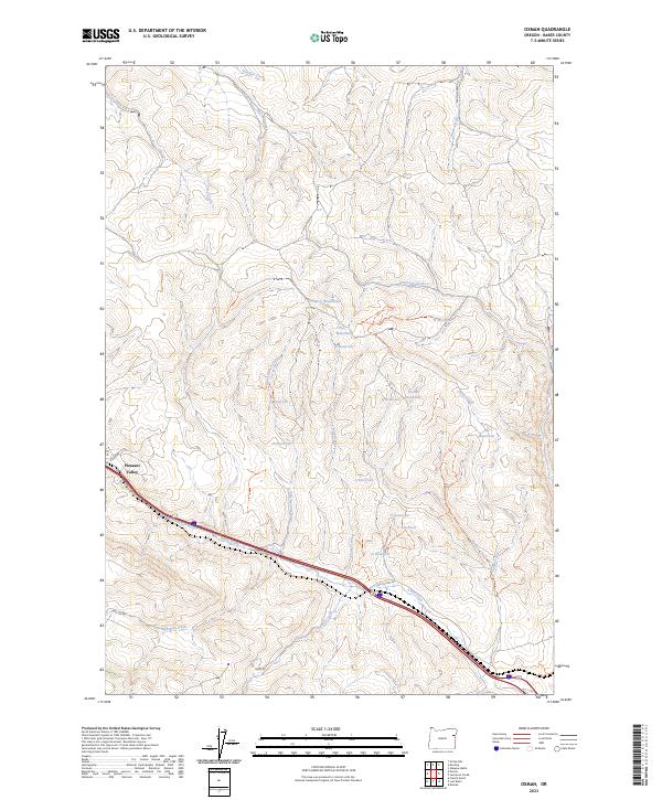
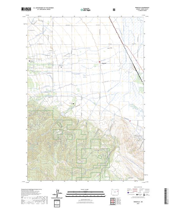
Little Lookout Mtn and Sheep Mountain dominate this landscape of the Blue Mountains, where the high-altitude terrain is defined by a complex network of springs and canyons. The settlement of Durkee appears along the western edge, situated near the headwaters of numerous drainages including Lawrence Creek and Nodine Creek. This 1988 provisional survey emphasizes a long-standing ranching and prospecting economy, evidenced by the proliferation of Stock Ponds and isolated Prospect sites throughout the area. Named landmarks like McCullough Spring and Upper Nodine Spring provide specific reference points for local history and land use. The drainage systems of Upper Timber Canyon and Lower Timber Canyon carved into the north, while the North Fork Daly Creek flows through the central portion of the quadrangle, illustrating the importance of water sources in this arid high-country environment.
Find a feature on this map
30 named features on this map. Tap any name to fly to it.
Don’t see what you’re looking for? This feature index may not catch every label — zoom into the map to look around manually.
Map Details
Editions of this 1988 Little Lookout Mtn Map
This is the sole edition of this map. No revisions or reprints were ever made.
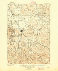
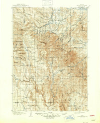
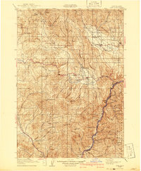
Historical Maps of Baker County Through Time
134 maps found
1901 Baker
Baker County, OR
1908 Ironside Mountain
Baker County, OR
1915 Pine
Baker County, OR
1955 Baker
Baker County, OR
1957 Durkee
Baker County, OR
1957 Mineral
Baker County, OR
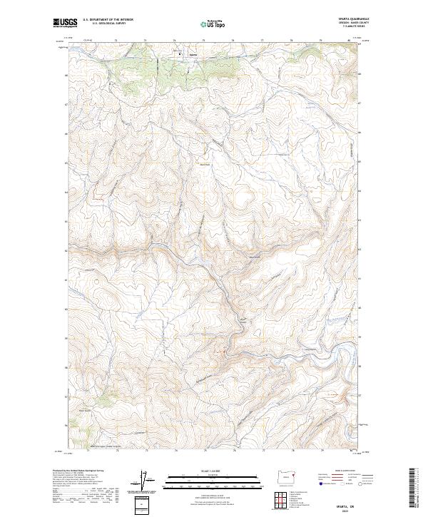
1957 Sparta
Baker County, OR
1959 Baker
Baker County, OR
1961 Whitney
Baker County, OR
1967 Baker
Baker County, OR
1967 Blue Canyon
Baker County, OR
1967 Bowen Valley
Baker County, OR
1967 Brannan Gulch
Baker County, OR
1967 Dooley Mtn
Baker County, OR
1967 Encina
Baker County, OR
1967 French Gulch
Baker County, OR
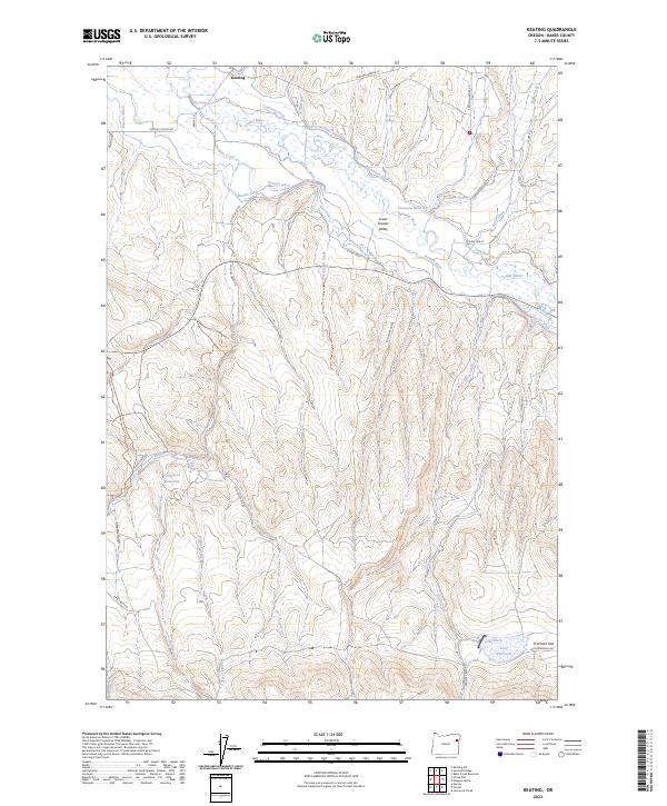
1967 Keating
Baker County, OR
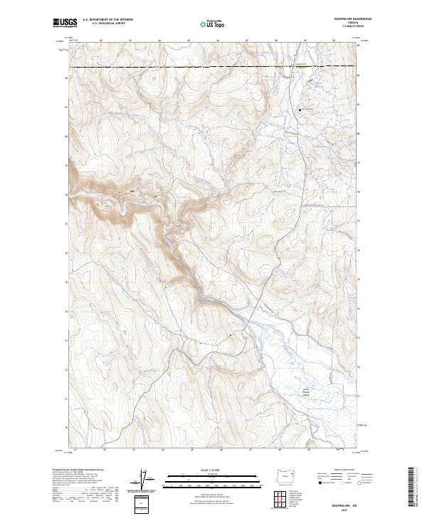
1967 Keating NW
Baker County, OR
1967 Lost Basin
Baker County, OR
1967 Magpie Peak
Baker County, OR
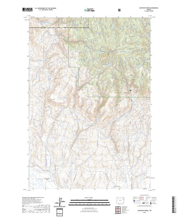
1967 Sawtooth Ridge
Baker County, OR
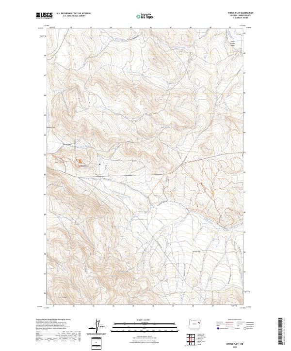
1967 Virtue Flat
Baker County, OR
1967 Wingville
Baker County, OR
1972 Anthony Lakes
Baker County, OR
1972 Beaverdam Creek
Baker County, OR
1972 Bourne
Baker County, OR
1972 Bullrun Rock
Baker County, OR
1972 Elkhorn Peak
Baker County, OR

1972 Hereford
Baker County, OR
1972 Little Baldy Mtn.
Baker County, OR
1972 Phillips Lake
Baker County, OR
1972 Pogue Point
Baker County, OR
1972 Rail Gulch
Baker County, OR
1972 Rastus Mtn
Baker County, OR
1972 Rock Creek
Baker County, OR
1972 Unity Reservoir
Baker County, OR
1972 Whitney
Baker County, OR
1981 Baker
Baker County, OR
1987 Brownlee Dam
Baker County, OR
1987 Connor Creek
Baker County, OR
1987 Daly Creek
Baker County, OR
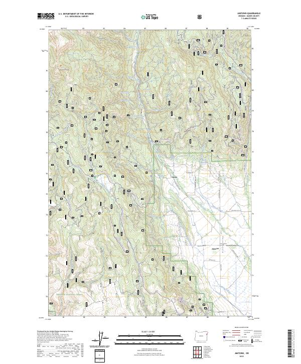
1987 Jimtown
Baker County, OR
1987 Mc Lain Gulch
Baker County, OR
1987 Oxbow
Baker County, OR
1987 Oxman
Baker County, OR
1987 Posy Valley
Baker County, OR
1988 Balm Creek Reservoir
Baker County, OR
1988 Big Lookout Mountain
Baker County, OR
1988 Birch Creek Meadow
Baker County, OR
1988 Durkee
Baker County, OR
1988 Glasgow Butte
Baker County, OR
1988 Lawrence Creek
Baker County, OR
1988 Lime
Baker County, OR
1988 Little Lookout Mtn
Baker County, OR
1988 Rye Valley
Baker County, OR
1988 Sparta
Baker County, OR
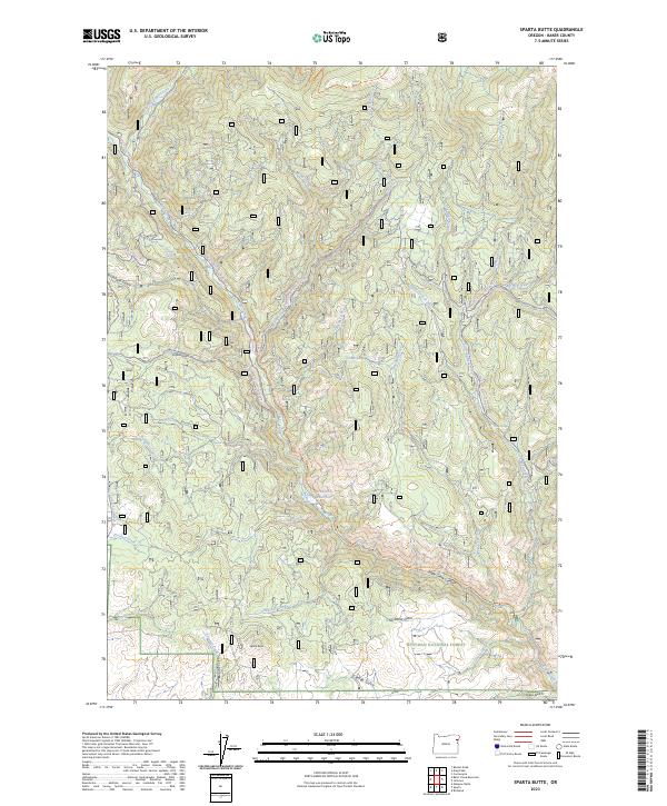
1988 Sparta Butte
Baker County, OR
1990 Bennet Peak
Baker County, OR
1990 Cornucopia
Baker County, OR

1990 Deadman Point
Baker County, OR
1990 Devils Heel
Baker County, OR
1990 Duck Creek
Baker County, OR
1990 Homestead
Baker County, OR
1990 Krag Peak
Baker County, OR
1990 Mormon Basin
Baker County, OR
1992 French Gulch
Baker County, OR
1993 Blue Canyon
Baker County, OR
1993 Bowen Valley
Baker County, OR
1993 Brannan Gulch
Baker County, OR
1993 Dooley Mtn
Baker County, OR
1993 Encina
Baker County, OR
1993 Wingville
Baker County, OR
1994 Keating
Baker County, OR
1994 Lost Basin
Baker County, OR
1994 Magpie Peak
Baker County, OR
1994 Oxman
Baker County, OR
1994 Virtue Flat
Baker County, OR
1998 Bullrun Rock
Baker County, OR
1998 Little Baldy Mountain
Baker County, OR
2004 Oxbow
Baker County, OR
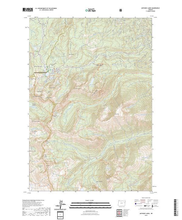
2023 Anthony Lakes
Baker County, OR
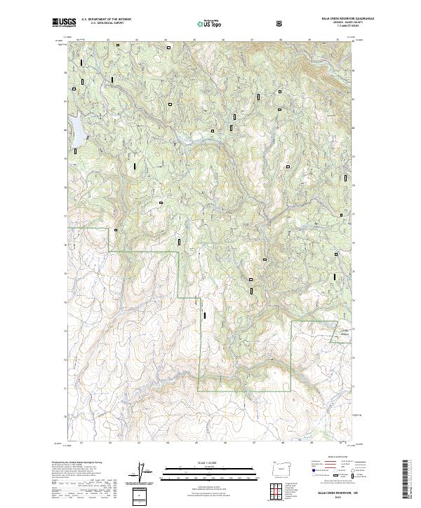
2023 Balm Creek Reservoir
Baker County, OR
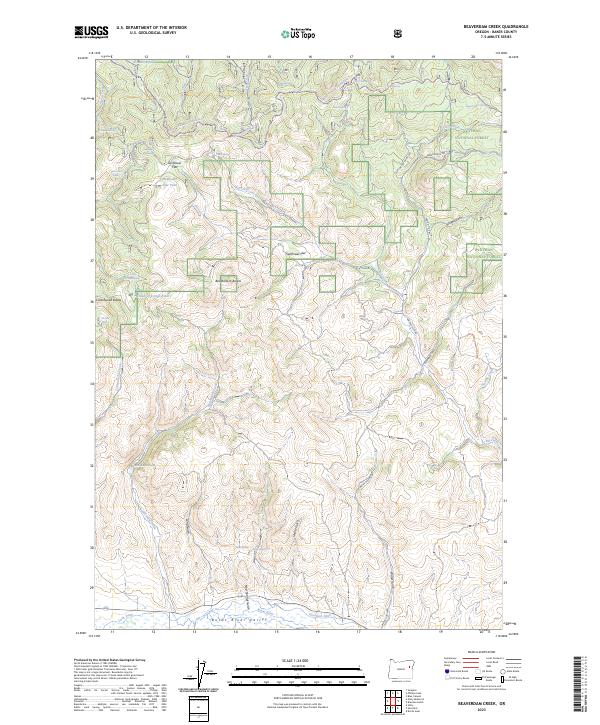
2023 Beaverdam Creek
Baker County, OR
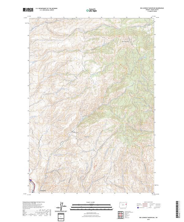
2023 Big Lookout Mountain
Baker County, OR
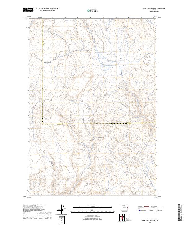
2023 Birch Creek Meadow
Baker County, OR
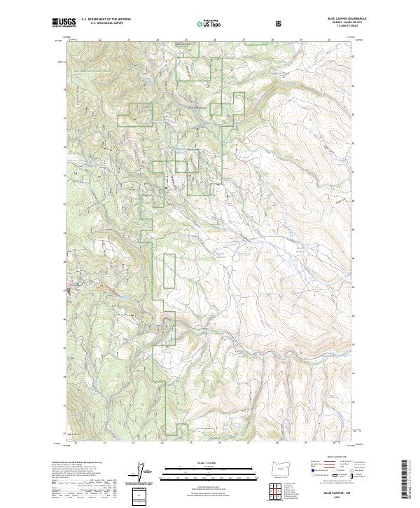
2023 Blue Canyon
Baker County, OR
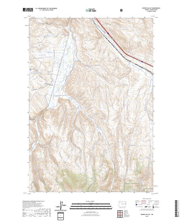
2023 Bowen Valley
Baker County, OR
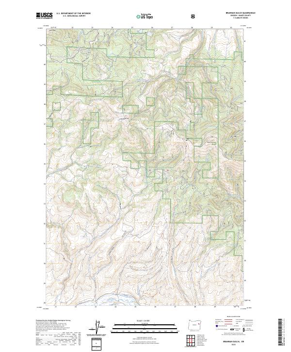
2023 Brannan Gulch
Baker County, OR
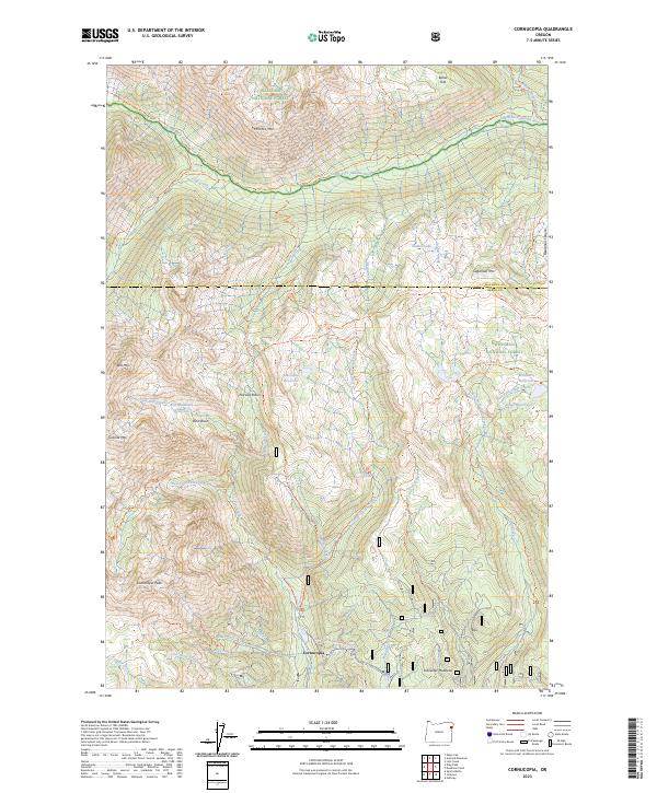
2023 Cornucopia
Baker County, OR
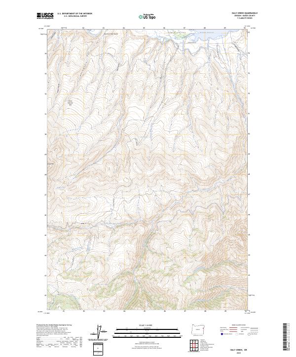
2023 Daly Creek
Baker County, OR
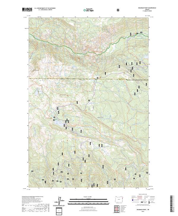
2023 Deadman Point
Baker County, OR
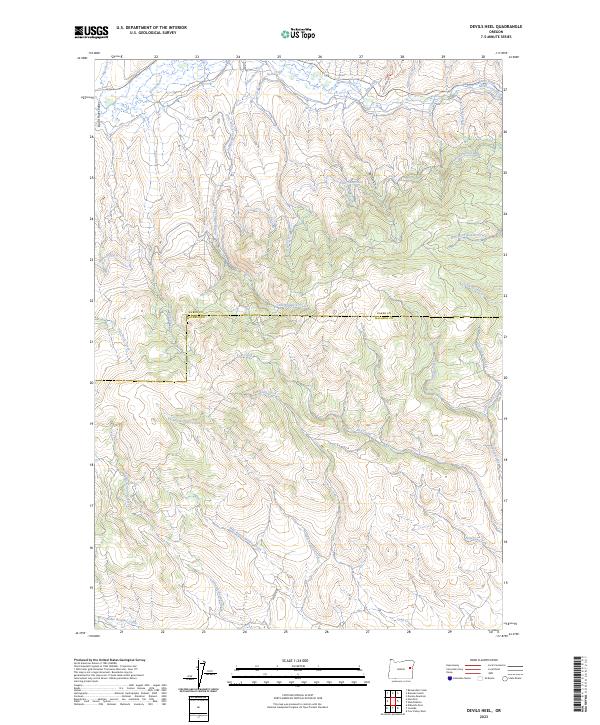
2023 Devils Heel
Baker County, OR
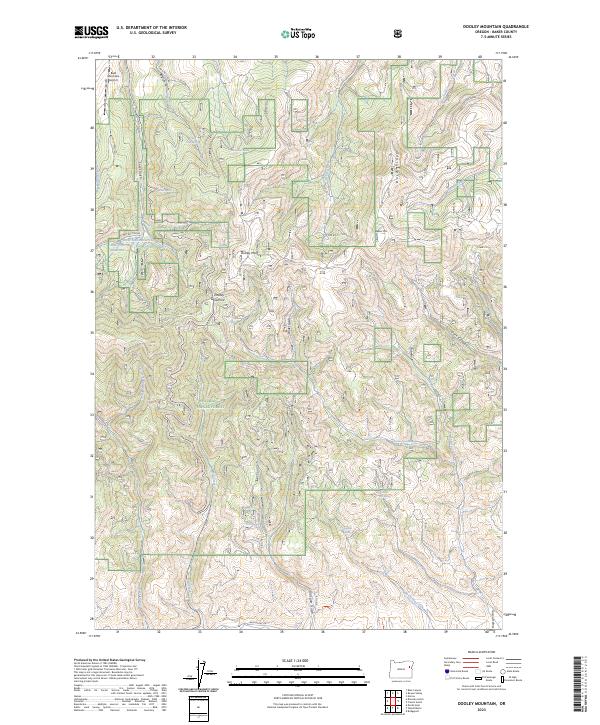
2023 Dooley Mountain
Baker County, OR
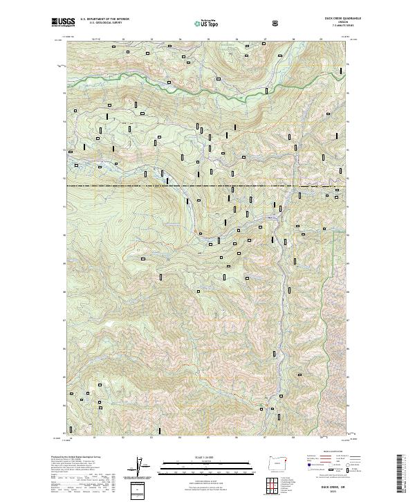
2023 Duck Creek
Baker County, OR
2023 Durkee
Baker County, OR
2023 French Gulch
Baker County, OR
2023 Glasgow Butte
Baker County, OR
2023 Hereford
Baker County, OR
2023 Homestead
Baker County, OR
2023 Jimtown
Baker County, OR
2023 Keating
Baker County, OR
2023 Keating NW
Baker County, OR
2023 Lawrence Creek
Baker County, OR
2023 Lime
Baker County, OR
2023 Little Lookout Mountain
Baker County, OR
2023 Lost Basin
Baker County, OR
2023 Magpie Peak
Baker County, OR
2023 McLain Gulch
Baker County, OR
2023 Mormon Basin
Baker County, OR
2023 Oxbow
Baker County, OR
2023 Oxman
Baker County, OR
2023 Rail Gulch
Baker County, OR
2023 Rastus Mountain
Baker County, OR
2023 Rye Valley
Baker County, OR
2023 Sawtooth Ridge
Baker County, OR
2023 Sparta
Baker County, OR
2023 Sparta Butte
Baker County, OR
2023 Virtue Flat
Baker County, OR
2023 Wingville
Baker County, OR
2024 Bennet Peak
Baker County, OR
2024 Bourne
Baker County, OR
2024 Brownlee Dam
Baker County, OR
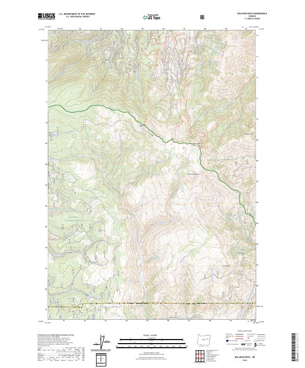
2024 Bullrun Rock
Baker County, OR
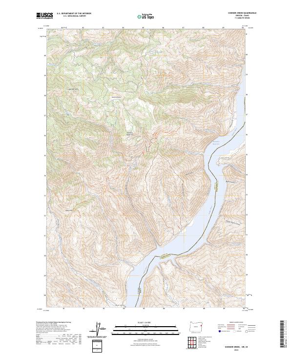
2024 Connor Creek
Baker County, OR
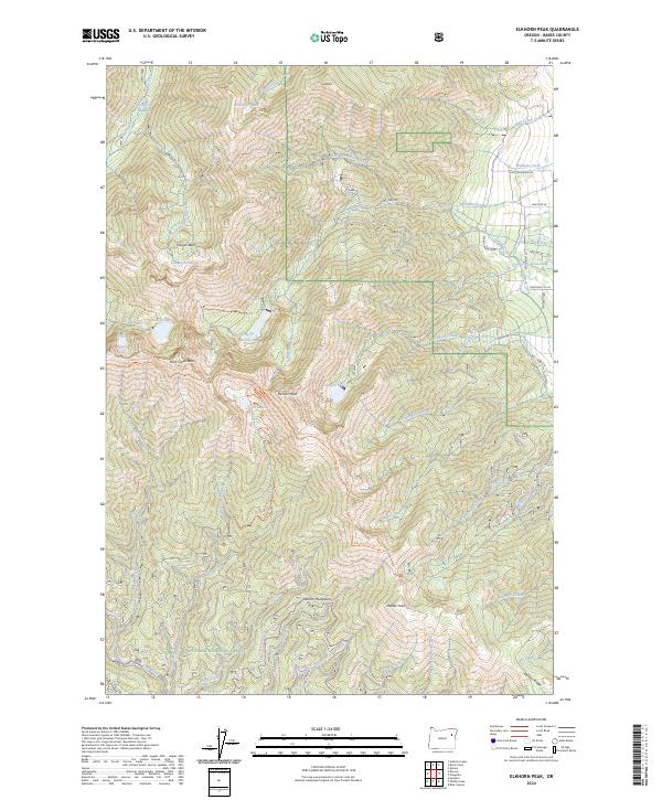
2024 Elkhorn Peak
Baker County, OR
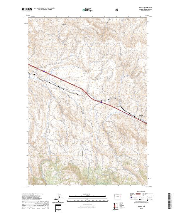
2024 Encina
Baker County, OR
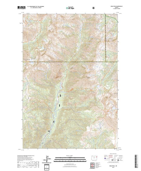
2024 Krag Peak
Baker County, OR
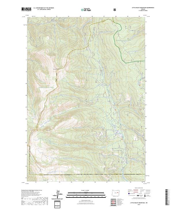
2024 Little Baldy Mountain
Baker County, OR
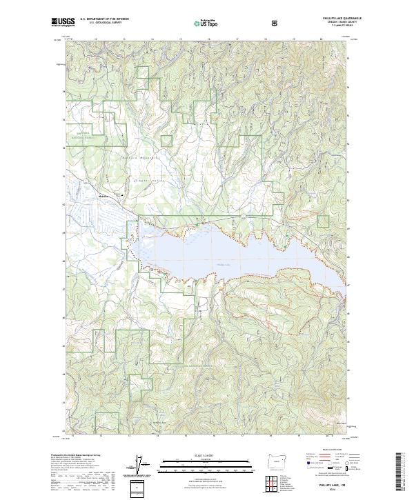
2024 Phillips Lake
Baker County, OR
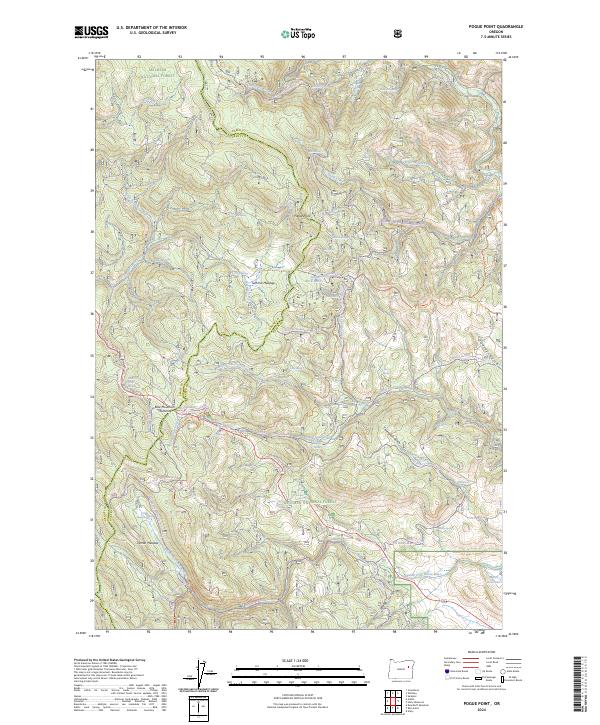
2024 Pogue Point
Baker County, OR
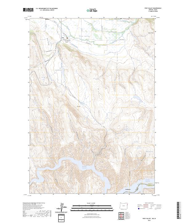
2024 Posy Valley
Baker County, OR
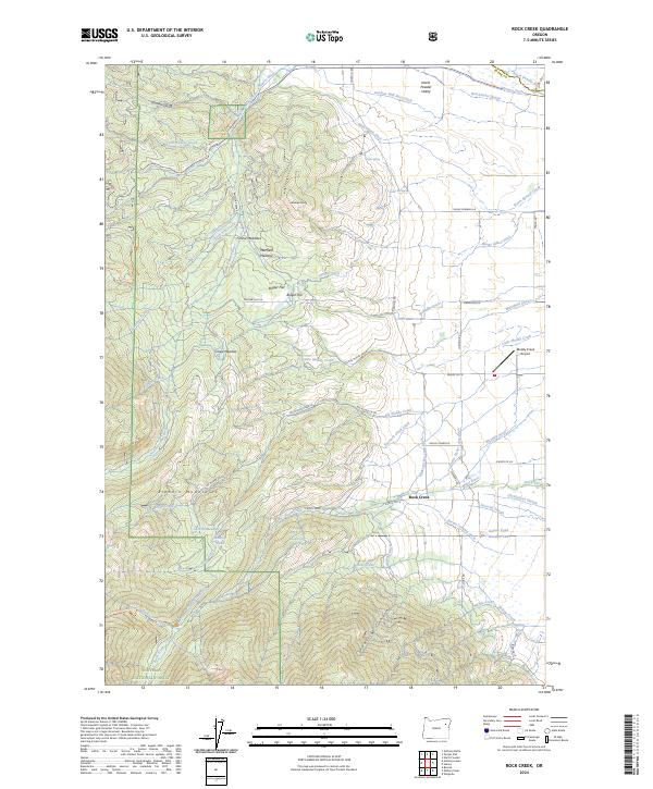
2024 Rock Creek
Baker County, OR
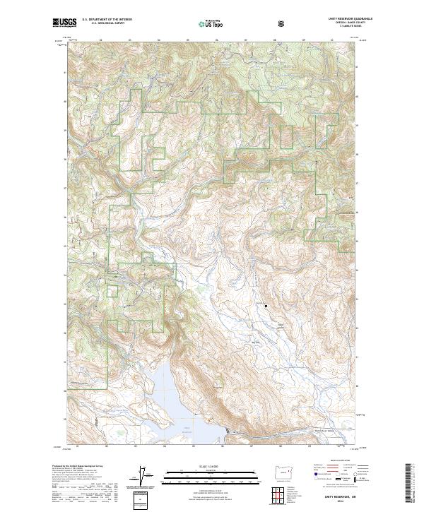
2024 Unity Reservoir
Baker County, OR
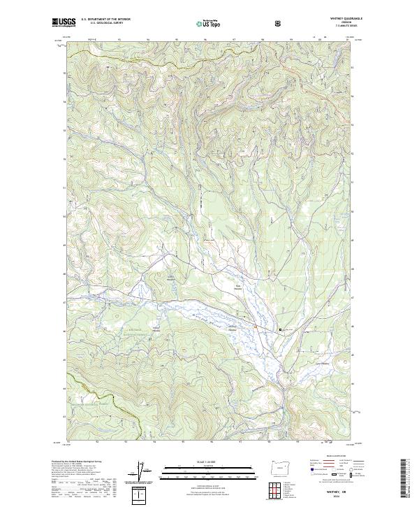
2024 Whitney
Baker County, OR