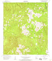
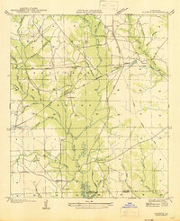
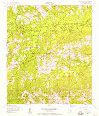
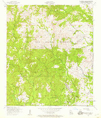
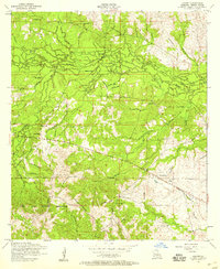
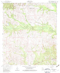
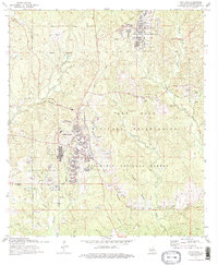
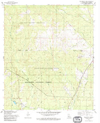
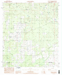
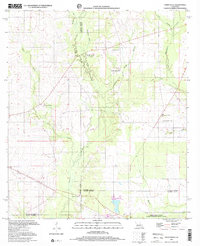
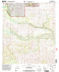
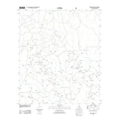
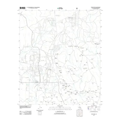
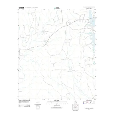
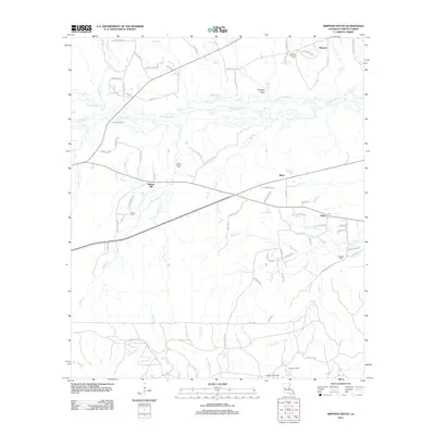
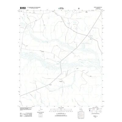
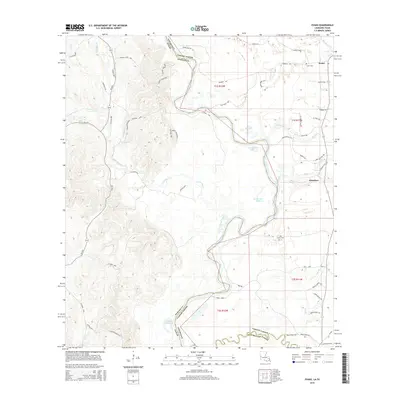
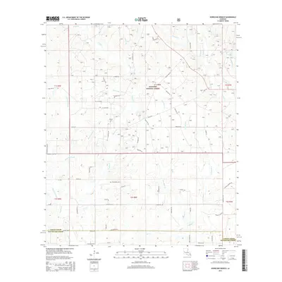
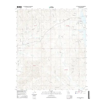
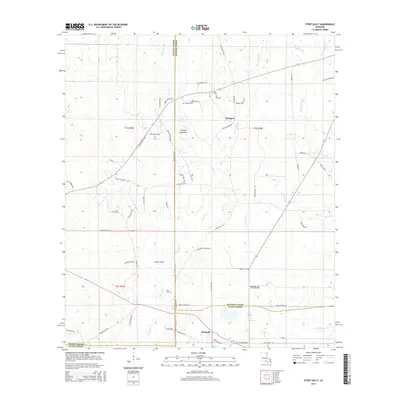
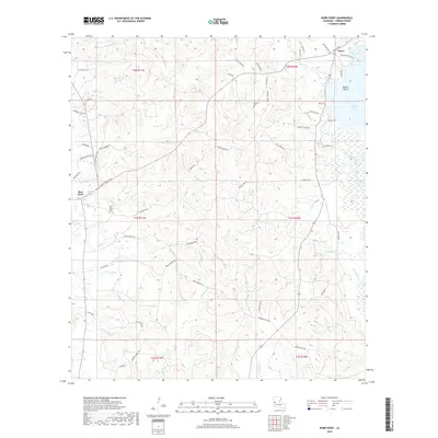
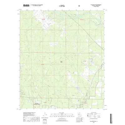
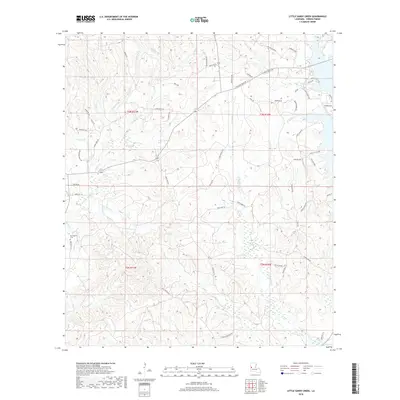
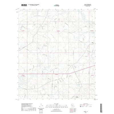
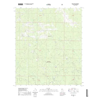
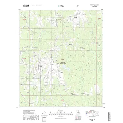
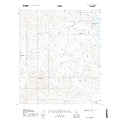
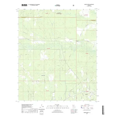
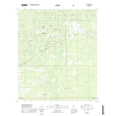
1954 Map of Little Sandy Creek
USGS Topo · Published 1958About this map
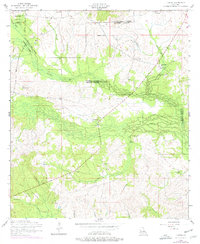
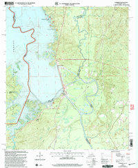
Good Hope Church and New Hope Church anchor the rural landscape of western Vernon Parish in the mid-1950s. The terrain is defined by a dense network of waterways, including Sandy Creek, Little Sandy Creek, and Caney Creek, which create a complex system of ridges and valleys. Evidence of the region's industrial past is visible in the form of a dismantled railroad that cuts through the topography, likely a remnant of earlier timber harvesting or local transport lines. Small community centers are identified by their spiritual and commemorative landmarks, such as Beech Grove Church and a lone Cemetery situated near the headwaters of Caney Creek. This survey reveals a quiet, interior Louisiana landscape where life centered around isolated church congregations and the natural drainage of the Anacoco Creek basin.
Find a feature on this map
21 named features on this map. Tap any name to fly to it.
Don’t see what you’re looking for? This feature index may not catch every label — zoom into the map to look around manually.
Map Details
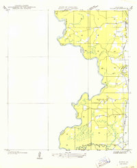
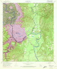
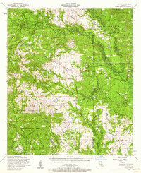
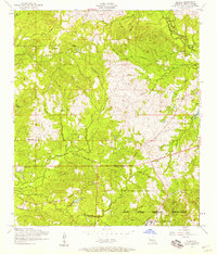
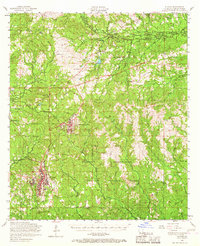
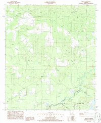
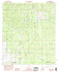
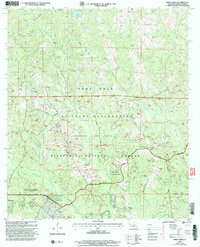
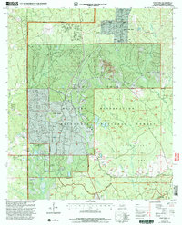
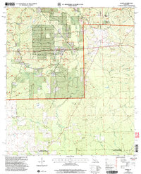
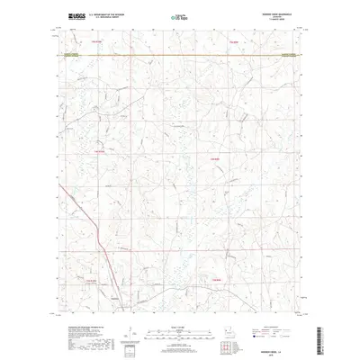
Editions of this 1954 Little Sandy Creek Map
2 editions found
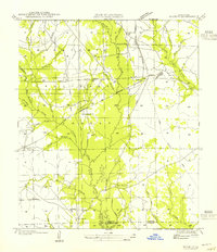
Historical Maps of Vernon Parish Through Time
145 maps found

1937 Chopin SW
Vernon Parish, LA

1941 Slagle
Vernon Parish, LA
1943 Leander
Vernon Parish, LA

1944 Slagle
Vernon Parish, LA
1947 Chasmore
Vernon Parish, LA
1947 Knight
Vernon Parish, LA

1947 Steep Gully
Vernon Parish, LA
1947 Sugrue
Vernon Parish, LA
1949 Evans
Vernon Parish, LA

1951 Steep Gully
Vernon Parish, LA
1954 Birds Creek
Vernon Parish, LA
1954 Burr Ferry
Vernon Parish, LA
1954 Burton Creek
Vernon Parish, LA
1954 Chasmore
Vernon Parish, LA
1954 Dowden Creek
Vernon Parish, LA
1954 Fort Polk
Vernon Parish, LA
1954 Fullerton Lake
Vernon Parish, LA
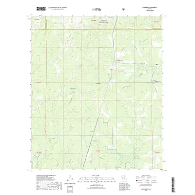
1954 Haddens
Vernon Parish, LA
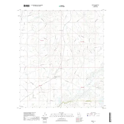
1954 Knight
Vernon Parish, LA
1954 Kurthwood
Vernon Parish, LA
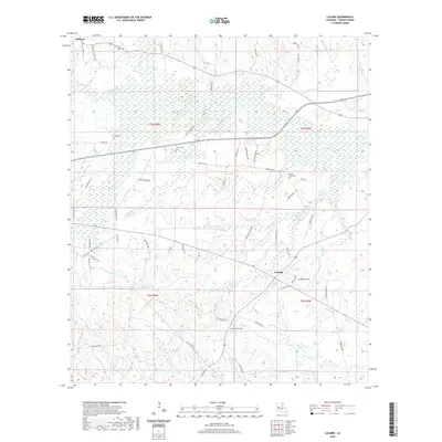
1954 Lacamp
Vernon Parish, LA
1954 Leander
Vernon Parish, LA
1954 Little Sandy Creek
Vernon Parish, LA
1954 Newllano
Vernon Parish, LA
1954 Simpson North
Vernon Parish, LA
1954 Slagle
Vernon Parish, LA
1954 Slagle
Vernon Parish, LA
1954 Sugrue
Vernon Parish, LA
1954 Temple
Vernon Parish, LA
1959 Steep Gully
Vernon Parish, LA
1974 Birds Creek
Vernon Parish, LA
1974 Fort Polk
Vernon Parish, LA
1974 Fort Polk
Vernon Parish, LA
1974 Simpson South
Vernon Parish, LA
1974 Slagle
Vernon Parish, LA
1977 Fort Polk
Vernon Parish, LA
1978 Fullerton Lake
Vernon Parish, LA
1978 Lacamp
Vernon Parish, LA
1984 Evans
Vernon Parish, LA
1985 Haddens
Vernon Parish, LA
1986 Hurricane Branch
Vernon Parish, LA
1986 Knight
Vernon Parish, LA
1986 Sugrue
Vernon Parish, LA
1994 Dowden Creek
Vernon Parish, LA
1997 Steep Gully
Vernon Parish, LA
2003 Birds Creek
Vernon Parish, LA
2003 Fort Polk
Vernon Parish, LA
2003 Fullerton Lake
Vernon Parish, LA
2003 Haddens
Vernon Parish, LA
2003 Hurricane Branch
Vernon Parish, LA
2003 Kurthwood
Vernon Parish, LA
2003 Simpson North
Vernon Parish, LA
2003 Temple
Vernon Parish, LA
2004 Sugrue
Vernon Parish, LA
2010 Evans
Vernon Parish, LA
2010 Haddens
Vernon Parish, LA
2012 Birds Creek
Vernon Parish, LA
2012 Burr Ferry
Vernon Parish, LA
2012 Dowden Creek
Vernon Parish, LA
2012 Evans
Vernon Parish, LA
2012 Fort Polk
Vernon Parish, LA
2012 Fullerton Lake
Vernon Parish, LA
2012 Hurricane Branch
Vernon Parish, LA
2012 Knight
Vernon Parish, LA
2012 Kurthwood
Vernon Parish, LA
2012 Lacamp
Vernon Parish, LA
2012 Little Sandy Creek
Vernon Parish, LA
2012 Simpson North
Vernon Parish, LA
2012 Simpson South
Vernon Parish, LA
2012 Slagle
Vernon Parish, LA
2012 Steep Gully
Vernon Parish, LA
2012 Sugrue
Vernon Parish, LA
2012 Temple
Vernon Parish, LA
2015 Birds Creek
Vernon Parish, LA
2015 Burr Ferry
Vernon Parish, LA
2015 Dowden Creek
Vernon Parish, LA
2015 Evans
Vernon Parish, LA
2015 Fort Polk
Vernon Parish, LA
2015 Fullerton Lake
Vernon Parish, LA
2015 Haddens
Vernon Parish, LA
2015 Hurricane Branch
Vernon Parish, LA
2015 Knight
Vernon Parish, LA
2015 Kurthwood
Vernon Parish, LA
2015 Lacamp
Vernon Parish, LA
2015 Little Sandy Creek
Vernon Parish, LA
2015 Simpson North
Vernon Parish, LA
2015 Simpson South
Vernon Parish, LA
2015 Slagle
Vernon Parish, LA
2015 Steep Gully
Vernon Parish, LA
2015 Sugrue
Vernon Parish, LA
2015 Temple
Vernon Parish, LA
2018 Birds Creek
Vernon Parish, LA
2018 Burr Ferry
Vernon Parish, LA
2018 Dowden Creek
Vernon Parish, LA
2018 Evans
Vernon Parish, LA
2018 Fort Polk
Vernon Parish, LA
2018 Fullerton Lake
Vernon Parish, LA
2018 Haddens
Vernon Parish, LA
2018 Hurricane Branch
Vernon Parish, LA
2018 Knight
Vernon Parish, LA
2018 Kurthwood
Vernon Parish, LA

2018 Lacamp
Vernon Parish, LA
2018 Little Sandy Creek
Vernon Parish, LA
2018 Simpson North
Vernon Parish, LA
2018 Simpson South
Vernon Parish, LA
2018 Slagle
Vernon Parish, LA
2018 Steep Gully
Vernon Parish, LA
2018 Sugrue
Vernon Parish, LA
2018 Temple
Vernon Parish, LA
2020 Birds Creek
Vernon Parish, LA
2020 Burr Ferry
Vernon Parish, LA
2020 Dowden Creek
Vernon Parish, LA
2020 Evans
Vernon Parish, LA
2020 Fort Polk
Vernon Parish, LA
2020 Fullerton Lake
Vernon Parish, LA
2020 Haddens
Vernon Parish, LA
2020 Hurricane Branch
Vernon Parish, LA
2020 Knight
Vernon Parish, LA
2020 Kurthwood
Vernon Parish, LA
2020 Lacamp
Vernon Parish, LA
2020 Little Sandy Creek
Vernon Parish, LA
2020 Simpson North
Vernon Parish, LA
2020 Simpson South
Vernon Parish, LA
2020 Slagle
Vernon Parish, LA
2020 Steep Gully
Vernon Parish, LA
2020 Sugrue
Vernon Parish, LA
2020 Temple
Vernon Parish, LA
2024 Birds Creek
Vernon Parish, LA
2024 Burr Ferry
Vernon Parish, LA
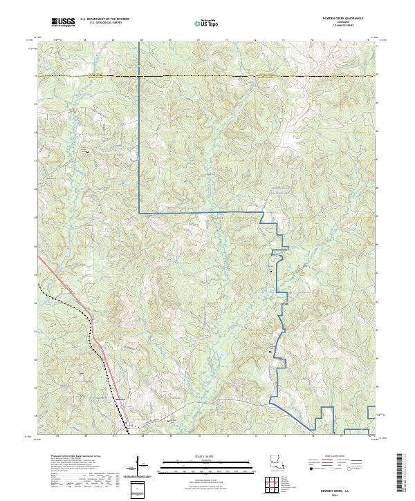
2024 Dowden Creek
Vernon Parish, LA
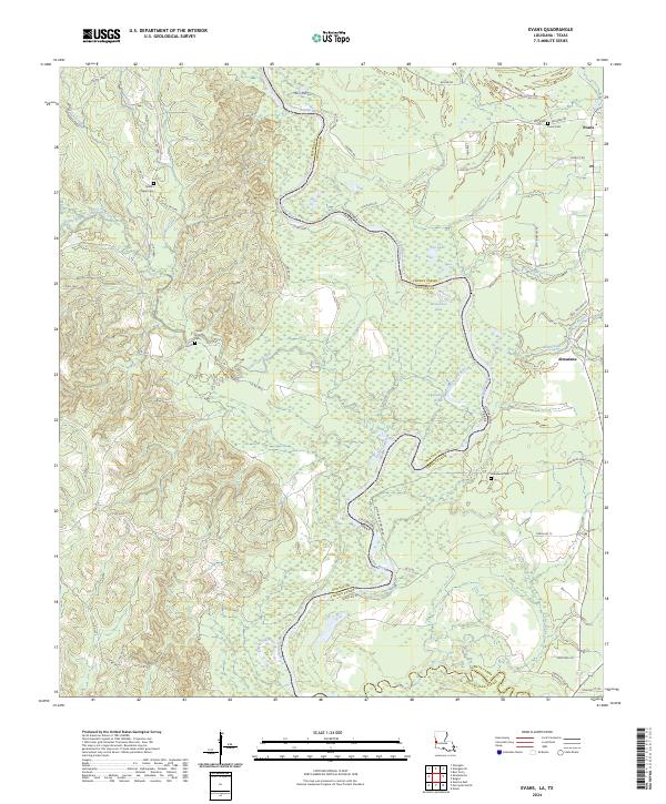
2024 Evans
Vernon Parish, LA
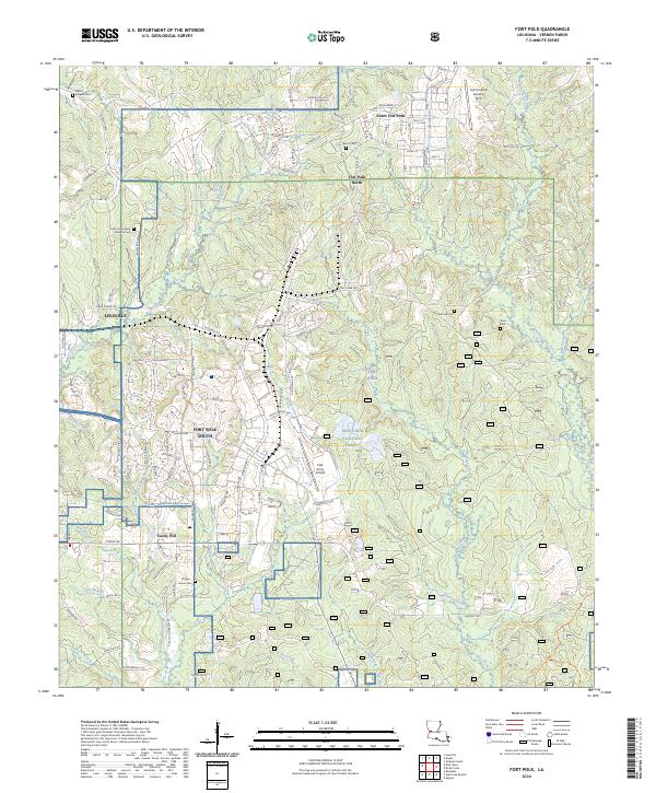
2024 Fort Polk
Vernon Parish, LA
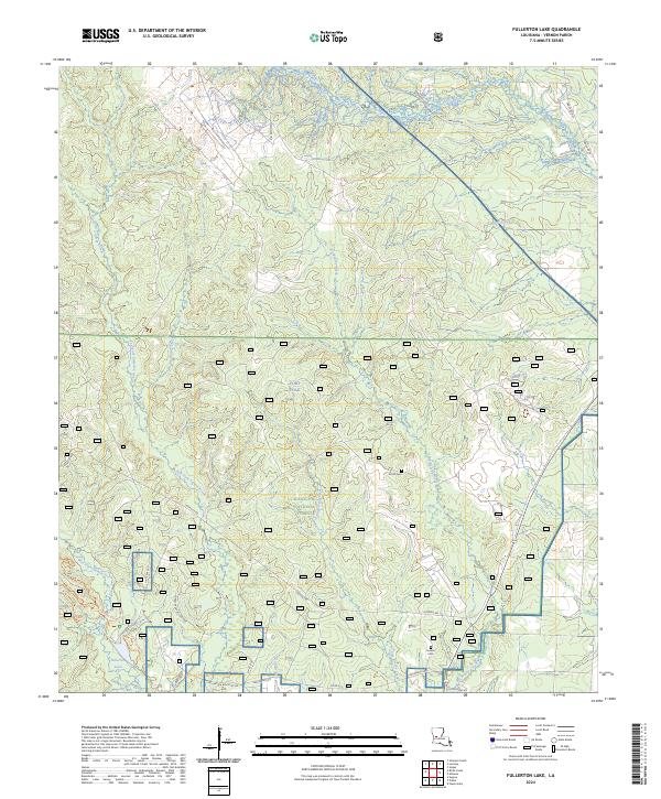
2024 Fullerton Lake
Vernon Parish, LA
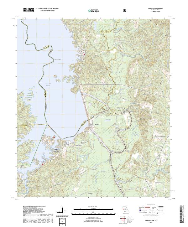
2024 Haddens
Vernon Parish, LA
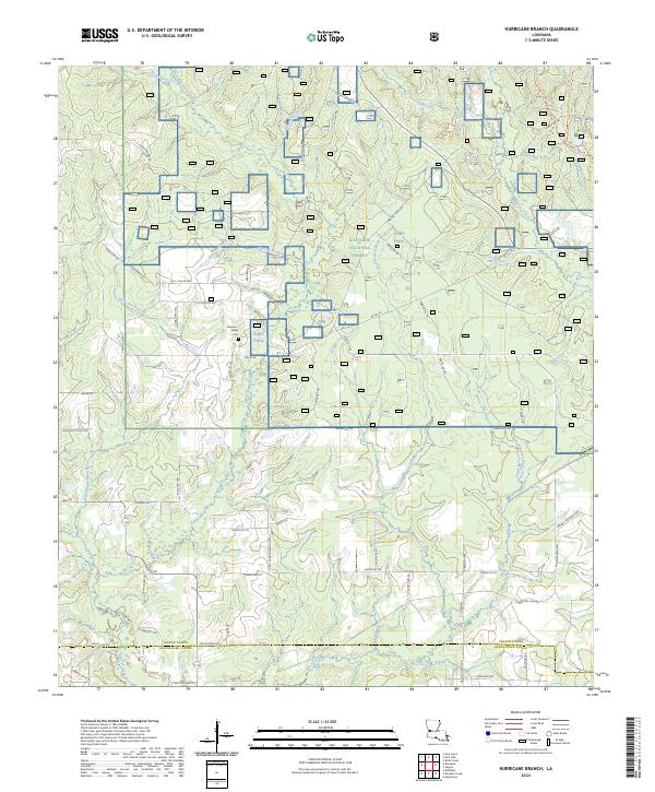
2024 Hurricane Branch
Vernon Parish, LA
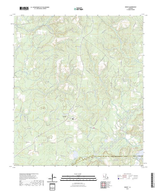
2024 Knight
Vernon Parish, LA
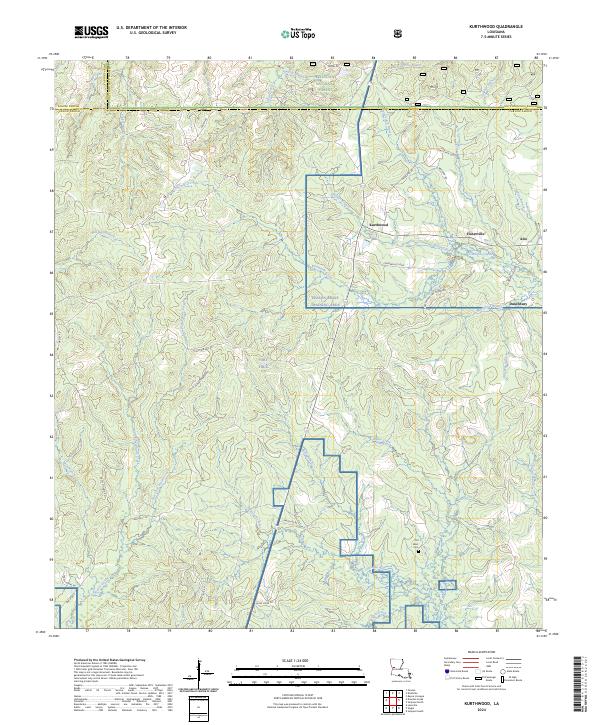
2024 Kurthwood
Vernon Parish, LA

2024 Lacamp
Vernon Parish, LA
2024 Little Sandy Creek
Vernon Parish, LA
2024 Simpson North
Vernon Parish, LA
2024 Simpson South
Vernon Parish, LA
2024 Slagle
Vernon Parish, LA
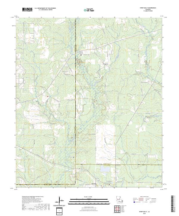
2024 Steep Gully
Vernon Parish, LA
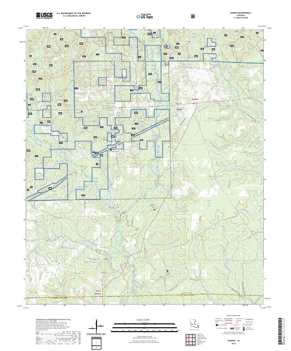
2024 Sugrue
Vernon Parish, LA
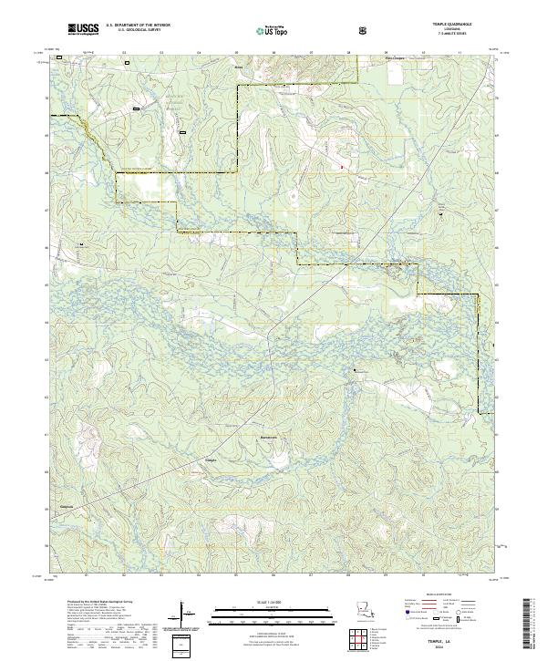
2024 Temple
Vernon Parish, LA