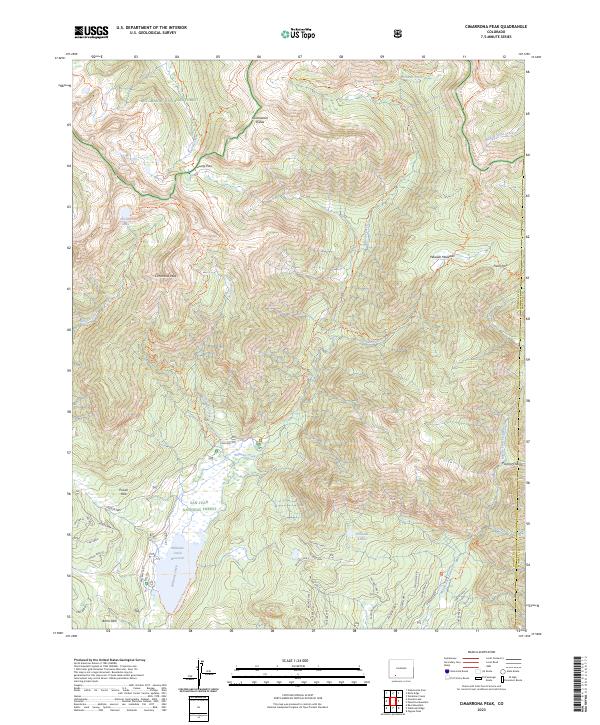
2023 Map of Cimarrona Peak
USGS Topo · Published 2023About this map
Cimarrona Peak stands as a central landmark in this high-altitude corner of the San Juan Mountains, marking a point where the San Juan National Forest and Rio Grande National Forest meet. The landscape is defined by the high crest of the Continental Divide, which winds through the northern portion of the map near Grizzly Pass. Downslope, the geography shifts toward significant water management and recreation areas, dominated by the Williams Creek Reservoir. The drainage patterns here are intricate, with Williams Creek and Cimarrona Creek feeding into the reservoir system. In the more remote eastern reaches, the Palisade Lakes sit below the meadows of Pistol Park, illustrating the typical alpine basin structure of the Weminuche Wilderness. This map captures a modern view of a preserved wilderness where recreational trails like the Continental Divide National Scenic Trl provide the primary access to the high peaks.
Find a feature on this map
55 named features on this map. Tap any name to fly to it.
Don’t see what you’re looking for? This feature index may not catch every label — zoom into the map to look around manually.
Map Details
Editions of this 2023 Cimarrona Peak Map
This is the sole edition of this map. No revisions or reprints were ever made.
Other maps of this area

1905 · San Cristobal
USGS Topo · 1:125,000

1907 · San Cristobal
USGS Topo · 1:125,000

1924 · Pagosa Springs
USGS Topo · 1:125,000

1927 · Pagosa Springs
USGS Topo · 1:125,000

1945 · Durango
USGS Topo · 1:250,000

1953 · Durango
USGS Topo · 1:250,000

1954 · Durango
USGS Topo · 1:250,000

1961 · Durango
USGS Topo · 1:250,000

1963 · Durango
USGS Topo · 1:250,000
1964 · Bear Mountain
USGS Topo · 1:24,000