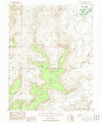
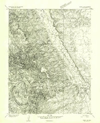
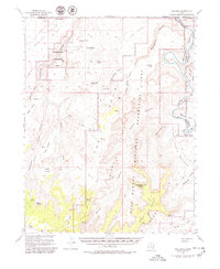
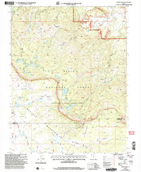
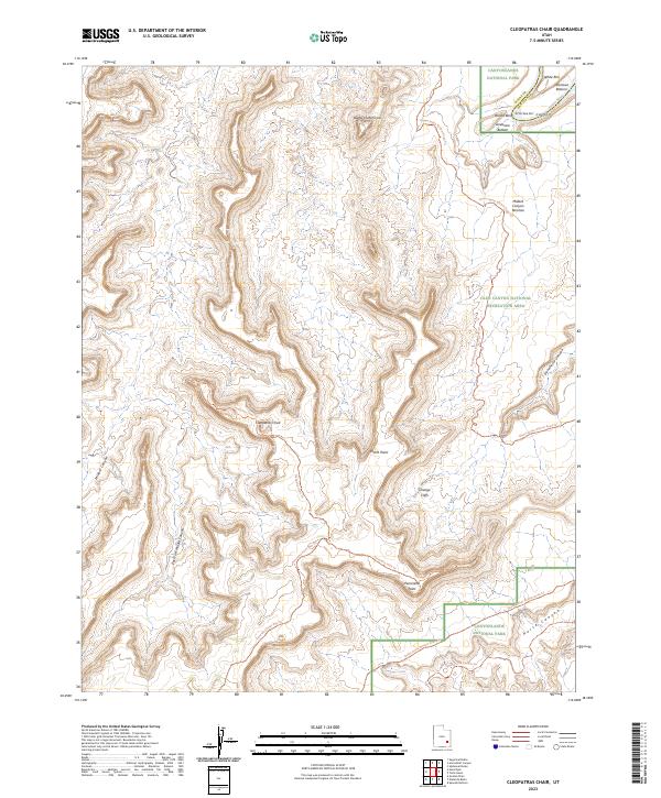
1988 Map of Cleopatras Chair
USGS Topo · Published 1988About this map
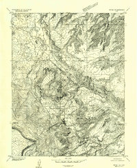
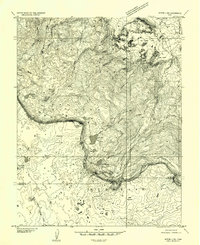
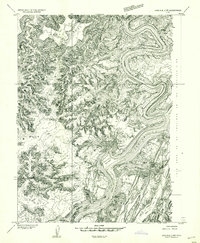
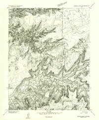
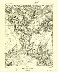
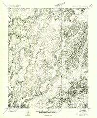
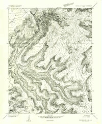
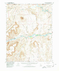
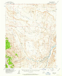
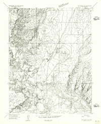
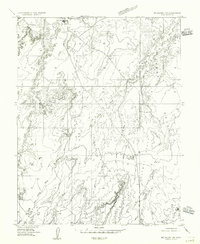
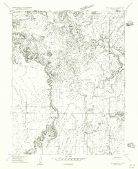
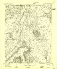
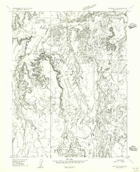
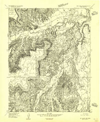
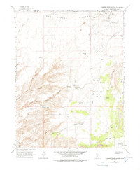
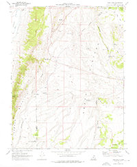
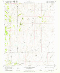
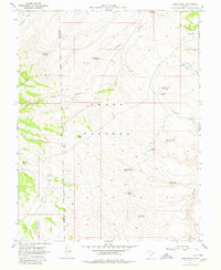
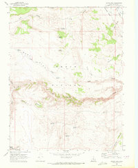
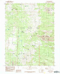
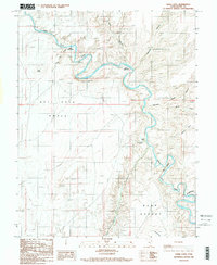
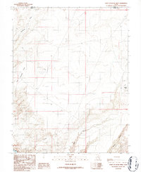
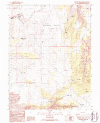
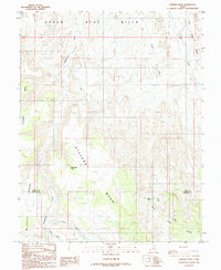
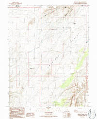
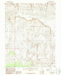
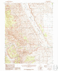
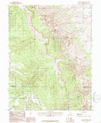
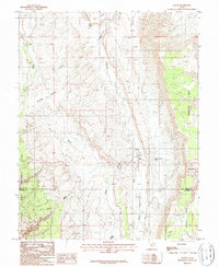
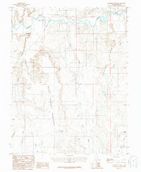
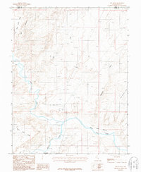
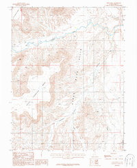
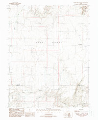
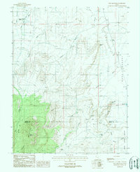
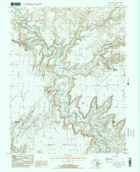
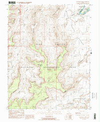
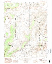
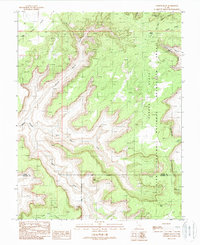
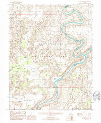
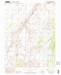
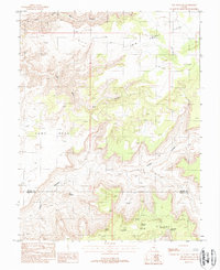
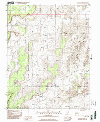
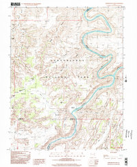
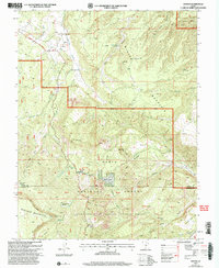
The Green River carves a deep path through the desert in the late 1980s, marking the convergence of two major federal protected areas. This landscape is defined by its dramatic verticality, where the Orange Cliffs and Benches rise above the waterway as it flows through Stillwater Canyon. The map details the border between Canyonlands National Park and the Glen Canyon National Recreation Area, highlighting unique geological formations such as the namesake Cleopatras Chair and the Buttes of the Cross. Historical travel routes and geographical milestones are evident at river crossings and lowlands like Bonita Bend, Anderson Bottom, and Spanish Bottom. These features underscore the importance of the river corridor for access and navigation within the remote canyons of Wayne and San Juan counties.
Find a feature on this map
19 named features on this map. Tap any name to fly to it.
Don’t see what you’re looking for? This feature index may not catch every label — zoom into the map to look around manually.
Map Details
Editions of this 1988 Cleopatras Chair Map
2 editions found
Historical Maps of San Juan County Through Time
127 maps found
1952 Loa 1 NE
Wayne County, UT
1952 Loa 1 SE
Wayne County, UT
1952 Mt. Ellen 4 NW
Wayne County, UT
1952 Notom 1 SW
Wayne County, UT
1952 Notom 2 NE
Wayne County, UT

1952 Notom 2 NW
Wayne County, UT
1952 Notom 2 SE
Wayne County, UT
1952 Notom 2 SW
Wayne County, UT
1952 Notom 3 NE
Wayne County, UT
1952 Notom 3 NW
Wayne County, UT
1952 Notom 4 NE
Wayne County, UT
1952 Notom 4 NW
Wayne County, UT
1953 Carlisle 3 NW
Wayne County, UT
1953 Loa 4 NE
Wayne County, UT
1953 Orange Cliffs 1 NE
Wayne County, UT
1953 Orange Cliffs 1 SE
Wayne County, UT
1953 Orange Cliffs 3 NE
Wayne County, UT
1953 Orange Cliffs 3 NW
Wayne County, UT
1953 Orange Cliffs 4 NE
Wayne County, UT
1953 Orange Cliffs 4 NW
Wayne County, UT
1953 The Spur
Wayne County, UT
1954 Factory Butte
Wayne County, UT
1954 Fruita
Wayne County, UT
1954 Mt. Ellen 1 NW
Wayne County, UT
1954 Mt. Ellen 1 SW
Wayne County, UT
1954 Mt. Ellen 2 NE
Wayne County, UT
1954 Mt. Ellen 2 NW
Wayne County, UT
1954 Mt. Ellen 2 SE
Wayne County, UT
1954 Mt. Ellen 2 SW
Wayne County, UT
1954 Notom 1 NE
Wayne County, UT
1954 Notom 1 NW
Wayne County, UT
1954 Notom 1 SE
Wayne County, UT
1963 Robbers Roost Canyon
Wayne County, UT
1969 Abes Knoll
Wayne County, UT
1969 Flossie Knoll
Wayne County, UT
1969 Jakes Knoll
Wayne County, UT
1969 Moroni Peak
Wayne County, UT
1969 Smooth Knoll
Wayne County, UT
1985 Blind Lake
Wayne County, UT
1985 Cathedral Mountain
Wayne County, UT
1985 Flat Top
Wayne County, UT
1985 Government Point
Wayne County, UT
1985 Grover
Wayne County, UT
1985 Twin Rocks
Wayne County, UT
1986 Angel Cove
Wayne County, UT
1986 Angel Point
Wayne County, UT
1986 Dry Lakes Peak
Wayne County, UT
1986 Point of Rocks East
Wayne County, UT
1986 Point of Rocks West
Wayne County, UT
1986 Robbers Roost Flats
Wayne County, UT
1986 Stevens Mesa
Wayne County, UT
1986 Whitbeck Knoll
Wayne County, UT
1987 Caine Springs
Wayne County, UT
1987 Caineville
Wayne County, UT
1987 Factory Butte
Wayne County, UT
1987 Fruita NW
Wayne County, UT
1987 Fruita
Wayne County, UT
1987 Golden Throne
Wayne County, UT
1987 Notom
Wayne County, UT
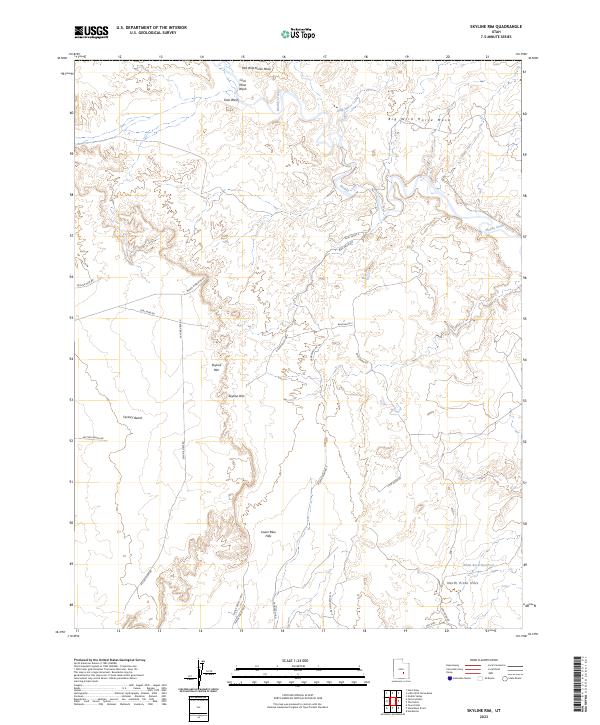
1987 Skyline Rim
Wayne County, UT
1987 Steamboat Point
Wayne County, UT
1987 The Notch
Wayne County, UT
1987 Town Point
Wayne County, UT
1988 Baking Skillet Knoll
Wayne County, UT
1988 Bull Mountain
Wayne County, UT
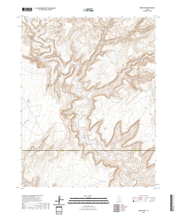
1988 Burr Point
Wayne County, UT
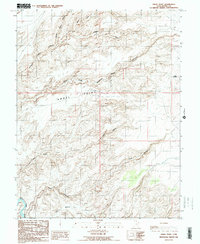
1988 Cleopatras Chair
Wayne County, UT
1988 Elaterite Basin
Wayne County, UT
1988 Gordon Flats
Wayne County, UT
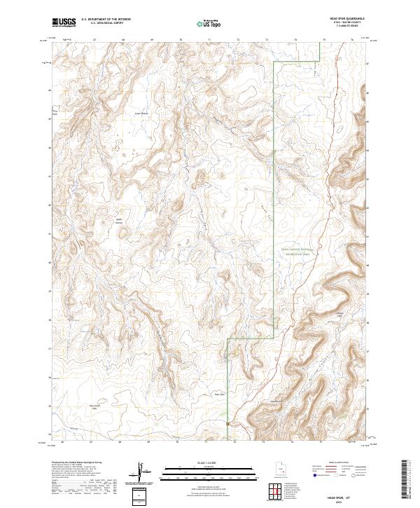
1988 Head Spur
Wayne County, UT
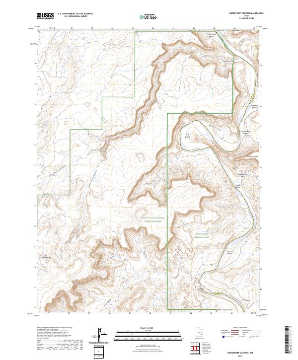
1988 Horsethief Canyon
Wayne County, UT
1988 Spanish Bottom
Wayne County, UT
1988 Sugarloaf Butte
Wayne County, UT
1988 The Pinnacle
Wayne County, UT
1996 Elaterite Basin
Wayne County, UT
1996 Spanish Bottom
Wayne County, UT
2001 Abes Knoll
Wayne County, UT
2001 Cathedral Mountain
Wayne County, UT
2001 Flat Top
Wayne County, UT
2001 Twin Rocks
Wayne County, UT
2002 Blind Lake
Wayne County, UT
2002 Flossie Knoll
Wayne County, UT
2002 Golden Throne
Wayne County, UT
2002 Government Point
Wayne County, UT
2002 Grover
Wayne County, UT
2002 Smooth Knoll
Wayne County, UT
2023 Abes Knoll
Wayne County, UT
2023 Angel Cove
Wayne County, UT
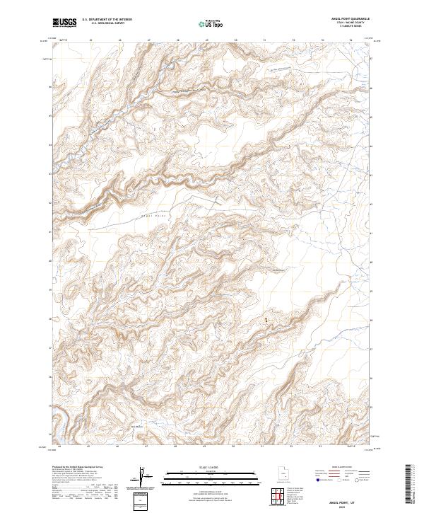
2023 Angel Point
Wayne County, UT
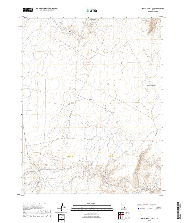
2023 Baking Skillet Knoll
Wayne County, UT
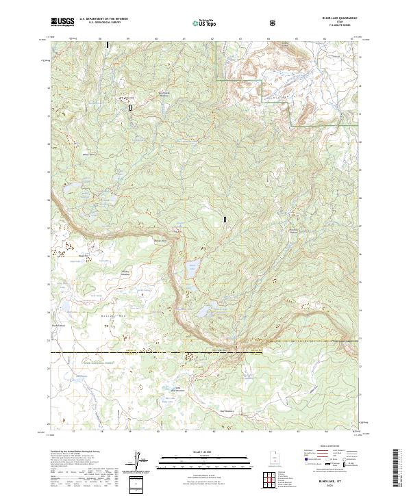
2023 Blind Lake
Wayne County, UT
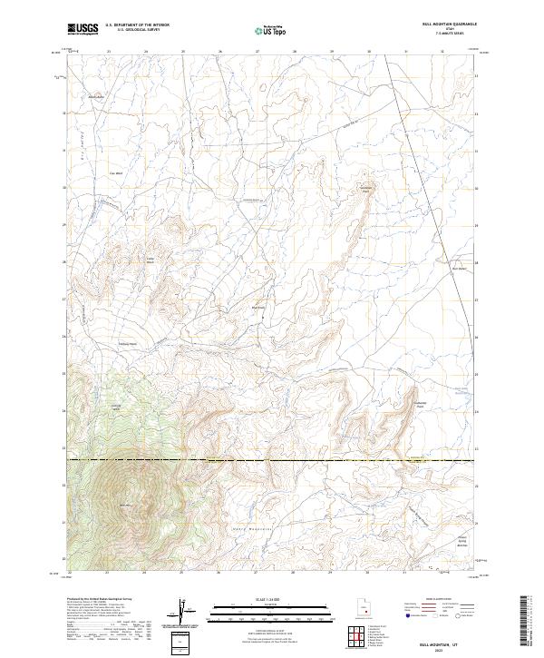
2023 Bull Mountain
Wayne County, UT
2023 Burr Point
Wayne County, UT
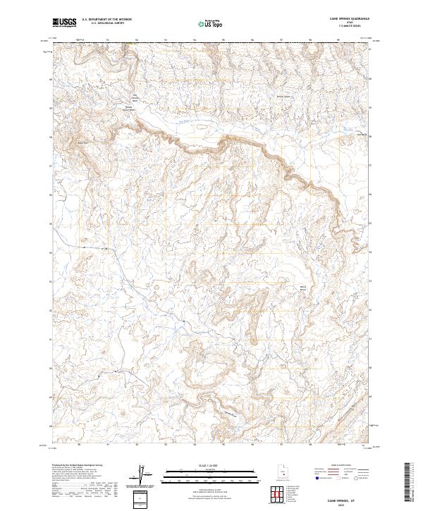
2023 Caine Springs
Wayne County, UT
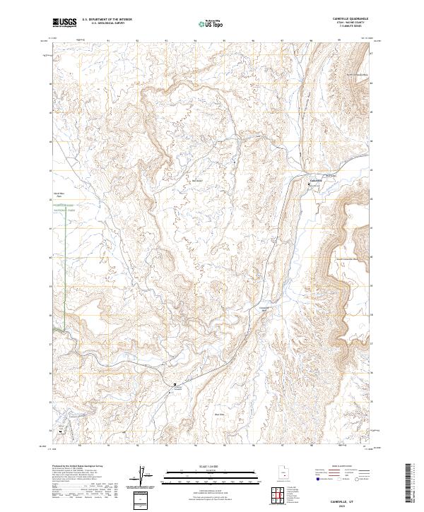
2023 Caineville
Wayne County, UT
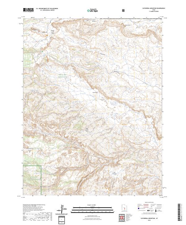
2023 Cathedral Mountain
Wayne County, UT
2023 Cleopatras Chair
Wayne County, UT
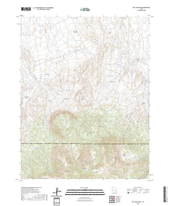
2023 Dry Lakes Peak
Wayne County, UT
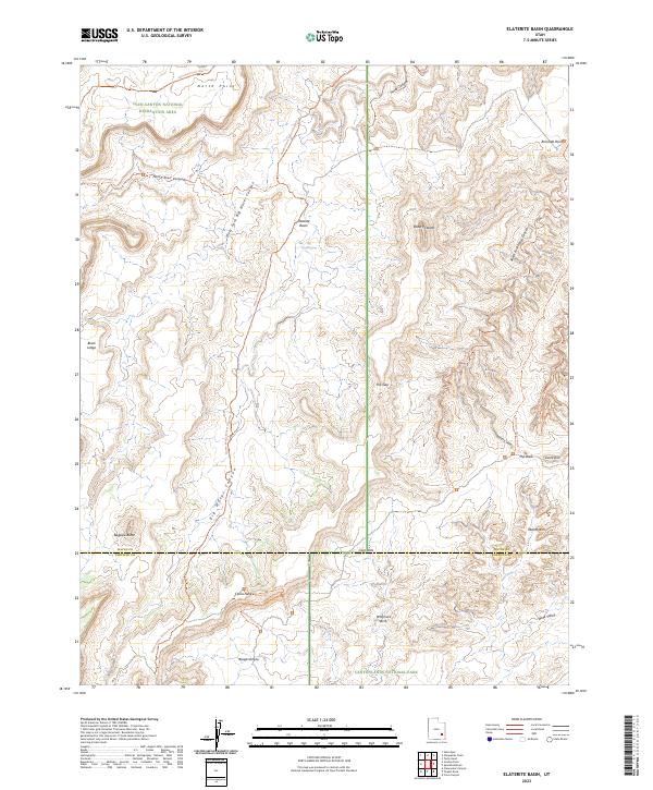
2023 Elaterite Basin
Wayne County, UT
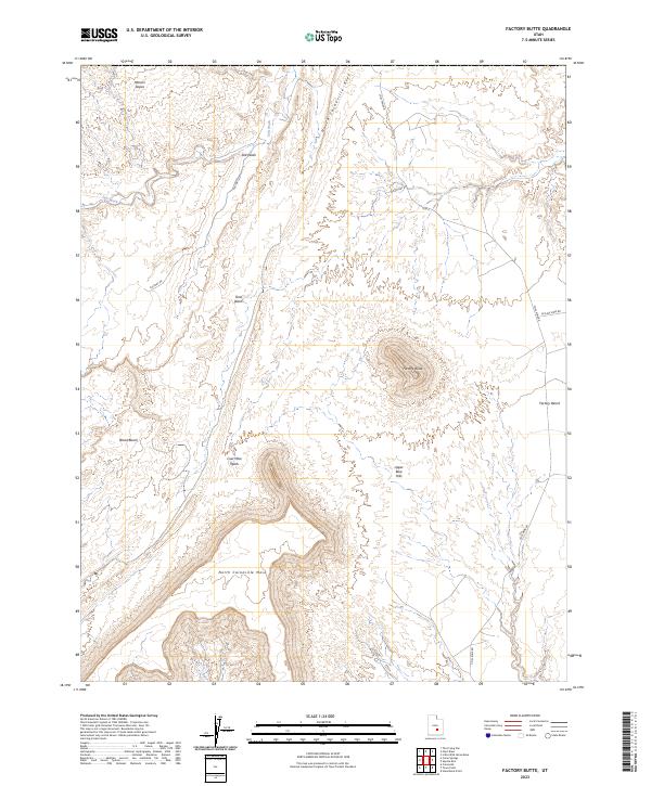
2023 Factory Butte
Wayne County, UT
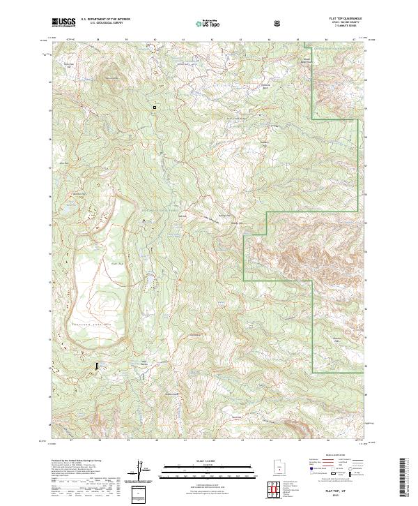
2023 Flat Top
Wayne County, UT
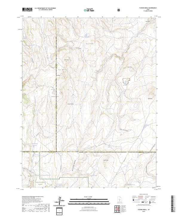
2023 Flossie Knoll
Wayne County, UT
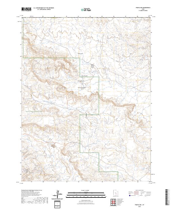
2023 Fruita NW
Wayne County, UT
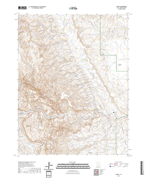
2023 Fruita
Wayne County, UT
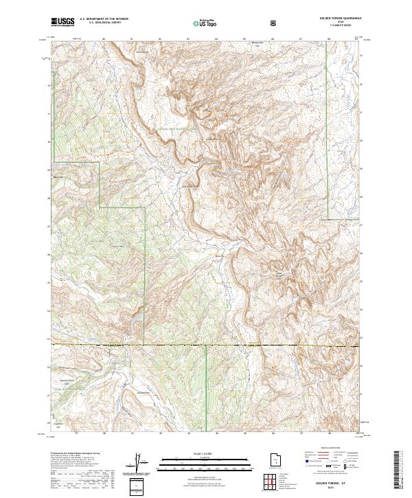
2023 Golden Throne
Wayne County, UT
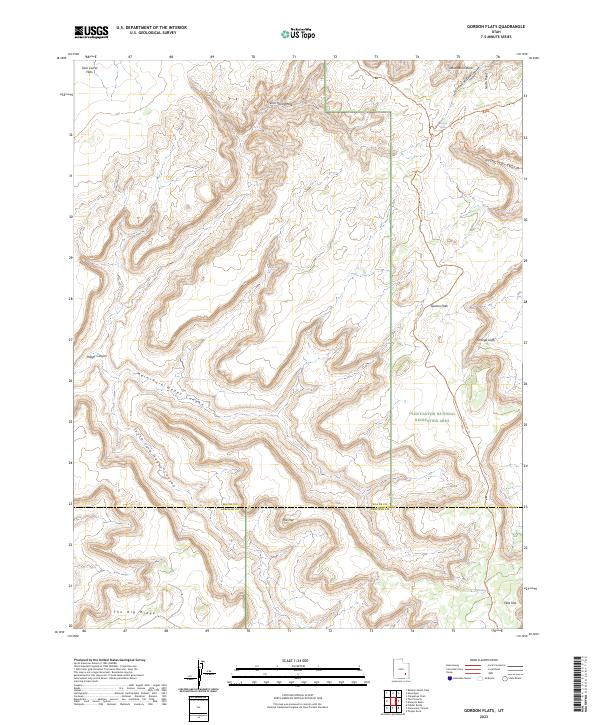
2023 Gordon Flats
Wayne County, UT
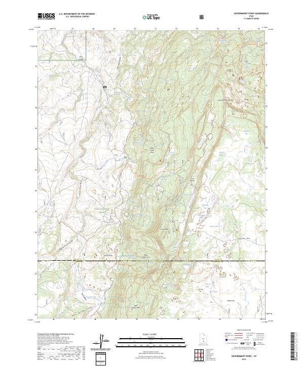
2023 Government Point
Wayne County, UT
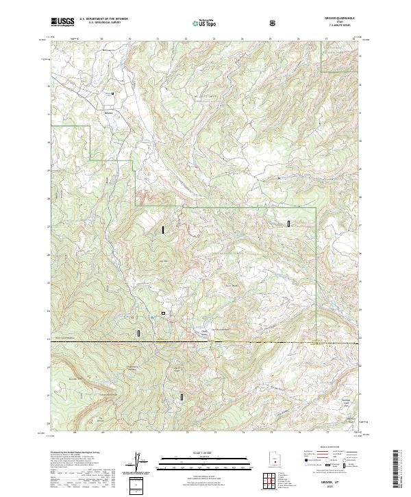
2023 Grover
Wayne County, UT
2023 Head Spur
Wayne County, UT
2023 Horsethief Canyon
Wayne County, UT
2023 Jakes Knoll
Wayne County, UT
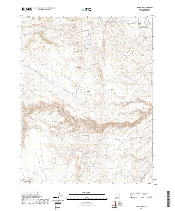
2023 Moroni Peak
Wayne County, UT
2023 Notom
Wayne County, UT
2023 Point of Rocks East
Wayne County, UT
2023 Point of Rocks West
Wayne County, UT
2023 Robbers Roost Flats
Wayne County, UT
2023 Skyline Rim
Wayne County, UT
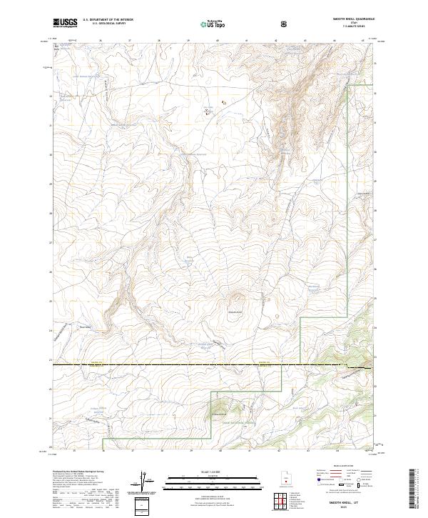
2023 Smooth Knoll
Wayne County, UT
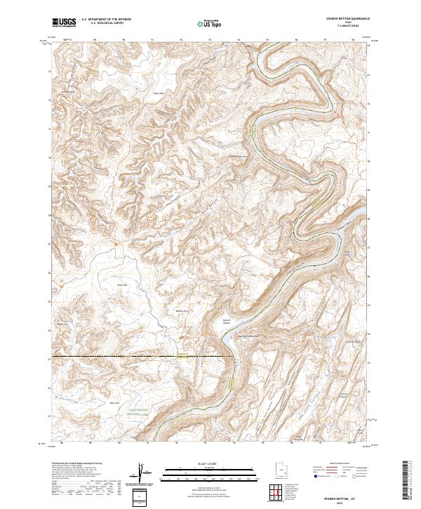
2023 Spanish Bottom
Wayne County, UT
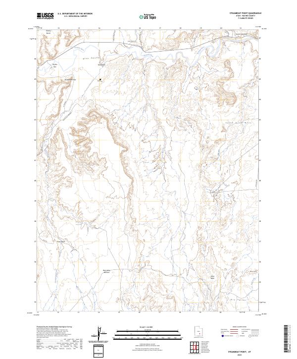
2023 Steamboat Point
Wayne County, UT
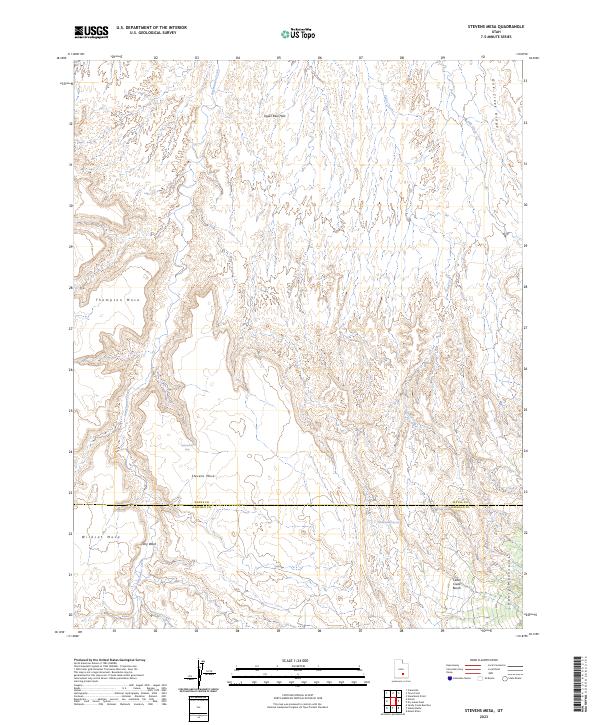
2023 Stevens Mesa
Wayne County, UT
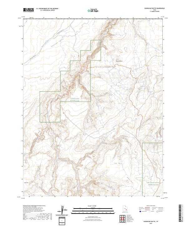
2023 Sugarloaf Butte
Wayne County, UT
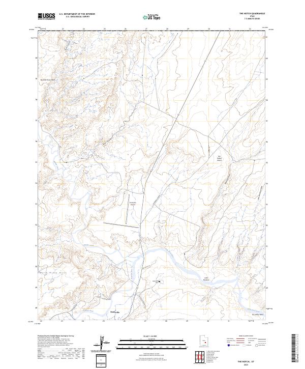
2023 The Notch
Wayne County, UT
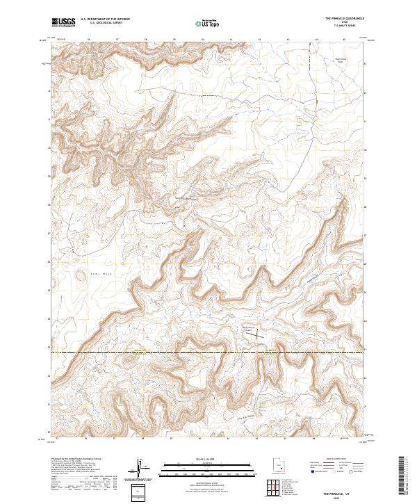
2023 The Pinnacle
Wayne County, UT
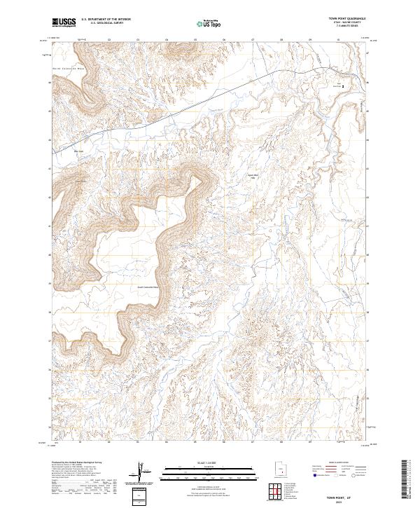
2023 Town Point
Wayne County, UT
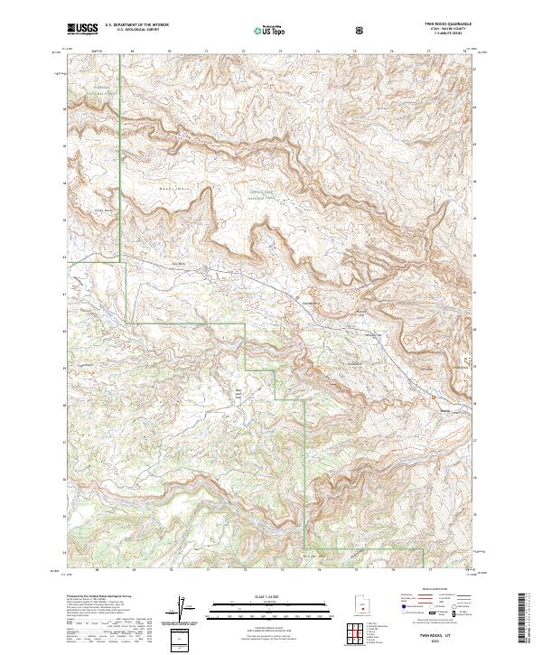
2023 Twin Rocks
Wayne County, UT
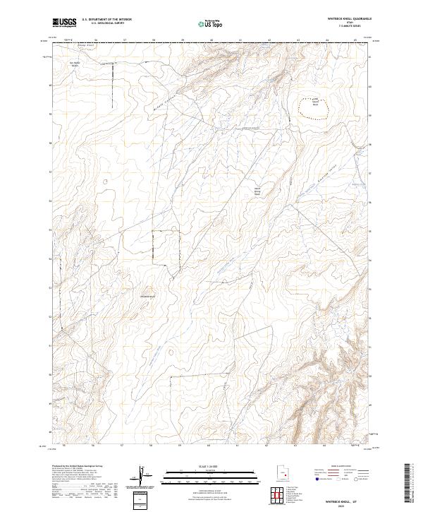
2023 Whitbeck Knoll
Wayne County, UT