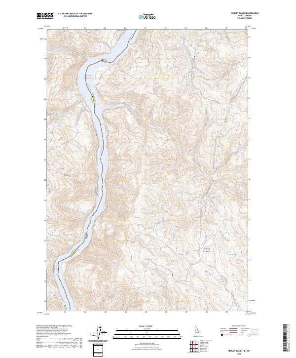
2024 Map of Henley Basin
USGS Topo · Published 2024About this map
Henley Basin serves as a prominent landform within this corridor where the Snake River marks the high-elevation boundary between Idaho and Oregon. The landscape is defined by the steep drainage systems of the Brownlee Reservoir, including Morgan Creek, Rock Creek, and Perkins Creek, which cut through the complex topography of Washington County and Baker County. Cultural footprints are concentrated along the primary transit corridors, notably Snake River Rd and Mineral Rd, which provide access to the remote interior. Genealogists and local historians can locate the Hibbard Creek Cem positioned near the northern bend of the river, a rare named historical marker in a region dominated by sharp ridges and deep gulches like Billy Gulch and Ryan Gulch. The map illustrates the intersection of state lines and township boundaries, such as t13n r7w, against a backdrop of complex riparian and upland environments.
Find a feature on this map
29 named features on this map. Tap any name to fly to it.
Don’t see what you’re looking for? This feature index may not catch every label — zoom into the map to look around manually.
Map Details
Editions of this 2024 Henley Basin Map
This is the sole edition of this map. No revisions or reprints were ever made.
Other maps of this area

1915 · Pine
USGS Topo · 1:125,000

1951 · Huntington
USGS Topo · 1:62,500

1952 · Olds Ferry NW
USGS Topo · 1:24,000

1952 · Olds Ferry
USGS Topo · 1:24,000

1952 · Olds Ferry
USGS Topo · 1:62,500

1952 · Olds Ferry SE
USGS Topo · 1:24,000

1955 · Baker
USGS Topo · 1:250,000

1957 · Durkee
USGS Topo · 1:62,500

1957 · Mineral
USGS Topo · 1:62,500

1959 · Baker
USGS Topo · 1:250,000