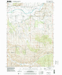
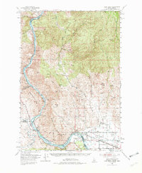
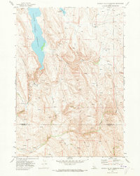
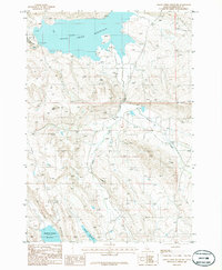
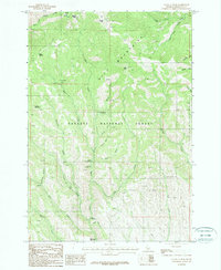
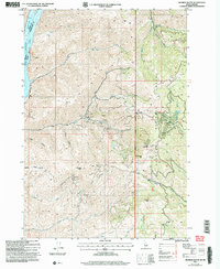
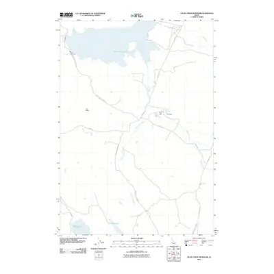
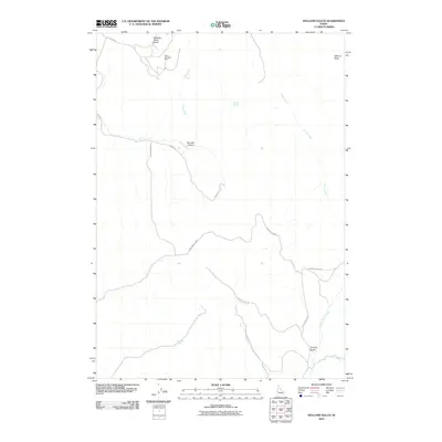
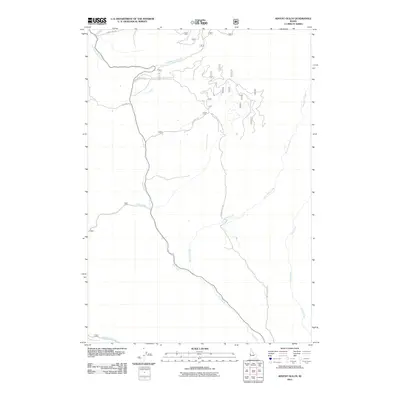
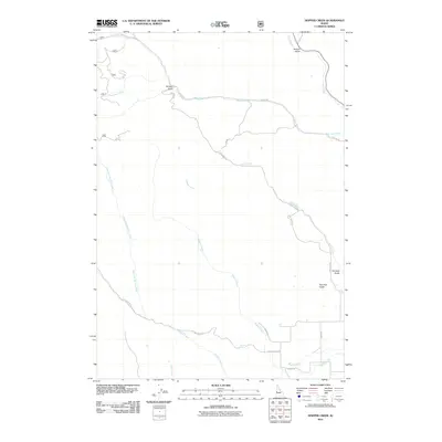
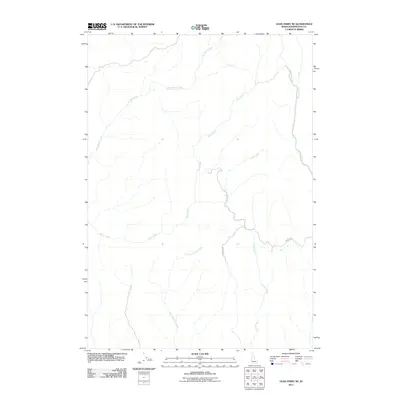
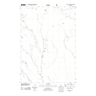
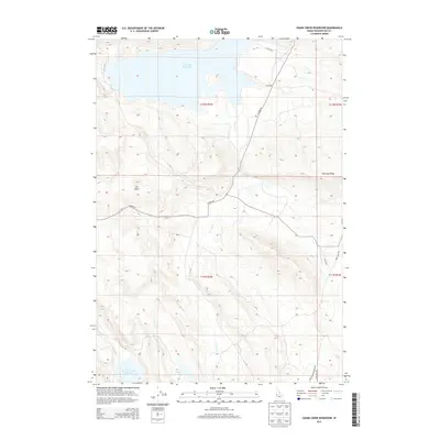
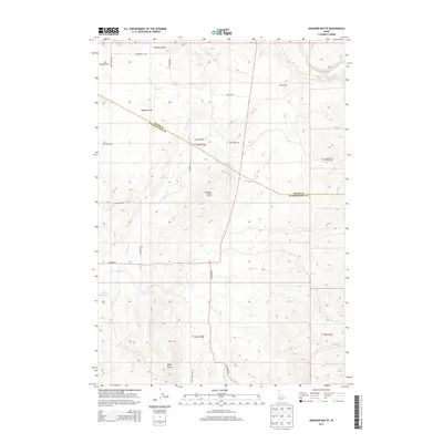
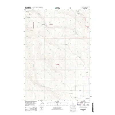
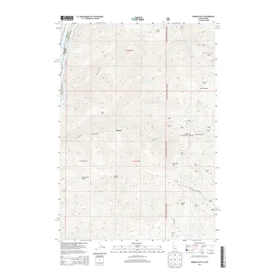
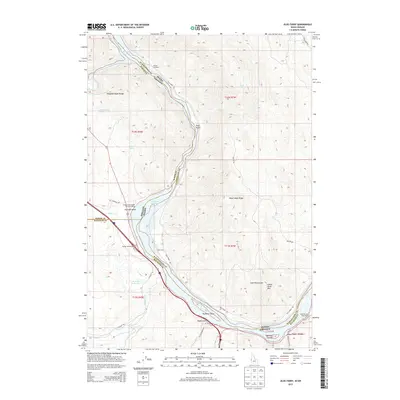
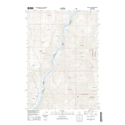
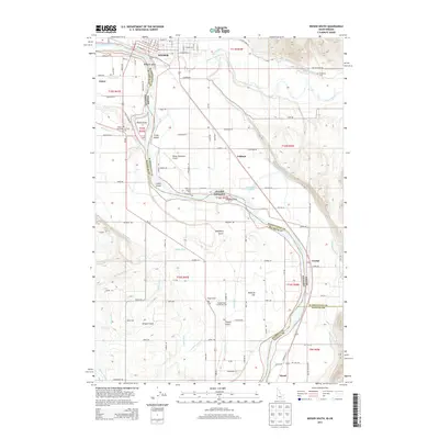
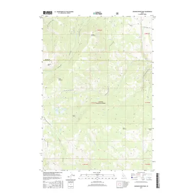
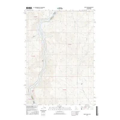
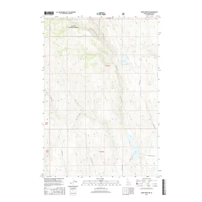
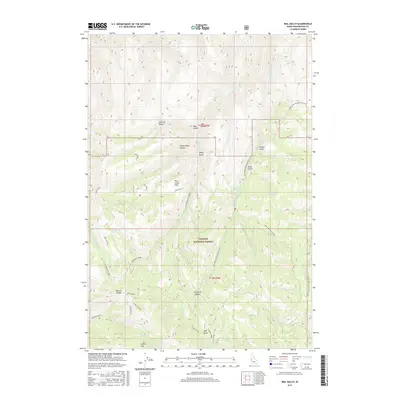
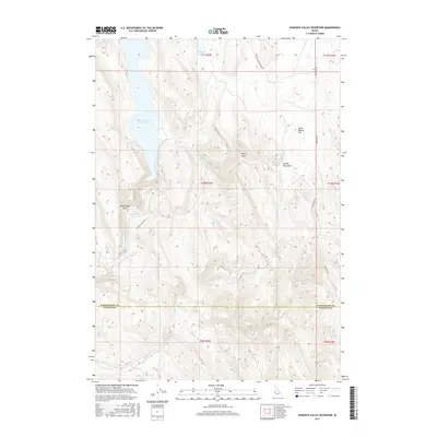
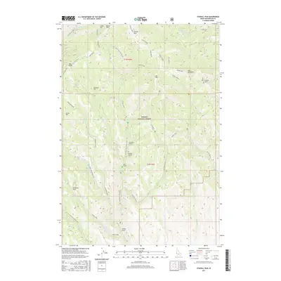
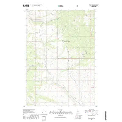
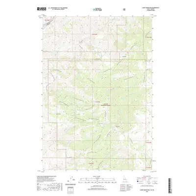
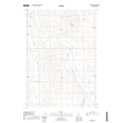
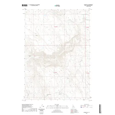
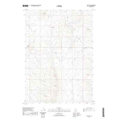
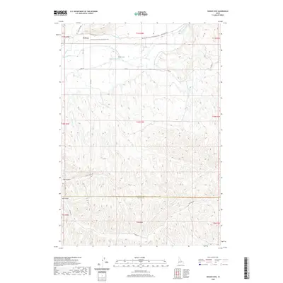
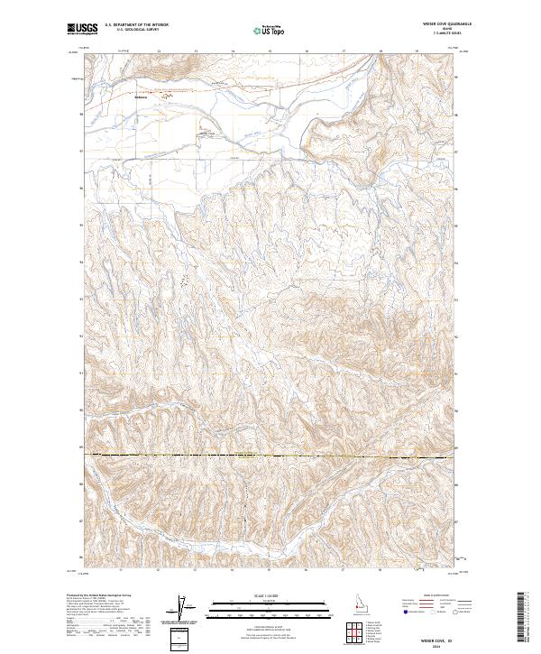
1998 Map of Weiser Cove
USGS Topo · Published 2002About this map
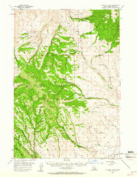
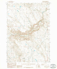
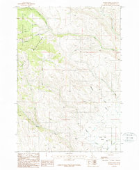
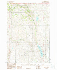
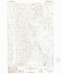
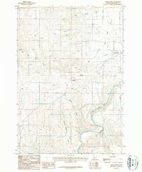
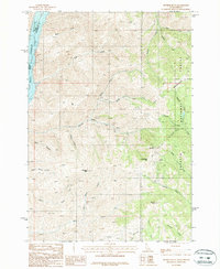
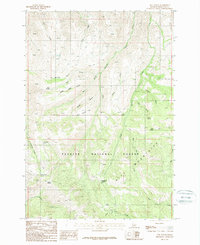
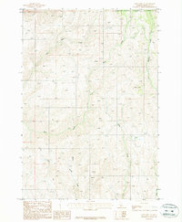
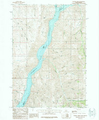
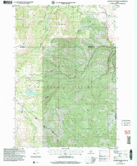
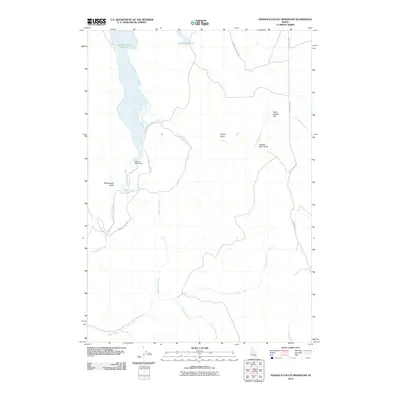
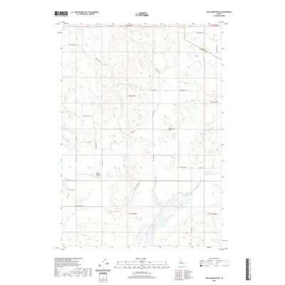
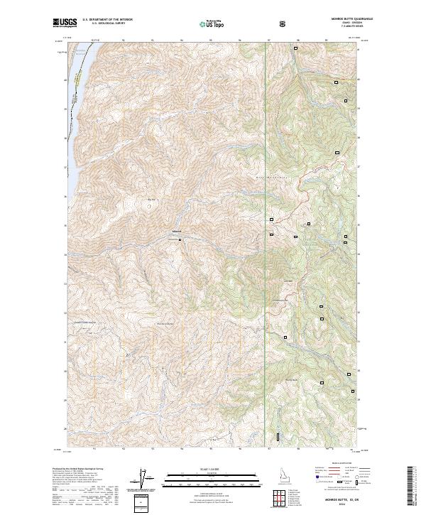
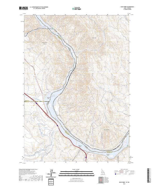
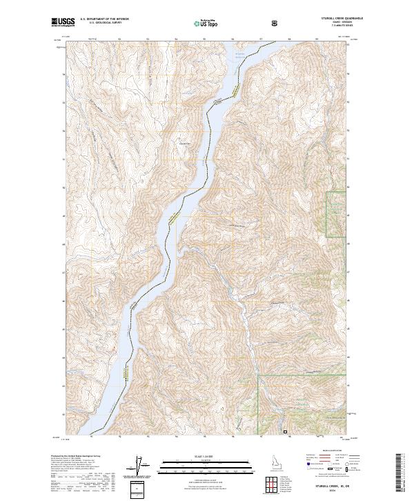
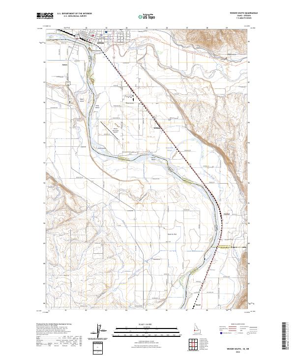
The Weiser River valley dominates this landscape, where complex irrigation systems supported a regional agricultural economy in the late twentieth century. Engineering of the land is evident in the parallel paths of the Galloway Canal and the Sunnyside Canal, which follow the river's contours to bring water to the valley floor. Settlement is concentrated along the northern half of the sheet, with the small communities of Rebecca, Sunnyside, and Cove established near the vital water sources and early transport routes like Cove Road. South of the river, the terrain rises into the dissected hills of Weiser Cove and Sand Hollow, where the land usage shifts toward more specialized activities. Local history and education are represented by the presence of Jeffreys School and the noted Pleasant View School (Aban'd), marking the evolution of rural school districts in this corner of Idaho.
Find a feature on this map
18 named features on this map. Tap any name to fly to it.
Don’t see what you’re looking for? This feature index may not catch every label — zoom into the map to look around manually.
Map Details
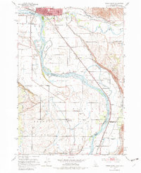
Editions of this 1998 Weiser Cove Map
This is the sole edition of this map. No revisions or reprints were ever made.
Historical Maps of Payette County Through Time
179 maps found
1951 Weiser South
Washington County, ID
1952 Olds Ferry NW
Washington County, ID

1952 Olds Ferry SE
Washington County, ID
1952 Olds Ferry
Washington County, ID
1952 Olds Ferry
Washington County, ID
1952 Weiser Cove
Washington County, ID
1953 Mann Creek
Washington County, ID
1957 Crane Creek Reservoir
Washington County, ID
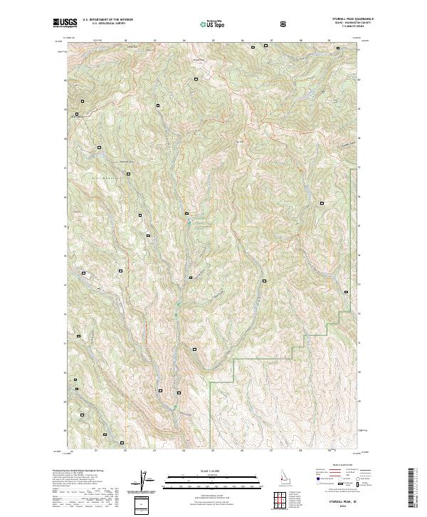
1957 Sturgill Peak
Washington County, ID
1970 Coonrod Gulch
Washington County, ID
1970 Granger Butte
Washington County, ID
1970 Holland Gulch
Washington County, ID
1970 Paddock Valley Reservoir
Washington County, ID
1970 Riley Butte
Washington County, ID
1974 Mann Creek SW
Washington County, ID
1974 Olds Ferry SE
Washington County, ID
1986 Crane Creek Reservoir
Washington County, ID
1986 Crooked River Point
Washington County, ID
1986 East of Cambridge
Washington County, ID
1986 Hog Creek Butte
Washington County, ID
1986 Nutmeg Flat
Washington County, ID
1986 Rush Peak
Washington County, ID
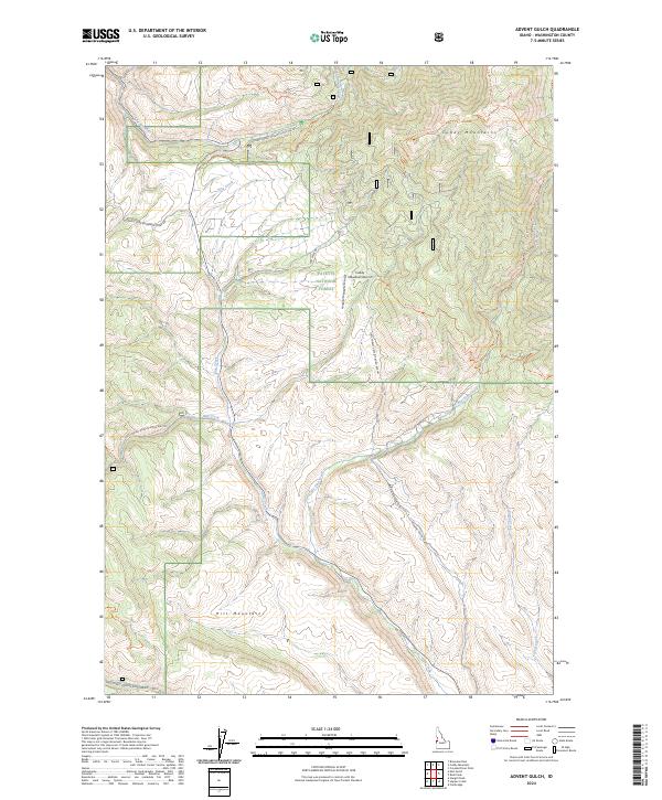
1987 Advent Gulch
Washington County, ID
1987 Cuddy Mountain
Washington County, ID
1987 Hopper Creek
Washington County, ID
1987 Mann Creek NW
Washington County, ID
1987 Mann Creek SE
Washington County, ID
1987 Midvale Hill
Washington County, ID
1987 Monroe Butte
Washington County, ID
1987 Neil Gulch
Washington County, ID
1987 Olds Ferry NE
Washington County, ID
1987 Sturgill Creek
Washington County, ID
1987 Sturgill Peak
Washington County, ID
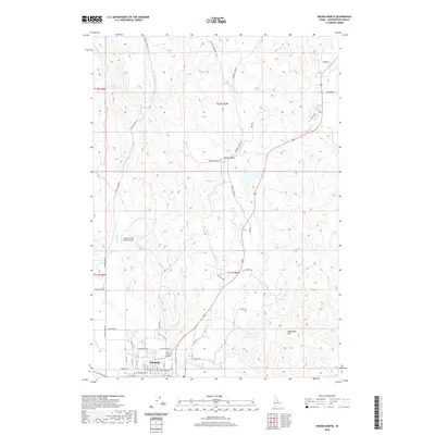
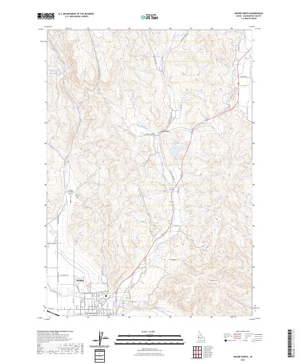
1987 Weiser North
Washington County, ID
1998 Weiser Cove
Washington County, ID
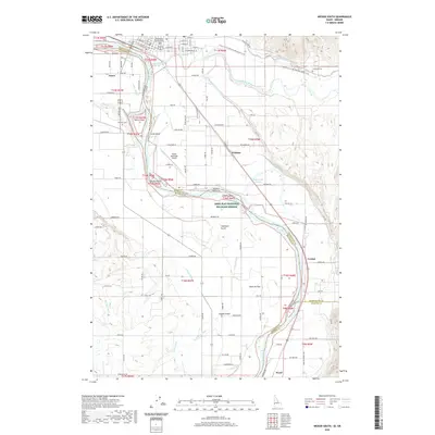
1998 Weiser South
Washington County, ID
2004 Advent Gulch
Washington County, ID
2004 Crooked River Point
Washington County, ID
2004 Cuddy Mountain
Washington County, ID
2004 Hopper Creek
Washington County, ID
2004 Mann Creek NW
Washington County, ID
2004 Monroe Butte
Washington County, ID
2004 Rush Peak
Washington County, ID
2004 Sturgill Peak
Washington County, ID
2010 Coonrod Gulch
Washington County, ID
2010 Crane Creek Reservoir
Washington County, ID
2010 East of Cambridge
Washington County, ID
2010 Granger Butte
Washington County, ID
2010 Hog Creek Butte
Washington County, ID
2010 Holland Gulch
Washington County, ID
2010 Mann Creek SE
Washington County, ID
2010 Midvale Hill
Washington County, ID
2010 Nutmeg Flat
Washington County, ID
2010 Paddock Valley Reservoir
Washington County, ID
2010 Riley Butte
Washington County, ID
2010 Weiser Cove
Washington County, ID
2010 Weiser North
Washington County, ID
2011 Advent Gulch
Washington County, ID
2011 Crooked River Point
Washington County, ID
2011 Cuddy Mountain
Washington County, ID
2011 Henley Basin
Washington County, ID
2011 Hopper Creek
Washington County, ID
2011 Mann Creek NW
Washington County, ID
2011 Monroe Butte
Washington County, ID
2011 Neil Gulch
Washington County, ID
2011 Olds Ferry NE
Washington County, ID
2011 Olds Ferry
Washington County, ID
2011 Rush Peak
Washington County, ID
2011 Sturgill Creek
Washington County, ID
2011 Sturgill Peak
Washington County, ID
2011 Weiser South
Washington County, ID
2013 Advent Gulch
Washington County, ID
2013 Coonrod Gulch
Washington County, ID
2013 Crane Creek Reservoir
Washington County, ID
2013 Crooked River Point
Washington County, ID
2013 Cuddy Mountain
Washington County, ID
2013 East of Cambridge
Washington County, ID
2013 Granger Butte
Washington County, ID
2013 Henley Basin
Washington County, ID
2013 Hog Creek Butte
Washington County, ID
2013 Holland Gulch
Washington County, ID
2013 Hopper Creek
Washington County, ID
2013 Mann Creek NW
Washington County, ID
2013 Mann Creek SE
Washington County, ID
2013 Midvale Hill
Washington County, ID
2013 Monroe Butte
Washington County, ID
2013 Neil Gulch
Washington County, ID
2013 Nutmeg Flat
Washington County, ID
2013 Olds Ferry NE
Washington County, ID
2013 Olds Ferry
Washington County, ID
2013 Paddock Valley Reservoir
Washington County, ID
2013 Riley Butte
Washington County, ID
2013 Rush Peak
Washington County, ID
2013 Sturgill Creek
Washington County, ID
2013 Sturgill Peak
Washington County, ID
2013 Weiser Cove
Washington County, ID
2013 Weiser North
Washington County, ID
2013 Weiser South
Washington County, ID
2017 Advent Gulch
Washington County, ID
2017 Coonrod Gulch
Washington County, ID
2017 Crane Creek Reservoir
Washington County, ID
2017 Crooked River Point
Washington County, ID
2017 Cuddy Mountain
Washington County, ID
2017 East of Cambridge
Washington County, ID
2017 Granger Butte
Washington County, ID
2017 Henley Basin
Washington County, ID
2017 Hog Creek Butte
Washington County, ID
2017 Holland Gulch
Washington County, ID
2017 Hopper Creek
Washington County, ID
2017 Mann Creek NW
Washington County, ID
2017 Mann Creek SE
Washington County, ID
2017 Midvale Hill
Washington County, ID
2017 Monroe Butte
Washington County, ID
2017 Neil Gulch
Washington County, ID
2017 Nutmeg Flat
Washington County, ID
2017 Olds Ferry NE
Washington County, ID
2017 Olds Ferry
Washington County, ID
2017 Paddock Valley Reservoir
Washington County, ID
2017 Riley Butte
Washington County, ID
2017 Rush Peak
Washington County, ID
2017 Sturgill Creek
Washington County, ID
2017 Sturgill Peak
Washington County, ID
2017 Weiser Cove
Washington County, ID
2017 Weiser North
Washington County, ID
2017 Weiser South
Washington County, ID
2020 Advent Gulch
Washington County, ID
2020 Coonrod Gulch
Washington County, ID
2020 Crane Creek Reservoir
Washington County, ID
2020 Crooked River Point
Washington County, ID
2020 Cuddy Mountain
Washington County, ID
2020 East of Cambridge
Washington County, ID
2020 Granger Butte
Washington County, ID
2020 Henley Basin
Washington County, ID
2020 Hog Creek Butte
Washington County, ID
2020 Holland Gulch
Washington County, ID
2020 Hopper Creek
Washington County, ID
2020 Mann Creek NW
Washington County, ID
2020 Mann Creek SE
Washington County, ID
2020 Midvale Hill
Washington County, ID
2020 Monroe Butte
Washington County, ID
2020 Neil Gulch
Washington County, ID
2020 Nutmeg Flat
Washington County, ID
2020 Olds Ferry NE
Washington County, ID
2020 Olds Ferry
Washington County, ID
2020 Paddock Valley Reservoir
Washington County, ID
2020 Riley Butte
Washington County, ID
2020 Rush Peak
Washington County, ID
2020 Sturgill Creek
Washington County, ID
2020 Sturgill Peak
Washington County, ID
2020 Weiser Cove
Washington County, ID
2020 Weiser North
Washington County, ID
2020 Weiser South
Washington County, ID
2024 Advent Gulch
Washington County, ID

2024 Coonrod Gulch
Washington County, ID
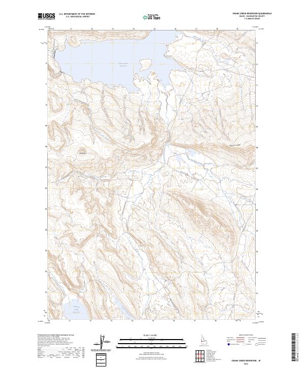
2024 Crane Creek Reservoir
Washington County, ID
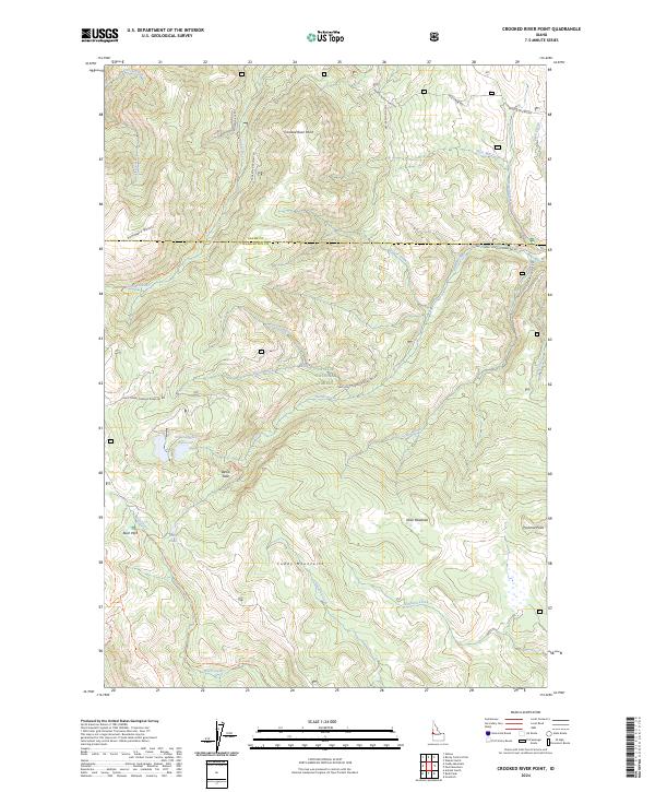
2024 Crooked River Point
Washington County, ID
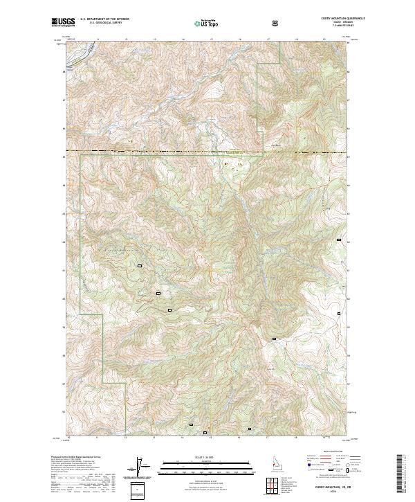
2024 Cuddy Mountain
Washington County, ID
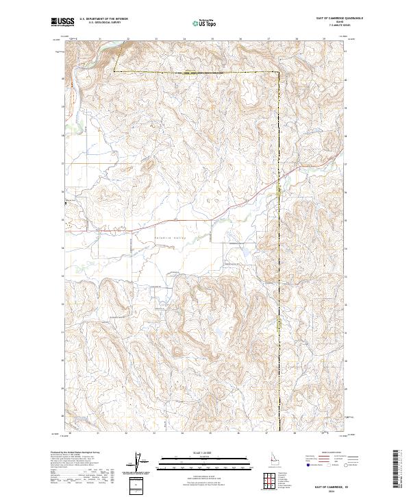
2024 East of Cambridge
Washington County, ID
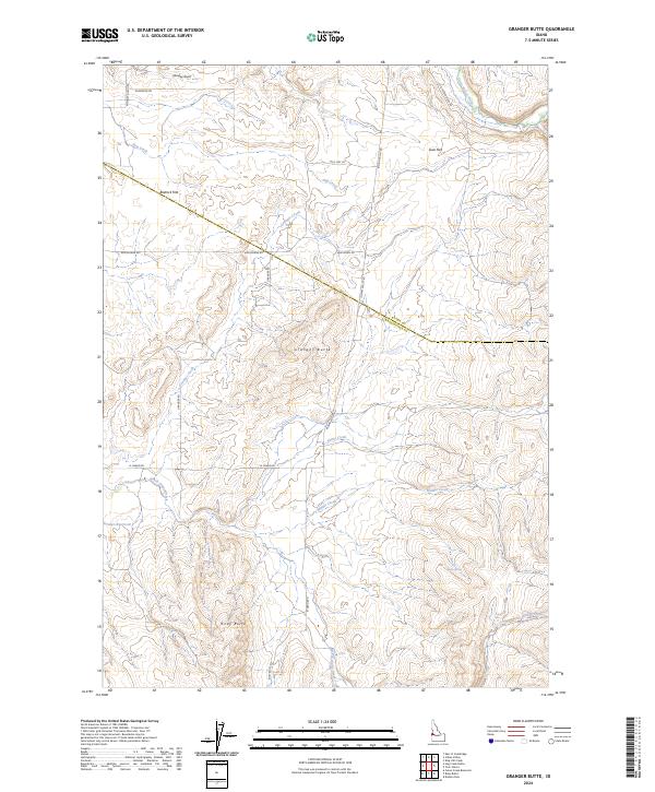
2024 Granger Butte
Washington County, ID
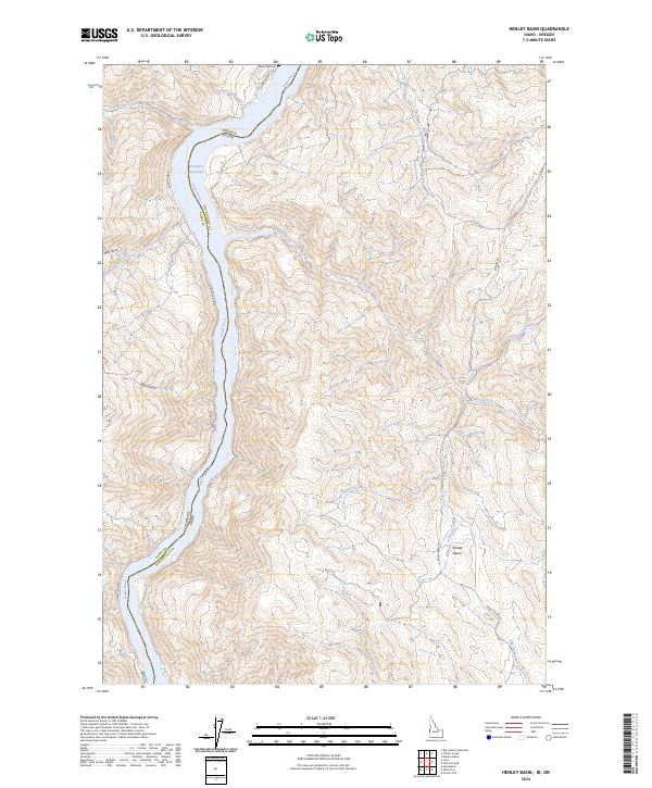
2024 Henley Basin
Washington County, ID
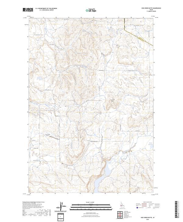
2024 Hog Creek Butte
Washington County, ID
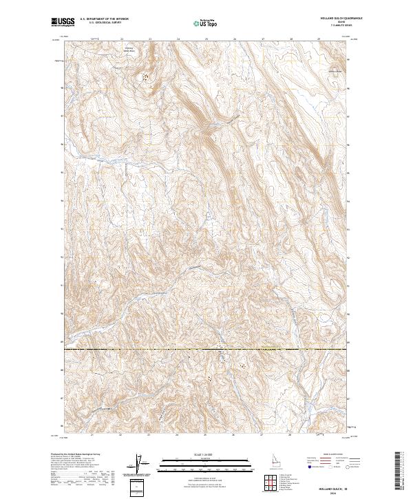
2024 Holland Gulch
Washington County, ID
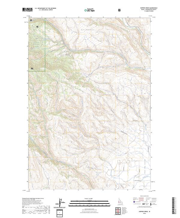
2024 Hopper Creek
Washington County, ID
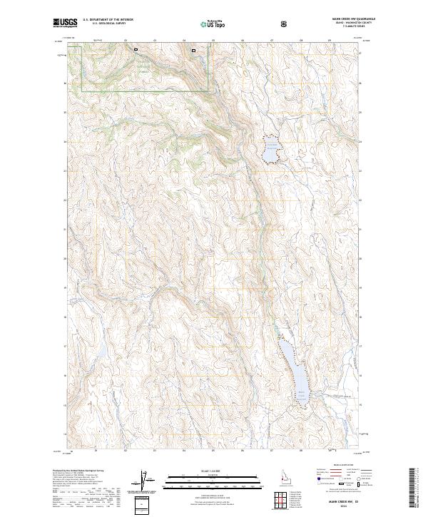
2024 Mann Creek NW
Washington County, ID
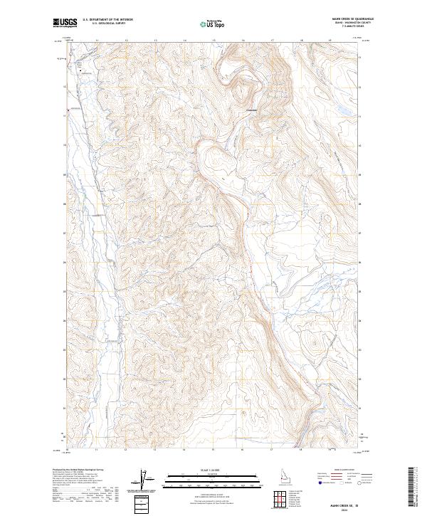
2024 Mann Creek SE
Washington County, ID
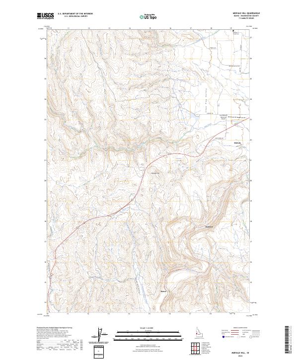
2024 Midvale Hill
Washington County, ID
2024 Monroe Butte
Washington County, ID
2024 Neil Gulch
Washington County, ID
2024 Nutmeg Flat
Washington County, ID
2024 Olds Ferry NE
Washington County, ID
2024 Olds Ferry
Washington County, ID
2024 Paddock Valley Reservoir
Washington County, ID
2024 Riley Butte
Washington County, ID
2024 Rush Peak
Washington County, ID
2024 Sturgill Creek
Washington County, ID
2024 Sturgill Peak
Washington County, ID
2024 Weiser Cove
Washington County, ID
2024 Weiser North
Washington County, ID
2024 Weiser South
Washington County, ID