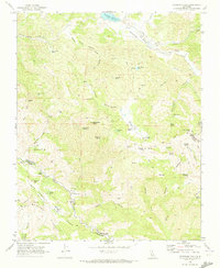
1969 Map of Hepsedam Peak
USGS Topo · Published 1973About this map
Mustang Ridge and the Rift Zone dominate the southern landscape of this 1960s survey, marking the tectonic activity of the San Andreas fault line. The region is characterized by isolated cattle operations and seasonal camps, including the Hepsedam Ranch, Bar B Ranch, and several remote outposts like John Cabin and Kenneth Cabin. In the north, the Hernandez Reservoir provides a primary water source for the San Benito River drainage, while the surrounding terrain is deeply incised by Sulphur Canyon and Miller Canyon Creek. For local historians, the map identifies specific locations of human activity in this sparsely populated area, from the Abelardo Cabin (Site) to a lonely Cem near the Hepsedam Ranch and scattered Drill Hole locations, indicating exploration into the earth's crust along this geologic boundary.
Find a feature on this map
69 named features on this map. Tap any name to fly to it.
Don’t see what you’re looking for? This feature index may not catch every label — zoom into the map to look around manually.
Map Details
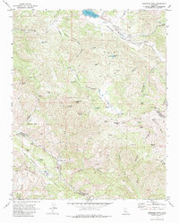
Editions of this 1969 Hepsedam Peak Map
2 editions found
Other maps of this area

1915 · Priest Valley
USGS Topo · 1:125,000

1941 · Priest Valley
USGS Topo · 1:62,500

1941 · San Ardo
USGS Topo · 1:62,500

1943 · New Idria
USGS Topo · 1:62,500

1943 · San Ardo
USGS Topo · 1:62,500

1943 · Hernandez Valley
USGS Topo · 1:62,500

1944 · Hernandez Valley
USGS Topo · 1:62,500

1944 · Priest Valley
USGS Topo · 1:62,500

1948 · Santa Cruz
USGS Topo · 1:250,000

1955 · Santa Cruz
USGS Topo · 1:250,000