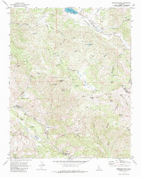
1969 Map of Hepsedam Peak
USGS Topo · Published 1980About this map
The San Andreas Rift Zone creates a distinctive tectonic signature across this landscape, defining the corridor where Lewis Creek flows between Mustang Ridge and the heights of Hepsedam Peak. In the late 1960s, this portion of the Hernandez Valley remained dominated by cattle ranching and isolated homesteads, evidenced by the Bar B Ranch and the Hepsedam Ranch with its associated Cem Hepsedam Ranch. Several structures are noted only as ruins or former locations, including the Calhoon Cabin (Site) and Abelardo Cabin (Site), suggesting a contraction of earlier settlement. Water remains the primary concern for these upland operations, with a network of improved sources like Sweetwater Spring, Hepsedam Spring, and the Airstrip Pond supporting the seasonal needs of the valley. The map also documents the high-water line of the Hernandez Reservoir at the northern edge, where the San Benito River enters the valley floor.
Find a feature on this map
62 named features on this map. Tap any name to fly to it.
Don’t see what you’re looking for? This feature index may not catch every label — zoom into the map to look around manually.
Map Details
Editions of this 1969 Hepsedam Peak Map
2 editions found
Other maps of this area

1915 · Priest Valley
USGS Topo · 1:125,000

1941 · Priest Valley
USGS Topo · 1:62,500

1941 · San Ardo
USGS Topo · 1:62,500

1943 · New Idria
USGS Topo · 1:62,500

1943 · San Ardo
USGS Topo · 1:62,500

1943 · Hernandez Valley
USGS Topo · 1:62,500

1944 · Hernandez Valley
USGS Topo · 1:62,500

1944 · Priest Valley
USGS Topo · 1:62,500

1948 · Santa Cruz
USGS Topo · 1:250,000

1955 · Santa Cruz
USGS Topo · 1:250,000