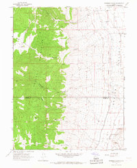
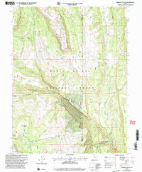
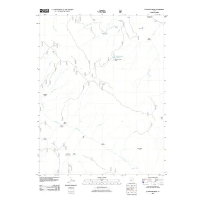
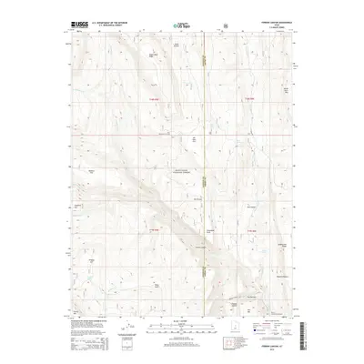
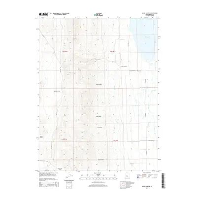
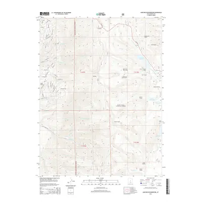
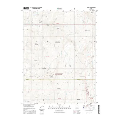
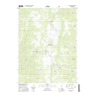
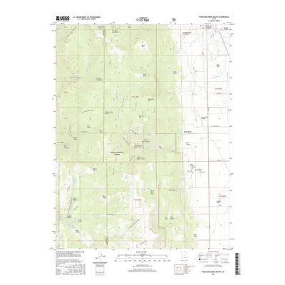
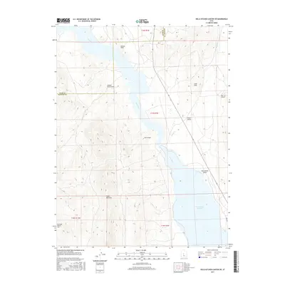
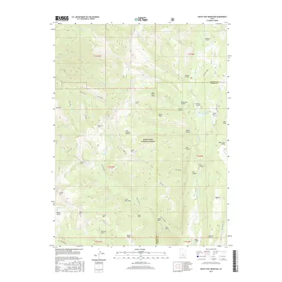
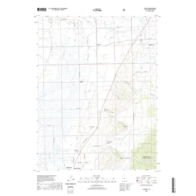
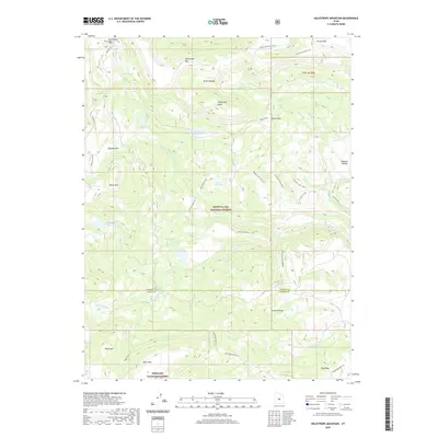
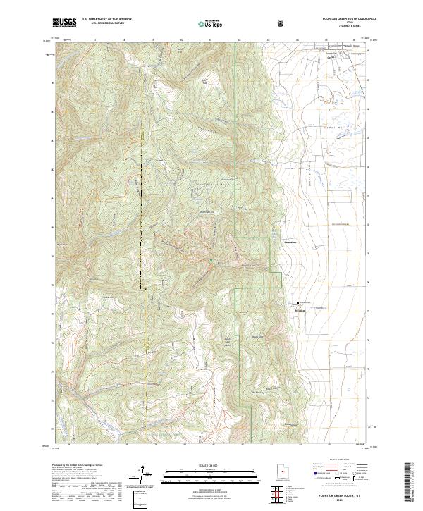
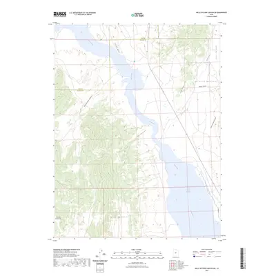
1983 Map of Fountain Green South
USGS Topo · Published 1984About this map
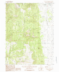
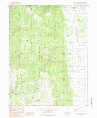
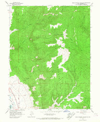
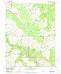
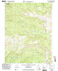
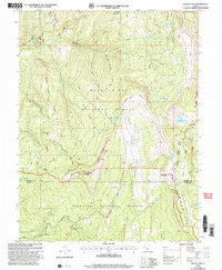
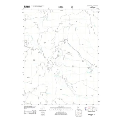
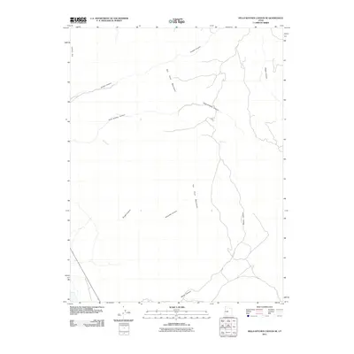
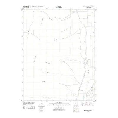
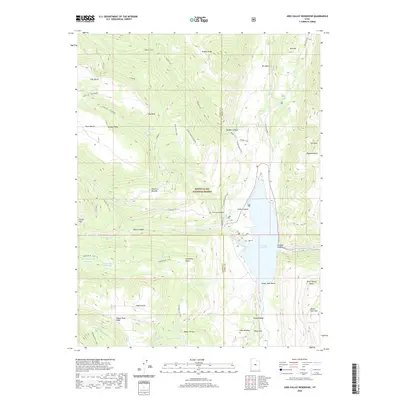
The Sanpete Valley floor meets the high-elevation terrain of the Pitch Mountains in this early 1980s topographical study. Small agricultural settlements like Fountain Green and Freedom anchor the eastern plains, while the western landscape is dominated by the dense canyon networks of the Manti-La Sal National Forest and Uinta National Forest. The transition from valley to mountain is marked by a series of flats and ridges, including Dandelion Flat and Tidds Ridge, which overlook the complex drainage of Birch Creek and Fourmile Creek. Genealogists will find the quiet community of Jerusalem and a local Cemetery east of Freedom, providing a clear view of the rural homesteading patterns in this part of Utah. The terrain is characterized by steep descents through Maple Canyon and Box Canyon, leading down to the Devils Gate Basin and the open flats that define the Sanpete County agriculture of the era.
Find a feature on this map
54 named features on this map. Tap any name to fly to it.
Don’t see what you’re looking for? This feature index may not catch every label — zoom into the map to look around manually.
Map Details
Editions of this 1983 Fountain Green South Map
2 editions found
Historical Maps of Fountain Green Through Time
123 maps found

1922 Wasatch
Sanpete County, UT
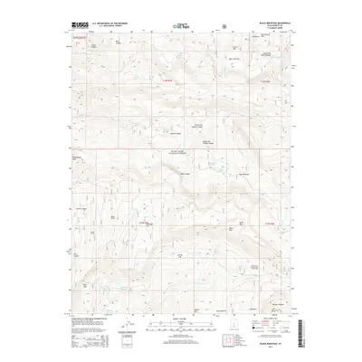
1965 Black Mountain
Sanpete County, UT
1965 Fairview Lakes
Sanpete County, UT
1965 Hells Kitchen Canyon SE
Sanpete County, UT
1965 Hells Kitchen Canyon SW
Sanpete County, UT
1965 Huntington Reservoir
Sanpete County, UT
1965 Woods Lake
Sanpete County, UT
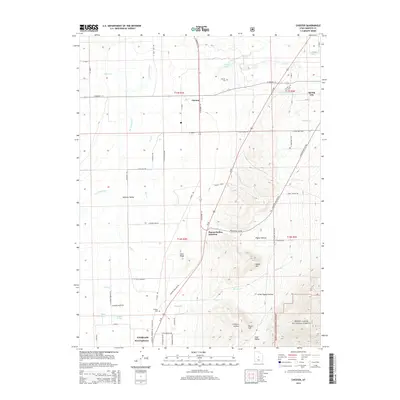
1966 Chester
Sanpete County, UT
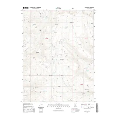
1966 Danish Knoll
Sanpete County, UT
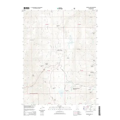
1966 Ferron Canyon
Sanpete County, UT
1966 Ferron Reservoir
Sanpete County, UT
1966 Flagstaff Peak
Sanpete County, UT
1966 Hayes Canyon
Sanpete County, UT
1966 Heliotrope Mtn
Sanpete County, UT
1966 Joes Valley Reservoir
Sanpete County, UT
1966 Redmond Canyon
Sanpete County, UT
1966 South Tent Mountain
Sanpete County, UT
1983 Big Hollow
Sanpete County, UT
1983 Fountain Green South
Sanpete County, UT
1983 Moroni Gap
Sanpete County, UT
2001 Black Mountain
Sanpete County, UT
2001 Chester
Sanpete County, UT
2001 Danish Knoll
Sanpete County, UT
2001 Fairview Lakes
Sanpete County, UT
2001 Ferron Canyon
Sanpete County, UT
2001 Ferron Reservoir
Sanpete County, UT
2001 Flagstaff Peak
Sanpete County, UT
2001 Fountain Green South
Sanpete County, UT
2001 Heliotrope Mountain
Sanpete County, UT
2001 Huntington Reservoir
Sanpete County, UT
2001 Joes Valley Reservoir
Sanpete County, UT
2001 South Tent Mountain
Sanpete County, UT
2001 Woods Lake
Sanpete County, UT
2011 Big Hollow
Sanpete County, UT
2011 Black Mountain
Sanpete County, UT
2011 Chester
Sanpete County, UT
2011 Danish Knoll
Sanpete County, UT
2011 Fairview Lakes
Sanpete County, UT
2011 Ferron Canyon
Sanpete County, UT
2011 Ferron Reservoir
Sanpete County, UT
2011 Flagstaff Peak
Sanpete County, UT
2011 Fountain Green South
Sanpete County, UT
2011 Hayes Canyon
Sanpete County, UT
2011 Heliotrope Mountain
Sanpete County, UT
2011 Hells Kitchen Canyon SE
Sanpete County, UT
2011 Hells Kitchen Canyon SW
Sanpete County, UT
2011 Huntington Reservoir
Sanpete County, UT
2011 Joes Valley Reservoir
Sanpete County, UT
2011 Redmond Canyon
Sanpete County, UT
2011 South Tent Mountain
Sanpete County, UT
2011 Woods Lake
Sanpete County, UT
2014 Big Hollow
Sanpete County, UT
2014 Black Mountain
Sanpete County, UT
2014 Chester
Sanpete County, UT
2014 Danish Knoll
Sanpete County, UT
2014 Fairview Lakes
Sanpete County, UT
2014 Ferron Canyon
Sanpete County, UT
2014 Ferron Reservoir
Sanpete County, UT
2014 Flagstaff Peak
Sanpete County, UT
2014 Fountain Green South
Sanpete County, UT
2014 Hayes Canyon
Sanpete County, UT
2014 Heliotrope Mountain
Sanpete County, UT
2014 Hells Kitchen Canyon SE
Sanpete County, UT
2014 Hells Kitchen Canyon SW
Sanpete County, UT
2014 Huntington Reservoir
Sanpete County, UT
2014 Joes Valley Reservoir
Sanpete County, UT
2014 Redmond Canyon
Sanpete County, UT
2014 South Tent Mountain
Sanpete County, UT
2014 Woods Lake
Sanpete County, UT

2017 Big Hollow
Sanpete County, UT
2017 Black Mountain
Sanpete County, UT
2017 Chester
Sanpete County, UT
2017 Danish Knoll
Sanpete County, UT
2017 Fairview Lakes
Sanpete County, UT
2017 Ferron Canyon
Sanpete County, UT
2017 Ferron Reservoir
Sanpete County, UT
2017 Flagstaff Peak
Sanpete County, UT
2017 Fountain Green South
Sanpete County, UT
2017 Hayes Canyon
Sanpete County, UT
2017 Heliotrope Mountain
Sanpete County, UT
2017 Hells Kitchen Canyon SE
Sanpete County, UT
2017 Hells Kitchen Canyon SW
Sanpete County, UT
2017 Huntington Reservoir
Sanpete County, UT
2017 Joes Valley Reservoir
Sanpete County, UT
2017 Redmond Canyon
Sanpete County, UT
2017 South Tent Mountain
Sanpete County, UT
2017 Woods Lake
Sanpete County, UT
2020 Big Hollow
Sanpete County, UT
2020 Black Mountain
Sanpete County, UT
2020 Chester
Sanpete County, UT
2020 Danish Knoll
Sanpete County, UT
2020 Fairview Lakes
Sanpete County, UT
2020 Ferron Canyon
Sanpete County, UT
2020 Ferron Reservoir
Sanpete County, UT
2020 Flagstaff Peak
Sanpete County, UT
2020 Fountain Green South
Sanpete County, UT
2020 Hayes Canyon
Sanpete County, UT
2020 Heliotrope Mountain
Sanpete County, UT
2020 Hells Kitchen Canyon SE
Sanpete County, UT
2020 Hells Kitchen Canyon SW
Sanpete County, UT
2020 Huntington Reservoir
Sanpete County, UT
2020 Joes Valley Reservoir
Sanpete County, UT
2020 Redmond Canyon
Sanpete County, UT
2020 South Tent Mountain
Sanpete County, UT
2020 Woods Lake
Sanpete County, UT
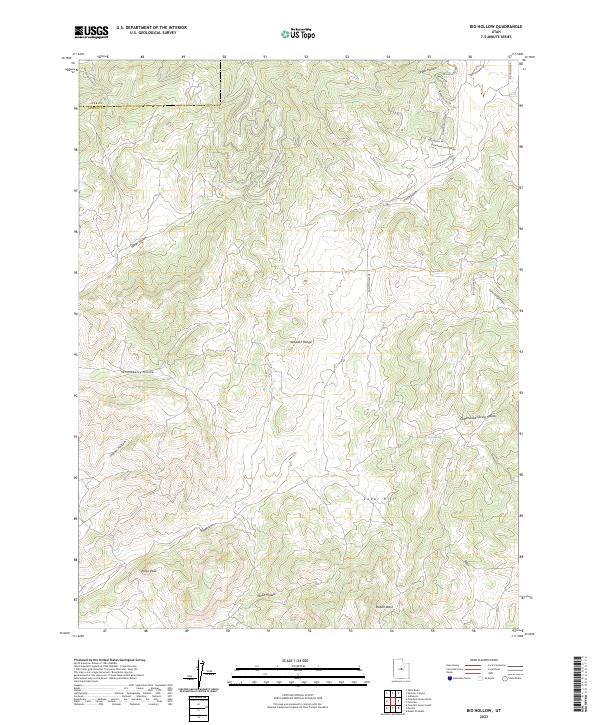
2023 Big Hollow
Sanpete County, UT
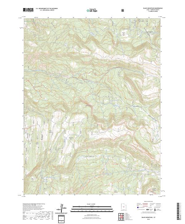
2023 Black Mountain
Sanpete County, UT
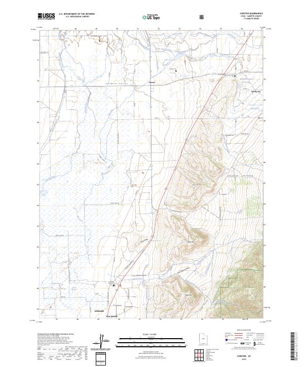
2023 Chester
Sanpete County, UT
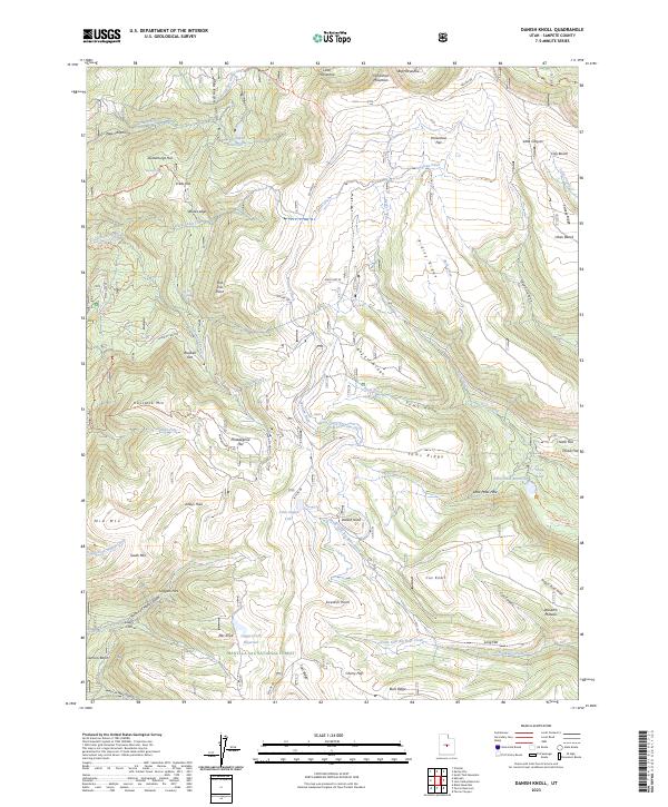
2023 Danish Knoll
Sanpete County, UT
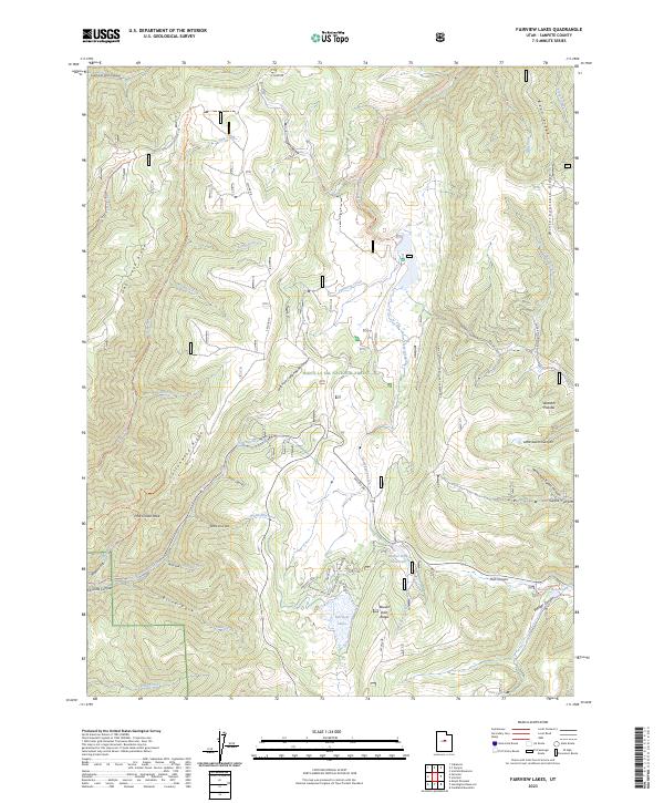
2023 Fairview Lakes
Sanpete County, UT
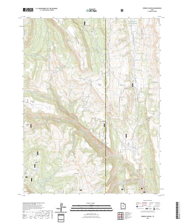
2023 Ferron Canyon
Sanpete County, UT
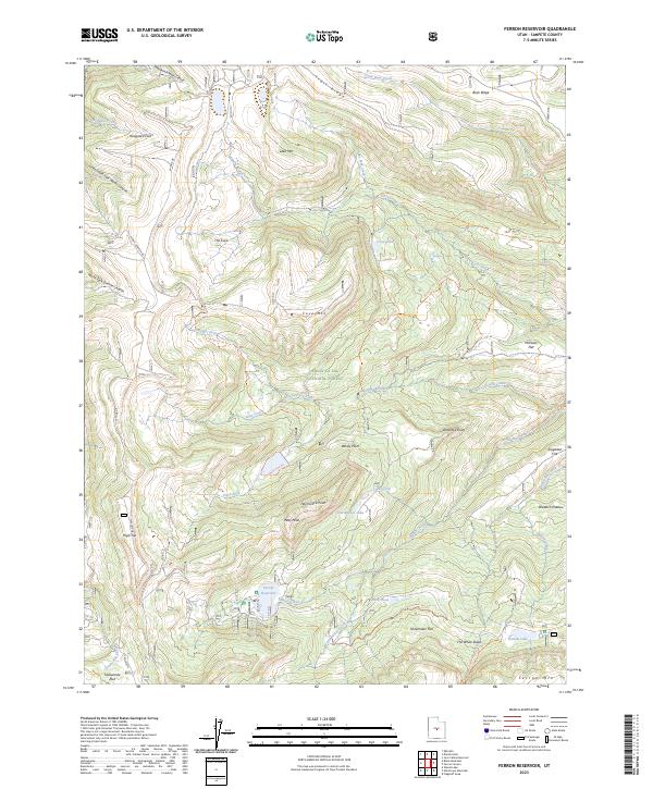
2023 Ferron Reservoir
Sanpete County, UT
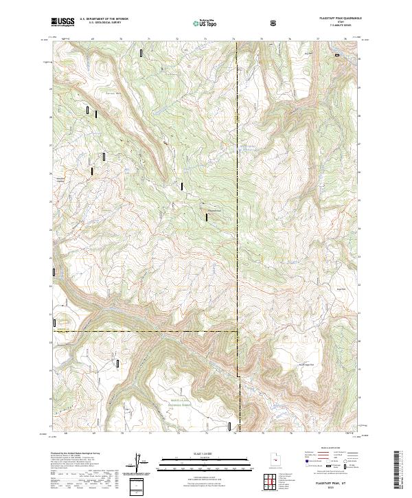
2023 Flagstaff Peak
Sanpete County, UT
2023 Fountain Green South
Sanpete County, UT
2023 Hayes Canyon
Sanpete County, UT
2023 Heliotrope Mountain
Sanpete County, UT
2023 Hells Kitchen Canyon SE
Sanpete County, UT
2023 Hells Kitchen Canyon SW
Sanpete County, UT
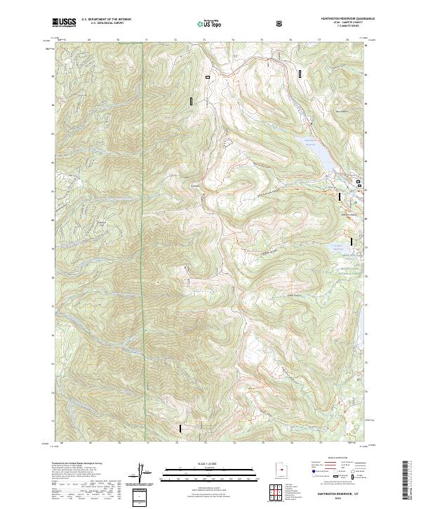
2023 Huntington Reservoir
Sanpete County, UT
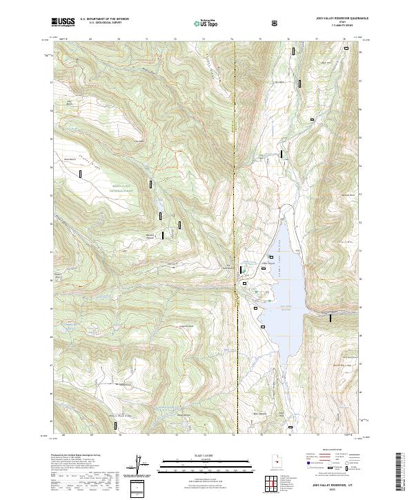
2023 Joes Valley Reservoir
Sanpete County, UT
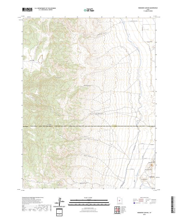
2023 Redmond Canyon
Sanpete County, UT
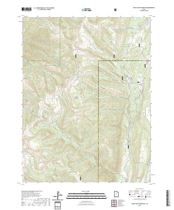
2023 South Tent Mountain
Sanpete County, UT
2023 Woods Lake
Sanpete County, UT