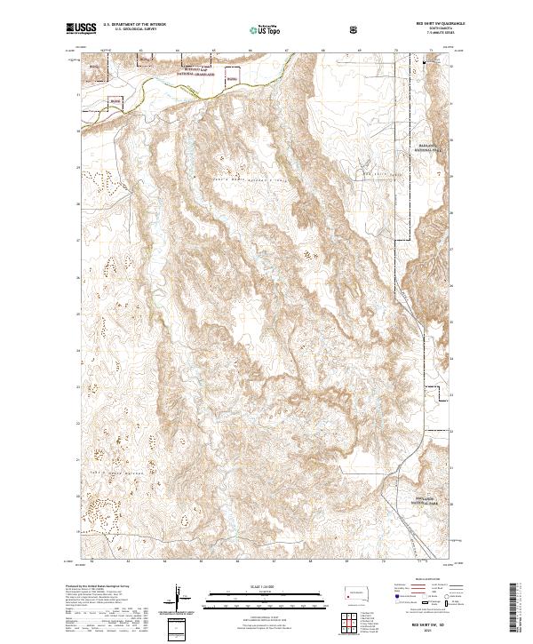
2021 Map of Red Shirt SW
USGS Topo · Published 2021About this map
The Cheyenne River flows across the northern reaches of this landscape, defining the boundary between Buffalo Gap National Grassland and the Badlands National Park. This territory within the Oglala Lakota and Custer county lines is characterized by the high, flat expanse of the Red Shirt Table and the intricate drainage systems of Tahc'a Okute Wakpa and Pass Cr. The topography reveals the dramatic erosion patterns typical of the region, where elevated tables give way to deeply carved draws and ridges such as Tahc'a Okute Aglehan. Human presence is sparse, marked primarily by transit corridors like Bia Hwy 41 and Red Shirt Table Rd. In the northeastern corner, the Christ Church Episcopal Cem provides a significant touchstone for local genealogy and cultural history, situated near the boundary where the national park meets the grassland.
Find a feature on this map
21 named features on this map. Tap any name to fly to it.
Don’t see what you’re looking for? This feature index may not catch every label — zoom into the map to look around manually.
Map Details
Editions of this 2021 Red Shirt SW Map
This is the sole edition of this map. No revisions or reprints were ever made.
Other maps of this area

1894 · Hermosa
USGS Topo · 1:125,000

1896 · Oelrichs
USGS Topo · 1:125,000

1900 · Oelrichs
USGS Topo · 1:125,000

1901 · Hermosa
USGS Topo · 1:125,000

1951 · Fairburn SE
USGS Topo · 1:24,000

1951 · Red Shirt
USGS Topo · 1:24,000

1951 · Willow Creek NW
USGS Topo · 1:24,000

1951 · Willow Creek NE
USGS Topo · 1:24,000

1951 · Red Shirt NE
USGS Topo · 1:24,000

1951 · Red Shirt SW
USGS Topo · 1:24,000