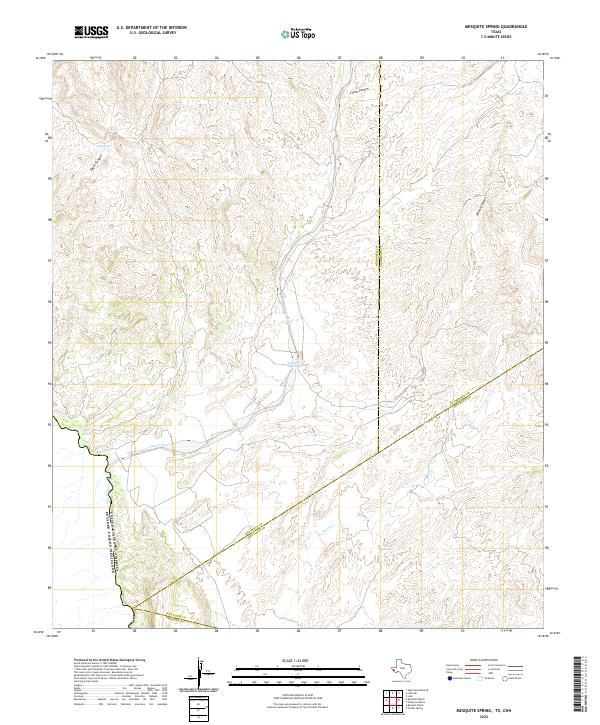
2022 Map of Mesquite Spring
USGS Topo · Published 2022About this map
Mesquite Spring and the drainage of the Rio Grande define this arid landscape along the international border of the United States of America and Mexico. This survey highlights the complex meeting point of several West Texas counties, where the boundaries of Hudspeth, Culberson, Jeff Davis, and Presidio counties converge. The terrain is deeply incised by dry washes and canyons, including Eagle Canyon, China Canyon, and Wilson Canyon, which channel intermittent water toward the river. Remote water sources such as Catclaw Spring and man-made features like Red Tank and Mud Tank represent the essential infrastructure for ranching in this sparsely populated region. The presence of the Green River and Sand Creek further illustrates the hydrology of the Trans-Pecos desert during the early twenty-first century.
Find a feature on this map
15 named features on this map. Tap any name to fly to it.
Don’t see what you’re looking for? This feature index may not catch every label — zoom into the map to look around manually.
Map Details
Editions of this 2022 Mesquite Spring Map
This is the sole edition of this map. No revisions or reprints were ever made.
Other maps of this area

1892 · Chispa
USGS Topo · 1:125,000

1895 · Chispa
USGS Topo · 1:125,000

1897 · Eagle Mountain
USGS Topo · 1:125,000

1897 · Chispa
USGS Topo · 1:125,000

1916 · Eagle Mountain
USGS Topo · 1:125,000

1959 · Marfa
USGS Topo · 1:250,000

1965 · Marfa
USGS Topo · 1:250,000
1972 · Lobo
USGS Topo · 1:24,000
1972 · Lobo SW
USGS Topo · 1:24,000
1972 · Bramlett Ranch
USGS Topo · 1:24,000