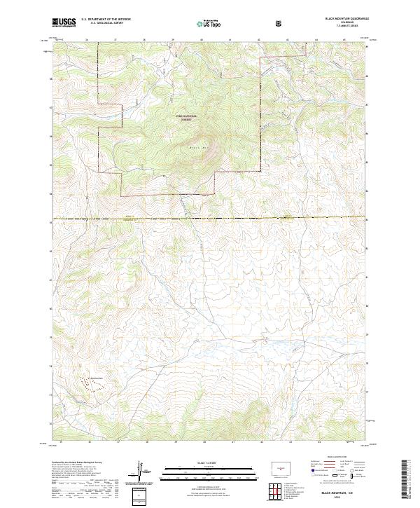
2022 Map of Black Mountain
USGS Topo · Published 2022About this map
Pike National Forest encompasses the northern half of this terrain, where the summit of Black Mtn stands as a central landmark at the boundary of Park and Fremont counties. The landscape is defined by its drainage systems and ridges, notably the Bighorn Ridge in the northeast and the open reaches of Poncha Park to the southwest. Water sources such as Rye Slough and Thirtyone Mile Cr cut through the forest, while the southern reaches are fed by Cottonwood Cr and Gribbles Run. A network of forest and county roads, including Red Houses Rd Lp and Co RD 107, provides access to these high-elevation valleys. The grid of township and range lines, such as t15s r74w and t51n r11e, reveals the systematic surveying of this montane environment, illustrating the transition from managed forest lands to the open parklands typical of central Colorado.
Find a feature on this map
31 named features on this map. Tap any name to fly to it.
Don’t see what you’re looking for? This feature index may not catch every label — zoom into the map to look around manually.
Map Details
Editions of this 2022 Black Mountain Map
This is the sole edition of this map. No revisions or reprints were ever made.
Other maps of this area

1954 · Pueblo
USGS Topo · 1:250,000

1956 · Cameron Mountain
USGS Topo · 1:62,500

1957 · Pueblo
USGS Topo · 1:250,000

1958 · Pueblo
USGS Topo · 1:250,000

1959 · Antero Reservoir
USGS Topo · 1:62,500

1959 · Black Mountain
USGS Topo · 1:62,500

1959 · Guffey
USGS Topo · 1:62,500

1962 · Pueblo
USGS Topo · 1:250,000

1966 · Pueblo
USGS Topo · 1:250,000
1983 · Jack Hall Mountain
USGS Topo · 1:24,000