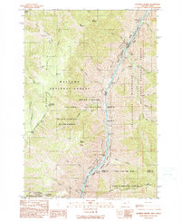
1990 Map of Squirrel Prairie
USGS Topo · Published 1990About this map
The Snake River carves a deep path through the borderlands of Oregon and Idaho, defining the central character of this remote landscape. To the west, the Summit Ridge and Long Ridge overlook the plateau of Squirrel Prairie, while the eastern side rises sharply toward the Nez Perce National Forest. The river itself is a succession of technical hazards, including Three Creek Rapids, Wild Sheep Rapids, and Rocky Point Rapids, marking a section of the river where passage was historically dictated by the water's flow through the Hells Canyon National Recreation Area.
Find a feature on this map
47 named features on this map. Tap any name to fly to it.
Don’t see what you’re looking for? This feature index may not catch every label — zoom into the map to look around manually.
Map Details
Editions of this 1990 Squirrel Prairie Map
This is the sole edition of this map. No revisions or reprints were ever made.
Other maps of this area

1920 · Seven Devils Mining District
USGS Topo · 1:48,000

1922 · He Devil
USGS Topo · 1:48,000

1954 · Harl Butte
USGS Topo · 1:62,500

1955 · Grangeville
USGS Topo · 1:250,000

1957 · He Devil
USGS Topo · 1:62,500

1957 · Cuprum
USGS Topo · 1:62,500

1957 · Homestead
USGS Topo · 1:62,500

1959 · Grangeville
USGS Topo · 1:250,000

1987 · Riggins
USGS Topo · 1:100,000
1990 · Puderbaugh Ridge
USGS Topo · 1:24,000