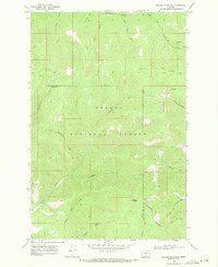
1968 Map of Nevada Mountain
USGS Topo · Published 1971About this map
The Continental Divide serpentines across this high-altitude landscape of the Helena National Forest, serving as the natural boundary between the Powell and Lewis and Clark counties. Dominating the topography is Nevada Mountain, a prominent peak that anchors a complex network of drainage systems. The map captures an era of resource extraction and transit through difficult terrain, evidenced by several mining operations including the Cyclone Mine near the headwaters of Poorman Creek. Connectivity across these ridges is maintained by a series of primitive routes, most notably the Helmville Trail and various jeep trails that follow the contours of the gulches. Waterways like Nevada Creek and Shingle Mill Creek carve deep into the landscape, reflecting the rugged hydrology of the northern Rockies in the late 1960s.
Find a feature on this map
26 named features on this map. Tap any name to fly to it.
Don’t see what you’re looking for? This feature index may not catch every label — zoom into the map to look around manually.
Map Details
Editions of this 1968 Nevada Mountain Map
3 editions found
Other maps of this area

1889 · Helena
USGS Topo · 1:250,000

1893 · Helena
USGS Topo · 1:250,000

1899 · Helena
USGS Topo · 1:250,000

1903 · Helena
USGS Topo · 1:250,000

1947 · Butte
USGS Topo · 1:250,000

1958 · Butte
USGS Topo · 1:250,000

1958 · Avon
USGS Topo · 1:62,500

1959 · Elliston
USGS Topo · 1:62,500

1960 · Butte
USGS Topo · 1:250,000

1962 · Butte
USGS Topo · 1:250,000