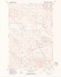
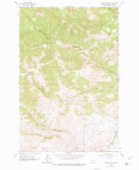
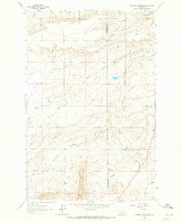
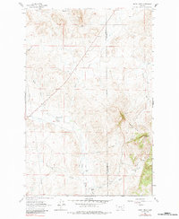
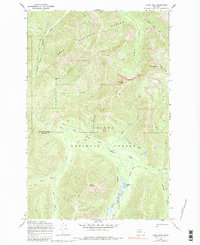
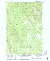
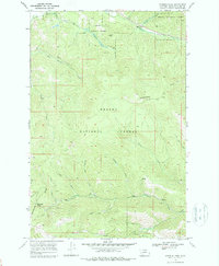
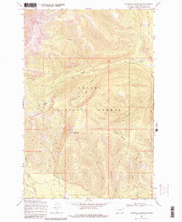
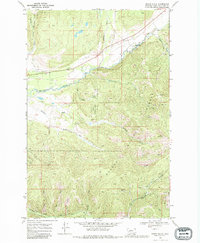
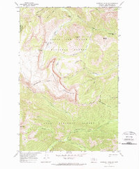
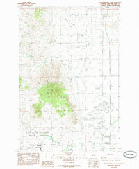
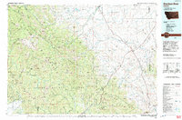
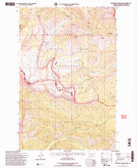
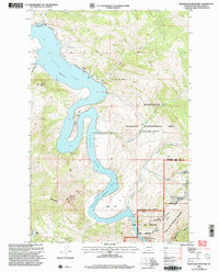
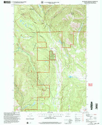
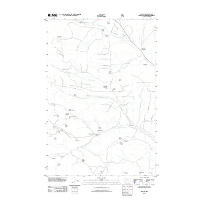
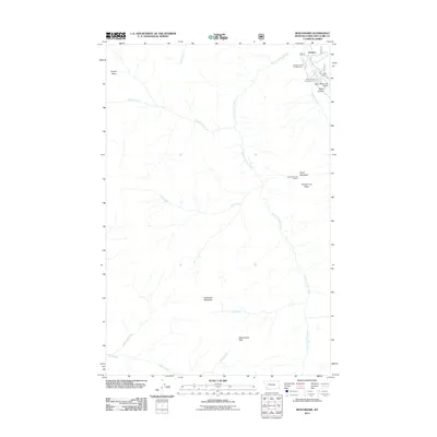
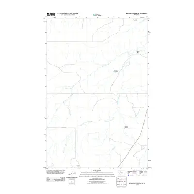
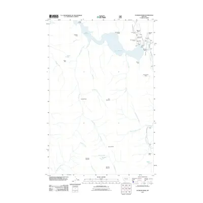
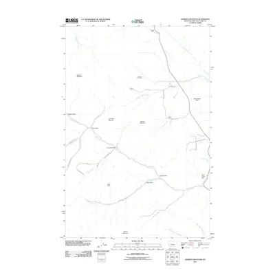
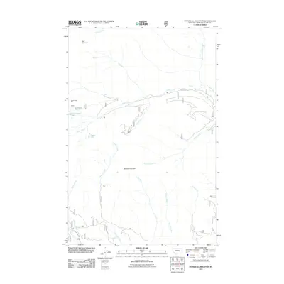
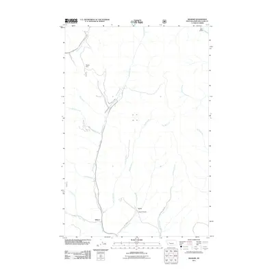
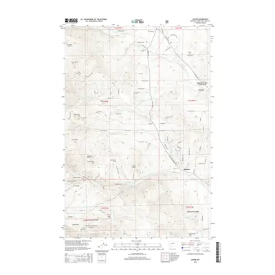
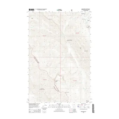
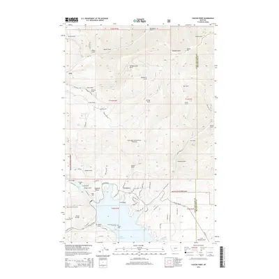
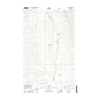
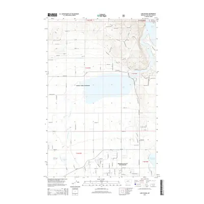
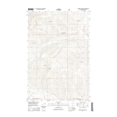
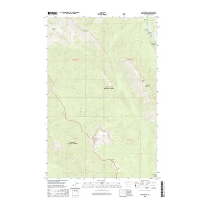
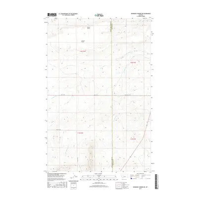
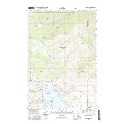
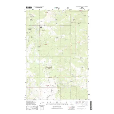
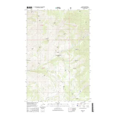
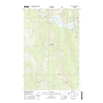
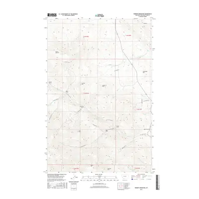
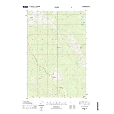
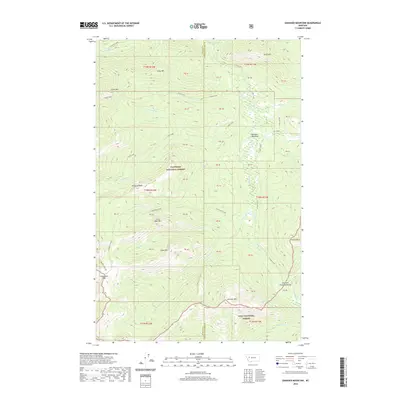
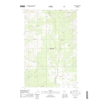
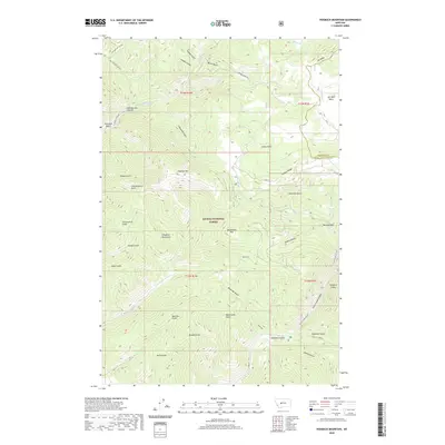
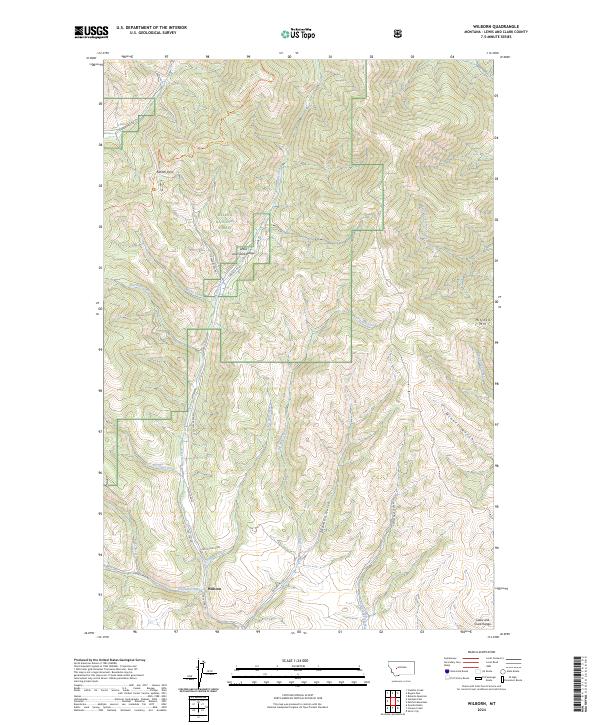
1968 Map of Wilborn
USGS Topo · Published 1971About this map
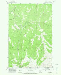
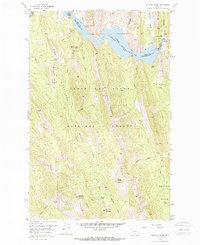
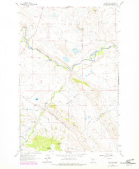
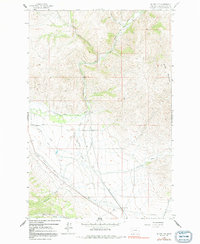
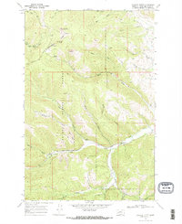
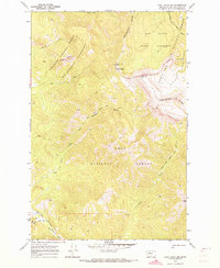
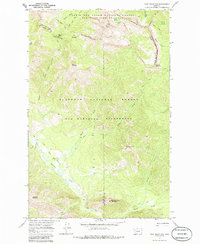
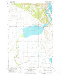
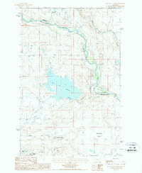
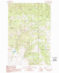
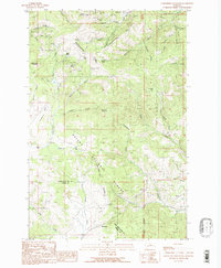
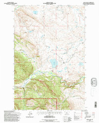
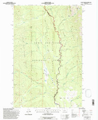
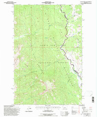
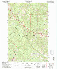
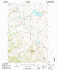
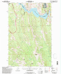
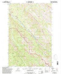
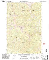
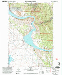
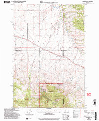
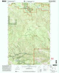
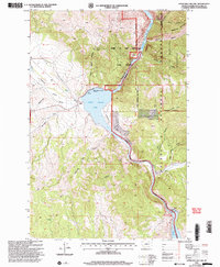
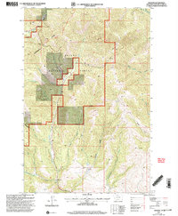
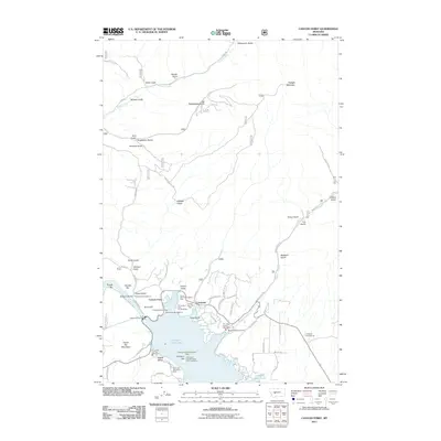
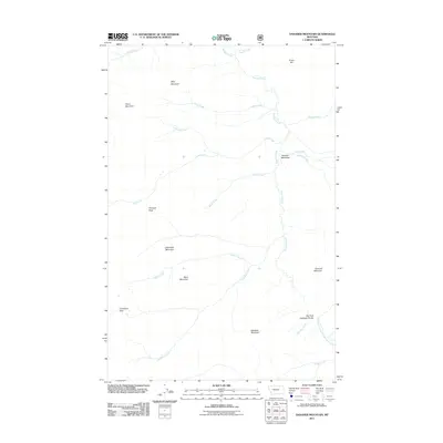
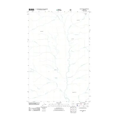
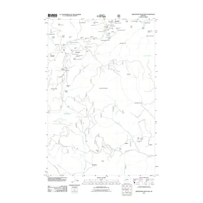
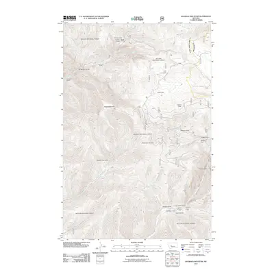
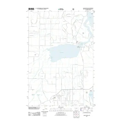
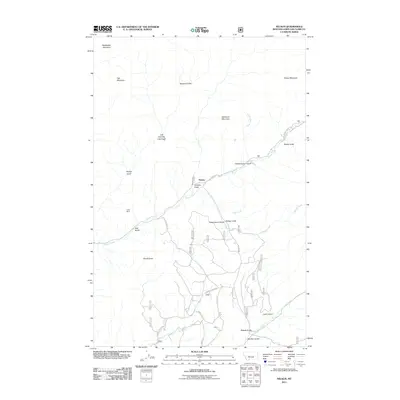
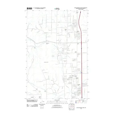
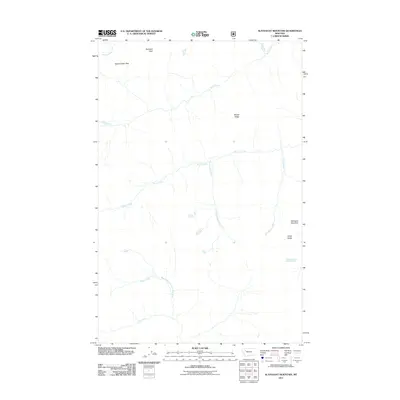
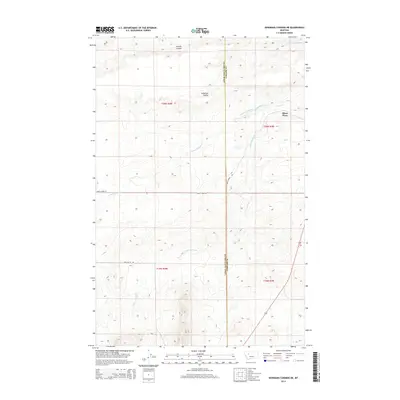
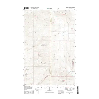
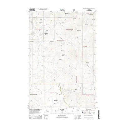
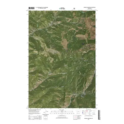
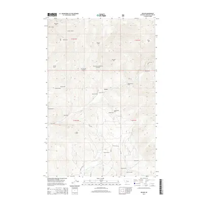
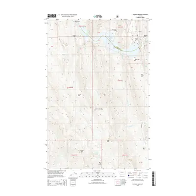
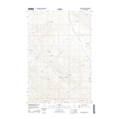
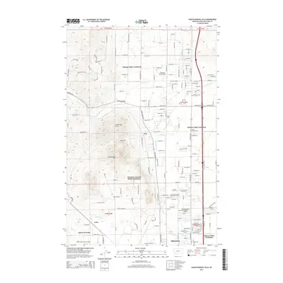
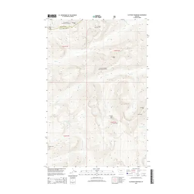
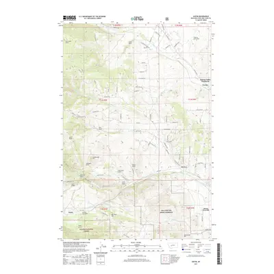
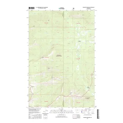
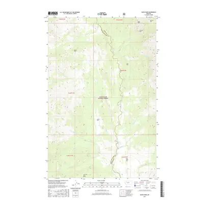
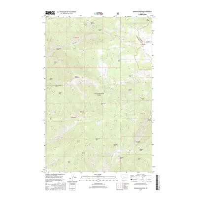
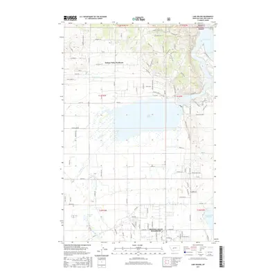
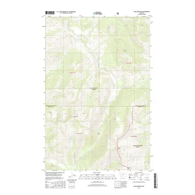
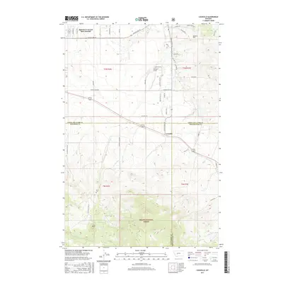
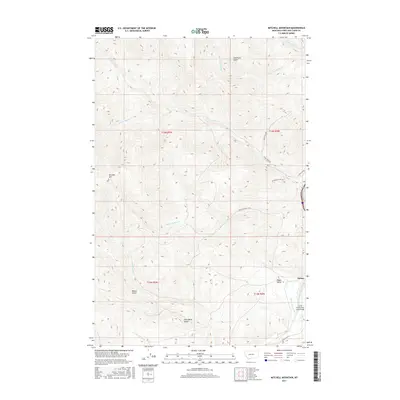
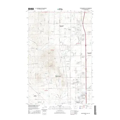
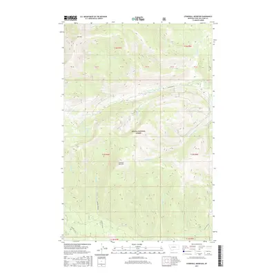
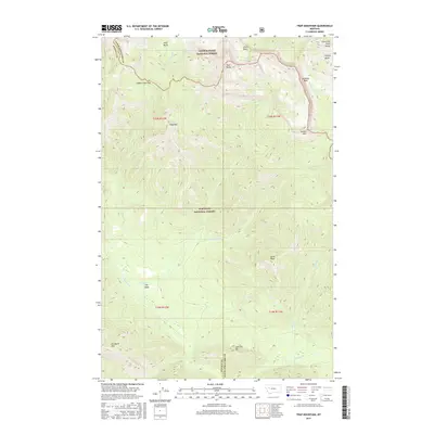
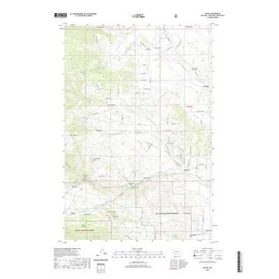
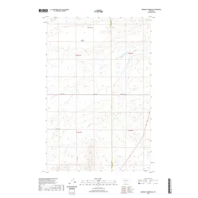
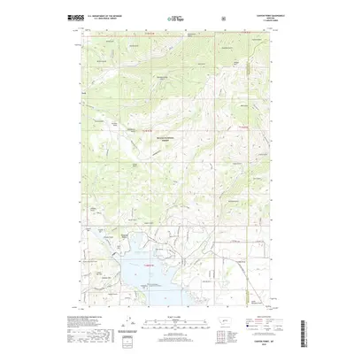
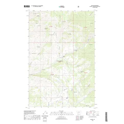
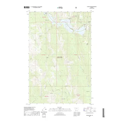
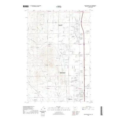
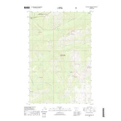
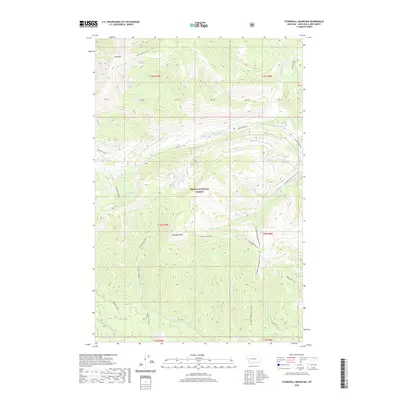
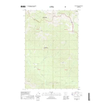
The Continental Divide defines the western high ground of this landscape, where the Flesher Pass Trail crosses through Flesher Pass. This 1968 field-checked map captures the remote character of the Helena National Forest in Lewis and Clark County, focusing on the small settlement of Wilborn situated at the confluence of several mountain drainages. The area is defined by a complex network of narrow gulches and creeks, including Miners Gulch and Sawmill Gulch, which suggest the historic resource extraction that once shaped these valleys. Numerous Prospects are scattered across the terrain, particularly in the northern reaches, while a series of Jeep Trails provide the primary access through the steep canyon floors of Canyon Creek and Rattlesnake Creek. This survey provides a precise view of the topography before modern development reached these high-elevation Montana drainages.
Find a feature on this map
26 named features on this map. Tap any name to fly to it.
Don’t see what you’re looking for? This feature index may not catch every label — zoom into the map to look around manually.
Map Details
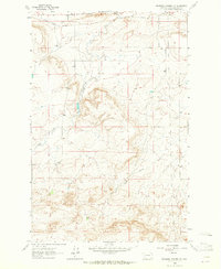
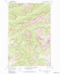
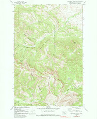
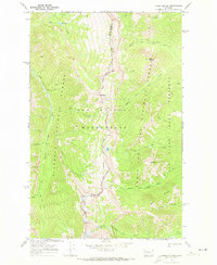
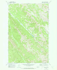
Editions of this 1968 Wilborn Map
This is the sole edition of this map. No revisions or reprints were ever made.
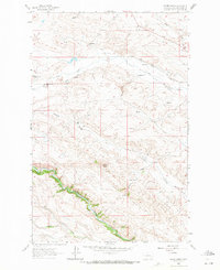
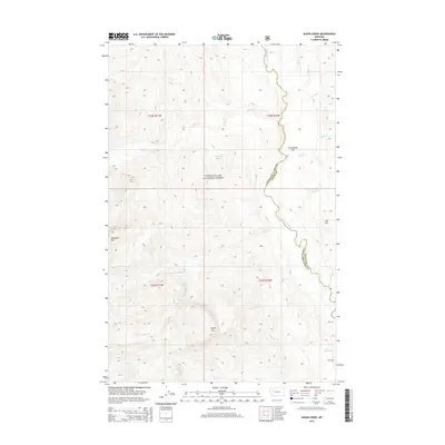
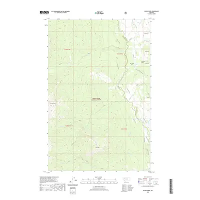
Historical Maps of Wilborn Through Time
432 maps found

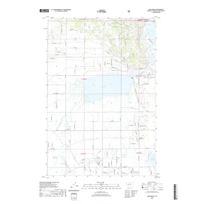
1903 Coopers Lake
Lewis and Clark County, MT

1943 Hogan
Lewis and Clark County, MT
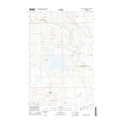
1958 Barr Creek
Lewis and Clark County, MT
1958 Gates Park
Lewis and Clark County, MT
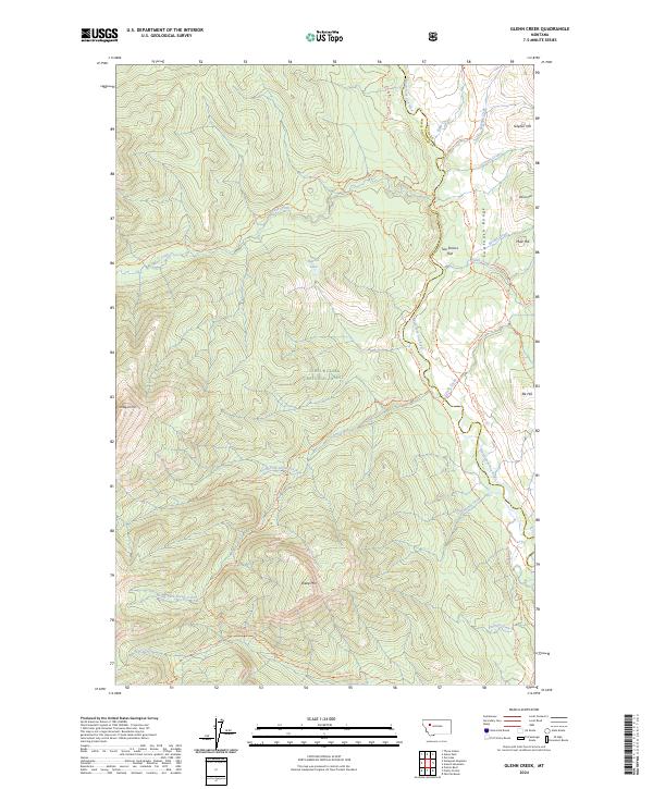
1958 Glenn Creek
Lewis and Clark County, MT
1958 Patricks Basin
Lewis and Clark County, MT
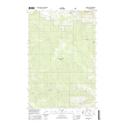
1958 Pretty Prairie
Lewis and Clark County, MT
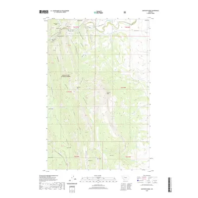
1958 Sawtooth Ridge
Lewis and Clark County, MT
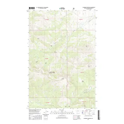
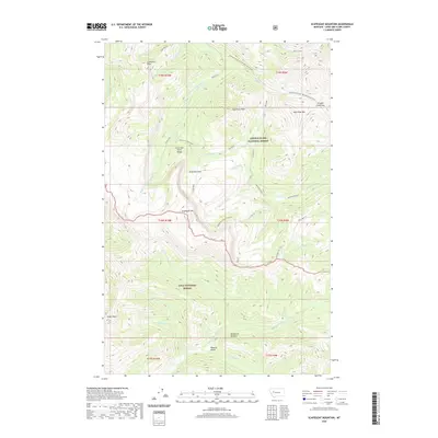
1961 Coburn Mountain
Lewis and Clark County, MT
1961 Comb Rock
Lewis and Clark County, MT
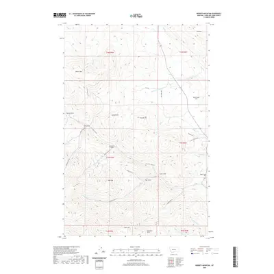
1961 Roberts Mountain
Lewis and Clark County, MT
1961 The Sawteeth
Lewis and Clark County, MT
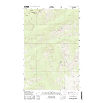
1962 Beartooth Mountain
Lewis and Clark County, MT
1962 Bowmans Corners
Lewis and Clark County, MT
1962 Candle Mountain
Lewis and Clark County, MT
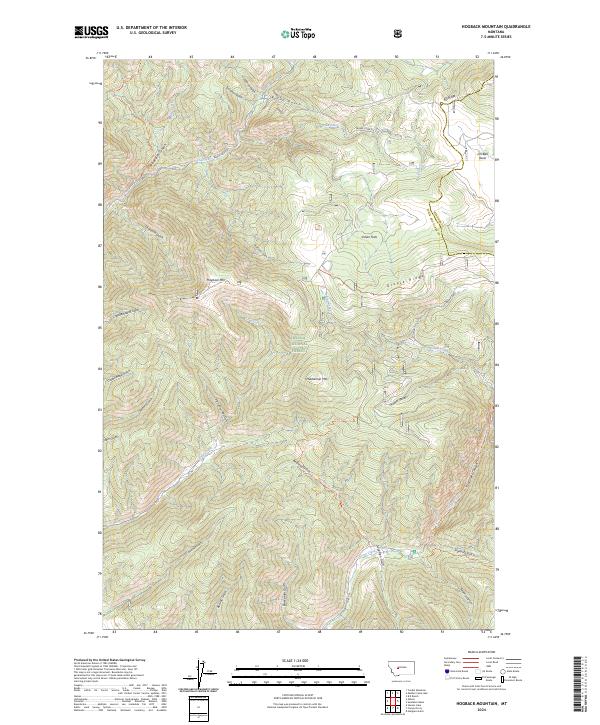
1962 Hogback Mountain
Lewis and Clark County, MT
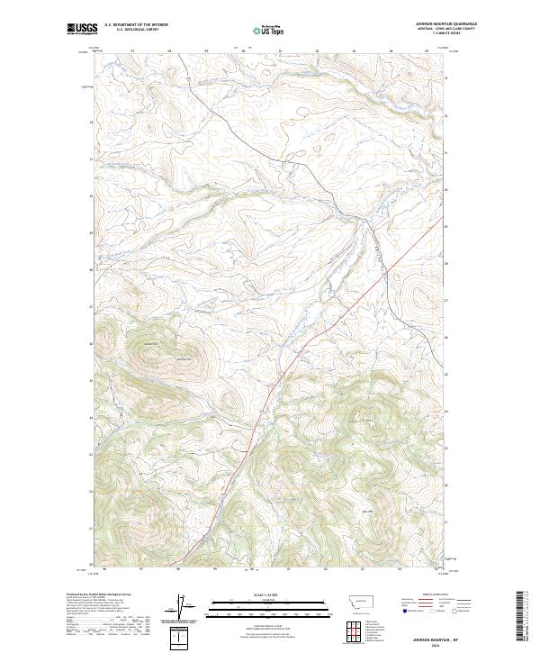
1962 Johnson Mountain
Lewis and Clark County, MT
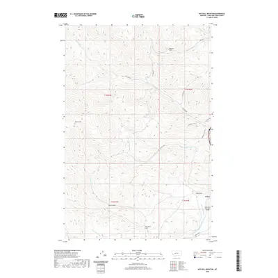
1962 Mitchell Mountain
Lewis and Clark County, MT
1962 Nelson
Lewis and Clark County, MT
1962 Rattlesnake Mountain
Lewis and Clark County, MT
1962 Sheep Creek
Lewis and Clark County, MT
1962 Silver City
Lewis and Clark County, MT
1962 Upper Holter Lake
Lewis and Clark County, MT
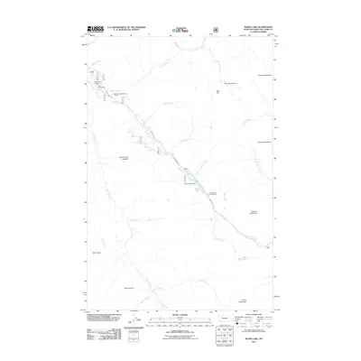
1963 Bean Lake
Lewis and Clark County, MT
1963 Blowout Mountain
Lewis and Clark County, MT
1963 Bowmans Corners NE
Lewis and Clark County, MT
1963 Bowmans Corners NW
Lewis and Clark County, MT
1963 Cadotte Creek
Lewis and Clark County, MT
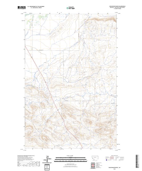
1963 Gouchnour Ranch
Lewis and Clark County, MT
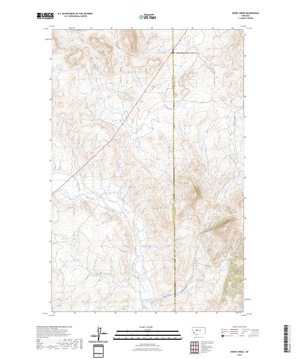
1963 Henry Creek
Lewis and Clark County, MT
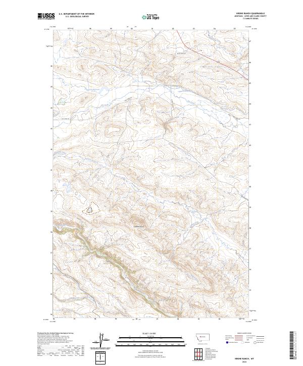
1963 Krone Ranch
Lewis and Clark County, MT
1963 Rogers Pass
Lewis and Clark County, MT
1968 Caribou Peak
Lewis and Clark County, MT
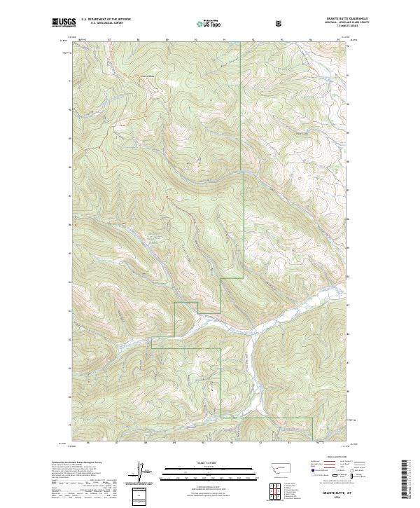
1968 Granite Butte
Lewis and Clark County, MT
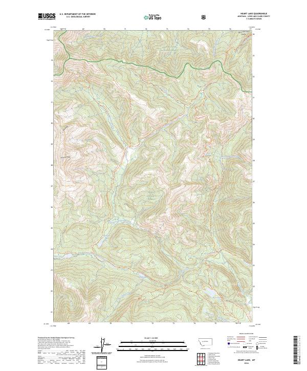
1968 Heart Lake
Lewis and Clark County, MT
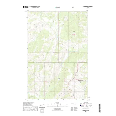
1968 Lake Mountain
Lewis and Clark County, MT
1968 Nevada Mountain
Lewis and Clark County, MT
1968 Olson Peak
Lewis and Clark County, MT
1968 Silver King Mountain
Lewis and Clark County, MT
1968 Stemple Pass
Lewis and Clark County, MT
1968 Stonewall Mountain
Lewis and Clark County, MT
1968 Swede Gulch
Lewis and Clark County, MT
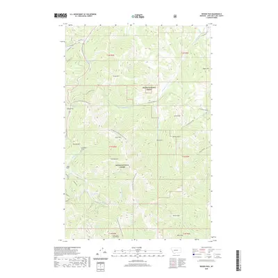
1968 Wilborn
Lewis and Clark County, MT
1970 Benchmark
Lewis and Clark County, MT
1970 Danaher Mountain
Lewis and Clark County, MT
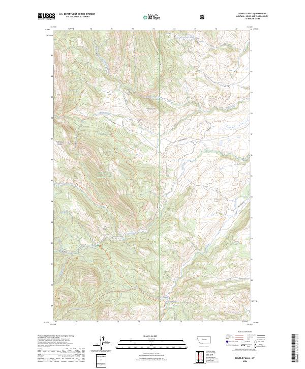
1970 Double Falls
Lewis and Clark County, MT
1970 Flint Mountain
Lewis and Clark County, MT
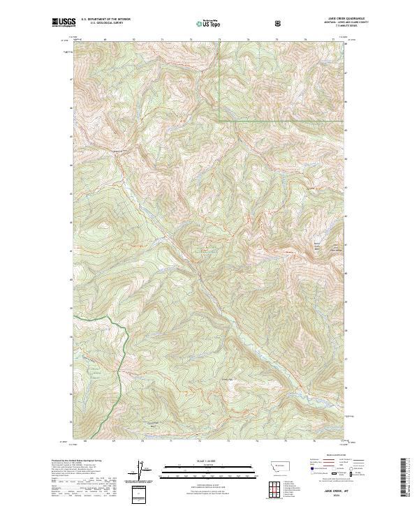
1970 Jakie Creek
Lewis and Clark County, MT
1970 Nilan Reservoir
Lewis and Clark County, MT
1970 Prairie Reef
Lewis and Clark County, MT
1970 Scapegoat Mountain
Lewis and Clark County, MT
1970 Slategoat Mountain
Lewis and Clark County, MT
1970 Steamboat Mountain
Lewis and Clark County, MT
1970 Three Sisters
Lewis and Clark County, MT
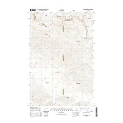
1970 Trap Mountain
Lewis and Clark County, MT
1970 Wood Lake
Lewis and Clark County, MT
1972 Canyon Ferry
Lewis and Clark County, MT
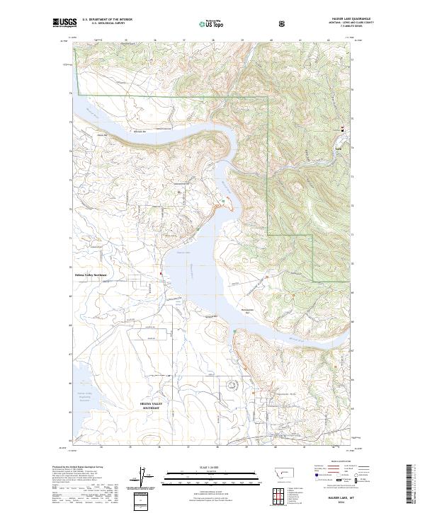
1972 Hauser Lake
Lewis and Clark County, MT
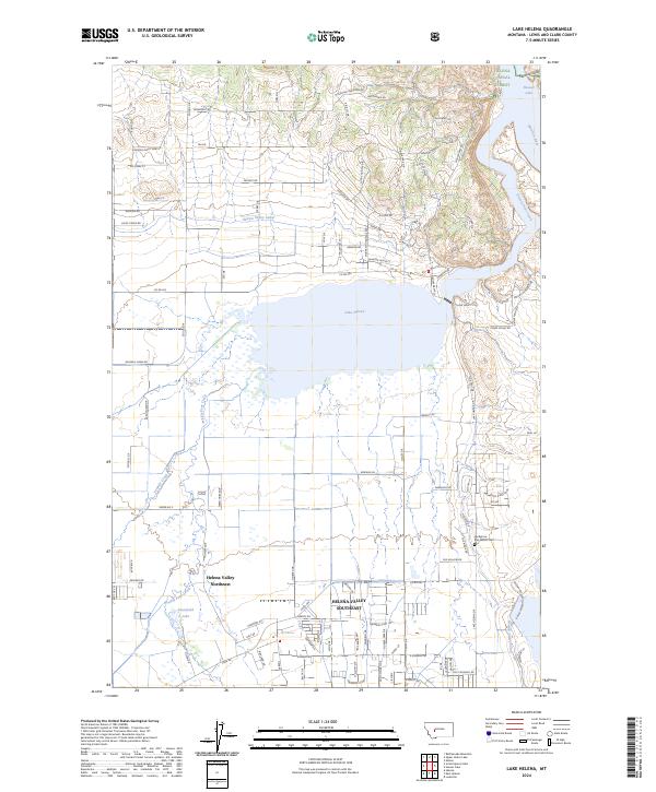
1972 Lake Helena
Lewis and Clark County, MT
1985 Austin
Lewis and Clark County, MT
1985 Black Mountain
Lewis and Clark County, MT
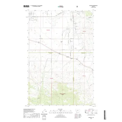
1985 Louisville
Lewis and Clark County, MT
1985 Scratchgravel Hills
Lewis and Clark County, MT
1986 Split Rock Junction
Lewis and Clark County, MT
1989 Esmeralda Hill
Lewis and Clark County, MT
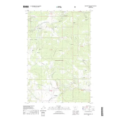
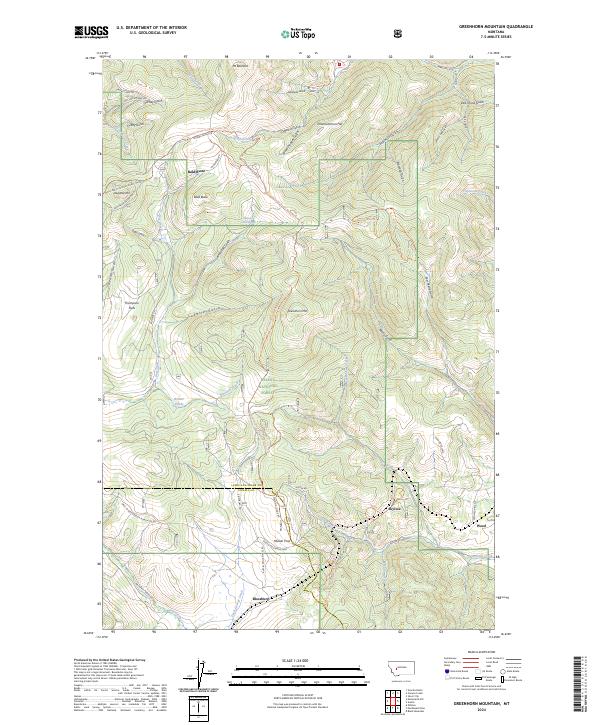
1989 Greenhorn Mountain
Lewis and Clark County, MT
1993 Dearborn River
Lewis and Clark County, MT
1994 Danaher Mountain
Lewis and Clark County, MT
1994 Trap Mountain
Lewis and Clark County, MT
1995 Barr Creek
Lewis and Clark County, MT
1995 Bean Lake
Lewis and Clark County, MT
1995 Benchmark
Lewis and Clark County, MT
1995 Blowout Mountain
Lewis and Clark County, MT
1995 Double Falls
Lewis and Clark County, MT
1995 Gates Park
Lewis and Clark County, MT
1995 Glenn Creek
Lewis and Clark County, MT
1995 Jakie Creek
Lewis and Clark County, MT
1995 Nilan Reservoir
Lewis and Clark County, MT
1995 Patricks Basin
Lewis and Clark County, MT
1995 Prairie Reef
Lewis and Clark County, MT
1995 Pretty Prairie
Lewis and Clark County, MT
1995 Sawtooth Ridge
Lewis and Clark County, MT
1995 Scapegoat Mountain
Lewis and Clark County, MT
1995 Slategoat Mountain
Lewis and Clark County, MT
1995 Steamboat Mountain
Lewis and Clark County, MT
1995 Three Sisters
Lewis and Clark County, MT
1995 Wood Lake
Lewis and Clark County, MT
1999 Flint Mountain
Lewis and Clark County, MT
1999 Lake Mountain
Lewis and Clark County, MT
2001 Austin
Lewis and Clark County, MT
2001 Beartooth Mountain
Lewis and Clark County, MT
2001 Black Mountain
Lewis and Clark County, MT
2001 Cadotte Creek
Lewis and Clark County, MT
2001 Canyon Ferry
Lewis and Clark County, MT
2001 Caribou Peak
Lewis and Clark County, MT
2001 Esmeralda Hill
Lewis and Clark County, MT
2001 Granite Butte
Lewis and Clark County, MT
2001 Greenhorn Mountain
Lewis and Clark County, MT
2001 Hauser Lake
Lewis and Clark County, MT
2001 Heart Lake
Lewis and Clark County, MT
2001 Hogback Mountain
Lewis and Clark County, MT
2001 Lake Helena
Lewis and Clark County, MT
2001 Louisville
Lewis and Clark County, MT

2001 Nelson
Lewis and Clark County, MT
2001 Nevada Mountain
Lewis and Clark County, MT
2001 Olson Peak
Lewis and Clark County, MT
2001 Rogers Pass
Lewis and Clark County, MT
2001 Silver King Mountain
Lewis and Clark County, MT
2001 Stemple Pass
Lewis and Clark County, MT

2001 Swede Gulch
Lewis and Clark County, MT
2001 Upper Holter Lake
Lewis and Clark County, MT
2001 Wilborn
Lewis and Clark County, MT
2011 Austin
Lewis and Clark County, MT
2011 Barr Creek
Lewis and Clark County, MT
2011 Bean Lake
Lewis and Clark County, MT
2011 Beartooth Mountain
Lewis and Clark County, MT
2011 Benchmark
Lewis and Clark County, MT
2011 Black Mountain
Lewis and Clark County, MT
2011 Blowout Mountain
Lewis and Clark County, MT
2011 Bowmans Corners
Lewis and Clark County, MT
2011 Bowmans Corners NE
Lewis and Clark County, MT
2011 Bowmans Corners NW
Lewis and Clark County, MT
2011 Cadotte Creek
Lewis and Clark County, MT
2011 Candle Mountain
Lewis and Clark County, MT
2011 Canyon Ferry
Lewis and Clark County, MT
2011 Caribou Peak
Lewis and Clark County, MT
2011 Coburn Mountain
Lewis and Clark County, MT
2011 Comb Rock
Lewis and Clark County, MT
2011 Danaher Mountain
Lewis and Clark County, MT
2011 Double Falls
Lewis and Clark County, MT
2011 Esmeralda Hill
Lewis and Clark County, MT
2011 Flint Mountain
Lewis and Clark County, MT
2011 Gates Park
Lewis and Clark County, MT
2011 Glenn Creek
Lewis and Clark County, MT
2011 Gouchnour Ranch
Lewis and Clark County, MT
2011 Granite Butte
Lewis and Clark County, MT
2011 Greenhorn Mountain
Lewis and Clark County, MT
2011 Hauser Lake
Lewis and Clark County, MT
2011 Heart Lake
Lewis and Clark County, MT
2011 Henry Creek
Lewis and Clark County, MT
2011 Hogback Mountain
Lewis and Clark County, MT
2011 Jakie Creek
Lewis and Clark County, MT
2011 Johnson Mountain
Lewis and Clark County, MT
2011 Krone Ranch
Lewis and Clark County, MT
2011 Lake Helena
Lewis and Clark County, MT
2011 Lake Mountain
Lewis and Clark County, MT
2011 Louisville
Lewis and Clark County, MT
2011 Mitchell Mountain
Lewis and Clark County, MT
2011 Nelson
Lewis and Clark County, MT
2011 Nevada Mountain
Lewis and Clark County, MT
2011 Nilan Reservoir
Lewis and Clark County, MT
2011 Olson Peak
Lewis and Clark County, MT
2011 Patricks Basin
Lewis and Clark County, MT
2011 Prairie Reef
Lewis and Clark County, MT
2011 Pretty Prairie
Lewis and Clark County, MT
2011 Rattlesnake Mountain
Lewis and Clark County, MT
2011 Roberts Mountain
Lewis and Clark County, MT
2011 Rogers Pass
Lewis and Clark County, MT
2011 Sawtooth Ridge
Lewis and Clark County, MT
2011 Scapegoat Mountain
Lewis and Clark County, MT
2011 Scratchgravel Hills
Lewis and Clark County, MT
2011 Sheep Creek
Lewis and Clark County, MT
2011 Silver City
Lewis and Clark County, MT
2011 Silver King Mountain
Lewis and Clark County, MT
2011 Slategoat Mountain
Lewis and Clark County, MT
2011 Split Rock Junction
Lewis and Clark County, MT
2011 Steamboat Mountain
Lewis and Clark County, MT
2011 Stemple Pass
Lewis and Clark County, MT
2011 Stonewall Mountain
Lewis and Clark County, MT
2011 Swede Gulch
Lewis and Clark County, MT
2011 The Sawteeth
Lewis and Clark County, MT
2011 Three Sisters
Lewis and Clark County, MT
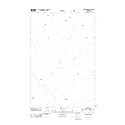
2011 Trap Mountain
Lewis and Clark County, MT
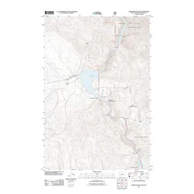
2011 Upper Holter Lake
Lewis and Clark County, MT
2011 Wilborn
Lewis and Clark County, MT
2011 Wood Lake
Lewis and Clark County, MT
2014 Austin
Lewis and Clark County, MT
2014 Barr Creek
Lewis and Clark County, MT
2014 Bean Lake
Lewis and Clark County, MT
2014 Beartooth Mountain
Lewis and Clark County, MT
2014 Benchmark
Lewis and Clark County, MT
2014 Black Mountain
Lewis and Clark County, MT
2014 Blowout Mountain
Lewis and Clark County, MT
2014 Bowmans Corners
Lewis and Clark County, MT
2014 Bowmans Corners NE
Lewis and Clark County, MT
2014 Bowmans Corners NW
Lewis and Clark County, MT
2014 Cadotte Creek
Lewis and Clark County, MT
2014 Candle Mountain
Lewis and Clark County, MT
2014 Canyon Ferry
Lewis and Clark County, MT
2014 Caribou Peak
Lewis and Clark County, MT
2014 Coburn Mountain
Lewis and Clark County, MT
2014 Comb Rock
Lewis and Clark County, MT
2014 Danaher Mountain
Lewis and Clark County, MT
2014 Double Falls
Lewis and Clark County, MT
2014 Esmeralda Hill
Lewis and Clark County, MT
2014 Flint Mountain
Lewis and Clark County, MT
2014 Gates Park
Lewis and Clark County, MT
2014 Glenn Creek
Lewis and Clark County, MT
2014 Gouchnour Ranch
Lewis and Clark County, MT
2014 Granite Butte
Lewis and Clark County, MT
2014 Greenhorn Mountain
Lewis and Clark County, MT
2014 Hauser Lake
Lewis and Clark County, MT
2014 Heart Lake
Lewis and Clark County, MT
2014 Henry Creek
Lewis and Clark County, MT
2014 Hogback Mountain
Lewis and Clark County, MT
2014 Jakie Creek
Lewis and Clark County, MT
2014 Johnson Mountain
Lewis and Clark County, MT
2014 Krone Ranch
Lewis and Clark County, MT
2014 Lake Helena
Lewis and Clark County, MT
2014 Lake Mountain
Lewis and Clark County, MT
2014 Louisville
Lewis and Clark County, MT
2014 Mitchell Mountain
Lewis and Clark County, MT
2014 Nelson
Lewis and Clark County, MT
2014 Nevada Mountain
Lewis and Clark County, MT
2014 Nilan Reservoir
Lewis and Clark County, MT
2014 Olson Peak
Lewis and Clark County, MT
2014 Patricks Basin
Lewis and Clark County, MT
2014 Prairie Reef
Lewis and Clark County, MT
2014 Pretty Prairie
Lewis and Clark County, MT
2014 Rattlesnake Mountain
Lewis and Clark County, MT
2014 Roberts Mountain
Lewis and Clark County, MT
2014 Rogers Pass
Lewis and Clark County, MT
2014 Sawtooth Ridge
Lewis and Clark County, MT
2014 Scapegoat Mountain
Lewis and Clark County, MT
2014 Scratchgravel Hills
Lewis and Clark County, MT
2014 Sheep Creek
Lewis and Clark County, MT
2014 Silver City
Lewis and Clark County, MT
2014 Silver King Mountain
Lewis and Clark County, MT
2014 Slategoat Mountain
Lewis and Clark County, MT
2014 Split Rock Junction
Lewis and Clark County, MT
2014 Steamboat Mountain
Lewis and Clark County, MT
2014 Stemple Pass
Lewis and Clark County, MT
2014 Stonewall Mountain
Lewis and Clark County, MT
2014 Swede Gulch
Lewis and Clark County, MT
2014 The Sawteeth
Lewis and Clark County, MT
2014 Three Sisters
Lewis and Clark County, MT
2014 Trap Mountain
Lewis and Clark County, MT
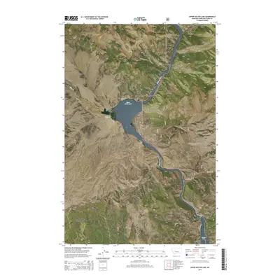
2014 Upper Holter Lake
Lewis and Clark County, MT
2014 Wilborn
Lewis and Clark County, MT
2014 Wood Lake
Lewis and Clark County, MT
2017 Austin
Lewis and Clark County, MT
2017 Barr Creek
Lewis and Clark County, MT
2017 Bean Lake
Lewis and Clark County, MT
2017 Beartooth Mountain
Lewis and Clark County, MT
2017 Benchmark
Lewis and Clark County, MT
2017 Black Mountain
Lewis and Clark County, MT
2017 Blowout Mountain
Lewis and Clark County, MT
2017 Bowmans Corners
Lewis and Clark County, MT
2017 Bowmans Corners NE
Lewis and Clark County, MT
2017 Bowmans Corners NW
Lewis and Clark County, MT
2017 Cadotte Creek
Lewis and Clark County, MT
2017 Candle Mountain
Lewis and Clark County, MT
2017 Canyon Ferry
Lewis and Clark County, MT
2017 Caribou Peak
Lewis and Clark County, MT
2017 Coburn Mountain
Lewis and Clark County, MT
2017 Comb Rock
Lewis and Clark County, MT
2017 Danaher Mountain
Lewis and Clark County, MT
2017 Double Falls
Lewis and Clark County, MT
2017 Esmeralda Hill
Lewis and Clark County, MT
2017 Flint Mountain
Lewis and Clark County, MT
2017 Gates Park
Lewis and Clark County, MT
2017 Glenn Creek
Lewis and Clark County, MT
2017 Gouchnour Ranch
Lewis and Clark County, MT
2017 Granite Butte
Lewis and Clark County, MT
2017 Greenhorn Mountain
Lewis and Clark County, MT
2017 Hauser Lake
Lewis and Clark County, MT
2017 Heart Lake
Lewis and Clark County, MT
2017 Henry Creek
Lewis and Clark County, MT
2017 Hogback Mountain
Lewis and Clark County, MT
2017 Jakie Creek
Lewis and Clark County, MT
2017 Johnson Mountain
Lewis and Clark County, MT
2017 Krone Ranch
Lewis and Clark County, MT
2017 Lake Helena
Lewis and Clark County, MT
2017 Lake Mountain
Lewis and Clark County, MT
2017 Louisville
Lewis and Clark County, MT
2017 Mitchell Mountain
Lewis and Clark County, MT
2017 Nelson
Lewis and Clark County, MT
2017 Nevada Mountain
Lewis and Clark County, MT
2017 Nilan Reservoir
Lewis and Clark County, MT
2017 Olson Peak
Lewis and Clark County, MT
2017 Patricks Basin
Lewis and Clark County, MT
2017 Prairie Reef
Lewis and Clark County, MT
2017 Pretty Prairie
Lewis and Clark County, MT
2017 Rattlesnake Mountain
Lewis and Clark County, MT
2017 Roberts Mountain
Lewis and Clark County, MT
2017 Rogers Pass
Lewis and Clark County, MT
2017 Sawtooth Ridge
Lewis and Clark County, MT
2017 Scapegoat Mountain
Lewis and Clark County, MT
2017 Scratchgravel Hills
Lewis and Clark County, MT
2017 Sheep Creek
Lewis and Clark County, MT
2017 Silver City
Lewis and Clark County, MT
2017 Silver King Mountain
Lewis and Clark County, MT
2017 Slategoat Mountain
Lewis and Clark County, MT
2017 Split Rock Junction
Lewis and Clark County, MT
2017 Steamboat Mountain
Lewis and Clark County, MT
2017 Stemple Pass
Lewis and Clark County, MT
2017 Stonewall Mountain
Lewis and Clark County, MT
2017 Swede Gulch
Lewis and Clark County, MT
2017 The Sawteeth
Lewis and Clark County, MT
2017 Three Sisters
Lewis and Clark County, MT
2017 Trap Mountain
Lewis and Clark County, MT
2017 Upper Holter Lake
Lewis and Clark County, MT
2017 Wilborn
Lewis and Clark County, MT
2017 Wood Lake
Lewis and Clark County, MT
2020 Austin
Lewis and Clark County, MT
2020 Barr Creek
Lewis and Clark County, MT
2020 Bean Lake
Lewis and Clark County, MT
2020 Beartooth Mountain
Lewis and Clark County, MT
2020 Benchmark
Lewis and Clark County, MT
2020 Black Mountain
Lewis and Clark County, MT
2020 Blowout Mountain
Lewis and Clark County, MT
2020 Bowmans Corners
Lewis and Clark County, MT
2020 Bowmans Corners NE
Lewis and Clark County, MT
2020 Bowmans Corners NW
Lewis and Clark County, MT
2020 Cadotte Creek
Lewis and Clark County, MT
2020 Candle Mountain
Lewis and Clark County, MT
2020 Canyon Ferry
Lewis and Clark County, MT
2020 Caribou Peak
Lewis and Clark County, MT
2020 Coburn Mountain
Lewis and Clark County, MT
2020 Comb Rock
Lewis and Clark County, MT
2020 Danaher Mountain
Lewis and Clark County, MT
2020 Double Falls
Lewis and Clark County, MT
2020 Esmeralda Hill
Lewis and Clark County, MT
2020 Flint Mountain
Lewis and Clark County, MT
2020 Gates Park
Lewis and Clark County, MT
2020 Glenn Creek
Lewis and Clark County, MT
2020 Gouchnour Ranch
Lewis and Clark County, MT
2020 Granite Butte
Lewis and Clark County, MT
2020 Greenhorn Mountain
Lewis and Clark County, MT
2020 Hauser Lake
Lewis and Clark County, MT
2020 Heart Lake
Lewis and Clark County, MT
2020 Henry Creek
Lewis and Clark County, MT
2020 Hogback Mountain
Lewis and Clark County, MT
2020 Jakie Creek
Lewis and Clark County, MT
2020 Johnson Mountain
Lewis and Clark County, MT
2020 Krone Ranch
Lewis and Clark County, MT
2020 Lake Helena
Lewis and Clark County, MT
2020 Lake Mountain
Lewis and Clark County, MT
2020 Louisville
Lewis and Clark County, MT
2020 Mitchell Mountain
Lewis and Clark County, MT
2020 Nelson
Lewis and Clark County, MT
2020 Nevada Mountain
Lewis and Clark County, MT
2020 Nilan Reservoir
Lewis and Clark County, MT
2020 Olson Peak
Lewis and Clark County, MT
2020 Patricks Basin
Lewis and Clark County, MT
2020 Prairie Reef
Lewis and Clark County, MT
2020 Pretty Prairie
Lewis and Clark County, MT
2020 Rattlesnake Mountain
Lewis and Clark County, MT
2020 Roberts Mountain
Lewis and Clark County, MT
2020 Rogers Pass
Lewis and Clark County, MT
2020 Sawtooth Ridge
Lewis and Clark County, MT
2020 Scapegoat Mountain
Lewis and Clark County, MT
2020 Scratchgravel Hills
Lewis and Clark County, MT
2020 Sheep Creek
Lewis and Clark County, MT
2020 Silver City
Lewis and Clark County, MT
2020 Silver King Mountain
Lewis and Clark County, MT
2020 Slategoat Mountain
Lewis and Clark County, MT
2020 Split Rock Junction
Lewis and Clark County, MT
2020 Steamboat Mountain
Lewis and Clark County, MT
2020 Stemple Pass
Lewis and Clark County, MT
2020 Stonewall Mountain
Lewis and Clark County, MT
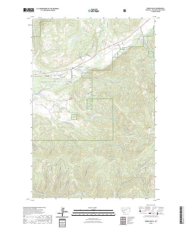
2020 Swede Gulch
Lewis and Clark County, MT
2020 The Sawteeth
Lewis and Clark County, MT
2020 Three Sisters
Lewis and Clark County, MT
2020 Trap Mountain
Lewis and Clark County, MT
2020 Upper Holter Lake
Lewis and Clark County, MT
2020 Wilborn
Lewis and Clark County, MT
2020 Wood Lake
Lewis and Clark County, MT
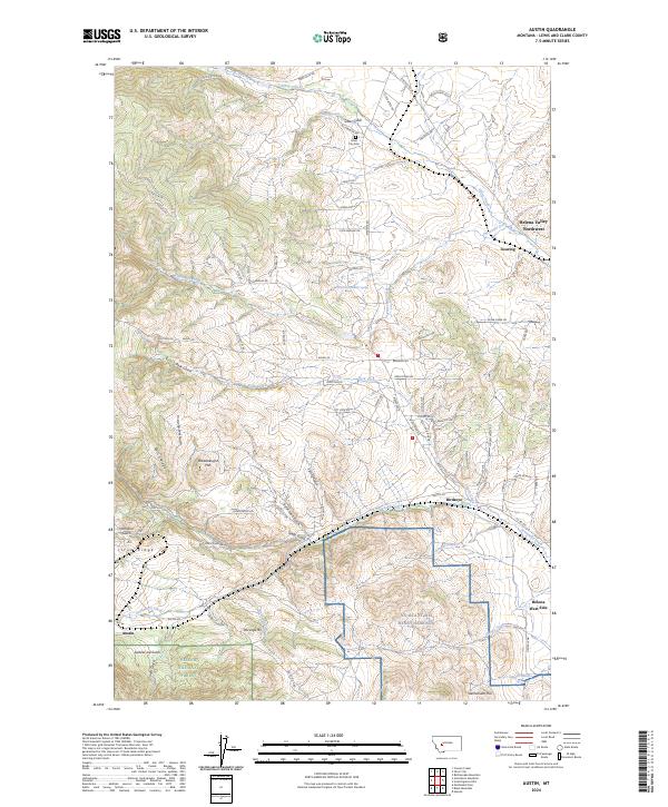
2024 Austin
Lewis and Clark County, MT
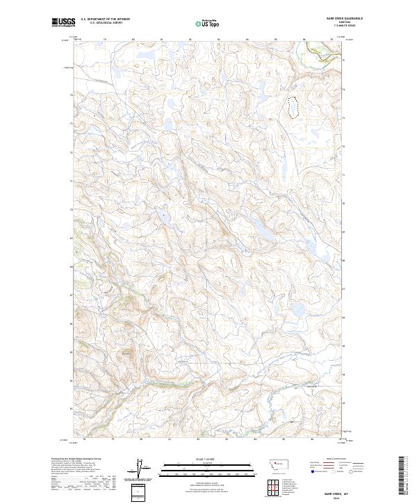
2024 Barr Creek
Lewis and Clark County, MT
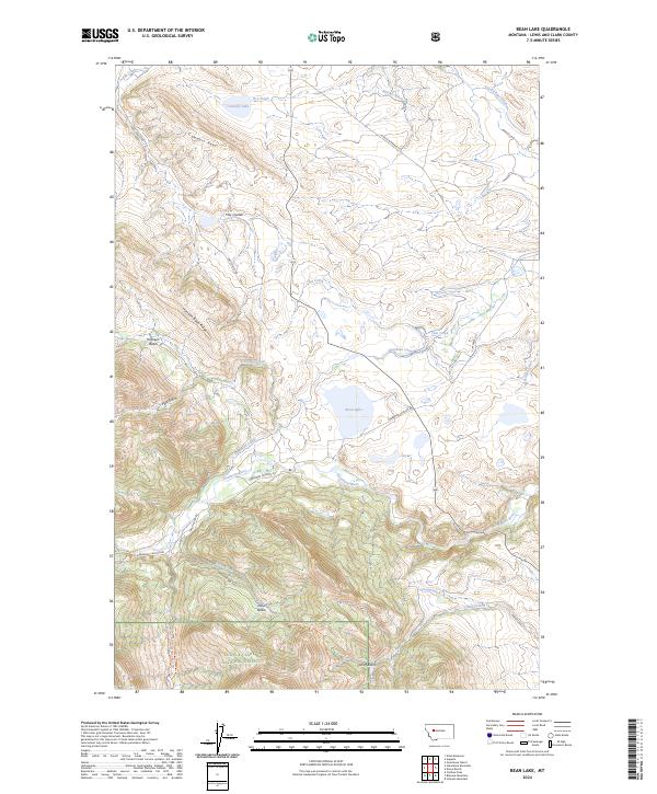
2024 Bean Lake
Lewis and Clark County, MT
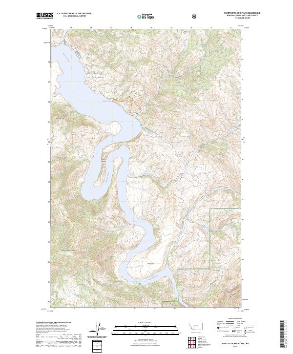
2024 Beartooth Mountain
Lewis and Clark County, MT
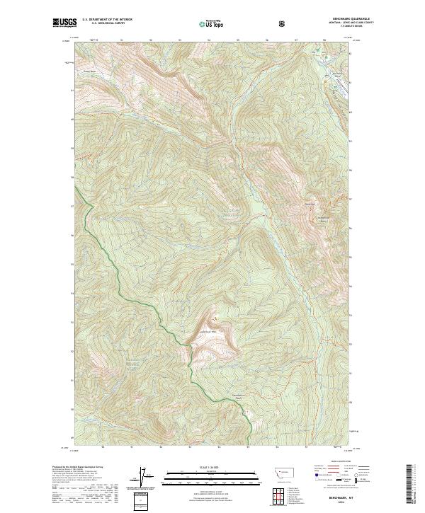
2024 Benchmark
Lewis and Clark County, MT

2024 Black Mountain
Lewis and Clark County, MT
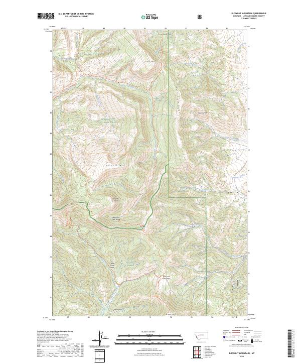
2024 Blowout Mountain
Lewis and Clark County, MT
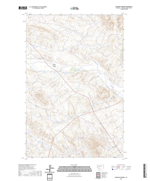
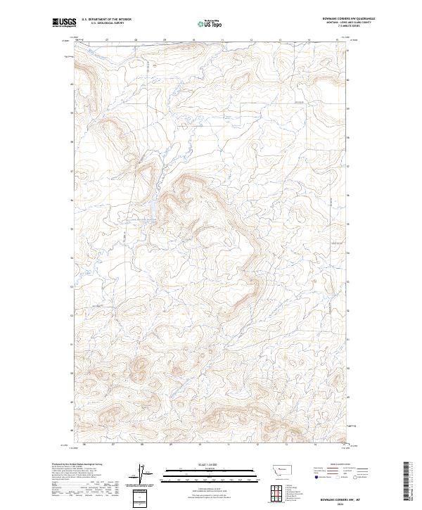
2024 Bowmans Corners
Lewis and Clark County, MT
2024 Bowmans Corners NE
Lewis and Clark County, MT
2024 Bowmans Corners NW
Lewis and Clark County, MT
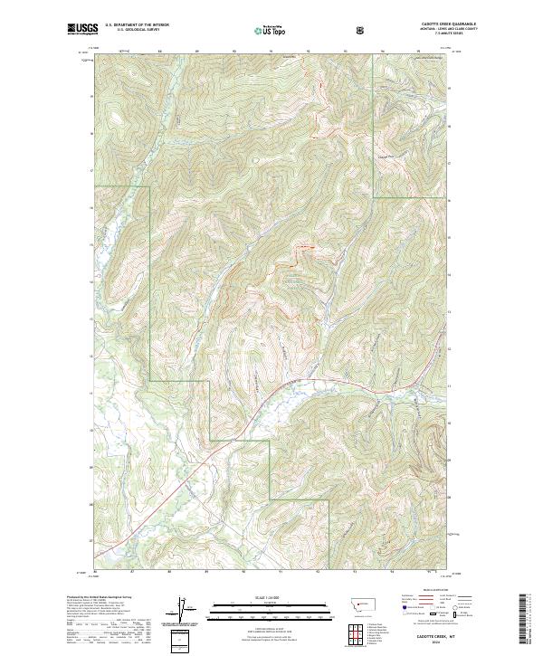
2024 Cadotte Creek
Lewis and Clark County, MT
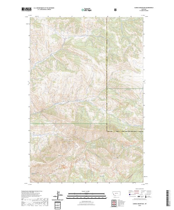
2024 Candle Mountain
Lewis and Clark County, MT
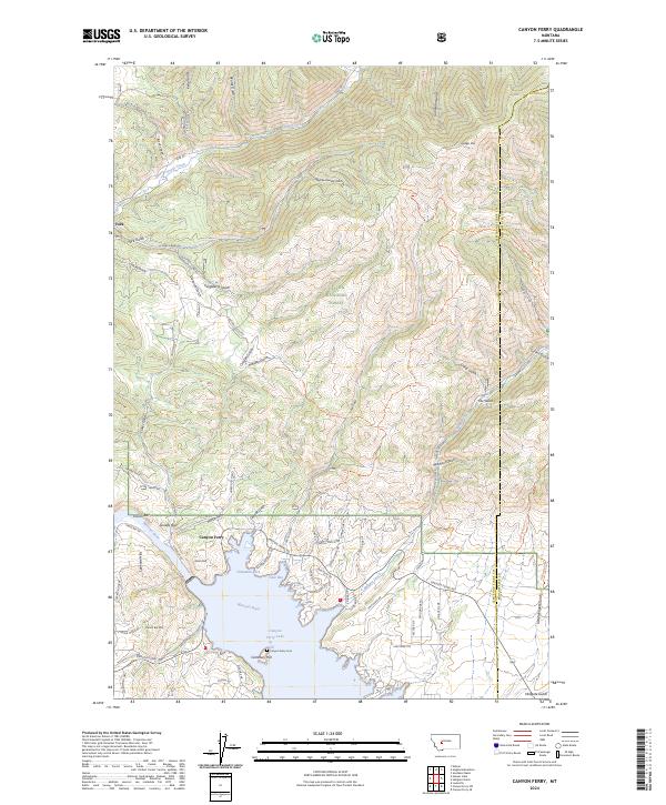
2024 Canyon Ferry
Lewis and Clark County, MT
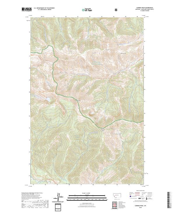
2024 Caribou Peak
Lewis and Clark County, MT
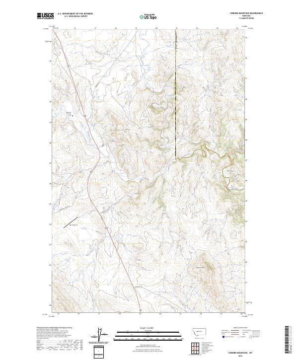
2024 Coburn Mountain
Lewis and Clark County, MT
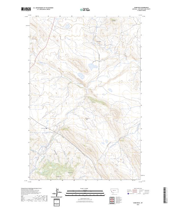
2024 Comb Rock
Lewis and Clark County, MT
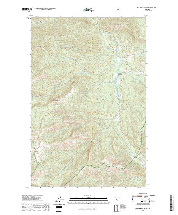
2024 Danaher Mountain
Lewis and Clark County, MT
2024 Double Falls
Lewis and Clark County, MT
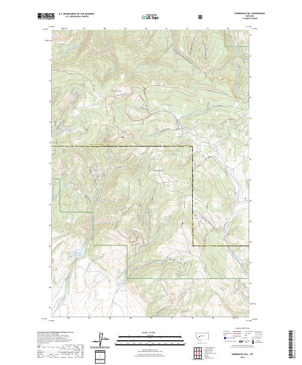
2024 Esmeralda Hill
Lewis and Clark County, MT
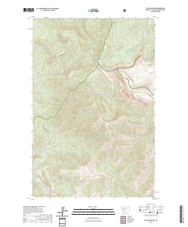
2024 Flint Mountain
Lewis and Clark County, MT
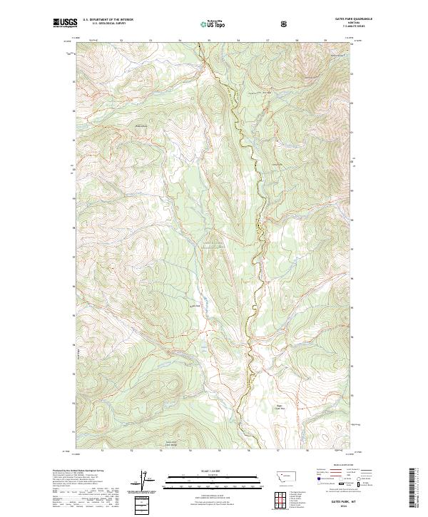
2024 Gates Park
Lewis and Clark County, MT
2024 Glenn Creek
Lewis and Clark County, MT
2024 Gouchnour Ranch
Lewis and Clark County, MT
2024 Granite Butte
Lewis and Clark County, MT
2024 Greenhorn Mountain
Lewis and Clark County, MT
2024 Hauser Lake
Lewis and Clark County, MT
2024 Heart Lake
Lewis and Clark County, MT
2024 Henry Creek
Lewis and Clark County, MT
2024 Hogback Mountain
Lewis and Clark County, MT
2024 Jakie Creek
Lewis and Clark County, MT
2024 Johnson Mountain
Lewis and Clark County, MT
2024 Krone Ranch
Lewis and Clark County, MT
2024 Lake Helena
Lewis and Clark County, MT
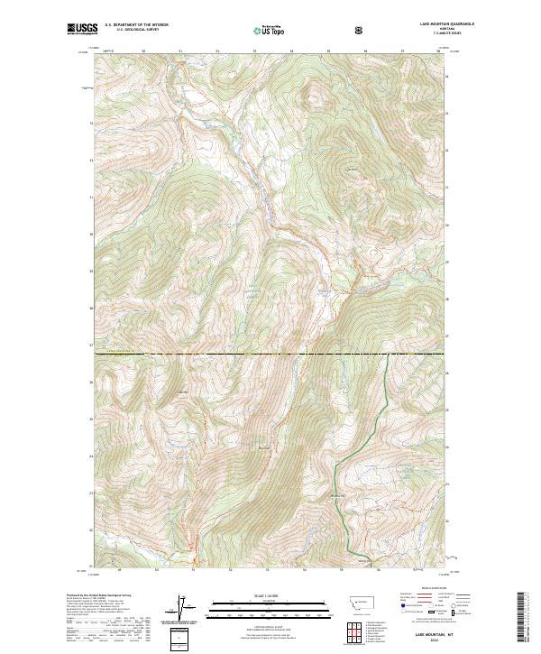
2024 Lake Mountain
Lewis and Clark County, MT
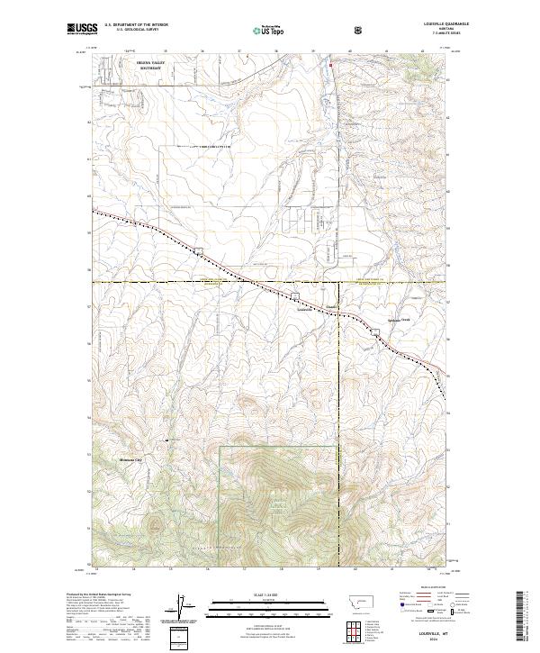
2024 Louisville
Lewis and Clark County, MT
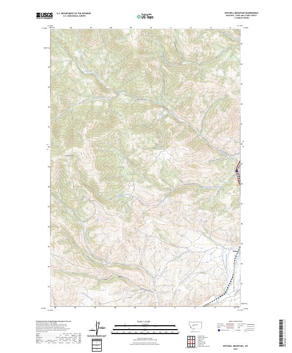
2024 Mitchell Mountain
Lewis and Clark County, MT
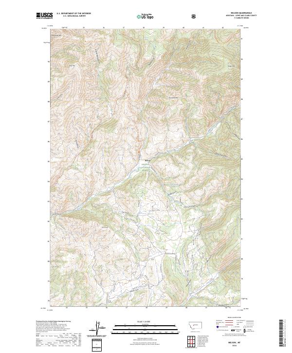
2024 Nelson
Lewis and Clark County, MT
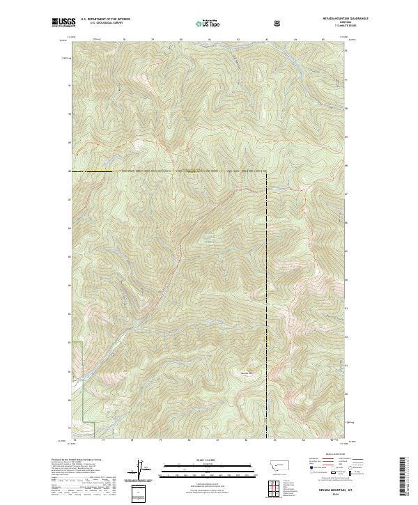
2024 Nevada Mountain
Lewis and Clark County, MT
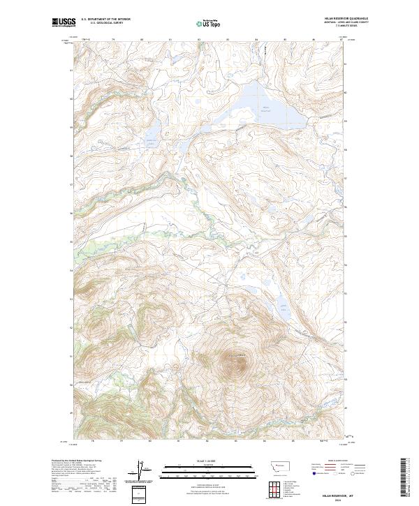
2024 Nilan Reservoir
Lewis and Clark County, MT
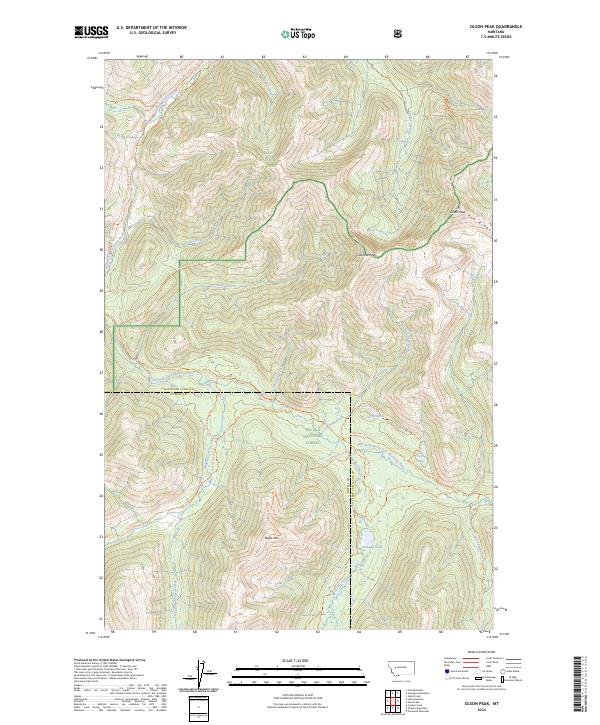
2024 Olson Peak
Lewis and Clark County, MT
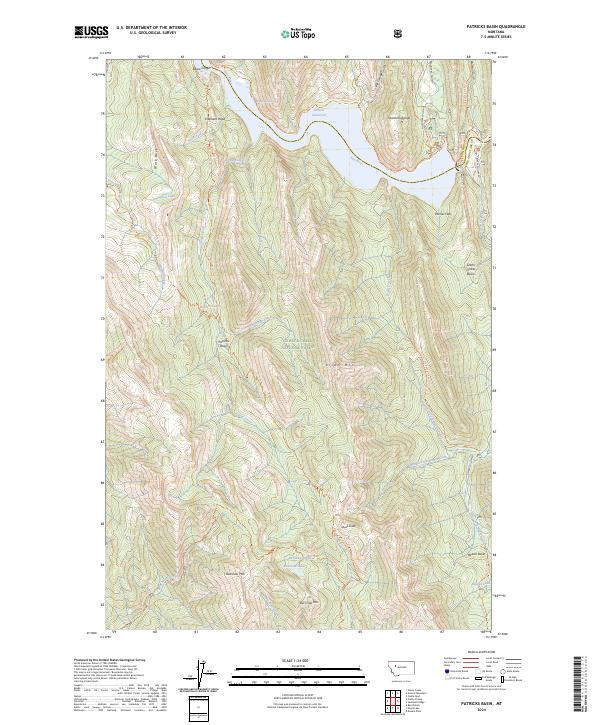
2024 Patricks Basin
Lewis and Clark County, MT
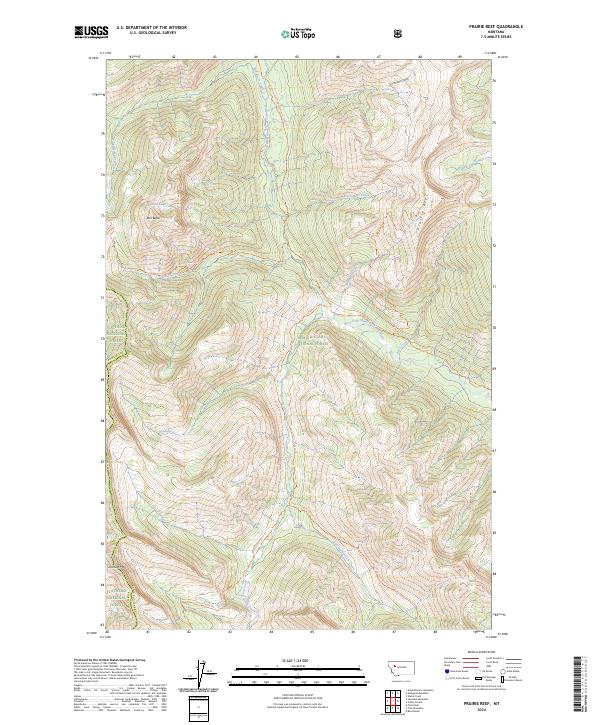
2024 Prairie Reef
Lewis and Clark County, MT
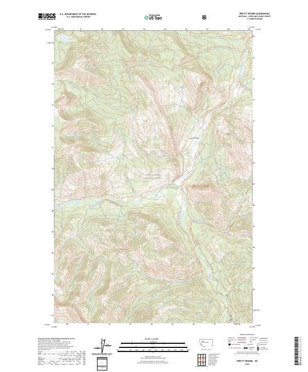
2024 Pretty Prairie
Lewis and Clark County, MT
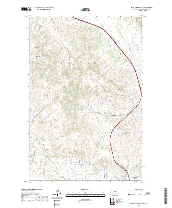
2024 Rattlesnake Mountain
Lewis and Clark County, MT
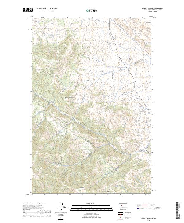
2024 Roberts Mountain
Lewis and Clark County, MT
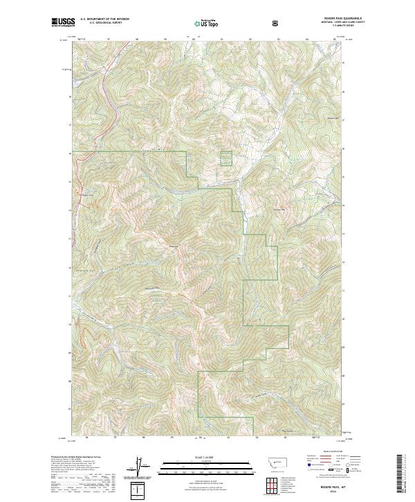
2024 Rogers Pass
Lewis and Clark County, MT
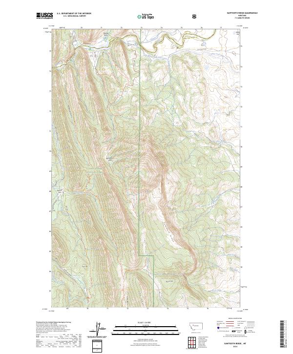
2024 Sawtooth Ridge
Lewis and Clark County, MT
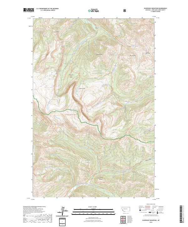
2024 Scapegoat Mountain
Lewis and Clark County, MT
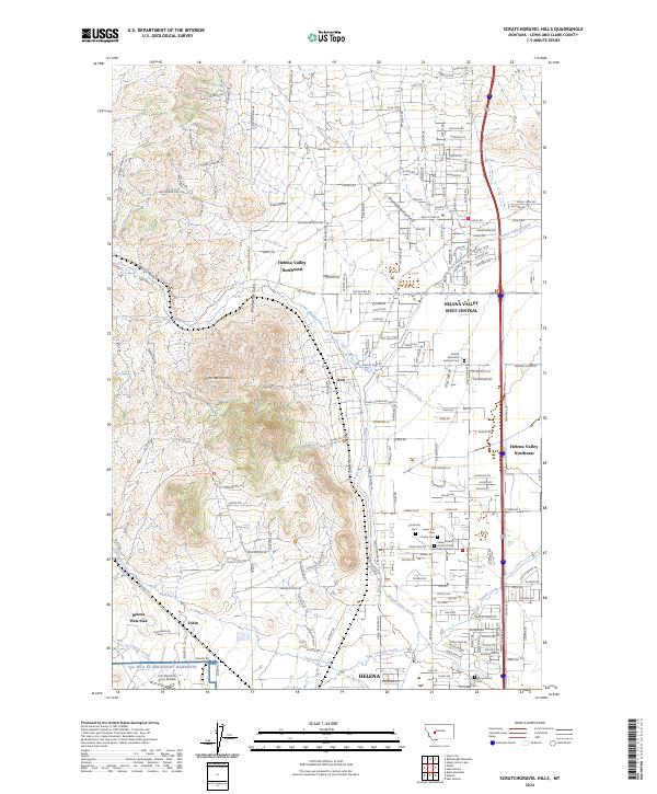
2024 Scratchgravel Hills
Lewis and Clark County, MT
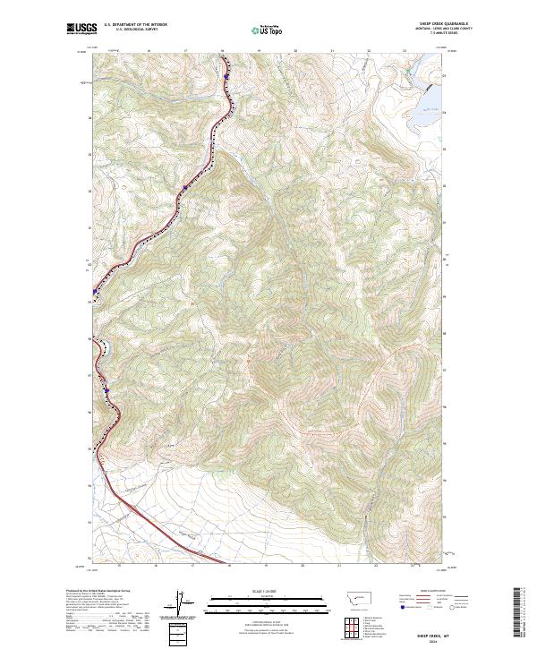
2024 Sheep Creek
Lewis and Clark County, MT
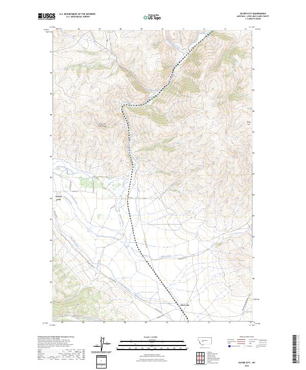
2024 Silver City
Lewis and Clark County, MT
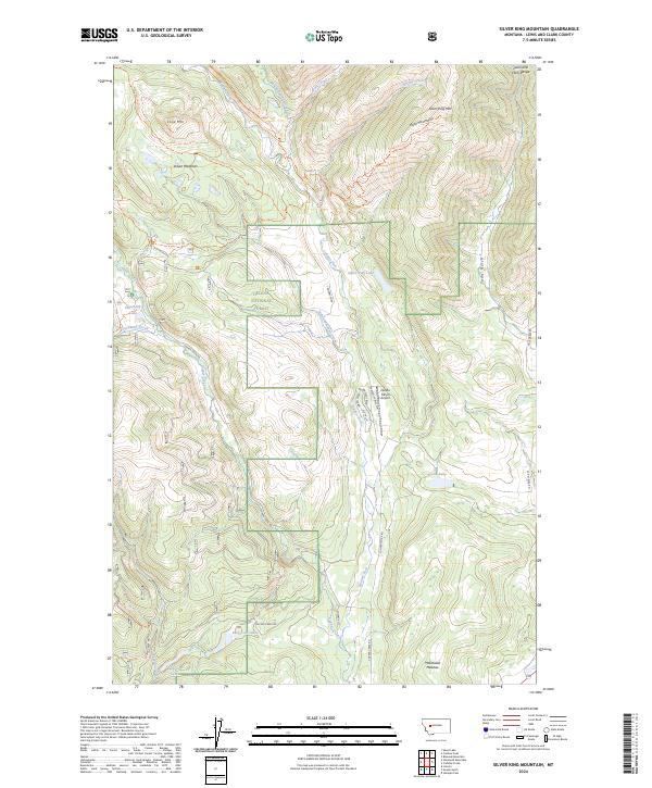
2024 Silver King Mountain
Lewis and Clark County, MT
2024 Slategoat Mountain
Lewis and Clark County, MT
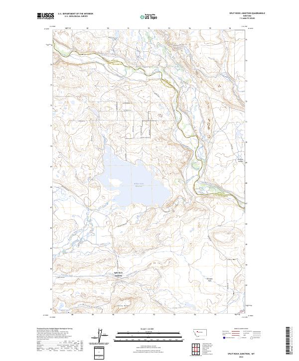
2024 Split Rock Junction
Lewis and Clark County, MT
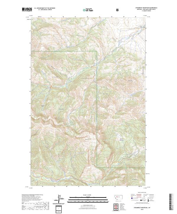
2024 Steamboat Mountain
Lewis and Clark County, MT
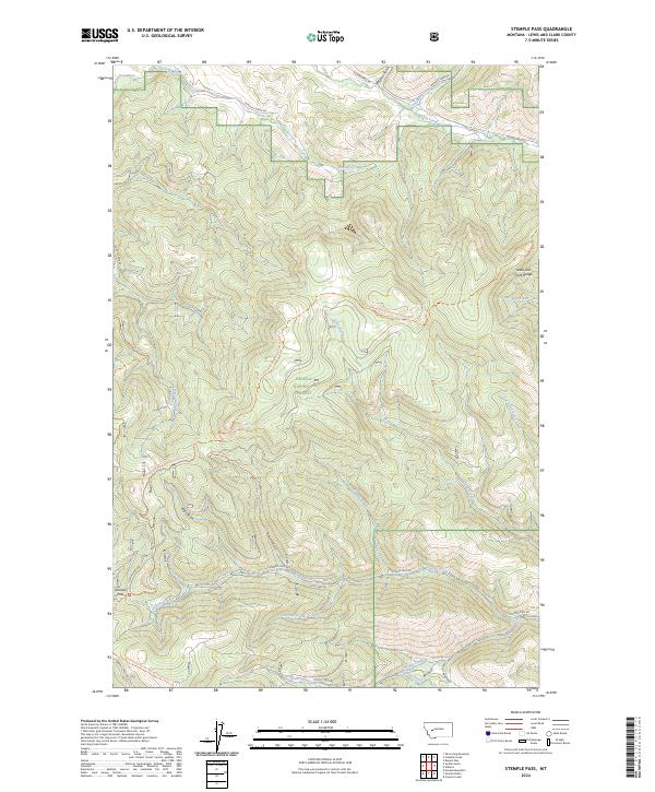
2024 Stemple Pass
Lewis and Clark County, MT
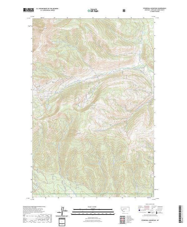
2024 Stonewall Mountain
Lewis and Clark County, MT
2024 Swede Gulch
Lewis and Clark County, MT
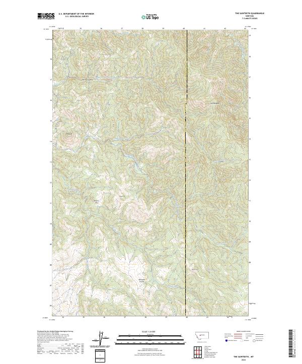
2024 The Sawteeth
Lewis and Clark County, MT
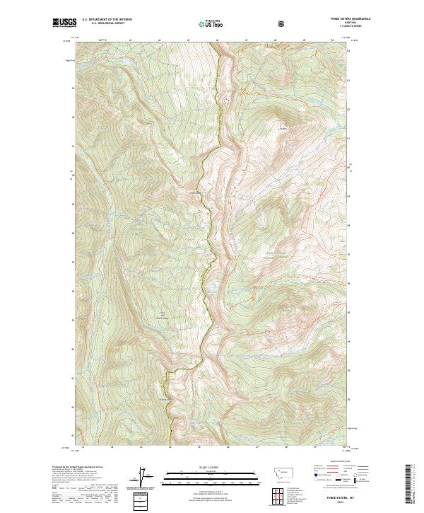
2024 Three Sisters
Lewis and Clark County, MT

2024 Trap Mountain
Lewis and Clark County, MT
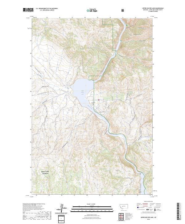
2024 Upper Holter Lake
Lewis and Clark County, MT
2024 Wilborn
Lewis and Clark County, MT
2024 Wood Lake
Lewis and Clark County, MT