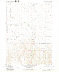
1979 Map of Stricker Butte
USGS Topo · Published 1980About this map
Stricker Cabin and the nearby Rock Creek Cemeteries anchor this Idaho landscape, where the agricultural plains meet the rising foothills of the south. The transition from the irrigation-dependent north to the drainage-carved south is marked by the High Line Canal and the distinctive Stricker Butte. The map reveals a complex water management system with features like the Perrine Coulee and Control Gates, essential for the high-desert farming economy. Moving south, the terrain becomes more varied as Rock Creek winds through the valley, joined by seasonal drainages like Niles Gulch and Dry Gulch. Numerous Gravel Pits and a Quarry near Cedar Hill indicate local extraction industries, while a Landing Strip highlights the logistical connectivity of this rural region. The boundary between Twin Falls Co and Cassia Co bisects the southeastern portion, cutting through the headwaters of Antelope Valley.
Find a feature on this map
27 named features on this map. Tap any name to fly to it.
Don’t see what you’re looking for? This feature index may not catch every label — zoom into the map to look around manually.
Map Details
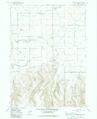
Editions of this 1979 Stricker Butte Map
2 editions found
Other maps of this area

1955 · Twin Falls
USGS Topo · 1:250,000

1958 · Twin Falls
USGS Topo · 1:250,000

1964 · Kimberly
USGS Topo · 1:24,000

1964 · Twin Falls
USGS Topo · 1:24,000

1964 · Eden
USGS Topo · 1:24,000

1965 · Rams Horn Ridge
USGS Topo · 1:24,000

1965 · Stricker Butte
USGS Topo · 1:24,000

1965 · Grand View Peak
USGS Topo · 1:24,000

1965 · Hub Butte
USGS Topo · 1:24,000

1965 · Murtaugh
USGS Topo · 1:24,000