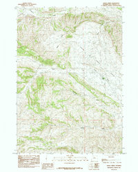
1985 Map of Grass Creek
USGS Topo · Published 1985About this map
The Grass Creek Oil Field and the adjacent Grass Creek Gas Field dominate this mid-1980s landscape in Hot Springs County, reflecting the region's intensive energy development during the late twentieth century. Centered around the settlement of Grass Creek, the terrain is defined by the massive natural amphitheater of the Grass Creek Basin. The map captures a sophisticated network of industrial infrastructure required for extraction, woven into a geography marked by significant drainages such as Gooseberry Creek and Sand Draw. This survey provides researchers a detailed view of the petroleum industry's footprint on the Wyoming landscape, documenting how roads and well sites integrated with natural features like Coalmine Draw and the high elevation of Enos. Local water sources, including Spring Gulch, remain critical markers for understanding the historical development of this remote industrial pocket.
Find a feature on this map
11 named features on this map. Tap any name to fly to it.
Don’t see what you’re looking for? This feature index may not catch every label — zoom into the map to look around manually.
Map Details
Editions of this 1985 Grass Creek Map
This is the sole edition of this map. No revisions or reprints were ever made.
Other maps of this area

1911 · Meeteetse
USGS Topo · 1:62,500

1913 · Meeteetse
USGS Topo · 1:62,500

1913 · Grass Creek Basin
USGS Topo · 1:62,500

1915 · Grass Creek Basin
USGS Topo · 1:62,500

1951 · Hillberry Rim
USGS Topo · 1:24,000

1951 · Gillies Draw
USGS Topo · 1:24,000

1955 · Cody
USGS Topo · 1:250,000

1955 · Thermopolis
USGS Topo · 1:250,000

1956 · Twentyone Creek
USGS Topo · 1:24,000

1956 · Adam Weiss Peak
USGS Topo · 1:24,000